Oberbrombach (Overath)
|
Oberbrombach
City of Overath
Coordinates: 50 ° 58 ′ 42 ″ N , 7 ° 15 ′ 20 ″ E
|
||
|---|---|---|
| Height : | 124 m above sea level NN | |
|
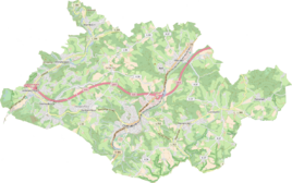
Location of Oberbrombach in Overath |
||
Oberbrombach is a district of Brombach in the town of Overath in the Rheinisch-Bergisches Kreis in North Rhine-Westphalia , Germany .
Before 1975 the residential area belonged to the municipality of Hohkeppel . In the course of a municipal reorganization , Oberbrombach became part of the city (then municipality) of Overath in 1975.
Location and description
The Oberbrombach residential area is on the border with Bergisch Gladbach on Landesstraße 284, which here runs parallel to Sülz in parts. It grows together with Unterbrombach to form the core area of the Brombach district. In addition to new buildings, half-timbered houses have been preserved in Oberbromberg up to the 17th century. A stately wooden figure The Puhmann in front of a country hotel on Dorfstrasse is reminiscent of an old form of communication used by the residents. Nearby places are Unterbilstein , Bilstein , Obersteeg and Hasenbüchel .
history
The Topographia Ducatus Montani by Erich Philipp Ploennies , Blatt Amt Steinbach , shows that the living space had two farms as early as 1715, which are labeled as Brambach . Carl Friedrich von Wiebeking names the court on his charter of the Duchy of Berg in 1789 as Ob. Brambach . It shows that at that time the place was part of the Tüschen community in the Hohkeppel parish .
The place is on the topographical survey of the Rhineland from 1817 as Ob. Brambach recorded. The Prussian first recording from 1845 shows the residential area under the name Obr. Brombach . From the Prussian new admission of 1892, the place is regularly recorded on measuring table sheets as Ober-Brombach or Oberbrombach .
In 1822 56 people lived in the place categorized as Hof and called Brombach , which after the collapse of the Napoleonic administration and its replacement belonged to the municipality of Hohkeppel of the Engelskirchen mayor in the Wipperfürth district . For the year 1830, 69 inhabitants are given for the place called Brombach . The town, which was categorized as a hamlet and designated Ober-Brombach according to the overview of the government district of Cologne in 1845 , had five residential buildings with 49 inhabitants at that time, all of them Catholic denominations. The municipality and estate district statistics of the Rhine province lists Oberbrombach in 1871 with 14 houses and 88 inhabitants. In the municipality lexicon for the province of Rhineland from 1888, 14 houses with 61 inhabitants are given for Ober Brombach . In 1895 the place had twelve houses with 56 inhabitants, in 1905 ten houses and 66 inhabitants are given.
In the times of the plague around four hundred years ago, when contagions had to be avoided and individual farms between the hills were difficult to reach anyway, the Brombach people are said to have communicated with each other by loud calls by holding their hands to their mouths like a funnel and puuzten . The name Pooh men is said to have originated from this.
Due to § 10 and § 14 of the Cologne Act , the municipality of Hohkeppel was dissolved in 1975 and incorporated into Lindlar. In the process, some districts of Hohkeppels were re-municipalityed into the municipality of Overath, including Oberbrombach.
Individual evidence
- ^ Wilhelm Fabricius : Explanations for the Historical Atlas of the Rhine Province ; Second volume: The map of 1789. Division and development of the territories from 1600 to 1794 ; Bonn; 1898
- ↑ Alexander A. Mützell: New topographical-statistical-geographical dictionary of the Prussian state . tape 1 . Karl August Künnel, Halle 1821.
- ↑ Friedrich von Restorff : Topographical-statistical description of the Royal Prussian Rhine Province , Nicolai, Berlin and Stettin 1830
- ↑ Overview of the components and list of all the localities and individually named properties of the government district of Cologne: by districts, mayor's offices and parishes, with information on the number of people and the residential buildings, as well as the Confessions, Jurisdictions, Military and former state conditions. / ed. from the Royal Government of Cologne [Cologne], [1845]
- ↑ Royal Statistical Bureau Prussia (ed.): The communities and manor districts of the Prussian state and their population . The Rhine Province, No. XI . Berlin 1874.
- ↑ Königliches Statistisches Bureau (Prussia) (Ed.): Community encyclopedia for the Rhineland Province, based on the materials of the census of December 1, 1885 and other official sources, (Community encyclopedia for the Kingdom of Prussia, Volume XII), Berlin 1888.
- ↑ Königliches Statistisches Bureau (Prussia) (Ed.): Community encyclopedia for the Rhineland Province, based on the materials of the census of December 1, 1895 and other official sources, (Community encyclopedia for the Kingdom of Prussia, Volume XII), Berlin 1897.
- ↑ Royal Statistical Bureau (Prussia) (Ed.): Community encyclopedia for the Rhineland Province, based on the materials of the census of December 1, 1905 and other official sources, (Community encyclopedia for the Kingdom of Prussia, Volume XII), Berlin 1909
- ↑ Willi Fritzen: Brombach place [1]
- ^ The Cologne Act in full. Retrieved June 7, 2016 .

