
Wald-Michelbach
| coat of arms | Germany map | |
|---|---|---|

|
Coordinates: 49 ° 34 ' N , 8 ° 49' E |
|
| Basic data | ||
| State : | Hesse | |
| Administrative region : | Darmstadt | |
| Circle : | Mountain road | |
| Height : | 340 m above sea level NHN | |
| Area : | 74.36 km 2 | |
| Residents: | 10,593 (Dec 31, 2019) | |
| Population density : | 142 inhabitants per km 2 | |
| Postal code : | 69483 | |
| Area code : | 06207 | |
| License plate : | HP | |
| Community key : | 06 4 31 021 | |
| LOCODE : | DE WMI | |
| Address of the municipal administration: |
In the Gass 17 69483 Wald-Michelbach |
|
| Website : | ||
| Mayor : | Sascha Weber ( SPD ) | |
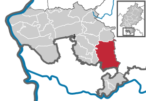
| Location of the community Wald-Michelbach in the Bergstrasse district | ||
  |
||

With an area of over 74 km², Wald-Michelbach in the Odenwald is the largest municipality in terms of area in the Bergstrasse district in southern Hesse , ahead of the city of Lampertheim .
geography
geology
Wald-Michelbach is located in the center of the geological development of the Odenwald , at the intersection of the northern → Böllsteiner-Gneis-Odenwald , the western → Trommgranit and the eastern → Buntsandstein-Odenwald .
These formations were caused by large movements of the earth's crust in two different geological ages and an intermediate erosion and sedimentation .
- The Biotitgranite - like the slightly older granodiorites of Weschnitzplutons - in the Palaeozoic ( Paleozoic ) emerged, and from legacy reshaped Service. The size and distribution of the continents at that time was very different from today: “Central Europe” was located in an ocean area south of the equator and consisted of small continents. At that time, a southern continent was drifting towards a northern continent due to the continental drift. As a result, the "Central European" dwarf continents in between collided and in the Devonian and Carboniferous periods (around 380-320 million years ago) the Variscan mountains , to which the Odenwald belongs , rose on and between them . As a result of the compressions (subduction), the old rocks were once sunk deep into the earth's crust and melted in the upper mantle at a depth of approx. 15 kilometers, and secondly , slowly - together with magma stones - pushed back into the earth's crust, where they were pushed up over the course of 60 million Gradually cooled and solidified over the years. During these tectonic processes, the rock mass tore open again and again and gave space for change. In the area around Kreidach and Ober-Mengelbach, a mixed zone with granitic rocks and converted old stocks developed ( slate or biotite-plagioclase-gneiss clods, formerly known as amphibolite ). The crevices were filled with melts, which crystallized into gangue rocks. Older biotite granites were broken through by younger aplit-like granites, e.g. B. west of Siedelsbrunn and Wald-Michelbach.
- In the prehistory of the granite Odenwald, the Böllsteiner gneiss was already formed. It emerged from granitic rocks that penetrated into older sedimentary rocks from below as glowing hot magmas about 410 million years ago . As a result of the pushing together, these were sunk into deeper areas of the earth's crust and metamorphosed into slates and gneiss at high temperature pressure . An old fault zone , the Otzberg Fissure running through the NNE , which continues from the Otzberg - via Wald-Michelbach - south to the Oberrheingraben - Heidelberg / Karlsruhe border , forms the western edge of the Böllsteiner gneiss, which - as a narrow intermediate gneiss zone - over Hammelbach and Scharbach to Aschbach is detectable, but is mostly hidden under the red sandstone ceiling. On this line the western Bergstrasse Odenwald (formed in the Lower Carboniferous about 333 to 329 million years ago) pushed against the older Böllsteiner Odenwald due to the continental drift . The drum granite that penetrated about 320 million years ago welded the two parts of the mountain together as the plate collision continued.
- About 260 million years ago - the granite-gneiss mountain range has now been eroded to the base - the so-called Zechstein Sea inundated the Odenwald in the early Permian era and covered it with deposits that are important for over-forest mining: dolomites , which later quartz solutions containing iron and manganese penetrated. The sedimentation history continues in the Mesozoic ( Mesozoic Era) between 251 and 65 million years with the deposition of up to 600 m thick red sandstone, shell limestone , Keuper and Jura layers.
- A long time later there were again strong movements in the earth's crust in Central Europe: In connection with a rift zone from the Mediterranean to the North Sea - in the Tertiary approx. 45 million years ago - the Upper Rhine Rift collapsed . As a result, many cross and transverse clefts divided the area of today's Odenwald into mountain blocks and ditches. Some columns in the forest-Michel Bacher room filled with quartz - and Schwerspatlösungen ( barite cleardown 1890). Through a warm, humid tertiary climate that promotes weathering and erosion and fluvial removal of the slope debris, the streams cut deep into the terrain and sawed up the mountain massifs. A layered landscape developed and the mighty Jura, Keuper, Muschelkalk and Zechstein sediments were gradually eroded towards the SE. The eroding forces exposed the crystalline mountain hull from the mountain road to the back of the drum. Orienting towards old fault zones ( Gersprenztal , upper Ulfenbachtal ), the streams changed their course. In the eastern Odenwald only the red sandstone deposits determine the landscape: In the Wald-Michelbacher area the border runs on the eastern slope of the Ulfenbach valley from Affolterbach, Aschbach, Unter-Wald-Michelbach and then swings to the west (Siedelsbrunn). At the edge of the red sandstone steps, the Zechstein layer below with the iron and manganese ores was made accessible for mining. B. in Strasbourg-Unter-Waldmichelbach and Aschbach. Mountains and slopes were divided into blocks by cracks, which then formed spherical rock castles and seas through chemical weathering ( wool sack weathering ), e.g. B. on the drum.
- In the subsequent Ice Age , a permafrost climate prevailed in the Odenwald . I.e. the ground was always deeply frozen. When it warmed up (at the end of the Ice Age), the upper layer thawed and the rocks, freed from the rubble, slide down the slope on the still frozen ground. Over the course of millions of years, today's typical low mountain range landscape around Wald-Michelbach was formed from the hull of the Variscan Mountains and the remaining red sandstone ceiling.
- From 1889 to the 1930s there was intensive mining for manganese in the district, the Ludwig pit can now be visited as a visitor mine , for details, see: List of mines in the Odenwald .
Surname
The place is not to be confused with the named Waldmichelbach , a district of the municipality of Bessenbach in the Bavarian district of Aschaffenburg .
Neighboring communities
Wald-Michelbach borders in the north on the community Grasellenbach , in the east on the community Mossautal and the city Oberzent (both in the Odenwaldkreis ), in the south on the city Eberbach (district Brombach) and the communities Heddesbach and Heiligkreuzsteinach (all three Rhein-Neckar- District in Baden-Württemberg ) and in the west to the communities of Abtsteinach , Mörlenbach and Rimbach .
Community structure
The community of Wald-Michelbach is made up of the following districts or districts
- Core community Wald-Michelbach with the hamlets of Ober-Mengelbach and Stallenkandel to the northwest . The hamlets Spechtbach, Kuhklingen and Seckenrain join in the south and the Ulfenbach in the southeast of Strasbourg ; and St. Mary in light blades , between Hardenberg (593 m) and Stiefelhöhe all located (584 m) to the southwest, still belongs to the forest-Michel district Bacher
- Kreidach and Siedelsbrunn are to the west of the community
- In the south are Ober-Schönmattenwag and Unter-Schönmattenwag with Frankel , Corsica , Ludwigsdorf , Holmbach , Schönbrunn and Flockenbusch
- In the east borders Aschbach with former Dürr Ellenbach to
- To the north of the core community, Hartenrod and Gadern follow, followed by Affolterbach and Kocherbach
history
overview
The existence of the place can be traced back to the year 1238 under the name Michilnbach. At that time there was talk of an ecclesia (chapel or church). This was dedicated to Laurentius . The monastery Lorsch had possessions in the area of Wald-Michelbach, without the place name in the resulting documents monastery is called. Wald-Michelbach Castle , which was probably built in the 12th or 13th century, was located on the site of today's Protestant church . The lower part of the church tower is probably identical to the residential tower of an aristocratic residence, which is referred to in a contract from 1264 as the "Lord's Court of the Abbot". On the northwest corner of the former castle grounds stood the ruins of a center tower that was destroyed by the French in 1693.
Since 1264 the place belonged to the Electoral Palatinate and was at times fiefdom of the taverns of Erbach and others. After the electoral Palatinate was dissolved in 1803, Wald-Michelbach became part of Hesse and was the seat of an administrative bailiff until 1821 . The place was also the seat of a regional court or district court from 1853 to 1968 . After its dissolution, the district court district was added to the Fürth district court.
Since 1901, Wald-Michelbach was a station of the Überwaldbahn , a railway connection from Wahlen to Mörlenbach . There was a connection to the Weschnitz Valley Railway . The line was closed in 1983 for passenger traffic and 1994 for freight traffic.
Incorporations
In the run-up to the regional reform in Hesse , several neighboring communities gradually joined the community of Wald-Michelbach by mutual agreement in 1970 and 1971. Were incorporated on
- December 1, 1970: Hartenrod
- December 31, 1970: Gadern and Kreidach
- October 1, 1971: Aschbach with Dürr-Ellenbach
- December 31, 1971: Siedelsbrunn, Ober-Schönmattenwag and Unter-Schönmattenwag
By the law for the reorganization of the district Bergstrasse followed on
- August 1, 1972: Affolterbach with Kocherbach
The seat of the municipal administration remained in Wald-Michelbach. For the places Affolterbach, Aschbach with Dürr Ellenbach, Gadern, Hartenrod, cooking Erbach, Kreidach, upper Schönmattenwag, Siedelsbrunn and sub-Schönmattenwag one was in each local district with the town council and mayor set up.
Territorial history
Wald-Michelbach originated in the area of the former Mark Heppenheim which designated an administrative district of the Franconian Empire . On January 20, 773, Charlemagne donated the city of Heppenheim and its district, the extensive Mark Heppenheim , to the imperial monastery of Lorsch . After long disputes, the Electoral Palatinate and the Archdiocese of Mainz were able to agree on the inheritance from the Lorsch Abbey at the beginning of the 14th century and the Palatinate parts were administered by the Lindenfels District Bailiwick, to which Wald-Michelbach also belonged.
The place was first mentioned under the name Michilnbach in 1238, when an ecclesia (chapel or church) was reported there. Until 1737 Lindenfels was subordinate to the Heidelberg Oberamt , after which Lindenfels became an Oberamt . Wald-Michelbach was part of the Zent Waldmichelbach within the Lindenfels Office and was the seat of the Zentgericht .
In the early days of the Reformation , the Palatinate rulers openly sympathized with the Lutheran faith, but it was not until Ottheinrich (Elector from 1556 to 1559) that the official transition to Lutheran teaching took place. After that, his successors and inevitably the population changed several times between the Lutheran , Reformed and Calvinist religions. After the Reformation, the existing church in Wald-Michelbach was used by the Reformed , while the Catholics built their own church dedicated to St. Lawrence in 1739. In 1780 the Lutherans set up a church in their schoolhouse.
According to an interest book from 1369 of the Heidelberg Oberamt there are 11 hubs in Wald-Michelbach . In 1613, "55 householders , 62 serfs and 52 women, 16 2/3 hubs" are counted. At the end of the Thirty Years' War (1648), like many areas of the Electoral Palatinate, the place was almost deserted. After the devastating war, the Electoral Palatinate pursued a policy of resettlement in its area characterized by religious tolerance. But the wars that broke out in the troubled times that followed, such as the War of the Palatinate Succession (1688–1697) and the War of Spanish Succession (1701–1714) destroyed many of the efforts and tens of thousands of Palatine emigrated and the like. a. to North America and Prussia.
From a religious point of view, too, the time after the Thirty Years' War was marked by great unrest. In 1685 the Reformed Palatinate-Simmern line died out and the Catholic cousins of the Palatinate-Neuburg line took over the government in the Electoral Palatinate with Elector Philipp Wilhelm . This ordered the equality of the Catholic faith in the predominantly Protestant Palatinate. Even during the War of the Palatinate Succession, France tried to advance the Counter-Reformation in the conquered areas and founded a number of Catholic parishes. The war ended in 1697 with the Peace of Rijswijk , which strengthened the position of the then reigning Catholic Elector Johann Wilhelm . This led to the decree of the Simultaneum on October 26, 1698 . According to this, the Catholics were entitled to use all reformed institutions such as churches, schools and cemeteries, while the reverse was not allowed. Furthermore, the reformed church administration, which had been independent until then, was subordinated to the sovereign. Only at the instigation of Prussia in 1705 came the so-called Palatinate church division in which the simultanum was reversed and the churches in the country, including rectories and schools, were divided between the Reformed and the Catholics in a ratio of five to two. There were special regulations for the three capitals Heidelberg , Mannheim and Frankenthal as well as the regional authorities Alzey , Kaiserslautern , Oppenheim , Bacharach and Weinheim . In cities with two churches, one should go to Protestants and the other to Catholics; in the others, where there was only one church, the choir was separated from the nave by a wall, and the one to the Catholics and the other to the Protestants. The Lutherans were only allowed those churches that they owned in 1624 or had built afterwards.
In 1784 173 families with 774 souls lived in the place and there were three churches, two parsonages, 2 schoolhouses and 97 civic or parish houses and three mills. While the district consisted of 834 acres of fields, 453 acres of meadows, 30 acres of gardens, 300 acres of pasture, and 1375 acres of forest. Of these forests, 1,129 acres belong to the community and the remainder were part of the lifting goods . In addition, there were 800 acres of forest that was shared by the Zent Wald-Michelbach. There was an electoral forester who was in charge of both these and all of the other forests in the Cent Wald-Michelbach and the Cent Hammelbach . On the big tithe , the Electoral Palatinate Court Chamber received two, and the Electoral Mainz Chamber received a third because of the Lorsch Monastery; the little tithe was given to the local Reformed pastor; from some districts, however, the official winery in Lindenfels. There were also some domain estates in the area, which the Count of Brezenheim and the Baron von Wreden owned as an Electoral Palatinate fief.
The late 18th and early 19th centuries brought far-reaching changes to Europe. As a result of the Napoleonic Wars , the Holy Roman Empire (German Nation) was reorganized by the Imperial Deputation of 1803 and ceased to exist with the laying down of the Imperial Crown on August 6, 1806. As a result of this reorganization and dissolution of the Electoral Palatinate, the Oberamt Lindenfels and with it Wald-Michelbach became part of the Landgraviate of Hessen-Darmstadt , which in 1806 became part of the Grand Duchy of Hesse , which was also formed under pressure from Napoleon . When the Oberamt Lindenfels became part of Hesse in 1803, it was initially continued as the Hessian district bailiwick and from 1812 Wald-Michelbach received its own district bailiwick. After the Congress of Vienna had confirmed the territorial situation in Hesse, provinces were formed in the Grand Duchy in 1816 and the area previously known as the “Principality of Starkenburg”, where Wald-Michelbach was now located, was renamed “Province of Starkenburg” . In 1821, as part of a comprehensive administrative reform, the district bailiffs in the provinces of Starkenburg and Upper Hesse of the Grand Duchy were dissolved and district councils were introduced, with Wald-Michelbach becoming part of the Lindenfels district . As part of this reform, regional courts were also created, which were now independent of the administration. The district court districts corresponded in scope to the district council districts and the district court of Fürth was responsible as the court of first instance for the district of Lindenfels . This reform also arranged the administrative administration at the municipal level. In addition to Wald-Michelbach, the mayor's office in Wald-Michelbach was also responsible for Oberschönmattenwaag , although the mayors had been elected by the municipality since 1820 and there were no more appointments of mayors .
Administration in Hessen
After the transition of the Oberamt Lindenfels to Hesse in 1803, as a result of the Reichsdeputationshauptschluss , Wald-Michelbach came to the district bailiff Wald-Michelbach in 1812 and to the district of Lindenfels of the Starkenburg province in the Grand Duchy of Hesse in 1821 . In 1832 the administrative units were further enlarged and circles were created. After the reorganization announced on August 20, 1832, there should only be the districts of Bensheim and Lindenfels in the future in Süd-Starkenburg; the district of Heppenheim was to fall into the Bensheim district. Even before the ordinance came into force on October 15, 1832, it was revised to the effect that instead of the Lindenfels district, the Heppenheim district was formed as the second district, to which Wald-Michelbach now belonged, alongside the Bensheim district. In 1842 the tax system in the Grand Duchy was reformed and the tithe and the basic pensions (income from property) were replaced by a tax system of the kind that still exists today.
As a result of the March Revolution of 1848, with the "Law on the Relationships of the Classes and Noble Court Lords" of April 15, 1848, the special rights of the class were finally repealed. In addition, in the provinces, the districts and the district administration districts of the Grand Duchy were abolished on July 31, 1848 and replaced by "administrative districts", whereby the previous districts of Bensheim and Heppenheim were combined to form the administrative district of Heppenheim . Just four years later, in the course of the reaction era, they returned to the division into districts and Wald-Michelbach became part of the newly created district of Lindenfels .
The population and cadastral lists recorded in December 1852 showed for Waldmichelbach: market town with 2215 inhabitants, reformed and catholic church, seat of a regional court, a district confiscation and a chief forester. The district consists of 7808 acres , 2595 acres of arable land, 974 acres of meadows and 4043 acres of forest. »These include 3 grinding mills, 1 iron hammer, 1 Schncidmühle, the houses on the Stallenkandel, the Obermengelbacher Höfe and the Forstschützenhof" Lichtenklingenhof ""
In the statistics of the Grand Duchy of Hesse, based on December 1867, for the market town of Wald-Michelbach with its own mayor's office , 66 houses, 1,397 inhabitants, the Lindenfels district, the Wald-Michelbach district court, the Protestant Reformed parish Wald-Michelbach of the Lindenfels deanery and the Catholic parish Wald-Michelbach of the dean's office in Heppenheim. The mayor's office also created the residential areas "Im Binzig" (10 houses, 65 inh.), "In der Halle" (8 houses, 40 in.), "Im Hardberg" (1 houses, 15 in.), "Im Hohlstein" (1 houses, 7 inh.), "In dem Kuhklingen" (1 houses, 6 in.), "Lichtenklinger Hof" (1 houses, 10 in.), Mühlklingen (1 houses, 8 in.), Ober-Mengelbach ( 6 houses, 60 inh.), "Im Seckenrain" (23 houses, 114 in.), "In der Spechbach" (5 houses, 25 in.), "Auf dem Stallenkandel" (8 houses, 57 in.), " In der Strasburg “(12 houses, 82 inh.) And Wetzkell (9 houses, 66 in.).
After the Grand Duchy of Hesse became part of the German Empire in 1871, a series of administrative reforms were decided in 1874. The state-specific rules of procedure as well as the administration of the districts and provinces were regulated by district and provincial assemblies. The new regulation came into force on July 12, 1874 and also decreed the dissolution of the Lindenfels and Wimpfen districts and the reintegration of Wald-Michelbach into the Heppenheim district .
The Hessian provinces of Starkenburg, Rheinhessen and Upper Hesse were abolished in 1937 after the provincial and district assemblies were dissolved in 1936. On November 1, 1938, a comprehensive regional reform came into force at the district level. In the former province of Starkenburg, the Bensheim district was particularly affected, as it was dissolved and most of it was added to the Heppenheim district. The district of Heppenheim also took over the legal successor to the district of Bensheim and was given the new name Landkreis Bergstrasse .
The Grand Duchy of Hesse was a member state of the German Confederation from 1815 to 1866 and then a federal state of the German Empire . It existed until 1919, after the First World War, the Grand Duchy for was republican written People's State of Hesse . In 1945 after the end of the Second World War , the area of today's Hesse was in the American zone of occupation and by order of the military government, Greater Hesse was created , from which the state of Hesse emerged in its current borders.
In 1961 the size of the district was given as 1956 ha , of which 1080 ha were forest.
Courts in Hessen
The jurisdiction of the Oberamt Lindenfels was transferred to the new justice office in Fürth in 1813. With the formation of the regional courts in the Grand Duchy of Hesse, the Fürth regional court was the court of first instance from 1821 . In 1853 a new district court was created, the seat of which was in Wald-Michelbach .
On the occasion of the introduction of the Courts Constitution Act with effect from October 1, 1879, as a result of which the previous grand-ducal Hessian regional courts were replaced by local courts in the same place, while the newly created regional courts now functioned as higher courts, the name was changed to the Wald-Michelbach District Court and assigned to the district of the Darmstadt Regional Court . After the district court of Wald-Michelbach had already been temporarily downgraded to a branch of the district court of Fürth in 1943, this court was finally dissolved on July 1, 1968 and incorporated into the district court district of Fürth.
Historical descriptions
In the attempt of a complete geographical-historical description of the Elector. Pfalz am Rheine can be found in 1786 via Wald-Michelbach:
“Wald-Michelbach. A large village in the Odenwalde, three hours from Lindenfels, borders the Kurmainzische village of Asbach and Herderrode to the east; towards the south to the following village of Ober-Schönmattenwaag; towards the west on Kreidach; to the north to the Kurmainzische village Gadern. Although the Lorsch Monastery was considerably wealthy in this Michelbach, its name does not appear anywhere in the otherwise numerous documents. [...] The Ulvenbach coming from the Hammelbacher Zent flows through the village, takes up the stream from Gadern and runs to the next Ober-Sckönmattenwag. The Ulvenbach drives a grinding, a cutting and a paper mill together with an iron hammer ; the village stream but a grinding mill in the village itself. The Euterbach rises in the village district and flows to Siedelsbrunn. A country road runs through the village from Mildenberg and the Mainstrom to Weinheim. Customs are levied in Waldmichelbach. […] The parish church in the village had to be appointed by the provost of Lorsch monastery and the count palatine. It contained two benefices, which the community had to grant with the knowledge and approval of the Electoral Cellar in Lindenfels, but there is no reliable information as to which diocese such was relevant. This church fell to the Reformists at the time of division, and has now been appointed with a preacher of his own who, apart from Hammelbach and Großellenbach, has to provide all localities, both the Wald-Michel and Hammelbacher Centers, and who is under the inspection of the Weinheim class. The Catholics also built their own church in 1759, elevated it to a parish, and consecrated it to H. Lorenz, where all the localities of the two centers are now parish priests. It belongs to the Mainz dioceses and the Bergstäßer Landkapitel. Likewise, the Lutherans brought about the building of a church on their schoolhouse through public contributions in 1780.
On the big tithe the Kurpfätzische Hofkammer moves into two, and the Kurmainzische one third because of the Lorsch Monastery; the little Reformed pastor of the place; from some districts, however, the official cellar in Lindenfels. There are also some domanial estates in the area, which the Count von Bretzenheim and the Baron von Wreden now own as the Electorate of the Palatinate. "
The statistical-topographical-historical description of the Grand Duchy of Hesse reports on Wald-Michelbach in 1829:
»Waldmichelbach (L. Bez. Lindenfels) market town; lies 3 hours from Lindenfels on both sides of the Ulvenbach, divides into Ober and Unterwaldmichelbach and extends ½ hour in length. The place has 220 houses and 1694 inhabitants. 903 of these are Reform. 658 Kath. 127 Luth. and 6 Mennonites, who are divided into 116 farmers and day laborers and 163 tradesmen. You can find 1 Reform. And 1 Catholic parish church, 1 town hall, 1 iron smelter, 1 iron hammer, 1 paper and 1 cutting mill and 2 grinding mills. In the district are iron ores. Every year 4 cattle and 4 grocer's markets are held. - Although the Lorsch monastery was very wealthy here, the name of this place does not appear anywhere in Lorsch documents. The parish church was shared by the provost of the monastery with the count palatine. At the partition of 1705 the church fell to the Reformed, who appointed it with a pastor of their own. The Catholics also built a church in 1739 and provided it with its own pastor. The Lutherans also built a church in their schoolhouse in 1780. In 1802 Waldmichelbach came from Churpfalz to Hesse. "
The latest and most thorough alphabetical lexicon of all localities in the German federal states from 1845 states:
»Waldmichelbach b. Lindenfels. Market town with Reformed and Catholic parish church. - 220 H. 1694 E. - Großherzogth. Hesse. - Starkenburg Province. - Heppenheim district. - Fürth district court. - Darmstadt Court of Justice. - The market town of Waldmichelbach, lying on both sides of the Ulvenbach, is divided into the upper village (Ober-Waldmichelbach) and the lower village (Unter-Waldmichelbach), and extends for half an hour. The place has 1 reformed u. 1 Catholic parish church, 1 town hall, 1 iron hammer and smelter, 2 grinding mills. l Scheidemühle , as well as 1 paper mill. - There are 900 Reformed people among the population, around 700 Catholics, 130 Lutherans and some Mennonites . - Economy and civil trade make up the food branches of the inhabitants. The place also has 4 cattle markets and 4 junk markets. - The district contains iron ores. - Before that, Waldmichelbach belonged to Palatinate, from which it was transferred to Hesse in 1802. - The individual houses Stallenkandel, Köningen, Spechtbach, Seckenrain, Hohlstein, Halle, Renstadt, im Binzig, Strasbourg, and im Wetzel, the Lichtenklinger Hof, and the 3 Obermengelbacher Höfe belong to the community.
Waldmichelbacher Eisenhammer and paper mill b. Waldmichelbach - iron hammer and paper factory, - to Protestant, resp. Catholic parish of Waldmicheibach. - 2 H. 16 E. - Großherzogth. Hesse. - Starkenburg Province. - Heppenheim district. - Fürth district court. - Hofger. Darmstadt."
In 1858, Christoph Friedrich Moritz Ludwig Marchand wrote in his local history of Lindenfels about the Zent and the village of Wald-Michelbach:
“Cent Waldmichelbach. She was the largest and most important ram, believes that she was originally not counted as part of Lindenfels Castle, but rather directly with the Palatinate, but she does not provide any clear reasons for this view. We leave that aside, and stick to the simple fact that the cent is listed in all known renewals as Appertinenz of the House of Lindeufels.
1) Waldmichelbach. The Lorsch Monastery was very wealthy there. The von Weiler family contributed a part to Waldmichelbach, together with all affiliations, from Count von Rineck to Mannlehen. According to the old interest book from 1369 there were 11 lifts, each 2 Mltr. Oats paid and a yard that was half lent. The Frene Mill gave 12 Mltr. Grain and 1 fattening. To Wetzels (today desert) the Palatinate owned 2 farms with 8 Mltr. Oats and 8 Mltr. Cheeses. The Church gives much to the Reformed in the division. In 1739 the Catholics built one for themselves. Lorenz consecrated church and the Lutherans he set up such a thing on their school building in 1780 through collected contributions. [...] The parish church used to be appointed by the provost of Lorsch and the count palatine together. Kurmainz and Electoral Palatinate compromised that the Palatinate should retain its patronage rights for the chapel at Lichtenklingen and the parish rights for the pastor at Waldmichelbach. (Scriba Regesten No. 1763). In earlier times the parish belonged to the Worms Diocese and the Weinheimer Landcapital. It contained 2 benefices which the community had to grant with the consent of the basement in Lindenfels. […] At Waldmichelbach the Count of Brezenheim and the Baron von Wreden owned some domanial estates as fiefs in the area and Kurmainz gave Lorsch fiefs there from 1420–1461 (Scriba Regesten p. 234, note A). Iron works and paper mills were already found there in the Palatinate era, and Waldmichelbach paper was considered the best in the Palatinate. The Mengelmuß farm belonged to Waldmichelbach, as well as the so-called Neue Höfe on 3 Huben. Built in 1665 with only 5 houses, the latter with regard to Jurisdicton, but in the Cent Abtsteinach. Eberhard von Saumsbeim, Teutschmeister etc. spoke in 1430 in disputes between Archbishop Conrad and Duke Ludwig of the Palatinate that because of the 1/3 march right to Michelbach pretended by Kurmainz, which the Palatinate only allowed to 2 1/2 strokes, should stay with the old. One of the complaints the Electoral Palatinate made against Kurmainz in 1654 was that the latter held the parishioners in Ober- and Unterabtsteinach, Litzelbach, Kocherbach, etc., before the war as a branch in Waldmichelbach, to hold church services there. "
Population development
Source: Historical local dictionary
| • 1961: | 1734 Protestant (= 49.56%), 1687 Catholic (= 48.21%) residents |
| Wald-Michelbach: Population from 1784 to 2015 | ||||
|---|---|---|---|---|
| year | Residents | |||
| 1784 | 774 | |||
| 1829 | 1,964 | |||
| 1834 | 2,040 | |||
| 1840 | 2,059 | |||
| 1846 | 2,215 | |||
| 1852 | 2,273 | |||
| 1858 | 2,351 | |||
| 1864 | 2,079 | |||
| 1871 | 2,032 | |||
| 1875 | 2.013 | |||
| 1885 | 2.016 | |||
| 1895 | 1,880 | |||
| 1905 | 2,037 | |||
| 1910 | 2,045 | |||
| 1925 | 2.007 | |||
| 1939 | 1,945 | |||
| 1946 | 2,710 | |||
| 1950 | 2,784 | |||
| 1956 | 3,055 | |||
| 1961 | 3,499 | |||
| 1967 | 4.030 | |||
| 1970 | 3,995 | |||
| 1972 | 9,632 | |||
| 1976 | 10.051 | |||
| 1984 | 10,785 | |||
| 1992 | 11,369 | |||
| 2000 | 11,500 | |||
| 2010 | 10,979 | |||
| 2015 | 10,600 | |||
| Data source: Historical municipality register for Hesse: The population of the municipalities from 1834 to 1967. Wiesbaden: Hessisches Statistisches Landesamt, 1968. Further sources:; 1972 :; 1977 :; 1984 :; 1992 :; 2000, 2015 :; 2010: From 1972 including the towns incorporated into Hesse as part of the regional reform . | ||||
coat of arms
The coat of arms shows a golden rust in black. The grate is reminiscent of St. Lawrence, the patron saint of the Catholic Church. The coat of arms can be found for the first time on a stone from 1605 in the churchyard wall. It has been used as a seal since the 18th century.
politics
Community representation
The local elections on March 6, 2016 produced the following results, compared to previous local elections:
|
Parties and constituencies |
% 2016 |
Seats 2016 |
% 2011 |
Seats 2011 |
% 2006 |
Seats 2006 |
% 2001 |
Seats 2001 |
|
| CDU | 28.5 | 10 | 33.3 | 12 | 38.9 | 14th | 37.3 | 14th | |
| SPD | 25.7 | 9 | 28.3 | 10 | 34.1 | 13 | 37.3 | 14th | |
| Citizens for Wald-Michelbach | 15.7 | 6th | 10.2 | 4th | - | - | - | - | |
| GREEN | 7.2 | 3 | 9.5 | 4th | 6.0 | 2 | 4.0 | 2 | |
| Affolterbach-Kocherbacher Citizens' Association | 10.2 | 4th | 8.6 | 3 | 9.9 | 4th | 9.3 | 3 | |
| FWG | 9.8 | 4th | 8.6 | 3 | 9.1 | 3 | 9.9 | 4th | |
| FDP | 3.0 | 1 | 1.6 | 1 | 2.1 | 1 | 1.1 | 0 | |
| total | 100.0 | 37 | 100.0 | 37 | 100.0 | 37 | 100.0 | 37 | |
| Voter turnout in% | 45.9 | 50.0 | 46.3 | 53.0 | |||||

mayor
Sascha Weber has been the mayor of the community since 2017.
|
|
Town twinning
Wald-Michelbach has been in partnership with Montmirail ( France ) since 1975 and with Hassocks ( Great Britain ) since 1991/92 , both of which are siblings.
Culture and sights


Museums
Local museum
The local history museum has been located in the old town hall in the town center since 1988. The building was built in 1594. In addition to details of the historical development of Wald-Michelbach, special exhibitions are also presented here.
Stoewer Museum
The Stoewer Museum was opened in 2002 and is located in the former building of the Sparkasse, near the town center. Here is a collection of articles was Stoewer -Werke Szczecin shown. The focus of the museum was on the automobiles shown on the ground floor. Most have been restored and are in running order. Further products from Stoewer, such as sewing machines, typewriters and bicycles were also presented. The museum was privately run by a Szczecin-born collector. In the spring of 2019 his collections (worth € 750,000) were sold to the Museum of Technology and Transport in Szczecin .
In 2005 a street in the core community was named "Stoewerstraße" in honor of the owners and their commitment.
Buildings
The Überwälder Einhaus was completed in 2005 by the Überwälder Museum and Culture Association and volunteers. The name “Einhaus” refers to the earlier use of such a building: the apartment, storage cellar, stable and barn were integrated into a single building. Today the community's wedding room is located here and a larger multi-purpose room that is used by local associations for social purposes. In 2006 the "art fountain" was also built in front of the Einhaus.
Hardberg
In the area of the Wald-Michelbacher district Siedelsbrunn is the Hardberg , at 593 m above sea level. NN the third highest mountain in the Odenwald. On the summit of the Hardberg there is a 135 meter high radio and television broadcasting mast of the Hessischer Rundfunk . From different sides of the Hardberg there is a unique view of the Odenwald and the Rhine Valley.
Leisure and sports facilities
Wald-Michelbach has an outdoor pool that was renovated in 2003. In addition, the place has an artificial turf soccer field , which replaced the previous ash field in 2000. It is played by SG Wald-Michelbach and SV Eintracht Wald-Michelbach .
There is also a sports hall, which is used by the male and female handball players from SG Wald-Michelbach and TV 02 Siedelsbrunn as well as by the volleyball players from ÜSC Wald-Michelbach.
Since 2010 there has been a summer toboggan run in the Wald-Michelbacher district of Kreidach, directly on the Kreidacher Höhe . It is one kilometer long and has two roundabouts and a bridge structure.
On the railway line of the Überwaldbahn, which was closed in 1994, a solar trolley can be used on the route between Wald-Michelbach and Mörlenbach.
Regular events
- Heimatfest (1st weekend in July)
- Fumaba
- Alley market
- Kerwe (3rd Sunday in August)
- Christmas Market
- Municipal cinema (2nd Saturday of the month)
Economy and Infrastructure
economy
The largest employer in the community and the surrounding area was the Coronet company with 800 employees in the Odenwald until the bankruptcy in 2005 . In 2009 there were still 40 jobs left. Since then, the community of Wald-Michelbach has tried to market the plant location as the IGENA industrial park. The world-famous motorsport team from Joest Racing is based in the municipality.
Healthcare
The Fachklinik am Hardberg , a spa clinic for psychotherapy and addiction medicine with a systemic - hypnotherapeutic focus for 160 patients was located on the hillside of the Hardberg in the Siedelsbrunn district .
education
The community of Wald-Michelbach has two primary schools, a special school, a secondary school and a secondary school as well as a grammar school. Since 2007 there has also been a privately run independent school.
- Core community
- Adam Karrillon School (Primary School)
- Mary Anne Kübel School (School for Learning Assistance)
- Eugen Bachmann School (secondary and secondary school)
- Überwald high school
- Dragon School Odenwald - free school (elementary and integrated comprehensive school, 1st to 10th grade)
- Districts
- Elementary school Unter-Schönmattenwag
Library
In 2007 the Überwald-Gymnasium opened its new library MIZ (media and information center). This may not only be visited and used by all students, but also by the citizens of the surrounding communities.
Personalities
Honorary citizen
- 1913: Rudolf Wünzer (1862–1929), politician
- 1913: Rudolf Wünzer (1862–1929), chief magistrate and Hessian deputy
- 1923: Adam Karrillon (1853–1938), doctor and writer, first Büchner Prize winner
- 1952: Josef Valentin Krämer (1891–1976), pastor, co-founder and deputy director of the Überwald-Gymnasium
Sons and daughters of the church
- Prosper Donderer (1715–1779), abbot of the Kreuzlingen monastery
- Johann Christian Huy (1813–1875), Hessian farmer and politician
- Christoph Arnold (1839–1893), judge and liberal politician and member of the state estates of the Grand Duchy of Hesse
- Heinrich Schlerf (1890-1970), founder of Coronet -Werke
- Karl Kübel (1909–2006), founder of the Karl Kübel Foundation
- Eugen Bachmann (1913–1975), Member of the Bundestag (CDU) and former mayor of Wald-Michelbach (1948 to 1975)
- Lothar Mark (* 1945), SPD politician
Other personalities
- Harald zur Hausen (* 1936), virologist and Nobel Prize winner 2008, lives in the community
- Jürgen Gerlach (* 1938), former federal chairman of the animal welfare party , lives in Unter-Schönmattenwag
Curiosities
On the occasion of the opening of the Überwaldbahn, the Mainz Railway Directorate decided : "Corpses and explosives are only allowed for transport in Michelbach".
literature
- Johann Goswin Widder: Attempt of a complete geographic-historical description of the Kurfürstl. Palatinate on the Rhine. Volume 1 , Leipzig 1786–1788. ( Online at Hathi Trust, digital library )
- Georg W. Wagner: Statistical-topographical-historical description of the Grand Duchy of Hesse: Province of Starkenburg, volume October 1 , 1829.
- Christoph Friedrich Moritz Ludwig Marchand: Lindenfels. A contribution to the local history of the Grand Duchy of Hesse . Darmstadt 1858 ( online at google books ).
- Peter W. Sattler: Festschrift for the 750th anniversary of the Wald-Michelbach community on May 28, 1988 . Wald-Michelbach municipal council, Wald-Michelbach 1988.
- Literature on Wald-Michelbach in the catalog of the German National Library
Web links
- Internet presence of the community of Wald-Michelbach
- Wald-Michelbach (municipality), Bergstrasse district. Historical local dictionary for Hessen. In: Landesgeschichtliches Informationssystem Hessen (LAGIS).
- Wald-Michelbach, Bergstrasse district. Historical local dictionary for Hessen. In: Landesgeschichtliches Informationssystem Hessen (LAGIS).
- Wald-Michelbach Castle, Bergstrasse district. Historical local dictionary for Hessen. In: Landesgeschichtliches Informationssystem Hessen (LAGIS).
- Link catalog on the subject of Wald-Michelbach at curlie.org (formerly DMOZ )
Individual evidence
- ↑ Hessian State Statistical Office: Population status on December 31, 2019 (districts and urban districts as well as municipalities, population figures based on the 2011 census) ( help ).
- ^ Franke, Wolfgang: The mid-European segment of the Variscides: tectono-stratigraphic units, terrane boundaries and plate tectonic evolution. In: Geol.Soc.London Spec.Publ. 179 2000, pp. 35-61.
- ↑ Altherr, R. u. a .: Plutonism in the Variscan Odenwald (Germany): from subduction to collision. In: Int. J. Earth Sci. 88 1999, pp. 422-443.
- ↑ Stein, Eckardt u. a .: Geology of the crystalline Odenwald - its magmatic and metamorphic development. In: Annual reports and communications from the Upper Rhine Geological Association. NF83 2001, pp. 89-111.
- ^ Nickel, Erwin : Odenwald - Vorderer Odenwald between Darmstadt and Heidelberg. 2nd edition Borntraeger, Berlin 1985, ISBN 3-443-15024-1 . (Collection of geological guides 65)
- ↑ Frenzel, G: The Nepheling Stone Sparagenesis of the Katzenbuckels in the Odenwald. In: Amstutz, GC u. a. (Ed.): Minerals and rocks in the Odenwald. The reveal. Special volume 27, Heidelberg 1975, pp. 213-228.
- ↑ Fettel, Michael: Mining history of the Odenwald. In: Amstutz, GC u. a. (Ed.): Minerals and rocks in the Odenwald. The reveal. Special volume 27. Heidelberg 1975, pp. 267-280.
- ^ Federal Statistical Office (ed.): Historical municipality directory for the Federal Republic of Germany. Name, border and key number changes in municipalities, counties and administrative districts from May 27, 1970 to December 31, 1982 . W. Kohlhammer, Stuttgart / Mainz 1983, ISBN 3-17-003263-1 , p. 348-349 .
- ↑ Incorporation of the municipality of Hartenrod into the municipality of Wald-Michelbach, Bergstrasse district on November 24, 1970 . In: The Hessian Minister of the Interior (Ed.): State Gazette for the State of Hesse. 1970 No. 49 , p. 2291 , item 2285 ( online at the information system of the Hessian state parliament [PDF; 6.3 MB ]).
- ↑ Integration of communities into the community of Wald-Michelbach, Bergstrasse district of January 7, 1971 . In: The Hessian Minister of the Interior (ed.): State Gazette for the State of Hesse. 1971 No. 4 , p. 142 , point 179 ( online at the information system of the Hessian state parliament [PDF; 6.3 MB ]).
- ↑ Law on the reorganization of the Bergstrasse district (GVBl. II 330–15 § 4) of July 11, 1972 . In: The Hessian Minister of the Interior (ed.): Law and Ordinance Gazette for the State of Hesse . 1972 No. 17 , p. 222 ff . ( Online at the information system of the Hessian State Parliament [PDF; 1,2 MB ]).
- ^ A b c Christoph Friedrich Moritz Ludwig Marchand: Lindenfels. A contribution to the local history of the Grand Duchy of Hesse . Darmstadt 1858, p. 49 ( online at google books ).
- ^ A b Johann Goswin Widder : Attempt of a complete geographical-historical description of the Kurfürstl. Palatinate on the Rhine . First part. Frankfurt and Leipzig 1786, OCLC 1067855437 , p. 512 ff ., 1) Wald-Michelbach ( online at googe books ).
- ↑ Konrad Dahl: Historical-topographical-statistical description of the Principality of Lorsch, or Church history of the Upper Rhinegau , Darmstadt 1812. Page 248 ( online at Google Books )
- ↑ Law on the Conditions of the Class Lords and Noble Court Lords of August 7, 1848 . In: Grand Duke of Hesse (ed.): Grand Ducal Hessian Government Gazette. 1848 no. 40 , p. 237–241 ( online at the information system of the Hessian state parliament [PDF; 42,9 MB ]).
- ^ Ordinance on the division of the Grand Duchy into circles of May 12, 1852 . In: Grand Ducal Hessian Ministry of the Interior (ed.): Grand Ducal Hessian Government Gazette 1852 No. 30 . S. 224–229 ( online at the Bavarian State Library digital [PDF]).
- ↑ Wolfgang Torge : History of geodesy in Germany . Walter de Gruyter, Berlin, New York 2007, ISBN 3-11-019056-7 , pp. 172 ( partial view on google books ).
- ↑ Philipp Alexander Ferdinand Walther: The Grand Duchy of Hesse according to history, country, people, state and locality. Jonghans, Darmstadt 1854, p. 351 ( online at google books )
- ↑ Alphabetical index of residential places in the Grand Duchy of Hesse , 1869, page 90 ( online at google books )
- ↑ Martin Kukowski: Hessisches Staatsarchiv Darmstadt: Tradition from the former Grand Duchy and the People's State of Hesse. Volume 3 , KG Saur, 1998, ISBN 3-598-23252-7
- ↑ Headlines from Bensheim on the 175th anniversary of the "Bergsträßer Anzeiger". (PDF; 9.0 MB) The creation of the Bergstrasse district. 2007, p. 109 , archived from the original on October 5, 2016 ; Retrieved February 9, 2015 .
- ↑ a b c d Wald-Michelbach, Bergstrasse district. Historical local dictionary for Hessen. (As of May 24, 2018). In: Landesgeschichtliches Informationssystem Hessen (LAGIS).
- ^ Ordinance on the implementation of the German Courts Constitution Act and the Introductory Act to the Courts Constitution Act of May 14, 1879 . In: Grand Duke of Hesse and the Rhine (ed.): Grand Ducal Hessian Government Gazette. 1879 no. 15 , p. 197–211 ( online at the information system of the Hessian state parliament [PDF; 17.8 MB ]).
- ↑ Second law amending the Court Organization Act (Amends GVBl. II 210–16) of February 12, 1968 . In: The Hessian Minister of Justice (ed.): Law and Ordinance Gazette for the State of Hesse . 1968 No. 4 , p. 41–44 , Article 1, Paragraph 1 g) and Article 2, Paragraph 1 c) ( online at the information system of the Hessian State Parliament [PDF; 298 kB ]).
- ↑ Georg W. Wagner: Volume 1, p. 253 ( online at Google Books )
- ^ Johann Friedrich Kratzsch : The latest and most thorough alphabetical lexicon of all localities in the German federal states , Naumburg 1845, Volume 2, Page 730 ( online at Hathi Trust, digital library )
- ↑ Konrad Dahl: Page 45 ( Online at Google Books )
- ^ Local elections 1972; Relevant population of the municipalities on August 4, 1972 . In: The Hessian Minister of the Interior (ed.): State Gazette for the State of Hesse. 1972 No. 33 , p. 1424 , point 1025 ( online at the information system of the Hessian state parliament [PDF; 5.9 MB ]).
- ↑ Local elections 1977; Relevant population figures for the municipalities as of December 15, 1976 . In: The Hessian Minister of the Interior (ed.): State Gazette for the State of Hesse. 1976 No. 52 , p. 2283 , point 1668 ( online at the information system of the Hessian state parliament [PDF; 10.3 MB ]).
- ^ Local elections 1985; Relevant population of the municipalities as of October 30, 1984 . In: The Hessian Minister of the Interior (ed.): State Gazette for the State of Hesse. 1984 No. 46 , p. 2175 , point 1104 ( online at the information system of the Hessian state parliament [PDF; 5.5 MB ]).
- ↑ local elections 1993; Relevant population of the municipalities as of October 21, 1992 . In: The Hessian Minister of the Interior (ed.): State Gazette for the State of Hesse. 1992 No. 44 , p. 2766 , point 935 ( online at the information system of the Hessian state parliament [PDF; 6.1 MB ]).
- ^ Community data sheet : Wald-Michelbach. (PDF; 222 kB) In: Hessisches Gemeindelexikon. HA Hessen Agency GmbH
- ↑ The population of the Hessian communities on June 30, 2010. (PDF; 552 kB) Hessisches Statistisches Landesamt, p. 11 , archived from the original on February 7, 2018 ; accessed on March 20, 2018 .
- ↑ Coat of arms of the community of Wald-Michelbach. In: www.wamiba.de. Archived from the original ; accessed in May 2019 .
- ^ Result of the municipal election on March 6, 2016. Hessian State Statistical Office, accessed in April 2016 .
- ^ Hessian State Statistical Office: Result of the municipal elections on March 27, 2011
- ^ Hessian State Statistical Office: Result of the municipal elections on March 26, 2006
- ^ Community of Wald-Michelbach
- ^ Community of Wald-Michelbach
- ^ Radio Szczecin
- ↑ Official homepage of the summer toboggan run , accessed on July 7, 2010
- ↑ Solardraisine Überwaldbahn ( memento from July 18, 2014 in the Internet Archive ), accessed on July 31, 2014
- ↑ Igena industrial park on the Internet ( Memento of 9 August 2013 Internet Archive )
- ↑ a b The honorary citizens of Wald-Michelbach ( Memento from February 19, 2012 in the Internet Archive )
- ↑ Eisenbahndirektion Mainz (Ed.): Collection of the published official gazettes of March 2, 1901. Volume 5, No. 9, Announcement No. 81, p. 51.
Affolterbach | Aschbach with the historical hamlet Dürr-Ellenbach | Gadern | Hartenrod | Kocherbach | Kreidach | Ober-Schönmattenwag | Siedelsbrunn | Unter-Schönmattenwag with the hamlet of Corsica | Core community of Wald-Michelbach with the hamlets of Ober-Mengelbach and Stallenkandel

Abtsteinach | Bensheim | Biblis | Birkenau | Bürstadt | Einhausen | Fürth | Gorxheimertal | Grasellenbach | Gross-Rohrheim | Heppenheim (Bergstrasse) | Hirschhorn (Neckar) | Lampertheim | Lautertal (Odenwald) | Lindenfels | Lorsch | Mörlenbach | Neckarsteinach | Rimbach | Viernheim | Wald-Michelbach | Zwingenberg
Non- parish area in the Bergstrasse
Michelbuch district