Le Pradal
|
Le Pradal Lo Pradal |
||
|---|---|---|

|
|
|
| region | Occitania | |
| Department | Herault | |
| Arrondissement | Beziers | |
| Canton | Clermont-l'Hérault | |
| Community association | Grand Orb | |
| Coordinates | 43 ° 38 ' N , 3 ° 6' E | |
| height | 236-662 m | |
| surface | 3.8 km 2 | |
| Residents | 332 (January 1, 2017) | |
| Population density | 87 inhabitants / km 2 | |
| Post Code | 34600 | |
| INSEE code | 34216 | |
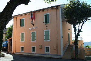
 City Hall ( Mairie ) of Le Pradal |
||
Le Pradal ( Occitan Lo Pradal ) is a southern French commune in the department of Herault in the region Occitania (before 2016: Languedoc-Roussillon ). It has 332 inhabitants (as of January 1, 2017). It belongs to the arrondissement of Béziers and the canton of Clermont-l'Hérault (until 2015: canton of Bédarieux ). The inhabitants are called Pradalais .
geography
Le Pradal is located about 32 kilometers north-northwest of Béziers . Le Pradal is surrounded by the neighboring communities of Taussac-la-Billière in the north, west and south, La Tour-sur-Orb in the north-east and Villemagne-l'Argentière in the east and south-east.
Population development
| 1962 | 1968 | 1975 | 1982 | 1990 | 1999 | 2006 | 2017 |
|---|---|---|---|---|---|---|---|
| 101 | 101 | 97 | 136 | 178 | 191 | 253 | 332 |
| Sources: Cassini and INSEE | |||||||
Web links
Commons : Le Pradal - collection of images, videos and audio files
