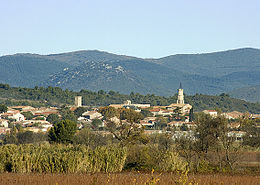
Cazouls-lès-Beziers
| Cazouls-lès-Beziers | ||
|---|---|---|

|
|
|
| region | Occitania | |
| Department | Herault | |
| Arrondissement | Beziers | |
| Canton | Cazouls-lès-Béziers (main town) | |
| Community association | Domitienne | |
| Coordinates | 43 ° 24 ' N , 3 ° 6' E | |
| height | 16-204 m | |
| surface | 38.46 km 2 | |
| Residents | 4,987 (January 1, 2017) | |
| Population density | 130 inhabitants / km 2 | |
| Post Code | 34370 | |
| INSEE code | 34069 | |
| Website | http://www.cazoulslesbeziers.com/ | |
 Town Hall ( Hôtel de ville ) |
||
Cazouls-lès-Béziers is a commune in the Hérault department in the Occitanie region of France . It has 4987 inhabitants (as of January 1, 2017), the "Cazoulins" are called. Cazouls-lès-Béziers belongs to the Arrondissement of Béziers and the canton of Cazouls-lès-Béziers .
geography
Cazouls-lès-Béziers is about five kilometers northwest of Béziers on the Orb River . Cazouls-lès-Béziers is surrounded by the neighboring communities of Cessenon-sur-Orb in the north, Murviel-lès-Béziers in the north-east, Thézan-lès-Béziers in the east, Maraussan in the south-east, Maureilhan in the south, Puisserguier in the west and south-west and Cazedarnes in the Northwest.
Population development
| 1962 | 1968 | 1975 | 1982 | 1990 | 1999 | 2006 | 2017 |
|---|---|---|---|---|---|---|---|
| 3123 | 3171 | 3050 | 3071 | 3251 | 3321 | 3920 | 4987 |
Attractions
- Saint-Saturnin church, already mentioned in 993, bell tower from 1857
- Visigotic Chapel Saint-Vincent-de-Savignac, Monument historique
- Notre-Dame-d'Ayde chapel
- Menhir of Roque-Blanche
- 17th century clock tower
- Savignac-le-Haut Castle, built between the 12th and 13th centuries, rebuilt in the 17th and 18th centuries, has been a monument historique since 1983
- Cazouls Bridge
Personalities
- Amédée Borrel (1867–1936), biologist and physician
Web links
Commons : Cazouls-lès-Béziers - Collection of images, videos and audio files


