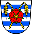
Neplachov
| Neplachov | ||||
|---|---|---|---|---|
|
||||
| Basic data | ||||
| State : |
|
|||
| Region : | Jihočeský kraj | |||
| District : | České Budějovice | |||
| Area : | 1088 ha | |||
| Geographic location : | 49 ° 8 ' N , 14 ° 36' E | |||
| Height: | 433 m nm | |||
| Residents : | 352 (Jan. 1, 2019) | |||
| Postal code : | 373 65 | |||
| License plate : | C. | |||
| traffic | ||||
| Street: | Ceske Budejovice - Veselí nad Lužnicí | |||
| Railway connection: | České Budějovice – Veselí nad Lužnicí | |||
| Next international airport : | České Budějovice Airport | |||
| structure | ||||
| Status: | local community | |||
| Districts: | 1 | |||
| administration | ||||
| Mayor : | Luboš Zasadil (as of 2018) | |||
| Address: | Neplachov 47 373 65 Dolní Bukovsko |
|||
| Municipality number: | 535435 | |||
| Website : | www.neplachov.cz | |||
| Location of Neplachov in the České Budějovice district | ||||

|
||||
Neplachov (German Neplachow ) is a municipality in the Czech Republic . It is located ten kilometers southwest of Veselí nad Lužnicí in South Bohemia and belongs to the Okres České Budějovice .
geography
Neplachov is located on both sides of the Neplachovský creek on the edge of the Wittingau basin in the Pšeničná Blata region . There are several large fish ponds in the vicinity of the village, including the Bošilecký rybník in the northeast, the Záblatský rybník in the southeast and the Stojčín in the southwest. On the eastern edge of the village, the E 55 / I / 3 runs between Budweis and Veselí nad Lužnicí , behind it the České Budějovice – Veselí nad Lužnicí railway line .
Neighboring towns are Pelejovice and Sedlíkovice in the north, Bošilec , Hradina and Dynín in the north-east, Lhota and Ponědraž in the east, Záblatí in the south-east, Mazelov and Švamberk in the south, Gebrovna, Ševětín and Vlkov in the south-west, Drahotěšice in the west and Radonice and Hvozdice in the .no, Hvozdice Northwest.
history
The first written mention of the village Neplachowicz took place on October 10, 1323 in a document from King John of Luxembourg about an exchange of goods between the Bohemian crown and Peter I. von Rosenberg . The king received the villages Radětice , Hvožďany and Křída to round off his rule Bechyně ; In return, he ceded the town of Bukovsko with the villages of Neplachowicz and Drahotěšice to Peter von Rosenberg. From 1379 the place was called Neplachow . Later Neplachov was partly subordinate to the rule and the Wittingau monastery . Via Neplachov, the Linzer Straße from Budweis to Prague was an important medieval trade route, from which the route to Bukovsko branched off.
After seven of the Princely Schwarzenberg rule and six farmsteads belonging to the monastery were burned down in a large fire in 1716 , Prince Adam zu Schwarzenberg ordered the relocation of the granaries from the village square to the field side and the construction of at least partly stone buildings. In 1789 the first branch of the parish school Shevetin was founded in Neplachov . In 1840 Neplachow consisted of 67 houses with 548 inhabitants. 56 houses belonged to the rulership and eleven to the Wittingau estate . There was a private school in the village. The pastor was Shevetin. With the support of Prince zu Schwarzenberg, a school house was built in 1841. Until the middle of the 19th century, the village always remained partly subordinate to the rulership or the Wittingau estate.
After the abolition of patrimonial formed Neplachov / Neplachow 1850 a municipality in the district administration Trebon / Wittingau and the judicial district of Lomnice nad Lužnicí . In 1873 the railway line České Budějovice – Veselí nad Lužnicí was built east of the village, but the place has not yet received a train station. In 1910 there were 568 Czech-speaking residents in the village. After the Okres Třeboň was abolished, Neplachov became part of the Okres Soběslav in 1948. This was dissolved again in 1961 and the village was assigned to the Okres České Budějovice. On April 1, 1976 it was incorporated into Dynín . After a referendum, Neplachov broke away from Dynín on November 24, 1990. The school closed in 1996.
Community structure
No districts are shown for the municipality of Neplachov.
Attractions
- Chapel of St. Wenceslas in the village square, built in 1929
- Farmsteads in the Blata style of the South Bohemian peasant baroque
- The Švamberk estate
Individual evidence
- ↑ http://www.uir.cz/obec/535435/Neplachov
- ↑ Český statistický úřad - The population of the Czech municipalities as of January 1, 2019 (PDF; 0.8 MiB)
- ^ Johann Gottfried Sommer The Kingdom of Bohemia, Vol. 9 Budweiser Kreis, 1841, p. 85
- ↑ Archived copy ( Memento of the original from January 13, 2006 in the Internet Archive ) Info: The archive link was inserted automatically and has not yet been checked. Please check the original and archive link according to the instructions and then remove this notice.
- ↑ Archived copy ( memento of the original from January 10, 2013 in the Internet Archive ) Info: The archive link was inserted automatically and has not yet been checked. Please check the original and archive link according to the instructions and then remove this notice.

