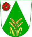
Vrábče
| Vrábče | ||||
|---|---|---|---|---|
|
||||
| Basic data | ||||
| State : |
|
|||
| Region : | Jihočeský kraj | |||
| District : | České Budějovice | |||
| Area : | 1573 ha | |||
| Geographic location : | 48 ° 55 ' N , 14 ° 23' E | |||
| Height: | 505 m nm | |||
| Residents : | 780 (Jan. 1, 2019) | |||
| Postal code : | 370 01 | |||
| License plate : | C. | |||
| traffic | ||||
| Street: | Křemže - České Budějovice | |||
| Railway connection: | České Budějovice – Černý Kříž | |||
| Next international airport : | České Budějovice Airport | |||
| structure | ||||
| Status: | local community | |||
| Districts: | 4th | |||
| administration | ||||
| Mayor : | František Ohrazda (as of 2018) | |||
| Address: | Ves - Na Návsi 33 370 01 České Budějovice |
|||
| Municipality number: | 545261 | |||
| Website : | www.vrabce.cz | |||
| Location of Vrábče in the České Budějovice district | ||||

|
||||
Vrábče , until 1924 Vrabče (German Prabsch ) is a municipality in the Czech Republic . It is located ten kilometers southwest of České Budějovice in South Bohemia and belongs to the Okres České Budějovice .
geography
Vrábče is located in the eastern foothills of the Blanský les on a plateau surrounded by the Vltava in the east and south . To the north rises the Na Vrchu (509 m), in the southwest the Třebiště (566 m), the Kašparka (612 m) and the Kluk (740 m) and northwest of the Švehlany (520 m). The railway line České Budějovice – Černý Kříž runs north and west of the village ; the Hradce railway station is located in Nová Hospoda in the Paniny forest , the Vrábče station in the Zastávka settlement on the road to Křemže . The Dehtářský potok rises in Zastávka .
Neighboring places are U Nové Hospody, Dvůr Koroseky and Závraty in the north, Koroseky in the northeast, Rozinka and Zahorčice in the east, Jamné in the southeast, Kroclov, U Cáby and U Prokopa in the south, U Dvořáčků, Třísov, Na Borech, Holubov and Mestíč in the south-west , U Zastávky and Bohouškovice in the west and Slavče, U Konopů, U Veverků and Hradce in the northwest.
history
Archaeological finds from the Mesolithic to the Latène Age prove that the municipality was settled at an early age.
The first written mention of villa Wrabczie took place in 1379 under the possession of Maidstein Castle . After Peter Wok von Rosenberg gave up the castle at the beginning of the 17th century, their goods were attached to the Krumlov rule . In 1840 Prabsch / Wrabčj consisted of 34 houses with 292 inhabitants. The village included a tavern ( Nová Hospoda ) on the imperial road leading to Krems to the north and the Dwořáček farm ( U Dvořáčků ) to the south-east in the Hlina forest . In Prabsch a branch school in which the children consisted of Hradce were taught. The parish was Payreschau . Until the middle of the 19th century, the village was always subject to the Krumlov rule.
After the abolition of patrimonial formed Vrabče / Prabsch 1850 with the districts Hradce , Jamné, Koroseky, Kroclov, Závraty and Zahorčice a municipality in the district administration Budějovice / Budweis. In 1891 the local railway Budweis - Gojau built by the Austrian Local Railway Company started operating . The settlement of Zastávka was formed around the Vrábče stop on Krems Street in the 20th century. In 1914, 921 people lived in the community, 920 of them Czechs and one German. The village of Vrábče had 286 Czech-speaking residents. In 1924 the official place name was changed from Vrabče to Vrábče . In 1960 the districts of Hradce and Závraty were separated to Homole . At the same time Slavče was incorporated. On July 1, 1985 Vrábče was incorporated with all districts to Boršov nad Vltavou . Since November 24, 1990, Vrábče has been a municipality again.
There is a moldavite litter field near Vrábče .
Community structure
The municipality of Vrábče consists of the districts Koroseky ( Korosek ), Kroclov ( Kräzles ), Slavče ( Slavtsch ) and Vrábče ( Prabsch ). Vrábče also includes the residential areas Na Padělků, Rozinka, U Cáby, U Dvořáčků, U Konopí, U Nové Hospody. U Rybáka, U Zastávky, Zahrádka and Zahrádky. The basic settlement units are Koroseky, Kroclov, Slavče, U Zastávky-západ, Vrábče and Vrábče-U Zastávky.
The municipality is divided into the cadastral districts of Slavče and Vrábče.
Attractions
- Neo-Gothic Church of St. Wenzel, built 1935–1936
- Niche chapel of St. John of Nepomuk, built at the beginning of the 19th century
- Farmsteads in the South Bohemian peasant baroque
Individual evidence
- ↑ http://www.uir.cz/obec/545261/Vrabce
- ↑ Český statistický úřad - The population of the Czech municipalities as of January 1, 2019 (PDF; 0.8 MiB)
- ^ Johann Gottfried Sommer The Kingdom of Bohemia, Vol. 9 Budweiser Kreis, 1840, p. 268
- ↑ Archived copy ( Memento of the original from October 15, 2004 in the Internet Archive ) Info: The archive link was inserted automatically and has not yet been checked. Please check the original and archive link according to the instructions and then remove this notice.
- ↑ Archived copy ( Memento of the original from June 7, 2012 in the Internet Archive ) Info: The archive link was inserted automatically and has not yet been checked. Please check the original and archive link according to the instructions and then remove this notice.
- ↑ http://www.uir.cz/casti-obce-obec/545261/Obec-Vrabce
- ↑ http://www.uir.cz/zsj-obec/545261/Obec-Vrabce
- ↑ http://www.uir.cz/katastralni-uzemi-obec/545261/Obec-Vrabce

