Servigny-lès-Raville
| Servigny-lès-Raville | ||
|---|---|---|

|
|
|
| region | Grand Est | |
| Department | Moselle | |
| Arrondissement | Metz | |
| Canton | Le Pays messin | |
| Community association | Haut Chemin-Pays de Pange | |
| Coordinates | 49 ° 5 ' N , 6 ° 27' E | |
| height | 229-344 m | |
| surface | 14.20 km 2 | |
| Residents | 484 (January 1, 2017) | |
| Population density | 34 inhabitants / km 2 | |
| Post Code | 57530 | |
| INSEE code | 57648 | |
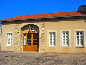
 Mairie Servigny-lès-Raville |
||
Servigny-lès-Raville is a French commune with 484 inhabitants (as of January 1, 2017) in the Moselle department in the Grand Est region (until 2015 Lorraine ). It belongs to the arrondissement of Metz .
geography
Servigny-lès-Raville is located east of Metz at an altitude between 229 and 344 m above sea level, the mean height is 300 m. The municipality covers 14.2 km².
history
The place was 1915-1918 and 1940-1944 the Germanized name Silbernachen .
Population development
| year | 1962 | 1968 | 1975 | 1982 | 1990 | 1999 | 2007 | 2015 |
| Residents | 247 | 258 | 266 | 294 | 347 | 343 | 353 | 472 |
Culture and sights
Web links
Commons : Servigny-lès-Raville - Collection of images, videos and audio files


