Novi Grad (Bosnia and Herzegovina)
|
Novi Grad Нови Град |
||
|
|
||
| Basic data | ||
|---|---|---|
| State : | Bosnia and Herzegovina | |
| Entity : | Republika Srpska | |
| Coordinates : | 45 ° 3 ' N , 16 ° 23' E | |
| Height : | 122 m. i. J. | |
| Area : | 470 km² | |
| Residents : | 23,716 (2018) | |
| Population density : | 50 inhabitants per km² | |
| Telephone code : | +387 (0) 52 | |
| Postal code : | 79220 | |
| Structure and administration (as of 2016) | ||
| Mayor : | Miroslav Drljača ( SNSD ) | |
| Website : | ||
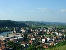
Novi Grad (Cyrillic: Нови Град; also Bosanski Novi ) is a municipality in northwestern Bosnia and Herzegovina and had about 29,000 inhabitants at the 2013 census. It belongs to the Republika Srpska , one of two entities in the country.
Before the Bosnian War, the city and municipality were named Bosanski Novi , but the adjective bosanski ("Bosnian") was removed from all place names by decision of the Republika Srpska. At the state level, the traditional name is still used.
geography
Novi Grad is located at the confluence of the Sana and the Una in the Banja Luka region 320 kilometers northwest of Sarajevo and 80 kilometers northwest of Banja Luka . Neighboring municipalities are Kostajnica and Kozarska Dubica in the north, Bosanska Krupa and Krupa na Uni in the southwest and Prijedor and Oštra Luka in the east. In the northwest the Una forms the border to the Croatian neighboring municipality Dvor na Uni .
The town and municipality of Bosanski Novi were renamed Novi Grad after the war. The main town of Novi Grad lies at the mouth of the Sana and Una . The city area is 470 km².
The municipality includes Lješljani , where a spa center is being built because of the thermal springs there.
history
As a border fortress between the Ottoman Empire and the Habsburg Monarchy , the city was often fought over. It was besieged by imperial troops in the course of the Russo-Austrian Turkish War in 1788 and conquered on October 3rd under the command of Field Marshal Gideon Ernst Freiherr von Laudon .
Bosnian War
In Bosanski Novi, according to testimony before the International Criminal Court in The Hague, the non-Serbian civilian population was expelled by the Vojska Republike Srpske . In the course of ethnic cleansing, non-Serbs were restricted in their freedom of movement, dismissed from their jobs, deported or driven out. Non-Serbian men were also called upon to go to the local stadium, where they were imprisoned. In addition, areas where mostly Bosniak civilians were located were bombed by the VRS.
Economy and Infrastructure
Before the Bosnian War , the city was well developed economically: wood processing, textile industry, mining of raw materials, etc. Today, most of the economy of that time has been destroyed, and few companies have survived. Above all there are companies in the construction industry and restaurants. One of the most important employers in the city is the drug trading company Interpromet in Novi Grad, founded after the war , and many people are also involved in wood processing. Agriculture is still the mainstay of the local economy.
In the city center in the former department store, the TROPIC shopping center has been completed, and a spa hotel and center near the Slatina thermal springs is also planned.
traffic
The community is well developed through the main roads M 4 ( Banja Luka – Novi Grad) and M 14 (Bihać – Novi Grad – Kostajnica) as well as the Croatian trunk road 6 via Glina to Karlovac .
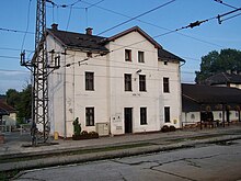
The Novi Grad train station is on the railway line (Zagreb–) Dobrljin – Banja Luka –Doboj (–Sarajevo), from which the Una railway branches off to Bihać and Knin . Night trains run towards Sarajevo and Bihać.
population
Population before the war: (as of May 1991)
- Serbs: approx. 63%
- Bosniaks: approx. 35.5%
- Croatians: 231 (0.65%)
- Members of other ethnic groups: 336
- Total: 35,024
The main settlement area is the central town of Novi Grad (formerly: Bosanski Novi ).
Web links
- Side of the Opština Novi Grad
- unofficial Bosniak site Bosanski Novi
- Bosanski Novi / Novi Grad on the website of the Federal Commissioner for Bosnia and Herzegovina (July 1998) ( Memento from June 12, 2007 in the Internet Archive )
Individual evidence
- ↑ http://rzs.rs.ba/front/article/3630/ Updated population figures for 2018 from the Institute for Statistics of the Republika Srpska. Retrieved June 9, 2019.
- ↑ Svjedok o etničkom čišćenju Opčine Bosanski Novi. Retrieved May 8, 2017 .


