Leavenworth County
![The Leavenworth County Courthouse in Leavenworth, listed on NRHP No. 02000394 [1]](https://upload.wikimedia.org/wikipedia/commons/thumb/7/7e/Leavenworth_county_kansas_courthouse_2009.jpg/298px-Leavenworth_county_kansas_courthouse_2009.jpg) The Leavenworth County Courthouse in Leavenworth, listed on NRHP No. 02000394 |
|
| administration | |
|---|---|
| US state : | Kansas |
| Administrative headquarters : | Leavenworth |
| Address of the administrative headquarters: |
County Courthouse 300 Walnut Street Leavenworth, KS 66048-2725 |
| Foundation : | August 30, 1855 |
| Made up from: | Original County |
| Area code : | 001 913 |
| Demographics | |
| Residents : | 76,227 (2010) |
| Population density : | 63.5 inhabitants / km 2 |
| geography | |
| Total area : | 1213 km² |
| Water surface : | 13 km² |
| map | |
| Website : www.leavenworthcounty.org/home.asp | |
The Leavenworth County is a county in the US state of Kansas . At the 2010 census , the county had 76,227 people and a population density of 63.5 people per square kilometer. The county seat is Leavenworth .
Leavenworth County is part of the Kansas City metropolitan area .
geography
The county is located in northeast Kansas, borders Missouri , with the Missouri River as the natural boundary, and covers an area of 1,213 square kilometers, of which 13 square kilometers are water. It borders on the following counties:
| Atchison County |
Platte County, Missouri |
|
| Jefferson County |

|
Wyandotte County |
| Douglas County | Johnson County |
history
| growth of population | |||
|---|---|---|---|
| Census | Residents | ± in% | |
| 1900 | 40,940 | - | |
| 1910 | 41.207 | 0.7% | |
| 1920 | 38,402 | -6.8% | |
| 1930 | 42,673 | 11.1% | |
| 1940 | 41,112 | -3.7% | |
| 1950 | 42,361 | 3% | |
| 1960 | 48,524 | 14.5% | |
| 1970 | 53,340 | 9.9% | |
| 1980 | 54,809 | 2.8% | |
| 1990 | 64,371 | 17.4% | |
| 2000 | 68,691 | 6.7% | |
| 2010 | 76.227 | 11% | |
| Before 1900 1900–1990 2000 + 2010 | |||
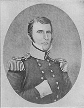
Leavenworth County was formed on August 30, 1866 as the original county from the Kansas Territory that was designated as free - but actually populated by Indians - and is one of the first 33 counties that were formed by the first Territorial Administration. It was named - like the district capital - after Henry Leavenworth (1783–1834), an officer in the war of 1812 .
Leavenworth County has two National Historic Landmarks , Fort Leavenworth and the Western Branch, National Home for Disabled Volunteer Soldiers . A total of 41 buildings and sites in the county are listed on the National Register of Historic Places (as of August 30, 2017).
Demographic data
As of the 2010 census , Leavenworth County had 76,227 people in 25,426 households. The population density was 63.5 inhabitants per square kilometer.
The racial the population was composed of 83.8 percent white, 9.4 percent African American, 0.8 percent Native American, 1.3 percent Asian and other ethnic groups; 3.3 percent were descended from two or more races. Hispanic or Latino of any race was 5.7 percent of the population.
Statistically, there were 2.63 people each in the 25,426 households.
25.0 percent of the population were under 18 years old, 64.5 percent were between 18 and 64 and 10.5 percent were 65 years or older. 47.3 percent of the population was female.
The median income for a household was 57,691 USD . The per capita income was $ 25,342. 9.5 percent of the population lived below the poverty line.
cities and communes
1 - partly in Johnson and Wyandotte Counties
2 - partly in Johnson County
Individual evidence
- ^ Extract from the National Register of Historic Places.Retrieved March 13, 2011
- ↑ GNIS-ID: 485016. Retrieved on February 22, 2011 (English).
- ^ National Association of Counties.Retrieved October 16, 2011
- ^ US Census Bureau - Census of Population and Housing.Retrieved March 15, 2011
- ↑ Extract from Census.gov.Retrieved February 17, 2011
- ↑ Extract from census.gov (2000 + 2010) ( Memento of the original from July 13, 2011 on WebCite ) Info: The archive link was automatically inserted and not yet checked. Please check the original and archive link according to the instructions and then remove this notice. Retrieved April 2, 2012
- ↑ Listing of National Historic Landmarks by State: Kansas . National Park Service , accessed August 30, 2017.
- ↑ Search mask database in the National Register Information System. National Park Service , accessed August 30, 2017.
- ↑ US Census Bureau, State & County QuickFacts - Leavenworth County ( Memento of the original from July 13, 2011 on WebCite ) Info: The archive link was automatically inserted and not yet checked. Please check the original and archive link according to the instructions and then remove this notice. Retrieved October 16, 2011
Web links
- US Census Bureau, State & County QuickFacts - Leavenworth County
- Yahoo Image Search - Leavenworth County
- www.city-data.com - Leavenworth County
Coordinates: 39 ° 16 ′ N , 95 ° 8 ′ W


