
Saint-Laurent-des-Hommes
|
Saint-Laurent-des-Hommes Sent Laurenç daus Urmes |
||
|---|---|---|

|
|
|
| region | Nouvelle-Aquitaine | |
| Department | Dordogne | |
| Arrondissement | Périgueux | |
| Canton | Vallée de l'Isle | |
| Community association | Isle et Crempse en Périgord | |
| Coordinates | 45 ° 2 ′ N , 0 ° 15 ′ E | |
| height | 31-113 m | |
| surface | 31.94 km 2 | |
| Residents | 1,018 (January 1, 2017) | |
| Population density | 32 inhabitants / km 2 | |
| Post Code | 24400 | |
| INSEE code | 24436 | |
| Website | http://www.saint-laurent-des-hommes.com/ | |
.JPG) Town hall (Mairie) of Saint-Laurent-des-Hommes |
||

Saint-Laurent-des-Hommes ( Occitan : Sent Laurenç daus Urmes ) is a municipality in the French region of Nouvelle-Aquitaine (before 2016: Aquitaine ) with 1,018 inhabitants (as of January 1, 2017). It is located in the Dordogne department . The municipality is part of the canton of Vallée de l'Isle (until 2015: canton of Mussidan ) in the Arrondissement of Périgueux . The inhabitants are called Saint-Laurentais .
geography
Saint-Laurent-des-Hommes is located in the Périgord Blanc (White Périgord) on the north bank of the Isle . Saint-Laurent-des-Hommes is surrounded by the neighboring communities of Saint-Michel-de-Double in the north, Saint-Martin-l'Astier in the east and northeast, Saint-Médard-de-Mussidan in the east and southeast, and Beaupouyet in the south South-east, Saint-Martial-d'Artenset in the south, Montpon-Ménestérol in the west and south-west and Saint-Barthélemy-de-Bellegarde in the north-west.
Population development
| year | 1962 | 1968 | 1975 | 1982 | 1990 | 1999 | 2006 | 2013 |
| Residents | 925 | 861 | 867 | 863 | 938 | 884 | 989 | 1,048 |
| Source: Cassini and INSEE | ||||||||
Attractions
- Merovingian necropolis
- Saint-Laurent church from the 15th century
- Les Fournils Castle
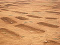
Merovingian necropolis

Saint Laurent Church

Les Fournils Castle

.JPG)
.JPG)
Parish partnership
A partnership has existed with the British parishes of Sutton and Shottisham in Suffolk, England since 1976.