Eygurande-et-Gardedeuil
|
Eygurande-et-Gardedeuil Eiguranda e Gardadelh |
||
|---|---|---|
|
|
||
| region | Nouvelle-Aquitaine | |
| Department | Dordogne | |
| Arrondissement | Périgueux | |
| Canton | Montpon-Ménestérol | |
| Community association | Isle Double Landais | |
| Coordinates | 45 ° 4 ′ N , 0 ° 7 ′ E | |
| height | 28-115 m | |
| surface | 35.62 km 2 | |
| Residents | 403 (January 1, 2017) | |
| Population density | 11 inhabitants / km 2 | |
| Post Code | 24700 | |
| INSEE code | 24165 | |
| Website | http://www.eygurande-et-gardedeuil.fr/ | |
Eygurande-et-Gardedeuil ( Occitan : Eiguranda e Gardadelh ) is a French municipality with 403 inhabitants (as of January 1 2017) in the department of Dordogne in the region Nouvelle-Aquitaine ; it belongs to the Arrondissement of Périgueux and the canton of Montpon-Ménestérol .
geography
Eygurande-et-Gardedeuil is located in the Périgord on the Duche River . The neighboring communities of Eygurande-et-Gardedeuil are La Roche-Chalais in the north and north-west, Servanches in the north and north-east, Saint-Barthélemy-de-Bellegarde in the east, Montpon-Ménestérol in the south and south-east, Le Pizou in the south and south-west and Saint -Antoine-sur-l'Isle to the west.
The former route nationale 730 (today's D730) runs through the municipality .
history
In 1827 the previously independent communities Eygurande and Gardedeuil were merged.
Population development
| year | 1962 | 1968 | 1975 | 1982 | 1990 | 1999 | 2006 | 2017 |
| Residents | 484 | 423 | 365 | 310 | 300 | 296 | 345 | 403 |
| Sources: Cassini and INSEE | ||||||||
Attractions
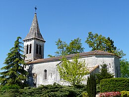
- Saint-Pierre church
- Notre-Dame des Victoires chapel
- La Molle Castle from the 17th century

