Saint-Jean-d'Ataux
| Saint-Jean-d'Ataux | ||
|---|---|---|
|
|
||
| region | Nouvelle-Aquitaine | |
| Department | Dordogne | |
| Arrondissement | Périgueux | |
| Canton | Vallée de l'Isle | |
| Community association | Isle Vern Salembre en Périgord | |
| Coordinates | 45 ° 9 ′ N , 0 ° 25 ′ E | |
| height | 71–157 m | |
| surface | 12.11 km 2 | |
| Residents | 128 (January 1, 2017) | |
| Population density | 11 inhabitants / km 2 | |
| Post Code | 24190 | |
| INSEE code | 24424 | |
| Website | saintjeandataux.com | |
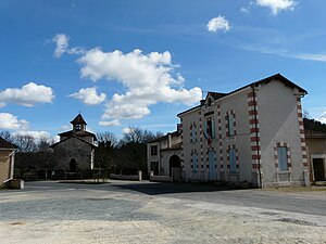
 Center of Saint-Jean-d'Ataux |
||
Saint-Jean-d'Ataux is a French municipality with 128 inhabitants (at January 1, 2017) in the department of Dordogne in the region Nouvelle-Aquitaine (before 2016: Aquitaine ). The municipality belongs to the Arrondissement Périgueux and the canton Vallée de l'Isle (until 2015: canton Neuvic ).
The name in the Occitan language is Sent Joan d'Astaus and is derived from John the Baptist . The addition "Astaus" probably comes from a male name of Germanic origin, "Astaldus", "Hastaus" or possibly "Asthaldwulf". This was changed in the Occitan language to "Astaud" or "Astouaud".
The inhabitants are called Ataussiens and Ataussiennes .
geography
Saint-Jean-d'Ataux is located approx. 25 km west-southwest of Périgueux in the Double area of the historic Périgord province .
Saint-Jean-d'Ataux is surrounded by the neighboring municipalities:
| Saint-Vincent-de-Connezac | Chantérac | |

|
Saint-Germain-du-Salembre | |
| Beauronne | Douzillac |
Saint-Jean-d'Ataux is located in the catchment area of the Dordogne river .
The Beauronne , a tributary of the Isle , crosses the territory of the municipality together with its tributaries, the Bardot, the Rieutord and the Ruisseau de Rieu Quérieu.
Population development
After records began, the population rose to a peak of around 320 in the middle of the 19th century. In the period that followed, the size of the community fell to around 95 inhabitants, with brief recovery phases up to the 1970s. A phase of growth followed, which increased the number of inhabitants to 150 by the turn of the millennium, before it then stabilized at a level of around 120 inhabitants.
| year | 1962 | 1968 | 1975 | 1982 | 1990 | 1999 | 2006 | 2011 | 2017 |
|---|---|---|---|---|---|---|---|---|---|
| Residents | 131 | 119 | 94 | 127 | 136 | 150 | 126 | 117 | 128 |
Attractions
- Parish church of Saint-Jean-Baptiste from the 11th century with a Romanesque choir
Economy and Infrastructure
The community benefits from its rural environment to develop “green” tourism.

total = 10
traffic
Saint-Jean-d'Ataux can be reached via Routes départementales 41 and 709, the former Route nationale 709 .
The commune is connected to other communes in the department by a line on the Transpérigord bus network from Ribérac to Mussidan .
Web links
Individual evidence
- ↑ Le nom occitan des communes du Périgord ( fr ) Départementrat des Dordogne. Retrieved January 11, 2019.
- ↑ a b c Saint-Jean-d'Ataux ( fr ) Conseil régional d'Aquitaine. Archived from the original on September 9, 2016. Retrieved January 11, 2019.
- ↑ Ma commune: Saint-Jean-d'Ataux ( fr ) Système d'Information sur l'Eau du Bassin Adour Garonne. Retrieved January 11, 2019.
- ^ Notice Communale Saint-Jean-d'Ataux ( fr ) EHESS . Retrieved January 11, 2019.
- ↑ Populations légales 2016 Commune de Saint-Jean-d'Ataux (24424) ( fr ) INSEE . Retrieved January 11, 2019.
- ↑ Caractéristiques des établissements en 2015 Commune de Saint-Jean-d'Ataux (24424) ( fr ) INSEE . Retrieved January 11, 2019.


