
Creyssensac-et-Pissot
| Creyssensac-et-Pissot | ||
|---|---|---|
|
||
| region | Nouvelle-Aquitaine | |
| Department | Dordogne | |
| Arrondissement | Périgueux | |
| Canton | Périgord Central | |
| Community association | Agglomération Le Grand Périgueux | |
| Coordinates | 45 ° 5 ′ N , 0 ° 40 ′ E | |
| height | 108-236 m | |
| surface | 8.62 km 2 | |
| Residents | 262 (January 1, 2017) | |
| Population density | 30 inhabitants / km 2 | |
| Post Code | 24380 | |
| INSEE code | 24146 | |
 Creyssensac-et-Pissot town hall |
||

Creyssensac-et-Pissot is a French municipality with 262 inhabitants (at January 1, 2017) in the department of Dordogne in the region Nouvelle-Aquitaine (before 2016: Aquitaine ). The municipality belongs to the arrondissement of Périgueux and the canton of Périgord Central (until 2015: canton of Vergt ).
The name in the Occitan language is Creissençac e Pissòt . The first part of the name goes back to the name of a country estate in Gallo-Roman times that belonged to a "Crescentius". The second part goes back either to the Occitan Pissòt ( German bubbling spring ) or to the Gallo-Roman name "Pincius".
The inhabitants are called Creyssensacois and Creyssensacoises .
geography
Creyssensac-et-Pissot is about 12 km southwest and thus in the catchment area ( Aire urbaine ) of Périgueux and about 30 km northwest of Bergerac in the Périgord Central region of the historic province of Périgord .
Creyssensac-et-Pissot is surrounded by the neighboring municipalities:
| Chalagnac | ||
| Saint-Paul-de-Serre |
.svg)
|
|
| Green Bordas | Vergt |
Creyssensac-et-Pissot lies in the catchment area of the Dordogne river . The Serre, a tributary of the Vern , flows past the border with the neighboring municipality of Chalagnac to the north.
history
The history of Creyssensac-et-Pissot is linked to the history of the Périgord. The Dordogne and with it the municipality were involved in the Hundred Years War between 1337 and 1453 and the Huguenot Wars in the 16th and 17th centuries. The most striking incident was the Battle of Vergt in October 1562. Due to the collection of new taxes despite a general emergency led to the rebellion of the croquants between 1584 and 1636. On April 20, 1820, the communities of Creyssensac and Pissot united to form the community of Creyssensac-et -Pissot.
Toponymy
Toponyms and mentions of Creyssensac were:
- Creichensa (1203, payment of the pension owed to the Seigneur de Taillefer),
- Creyschensacum (church property book of the 13th century),
- Creyssensac (1750, map by Cassini ),
- Creissensac (1793, Notice Communale ),
- Cressensac (1801, Bulletin des Lois ).
Toponyms and mentions of Pissot were:
- Pihsot (1247, castellany of the Périgord),
- Pichot (1365, Collection de l'abbé de Lespine ),
- Ecclesia nova de Pischol (1382, report by Pierre des Mortiers),
- Pissot (1750, 1793 and 1801, map from Cassini, Notice Communale or Bulletin des Lois ).
Population development
After records began, the population rose to a peak of 440 in the mid-19th century. In the following period, the size of the community fell to around 125 inhabitants with brief recovery periods up to the 1980s, before a robust growth phase set in that is today still persists.
| year | 1962 | 1968 | 1975 | 1982 | 1990 | 1999 | 2006 | 2010 | 2017 |
|---|---|---|---|---|---|---|---|---|---|
| Residents | 155 | 138 | 128 | 126 | 178 | 201 | 212 | 232 | 262 |

Town twinning
Creyssensac-et-Pissot has had a town partnership with the former canton of Vergt since 1996 :
- Saint-Jacques-de-Montcalm in the Canadian province of Quebec .
Attractions
Castle de la Grèze

The building is austere in appearance, with a main section covered with slate and two smaller wings. Marked on the courtyard side. A large dormer on the courtyard side marks the center of the house. On the garden side, a risalit protrudes from the facade with two projections and supports the dormer window and the cast iron balcony. Access to the building is via an open staircase.
Creyssensac Castle
It was built in 1860 by M. Bachon, a stable master of the son of Napoleon III. erected near the parish church. The castle is privately owned and is not open to the public.
More Attractions
- Parish church of Saint-Pardoux in Creyssensac
- Parish Church of Saint-Pardoux

South side

Bell gable

Nave overlooking the choir

Stained glass window depicting Saint Roch
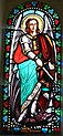
Stained glass window depicting the Archangel Michael


.JPG)

- Church of Sainte-Marie , called Église-Neuve in Pissot
- Church of Sainte-Marie, called Église-Neuve

South side

Entrance portal

Choir

Nave overlooking the choir


Economy and Infrastructure

Agriculture with its mixed culture, cattle breeding and the cultivation of strawberries is the most important economic factor in the municipality.

total = 20
sport and freetime
The long-distance hiking trail GR 654 from Namur in Belgium via Vézelay to Saint-Jean-Pied-de-Port leads through Creyssensac-et-Pissot. It follows the Via Lemovicensis, one of the four Camino de Santiago in France.
traffic
The national route 21 , which connects Périgueux and Bergerac, crosses the territory of the commune. Creyssensac-et-Pissot can also be reached by secondary roads that branch off from Routes départementales 43 and 44.

Personalities
Valentin Huot , born on May 1, 1929 in Creyssensac-et-Pissot, died on November 21, 2017 in Manzac-sur-Vern , was a French cyclist . He took part in the Tour de France several times . 1957 and 1958 he became French champion in the pro - road race .
Web links
Individual evidence
- ↑ Le nom occitan des communes du Périgord ( fr ) Départementrat des Dordogne. Retrieved October 25, 2018.
- ↑ a b c Creyssensac-et-Pissot ( fr ) Conseil régional d'Aquitaine. Archived from the original on September 9, 2016. Retrieved October 25, 2018.
- ↑ Dordogne ( fr ) habitants.fr. Retrieved October 25, 2018.
- ↑ Aire urbaine de Périgueux (087) ( fr ) INSEE . Retrieved October 25, 2018.
- ↑ Ma commune: Creyssensac-et-Pissot ( fr ) Système d'Information sur l'Eau du Bassin Adour Garonne. Retrieved October 25, 2018.
- ^ Paul Vicomte de Gourgues: Dictionnaire topographique du département de la Dordogne ( fr ) In: Dictionnaire topographique de la France . Imprimerie nationale. P. 92, 1873. Retrieved October 25, 2018.
- ^ A b France 1750 ( en ) David Rumsey Map Collection: Cartography Associates. Retrieved October 25, 2018.
- ↑ a b Notice Communale Creyssensac-et-Pissot ( fr ) EHESS . Retrieved October 25, 2018.
- ^ Paul Vicomte de Gourgues: Dictionnaire topographique du département de la Dordogne ( fr ) In: Dictionnaire topographique de la France . Imprimerie nationale. P. 241, 1873. Retrieved October 25, 2018.
- ↑ Notice Communale Pissot ( fr ) EHESS . Retrieved October 25, 2018.
- ↑ Populations légales 2006 Commune de Creyssensac-et-Pissot (24146) ( fr ) INSEE . Retrieved October 25, 2018.
- ↑ Populations légales 2015 Commune de Creyssensac-et-Pissot (24146) ( fr ) INSEE . Retrieved October 25, 2018.
- ↑ Le comité de jumelage du Pays vernois a 20 ans ( fr ) Sud Ouest . June 14, 2016. Retrieved October 25, 2018.
- ↑ Château de la Grèze ( fr ) chateau-fort-manoir-chateau.eu. Retrieved October 25, 2018.
- ↑ Château de Creyssensac ( fr ) chateau-fort-manoir-chateau.eu. Retrieved October 25, 2018.
- ↑ Caractéristiques des établissements en 2015 Commune de Creyssensac-et-Pissot (24146) ( fr ) INSEE . Retrieved October 25, 2018.
- ↑ La voie de Vézelay ( fr ) Agence de Coopération Interrégionale et Réseau “Chemins de Saint-Jacques de Compostelle”. Retrieved October 25, 2018.
- ↑ Valentin Huot . the cycling pages. Retrieved October 25, 2018.