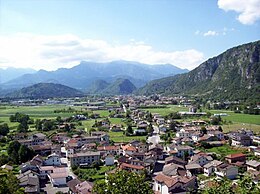
Villa Santina
| Villa Santina | ||
|---|---|---|

|
|
|
| Country | Italy | |
| region | Friuli Venezia Giulia | |
| Coordinates | 46 ° 25 ′ N , 12 ° 55 ′ E | |
| height | 363 m slm | |
| surface | 13.00 km² | |
| Residents | 2,200 (Dec. 31, 2019) | |
| Population density | 169 inhabitants / km² | |
| Post Code | 33029 | |
| prefix | 0433 | |
| ISTAT number | 030133 | |
| Popular name | Villots or Villosi | |
| Patron saint | Lawrence of Rome | |
| Website | Villa Santina | |
Villa Santina (in the Furlan dialect : Vile ) is a north-eastern Italian municipality ( comune ) with 2200 inhabitants (as of December 31, 2019) in the Friuli-Venezia Giulia region . The municipality is located about 39 kilometers northwest of Udine on the Tagliamento and belongs to the Comunità Montana della Carnia .
traffic
From here the former Strada Statale 355 di Val Degano to Santo Stefano di Cadore begins and the Strada Statale 52 Carnica leads through the municipality of Venzone to Innichen (Italian: San Candido ).
history
On the Monte Santina , an island mountain directly on the Tagliamento , which rises about 50 m above the valley, there was a hilltop settlement in late antiquity and in the early Middle Ages . The fortified system blocked a crossing over the Tagliamento on the old Roman road from Aquileia over the Plöckenpass to Aguntum . Paulus Diaconus mentions it with the name Ibligo in connection with an Avar attack on the Lombard Duchy of Friuli around the year 610 and describes it as impregnable due to its location. Church buildings, cisterns, walls, towers and gates can be proven archaeologically. The village at the foot of Monte Santina still bears the name Invillino today. The Ibligo fort was only identified with Monte Satina in 1962. The cemetery of the residents of Ibligo was probably located on the Col di Zuca hill a few hundred meters upstream , where there was also an early church with a mosaic floor. Up until the 13th century there was a castle of the Patriarch of Venice on Monte Santina , which can be seen as the direct successor to the early medieval complex. The entire community of Villa Santina was severely damaged by the 1976 earthquake.
Individual evidence
- ↑ Statistiche demografiche ISTAT. Monthly population statistics of the Istituto Nazionale di Statistica , as of December 31 of 2019.
- ↑ Wilfried Menghin : The Longobards. Archeology and history. Theiss, Stuttgart 1985, ISBN 3-8062-0364-4 (p. 122 f.)


