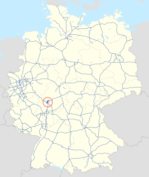
Federal motorway 485
| Bundesautobahn 485 in Germany | |||||||||||||||||||||||||||||||||||||||||||||||||||||||

|
|||||||||||||||||||||||||||||||||||||||||||||||||||||||
| map | |||||||||||||||||||||||||||||||||||||||||||||||||||||||
| Basic data | |||||||||||||||||||||||||||||||||||||||||||||||||||||||
| Operator: |
|
||||||||||||||||||||||||||||||||||||||||||||||||||||||
| Start of the street: |
Giessener Nordkreuz ( 50 ° 38 ′ N , 8 ° 43 ′ E ) |
||||||||||||||||||||||||||||||||||||||||||||||||||||||
| End of street: |
Langgöns ( 50 ° 30 ′ N , 8 ° 39 ′ E ) |
||||||||||||||||||||||||||||||||||||||||||||||||||||||
| Overall length: | 19 km | ||||||||||||||||||||||||||||||||||||||||||||||||||||||
|
State : |
|||||||||||||||||||||||||||||||||||||||||||||||||||||||
| Development condition: | four-lane | ||||||||||||||||||||||||||||||||||||||||||||||||||||||
|
Course of the road
|
|||||||||||||||||||||||||||||||||||||||||||||||||||||||
The federal highway 485 (abbreviation: BAB 485 ) - short form: Autobahn 485 (abbreviation: A 485 ) - leads from Gießener Nordkreuz past Gießen and Linden to Langgöns . It is part of the Gießener Ring up to the Bergwerkswald junction and is used by an average of around 50,000 vehicles every day. The highest volume of traffic is between the Schiffenberger Tal and Bergwerkswald junctions with more than 63,000 vehicles per day at times.
The A 485 was originally part of an abandoned section of the A 49 .
Web links
Commons : Bundesautobahn 485 - Collection of pictures, videos and audio files


