
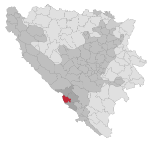
Grude (Bosnia and Herzegovina)
|
Grude Груде |
|||
|
|
|||
|
|||
| Basic data | |||
|---|---|---|---|
| State : | Bosnia and Herzegovina | ||
| Entity : | Federation of BiH | ||
| Canton : | |||
| Coordinates : | 43 ° 22 ' N , 17 ° 25' E | ||
| Height : | 270 m. i. J. | ||
| Area : | 221 km² | ||
| Residents : | 17,865 (2013) | ||
| Population density : | 81 inhabitants per km² | ||
| Telephone code : | +387 (0) 66 | ||
| Postal code : | 88340 | ||
| Structure and administration (as of 2016) | |||
| Structure : | 15 local communities | ||
| Mayor : | Ljubo Grizelj ( HDZ BiH ) | ||
| Postal address : | from Gabre Grubišića 4 88340 Grude |
||
| Website : | |||
| Others | |||
| Patron saint : |
St. Catherine ( Sv. Kata ) |
||
| City Festival : |
November 25th (patron saint's day) |
||
  |
|||


Grude ( Cyrillic Груде ) is a municipality in Bosnia and Herzegovina with just under 18,000 inhabitants. The community, almost exclusively populated by Croats , is located in western Herzegovina and belongs to the canton of West Herzegovina of the Federation .
The main town of the same name is the administrative seat of the municipality. The municipality is divided into 15 local communities : Pocrte, Borajna, Tihaljina, Grude Zapad, Cerov Dolac Pogana Vlaka, Ledinac-Podledinac, Višnjica-Medovići, Dragicina, Jabuka-Puteševica, Ružići, Gorica, Sovici Donji , Sovici Gornji , Drinovci and Grude Centar.
population
Population in the municipality of Grude according to the 1991 census:
- Total: 15,976
- Croatians: 13,150 (99.77%)
- Serbs: 8 (0.05%)
- Bosniaks: 4 (0.03%)
- Others: 25 (0.16%)
geography
Geographically, the Verbandsgemeinde is determined by the course of the Bekijsko Polje, which runs from northwest to southeast and then widens to the west to a lowland. The lowlands are very fertile and are mainly used for agriculture. The mountain ranges and plateaus adjoining in the course of the valley cuts are karstified and hardly usable for agriculture. With a height of 819 m, the Trstike mountain in the southwest is the highest elevation in the association, the lowlands are at around 250 m. The Verbandsgemeinde Grude has an area of about 221 km². Grude is around 40 km from Mostar and around 100 km from Split .
Neighboring communities
Grude borders in the northwest on Posušje , in the northeast on Široki Brijeg , in the southeast on Ljubuški , in the west on Imotski ( Croatia ) and in the south on Vrgorac (Croatia).
Geographical location
The Verbandsgemeinde Grude has an extension of around 18 km in a north-south direction and around 22 km in a west-east direction.
history
During the Bosnian War , Grude was the seat of government of the internationally unrecognized Croatian Republic of Herceg-Bosna , with its President Mate Boban .
On April 6, 2001, following a raid by SFOR troops in the local branch of Hercegovačka banka in Grude, a hostage-taking occurred .
religion
The population of the large community of Grude is almost exclusively Catholic .
There are six Roman Catholic parishes in the municipality : Grude, Drinovci, Gorica, Ružići, Tihaljina and Ledinac. The parishes belong to the Mostar-Duvno diocese .
Town twinning
The municipality of Grude has twinned cities with Slunj ( Croatia ) and Baldissero Torinese (Italy).
Economy and Infrastructure
- Kamenko (ice cream factory)
- Violeta (toilet paper factory)
- Prima (brewery)
- Grafotisak (printer)
traffic
- Regional road R 420 Grude - Privalj - Široki Brijeg - Mostar
- Regional road R 421 Sovići-Klobuk
- New regional road Grude-Posušje
Sports
- Basketball Club Grude ( HKK Grude )
- Women's Basketball Club ( ŽKK Grude )
- Handball Club Grude
- Football Club Grude ( NK Grude )
- Football Club Drinovci
- Chess Club Grude
- Majorets Club Grude
- Annual marathon from Grude via Ljubuški to Međugorje
Personalities
- Milan Bandić (* 1955), Mayor of Zagreb
- Mate Boban (1940–1997), President of the Croatian Republic of Herceg-Bosna
- Rafael Boban (1907 – after May 1945), Ustaša officer and general
- Paškal Buconjić (1834–1910), Bishop of Mostar Duvno - ( Trebinje-Mrkan )
- Ivan Bušić Roša (around 1745–1783), Heiduck
- Zvonko Bušić (1946–2013), terrorist
- Andrijica Šimić (1833–1905), Heiduck
- Antun Branko Šimić (1898–1925), writer
- Blago Zadro (1944–1991), politician and general
- Vinko Marinko Prlić (1940-2017), Franciscan
- Velimir Petković (* 1956), handball coach
Web links
Individual evidence
- ↑ Internet presence of the large community of Grude. Retrieved December 3, 2013 (Croatian).
- ↑ Central European News: SFOR raids Croat bank - take two , April 23, 2001
- ↑ Website of the Peace Marathon Međugorje ( Memento of the original from April 30, 2008 in the Internet Archive ) Info: The archive link has been inserted automatically and has not yet been checked. Please check the original and archive link according to the instructions and then remove this notice.

Banja Luka | Banovići | Berkovići | Bihać | Bijeljina | Bileća | Bos. Krupa | Bos. Brod | Bos. Petrovac | Šamac | Bos. Grahovo | Bratunac | Brčko | Breza | Bugojno | Busovača | Bužim | Cazin | Centar | Čajniče | Čapljina | Čelić | Čelinac | Čitluk | Derventa | Drvar | Doboj | Doboj Istok | Doboj Jug | Dobretići | Domaljevac-Šamac | Donji Vakuf | Donji Žabar | Foča | Foča-Ustikolina | Fojnica | Gacko | Glamoč | Goražde | Gornji Vakuf-Uskoplje | Gračanica | Gradačac | Gradiška | Grude | Hadžići | Han Pijesak | Ilidža | Ilijaš | Istočna Ilidža | Istočni Drvar | Istočni Mostar | Istočni Stari Grad | Istočno Novo Sarajevo | Jablanica | Jajce | Jezero | Kakanj | Kalesija | Kalinovik | Kiseljak | Kladanj | Ključ | Kneževo | Konjic | Kostajnica | Kotor Varoš | Kozarska Dubica | Kreševo | Krupa na Uni | Kupres | Kupres (RS) | Laktaši | Livno | Ljubinje | Ljubuški | Lopare | Lukavac | Maglaj | Milići | Modriča | Mostar | Mrkonjić degree | Neum | Nevesinje | Novi Grad | Novi Grad (Bos. Novi) | Novi Travnik | Novo Sarajevo | Odžak | Olovo | Orašje | Osmaci | Oštra Luka | Pale | Pale-Prača | Pelagićevo | Petrovac | Petrovo | Posušje | Prijedor | Prnjavor | Prozor-Rama | Ravno | Ribnik | Rogatica | Rudo | Sanski Most | Sapna | Sokolac | Srbac | Srebrenica | Srebrenik | Stari Grad | Stanari | Stolac | Šekovići | Šipovo | Široki Brijeg | Teočak | Teslić | Tešanj | Tomislavgrad | Travnik | Trebinje | Trnovo (RS) | Trnovo (FBiH) | Tuzla | Ugljevik | Usora | Ustiprača | Vareš | Velika Kladuša | Visoko | Višegrad | Vitez | Vlasenica | Vogošća | Vukosavlje | Zavidovići | Zenica | Zvornik | Žepče | Živinice