Neuilly-le-Dien
| Neuilly-le-Dien | ||
|---|---|---|

|
|
|
| region | Hauts-de-France | |
| Department | Somme | |
| Arrondissement | Abbeville | |
| Canton | Rue | |
| Community association | Ponthieu-Marquenterre | |
| Coordinates | 50 ° 13 ' N , 2 ° 3' E | |
| height | 40-101 m | |
| surface | 4.90 km 2 | |
| Residents | 96 (January 1, 2017) | |
| Population density | 20 inhabitants / km 2 | |
| Post Code | 80150 | |
| INSEE code | 80589 | |
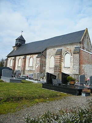
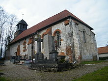
 The Notre-Dame-de-l'Assomption church |
||
Neuilly-le-Dien ( Picard : Noly-l'Dien ) is a northern French municipality with 96 inhabitants (at January 1, 2017) in the department of Somme in the region of Hauts-de-France . The municipality is located in the arrondissement of Abbeville and is part of the Communauté de communes Ponthieu-Marquenterre and the canton of Rue .
geography
The community on the Fossé des Eaux-Sauvages , which drains to the Authie , is about twelve kilometers east of Crécy-en-Ponthieu and 6.5 kilometers west of Auxi-le-Château . The district of Acquet in the valley of the Fossé des Eaux-Sauvages , which used to be an independent municipality, belongs to it .
Toponymy and History
The community was devastated by Spanish troops in 1635. During the Second World War , the German Wehrmacht set up a rocket launch base.
Residents
| 1962 | 1968 | 1975 | 1982 | 1990 | 1999 | 2006 | 2011 |
|---|---|---|---|---|---|---|---|
| 168 | 154 | 114 | 97 | 103 | 110 | 106 | 97 |
Attractions
- Church of the Assumption of Our Lady in Neuilly-le-Dien
- Saint-Maclou Chapel in Acquet
- War memorial

