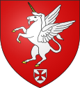
Brailly-Cornehotte
| Brailly-Cornehotte | ||
|---|---|---|

|
|
|
| region | Hauts-de-France | |
| Department | Somme | |
| Arrondissement | Abbeville | |
| Canton | Rue | |
| Community association | Ponthieu-Marquenterre | |
| Coordinates | 50 ° 13 ′ N , 1 ° 58 ′ E | |
| height | 47-91 m | |
| surface | 11.50 km 2 | |
| Residents | 241 (January 1, 2017) | |
| Population density | 21 inhabitants / km 2 | |
| Post Code | 80150 | |
| INSEE code | 80133 | |
 The lock |
||
Brailly-Cornehotte ( Picard : Brailly-Cornote ) is a northern French municipality with 241 inhabitants (at January 1, 2017) in the department of Somme in the region of Hauts-de-France . The municipality is located in the arrondissement of Abbeville and is part of the Communauté de communes Ponthieu-Marquenterre and the canton of Rue .
geography
The community is located on a section of the historic Chaussée Brunehaut on the Ponthieu plateau between Crécy-en-Ponthieu and Bernaville, which is around 7.5 kilometers west-northwest . It includes the Bambou inn , the Bézencourt homestead , the Le Grand Bélinval homestead and the hamlet of Cornehotte in the southwest.
Toponymy and History
The place was mentioned in 1079 in the Auchy cartel as Brasli . Local custom was established in 1507.
Residents
| 1962 | 1968 | 1975 | 1982 | 1990 | 1999 | 2006 | 2011 |
|---|---|---|---|---|---|---|---|
| 319 | 324 | 281 | 255 | 233 | 240 | 240 | 242 |
Attractions
- 18th century castle on the southern edge of Brailly, partially registered as a Monument historique in 1926 ( Base Mérimée PA00116108)
