Huppy
| Huppy | ||
|---|---|---|

|
|
|
| region | Hauts-de-France | |
| Department | Somme | |
| Arrondissement | Abbeville | |
| Canton | Gamaches | |
| Community association | Baie de Somme | |
| Coordinates | 50 ° 2 ′ N , 1 ° 46 ′ E | |
| height | 60-113 m | |
| surface | 10.81 km 2 | |
| Residents | 785 (January 1, 2017) | |
| Population density | 73 inhabitants / km 2 | |
| Post Code | 80140 | |
| INSEE code | 80446 | |
| Website | http://www.huppy.net | |
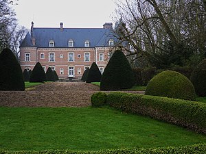
 Huppy Castle |
||
Huppy is a French municipality with 785 inhabitants (at January 1, 2017) in the department of Somme in the region of Hauts-de-France . It belongs to the Arrondissement Abbeville and the canton of Gamaches .
geography
Huppy lies on the limestone plateau of the Vimeu between the département roads D928 (former Route nationale 28 ) from Abbeville to Blangy-sur-Bresle and D25 and is crossed in the west by the A28 autoroute .
history
The castle was completed in 1692.
Residents
| 1962 | 1968 | 1975 | 1982 | 1990 | 1999 | 2006 | 2011 |
|---|---|---|---|---|---|---|---|
| 614 | 631 | 579 | 592 | 590 | 694 | 761 | 805 |
Attractions
- Huppy Castle (17th century), Charles de Gaulle's command center during the Battle of Abbeville (May 28–31, 1940), registered as Monument historique in 1926 ( Base Mérimée PA00116182)
- Saint-Sulpice church classified as a Monument historique in 1907 (Base Mérimée PA00116184)
- 13th century stone cross, classified as a monument historique in 1912
Individual evidence
Web links
Commons : Huppy - collection of pictures, videos and audio files

