Neufmoulin
| Neufmoulin | ||
|---|---|---|
|
|
||
| region | Hauts-de-France | |
| Department | Somme | |
| Arrondissement | Abbeville | |
| Canton | Abbeville-1 | |
| Community association | Baie de Somme | |
| Coordinates | 50 ° 8 ′ N , 1 ° 55 ′ E | |
| height | 11-86 m | |
| surface | 4.43 km 2 | |
| Residents | 361 (January 1, 2017) | |
| Population density | 81 inhabitants / km 2 | |
| Post Code | 80132 | |
| INSEE code | 80588 | |
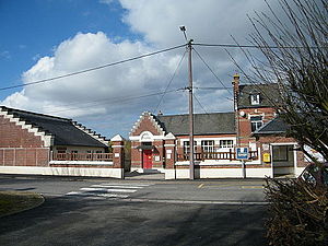
 The Mairie |
||
Neufmoulin ( Picard : Neumolin ) is a northern French municipality with 361 inhabitants (at January 1, 2017) in the department of Somme in the region of Hauts-de-France . The municipality is located in the arrondissement of Abbeville and is part of the Communauté d'agglomération de la Baie de Somme and the canton of Abbeville-1 .
geography
The commune on the Scardon river, bordering on the west of Saint-Riquier , is bounded to the south by the D925 départemental road, which it clearly extends beyond in the area of the Bois de l'Abbaye forest. On the route of the former railway line from Doullens via Auxi-le-Château to Abbeville, a hiking trail, the Voie Verte (Traverse du Ponthieu), is now led.
Residents
| 1962 | 1968 | 1975 | 1982 | 1990 | 1999 | 2006 | 2011 |
|---|---|---|---|---|---|---|---|
| 205 | 217 | 270 | 337 | 368 | 345 | 350 | 353 |
administration
Mayor ( maire ) has been Anne-Marie Dorion since 2001.
Attractions
- War memorial

