Vitz-sur-Authie
| Vitz-sur-Authie | ||
|---|---|---|
|
|
||
| region | Hauts-de-France | |
| Department | Somme | |
| Arrondissement | Abbeville | |
| Canton | Rue | |
| Community association | Ternois | |
| Coordinates | 50 ° 15 ′ N , 2 ° 4 ′ E | |
| height | 22-94 m | |
| surface | 4.66 km 2 | |
| Residents | 127 (January 1, 2017) | |
| Population density | 27 inhabitants / km 2 | |
| Post Code | 80150 | |
| INSEE code | 80810 | |
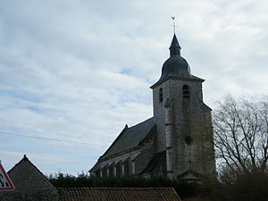
 Saint Martin Church |
||
Vitz-sur-Authie ( Picard : Visse-su-Eutie ) is a northern French municipality with 127 inhabitants (at January 1, 2017) in the department of Somme in the region of Hauts-de-France . The municipality is located in the Abbeville arrondissement and is part of the Communauté de communes du Ternois and the canton of Rue .
geography
The municipality is located opposite Le Ponchel on the left (southern) bank of the Authie , which forms the border with the Pas-de-Calais department , around five kilometers west-northwest of Auxi-le-Château and 15 kilometers east of Crécy-en-Ponthieu . The downstream district of Villeroy-sur-Authie belongs to it. There is an old lime kiln in the south of the municipality.
Residents
| 1962 | 1968 | 1975 | 1982 | 1990 | 1999 | 2006 | 2011 |
|---|---|---|---|---|---|---|---|
| 175 | 175 | 158 | 137 | 122 | 127 | 112 | 116 |
Attractions
- The Saint-Martin church, registered as a monument historique in 1969 ( Base Mérimée PA00116268)
- Saint-Nicolas chapel in Villeroy-sur-Authie
- War memorial
Individual evidence
Web links
Commons : Vitz-sur-Authie - collection of images, videos and audio files

