
Vienna Ringstrasse
The Ringstrasse , which leads with the Franz-Josefs-Kai around the historical center of Vienna (today a large part of the 1st district ), and its numerous historical buildings are among the main attractions of the Austrian capital. The total length of the approximately circular street is 5.2 km. The ring road itself takes up about three quarters of it; it is often called just the ring , although this ring is divided into nine sections for official street names.
The Ringstrasse style as a special form of historicism was style-forming for the architecture of the 1860s to 1890s. In Vienna, Jews attained real ownership from 1860 onwards and were a decisive force in historicism to express their need to belong to European history through a backward-looking style.
Today the entire street is part of the historical center of Vienna World Heritage Site .


development


prehistory
From the 13th century onwards, a wall surrounded the city. After the first Turkish siege in 1529 and the Thirty Years War (1618–1648), this defense system was further expanded and reinforced. In addition, a glacis , a strip of meadow, was created around the fortifications , which was not allowed to be built on and not allowed to have any vegetation that would hinder the defense. The strip with a construction ban was originally 95 meters wide and was expanded to 450 meters by 1683. The city wall with its protruding protected terraces - so-called bastions - proved its worth during the second Turkish siege in 1683, but then lost its importance and was technically out of date from the late 18th century onwards.
Emperor Joseph II therefore had pedestrian paths and driveways laid across the glacis from 1770, lanterns erected in 1776 and around 3,000 trees in the avenue planted from 1781. The glacis now also served as an open-air workshop for craftsmen. Stalls were set up. In 1809 the castle bastion was blown up by Napoleon's troops , and in 1820 the outer castle gate was built in this area to serve as a representation.
After the revolution in 1848 , the city wall and the fortifications in front of it were also in the way of the urban development of the rapidly growing metropolis: In 1850 the suburbs were incorporated as Districts II to VIII (from 1861 II-IX), so that the fortifications represented a noticeable obstacle to traffic. The park-like glacis with its refreshment pavilions was appreciated by everyone as a recreational area.
Demolition of the city wall and construction of the ring road
On December 20, 1857, Emperor Franz Joseph I made the decision to “abandon the walls and fortifications of the inner city, as well as the trenches around it” and ordered the construction of a boulevard at this point. In his most high hand letter to Interior Minister Alexander von Bach , which begins with the often quoted words "It is my will" and was published in full on page 1 of the official Wiener Zeitung on December 25 , the emperor decreed the exact size and use of the newly acquired area and announced a planning competition. In March 1858, demolition work began on the Rotenturm Gate on the Danube Canal and was not completed until 1874. By the summer of 1858, 85 projects had been received for the basic plan of the Ringstrasse.
The new street was planned as a representative boulevard; therefore the parallel “freight road” was provided for truck vehicles. This traffic regulation still exists today. The freight road, officially bearing different names, is known today as the two-way line ; the name borrowed from the tram operation referred to the tram lines E 2 , G 2 and H 2 that operated here until 1980 and since then has referred to the underground line U2 running between Karlsplatz and Alser Straße under the street .
After disputes over competencies between the government and the city administration, the city expansion fund was created in 1858 , which belonged to the arar , state assets administered by the government. In 1859 he was commissioned to take over the project, sold the land freed by the demolition of the city wall and the discontinuation of the defensive purpose to private investors and thus financed the state representative buildings. Only the New Town Hall , as it was called until 1960, was planned by the city administration. Because the city missed out on this large-scale real estate operation, it was all the more resolute in advocating the partial preservation of the existing recreational areas. Up to the present day there have been comparatively large green spaces along the Ringstrasse with the Stadtpark , Burggarten , Volksgarten , Rathauspark and Sigmund-Freud- Park.
For a long time, the Franz-Josephs-Kaserne stood in the way of the expansion of the Stubenring . It was supposed to militarily control the city center together with the Rossauer barracks north of the old town and the arsenal , built between 1865 and 1869 . Construction of the Franz-Josephs-Kaserne began in 1854. It was completed in 1857; in the same year the emperor decided to abandon the fortifications. The Aspern Bridge as a connection from the Stubenring to Leopoldstadt , the 2nd district, was opened in 1864, but the Franz-Josephs-Kaserne was not torn down until 1900/1901. The quarter built until 1913 around the former Imperial and Royal Post Office Savings Bank (built 1904–1906, later expanded) stands on its former site ; In 1909/1910 the Urania was placed at the end of the Ringstrasse next to the Aspern Bridge, and it was not until 1913 that the new Austro-Hungarian War Ministry opened opposite the Post Office Savings Bank, thus completing the Stubenring.
The Ringstrasse was inaugurated on May 1, 1865 by Emperor Franz Joseph in the presence of Empress Elisabeth, numerous archdukes, ministers and representatives of the City of Vienna, headed by Mayor Andreas Zelinka . The ceremony took place in front of the outer castle gate on the castle ring; More than 100 equipages were involved in the subsequent drive of the guests of honor to the court table in the Prater . At the time the street was opened, the Stubenring, Burgring, Dr.-Karl-Renner-Ring, Universitätsring and Schottenring (today's names) were largely undeveloped. From Wollzeile to Babenbergerstrasse , however, builders from the aristocracy and upper middle class had already built many “lordly” houses.
buildings


Numerous public and private buildings were erected along the entire ring road. Nobles and other wealthy private individuals hurried to have representative palaces ( Ringstrasse palace ) built in the monumental historicist style .
One of the first buildings was the Heinrichhof (historical spelling without s) owned by the brick manufacturer Heinrich von Drasche-Wartinberg , who, most recently damaged by the war, stood opposite the opera until 1954 .
Particularly noteworthy are the Imperial and Royal Court Opera Theater (now the State Opera ) in the neo-renaissance style by August Sicard von Sicardsburg and Eduard van der Nüll , the parliament in the neo-Attic style (a reference to the old-Athenian democracy) and the Palais Epstein by Theophil von Hansen , the town hall in the Flemish Gothic style by Friedrich von Schmidt , the Burgtheater by Karl von Hasenauer and Gottfried Semper and the new university building by Heinrich von Ferstel . The only sacred building is the neo-Gothic style votive church (also by Ferstel), which was donated in 1853 on the occasion of the rescue of Emperor Franz Joseph from an assassination attempt and was under construction for decades.
Across the Ringstrasse, in front of the historic Hofburg , the imperial residence, the monumental Imperial Forum was to be built to demonstrate the power of the Austro-Hungarian monarchy . The project remained a torso. Until the beginning of the First World War, the New Hofburg was built within the Ringstrasse , which today houses the Austrian National Library , the World Museum , the collection of old musical instruments, the Ephesus Museum and the court hunting and armament chamber. Other parts of the Kaiserforum that have been realized are the Museum of Art History and the Museum of Natural History outside the Ringstrasse .
According to the original plan, a mirror-like wing should have been added to the old buildings opposite the New Hofburg, which should have been attached to the Natural History Museum. The Heldenplatz and the Maria Theresa Square would thus become part of the ring road through archways between the museums and the new Hofburg parts gequerten Imperial Forum. This plan stalled for lack of money, and at the beginning of the First World War, the interior of the "New Castle" was not even completed. The changed political conditions after 1918 made the project obsolete.
The completion of the representative building activity on the Ring was only achieved in 1913 with the completion of the Austro-Hungarian War Ministry , when the Ringstrasse style had already become a little out of fashion, as the Post Savings Bank building opposite, built by Otto Wagner at the same time in Art Nouveau , shows.
The biggest disaster on the Ringstrasse was the fire in the Ringtheater in 1881, which killed several hundred people. In place of the theater, the atonement house was built, which in turn was destroyed in World War II and provided space for the new building of the Vienna police headquarters (Schottenring 7-9) to replace the previous police headquarters (Schottenring 11), which had also been destroyed .
Subdivision and important structures
The ring road is divided clockwise or in the direction of travel of individual traffic (the tram runs in both directions), starting from the Urania or the Aspern Bridge on the Danube Canal , into the following sections. With the exception of the Kärntner Ring, they were numbered clockwise: even house numbers on the side of the street facing the center, odd numbers on the periphery. The naming of structures and facilities is also made in clockwise order.
Since the official naming dates occasionally do not match the period of the actual construction of a section, the first mention in each case in Adolph Lehmann 's General Housing Anzeiger is given .
Stubenring

The Stubenring leads from Urania or Franz-Josefs-Kai ( Julius-Raab- Platz, previously Aspernplatz) to Weiskirchnerstraße. It was named in 1867 after the former bastion . This year the street name was also mentioned for the first time in Lehmann .
City center side:
- Across from No. 1, Georg-Coch-Platz 2: Former. kk Post Office Savings Bank
- No. 8–10: Vienna Chamber of Commerce (moved to the Austria Campus in the Nordbahnviertel of the 2nd district in 2019 )
- No. 24 / Dr.-Karl-Lueger-Platz 6: Café Prückel
- Dr.-Karl-Lueger-Platz with the Lueger monument
- Stubentor underground station (U3) under Dr.-Karl-Lueger-Platz
Peripheral side:
- No. 1: Former kuk war ministry ("government building"), today ministries
- In front of No. 1: Radetzky monument
- No. 3 / Oskar-Kokoschka-Platz: University of Applied Arts
- No. 5 / Weiskirchnerstraße: Museum of Applied Arts (MAK)
Parking ring

The Parkring runs from Weiskirchnerstraße to Johannesgasse. It was named in 1861 after the city park under construction on the periphery of the ring. In Lehmann , the street name is not yet recorded in the next two editions, 1864 and 1865, and then for the first time in 1867. From 1910 to 1919 this section of the ring was called Kaiser-Wilhelm-Ring (after Kaiser Wilhelm II ).
City center side:
- No. 4: Palais Dumba
- No. 6 / Zedlitzgasse 8: Palais Colloredo-Mansfeld
- No. 8: Palais Erzherzog Wilhelm , former Federal Police Directorate , today OPEC Fund for International Development
- No. 12: Horticultural high-rise with horticultural cinema
- Theodor-Herzl-Platz or Gartenbaupromenade, view of the Palais Coburg
- No. 12A: Hotel Marriott (new building)
- No. 14: Palais Henckel von Donnersmarck , a hotel until 2013, planned to open in 2019 after being converted into a Hotel Almanac
- No. 16: Palais Leitenberger , like No. 14
Peripheral side:
Schubertring

The Schubertring leads from Johannesgasse to Schwarzenbergstraße. It was named in 1928 after the composer Franz Schubert . Before that, it was called Kolowrat-Ring from 1862 to 1928 after the Kolowrat palace of statesman Count Franz Anton von Kolowrat-Liebsteinsky in today's Schwarzenbergstrasse, which was demolished in 1869 . In Lehmann it is not yet listed in the next two editions, 1864 and 1865, then for the first time in 1867.
City center side:
- No. 10–12: Hotel Grand Ferdinand (since October 2015); Built 1952–1954 by Percy A. Faber and Walter Sobotka on the site of a palace that was demolished after being bombed, Veitscher Magnesitwerke AG's Vienna headquarters for decades , most recently vacant; Facade and entrance hall under monument protection; Client of the redesign and lessee: Florian Weitzer, Graz hotelier
Peripheral side:
- No. 3: Automobile Club ÖAMTC (headquarters until 2016, today various services)
- No. 5: formerly noble casino ; No. 5–7: opened at the end of August 2012 as the Ritz-Carlton Hotel
- No. 11 / Schwarzenbergplatz 1: Palais Archduke Ludwig Viktor , former officers' mess; Another Burgtheater venue under the name Kasino am Schwarzenbergplatz
- Schwarzenbergplatz with Schwarzenberg monument
Carinthian Ring

The Kärntner Ring runs from Schwarzenbergstraße to Kärntner Straße. It was named in 1861 (original: Kärnthner ... ) after Kärntner Straße , the most important street in the old town surrounded by the ring, and the Kärntner Tor of the demolished city wall . In Lehmann it is listed in the next edition, 1864. From 1917 to 1919 it was called the Kaiserin Zita Ring.
The rule that the traffic areas running in circular segments around the city center should be numbered clockwise was decided in 1862, but not yet applied to the Kärntner Ring, which was inhabited at that time. Starting from Kärntner Straße , it is numbered counterclockwise. The structures are also named here in clockwise order:
City center side:
- No. 17 / corner of Schwarzenbergstrasse: Café Schwarzenberg
- No. 9–13: Grand Hotel
- Nos. 5–7 and 9: Ringstrasse galleries in Kärntner-Ring-Hof and Palais Corso
- No. 5: Former Palais Hoyos-Sprinzenstein
- No. 1–5 / Kärntner Straße 53–55 / Mahlerstraße 2: Hotel Bristol (main building 1892–1945 at No. 7)
- Opernpassage with access to the Karlsplatz underground station (U1, U2, U4)
Peripheral side:
- No. 18 / Schwarzenbergplatz 17: Palais Wertheim
- No. 16: Hotel Imperial with café
- No. 8: "The Ring" hotel
- No. 4: Palais Königswarter
- In front of No. 2: Badner Bahn departure point
- Opernpassage with access to the Karlsplatz underground station (U1, U2, U4)
Opera ring

The Opernring leads from Kärntner Straße to Eschenbachgasse . It was named in 1861 on the occasion of the start of construction of the kk Hofoperntheater, today's State Opera . In Lehmann it is listed in the next edition, 1864. From 1917 to 1919 the street was called Kaiser-Karl-Ring (after Kaiser Karl I. ).
City center side:
- No. 2: Vienna State Opera
- Between No. 2 and 4: Dinner Club Albertinapassage (in the former underground pedestrian passage)
- No. 4 / corner of Operngasse 8: first owner Anton Dreher sen. , Brewing entrepreneur
- No. 10 / Goethegasse 3: Palais Schey von Koromla
- According to No. 10: Goethe Monument
- Burggarten with Mozart monument
Peripheral side:
- No. 1–5: Opernringhof , formerly Heinrichhof
- No. 13–15: Hotel Le Meridien
- Between No. 15 and 17: Robert-Stolz- Platz, behind it Schillerplatz with the Schiller Monument
Castle ring

The Burgring begins at Eschenbachgasse and originally ended at Schmerlingplatz ; since 1934 it has only led to Bellaria Street. It was named in 1863 after the imperial Hofburg . In Lehmann it is not yet recorded in the 1864 and 1865 editions, then for the first time in 1867.
City center side:
- Burggarten with Mozart monument
- Opposite No. 3 and 5: Babenbergerpassage club disco (in the former underground pedestrian passage)
- Opposite No. 5: New Castle
- Opposite Maria-Theresien-Platz: Outer castle gate on Heldenplatz , behind it Hofburg
Peripheral side:
- No. 5: Kunsthistorisches Museum
- Between No. 5 and 7: Maria-Theresien-Platz with Maria-Theresien-Monument
- No. 7: Natural History Museum
- Until 1934 No. 9: see Dr.-Karl-Renner-Ring 1
Dr. Karl Renner Ring

Today the Dr.-Karl-Renner-Ring runs from Bellariastraße to the beginning of Rathausplatz or the extended Stadiongasse . It was named in 1956 in honor of Federal President Karl Renner . Originally it was called from 1870 on from Schmerlingplatz to Schottengasse Franzensring after Emperor Franz I ; In Lehmann , this name is not yet listed in the next edition, 1871, and then for the first time in 1872. The section in front of Parliament was then called the Ring of November 12th, 1919–1934 , after the Republic of German Austria was proclaimed on that day. In the years 1934–1940 and 1945–1949 the section of the ring was called Dr.-Ignaz-Seipel-Ring (after Federal Chancellor Ignaz Seipel ) in its current length , and in 1940–1945 Josef-Bürckel-Ring (after the Nazi politician Josef Bürckel ), and 1949–1956 Parliament Ring .
City center side:
- Volksgarten , embedded in the fence grille: Julius Raab monument
Peripheral side:
- No. 1: Palais Epstein (until 1934 Burgring 9 )
- In front of No. 1: exits to the Volkstheater underground station (U2, U3)
- Between No. 1 and 3: Republic Monument , behind Schmerlingplatz with Grete-Rehor -Park and Leopold-Gratz -Platz
- No. 3: Parliament
University ring

The Universitätsring leads from the beginning of the Rathausplatz or the extended Stadiongasse to Schottengasse . It was originally a part of the Franzensring from 1870 (in Lehmann in the next edition, 1871, not yet, then listed for the first time in 1872). From 1919 he was part of the Ring of November 12th (after the day the First Republic was proclaimed ). From 1934 (beginning of the Austro-Fascist corporate state ) to 2012 it was called Dr.-Karl-Lueger-Ring (after Mayor Karl Lueger ). It was renamed Universitätsring on June 5, 2012 ; the first new road sign was installed on July 4th, 2012.
City center side:
- Volksgarten
- Between Volksgarten and Burgtheater: Josef-Meinrad- Platz
- No. 2: Burgtheater
- No. 4 / Löwelstraße 22: Palais Lieben-Auspitz (see Berta Zuckerkandl ) with Café Landtmann
- Opposite no. 1: Liebenberg monument , behind it Mölker Bastei
- No. 14 / Schottengasse 11: Palais Ephrussi
Peripheral side:
- Town Hall Square and Park
- Corner of Rathausplatz: Karl Renner Monument
- Opposite the Burgtheater: Rathausplatz, behind it Vienna City Hall ; near the ring: monuments to Theodor Körner and Karl Seitz
- After the Rathauspark: No. 1, University
- Schottentor with subway station Schottentor / Universität (U2) and two-story tram loop ( Jonas- Reindl ), behind Sigmund-Freud -Park, Rooseveltplatz with Votive Church
Schottenring


The Schottenring runs from Schottengasse to Franz-Josefs-Kai or the Ringturm . It was officially named in 1870 after the Schottenstift and the dismantled Schottentor . In Lehmann it is already recorded in 1865.
City center side:
- No. 2–6 / Schottengasse 6–8: Former Creditanstalt-Bankverein (main institution)
- No. 14: Birthplace of Stefan Zweig
- No. 16: Former Vienna Stock Exchange
- No. 20–26: Hotel Kempinski in the " Palais Hansen " (since 2013)
- No. 30: Ringturm
Peripheral side:
- Mostly underground: Schottentor traffic junction with Schottentor underground station
- No. 3: Hotel de France
- No. 7: Former Ringtheater , site of the Ringtheater fire in 1881
- No. 7–9: State Police Directorate Vienna
- # 11: Hotel Hilton Plaza
- No. 17: Former Palais Léon
- No. 19: Former fruit and flour exchange , formerly Café Schottenring (until July 2012)
- No. 21: Palais Sturany , since 2012 King Abdullah Bin Abdulaziz International Center for Interreligious and Intercultural Dialogue
- Between nos. 25 and 27: Deutschmeisterplatz with Deutschmeister monument , behind it Rossauer barracks
The Schottenring underground station (U2, U4) is on the Franz-Josefs-Kai.
Gallery: Important buildings on the Ringstrasse

Café Prückel at the corner of Stubenring (right)


.JPG)


.JPG)


Franz-Josefs-Kai and Ringstrasse zone

Occasionally the Franz-Josefs-Kai on the Danube Canal, which connects the Schottenring at the western end and the Stubenring at the eastern end and thus closes the circle around the old town, is counted as part of the Ringstrasse; but he is not part of it. (The buildings erected there in the Ringstrasse style were largely destroyed in 1945.)
In the entire ring road zone, the aristocracy and upper middle class built ring road palaces . The Ringstrasse is accompanied by a parallel street, mostly two to four blocks further out of town, which was mostly built at the same time as the Ringstrasse and which started the truck traffic that was then prohibited on the Ringstrasse. From 1907 onwards, tram lines with the index number 2 were run over the majority of the street, which was given individual street names and collectively referred to as freight street, which is why the name Zweierlinie has been used for the section from Stadtpark to Universitätsstraße since the 1960s .
Mostly located on the double line and part of the ring road ensemble:
- Wiener Konzerthaus with Akademietheater (Lothringerstraße)
- Beethoven Monument (Lothringerstraße)
- Academic high school (neo-Gothic; Lothringerstraße)
- Musikverein (neoclassical; Karlsplatz )
- Künstlerhaus Vienna ( Karlsplatz )
- Secession ( Karlsplatz , Friedrichstrasse )
- Academy of Fine Arts (Schillerplatz)
- Museum Quarter , Museum Square
- Volkstheater (Burggasse, Arthur-Schnitzler-Platz)
- Palace of Justice (Schmerlingplatz)
- Rossauer Kaserne (Schlickplatz, Maria-Theresien-Straße, Rossauer Lände)
traffic
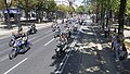
The 57-meter-wide, 4-kilometer-long street, mostly equipped with double avenues (originally bridle paths in between), was opened in 1865 and very soon became the most important traffic hub in Vienna. The pageants for the 25th wedding anniversary of Franz Joseph I with Empress Elisabeth in 1879, designed by Hans Makart , and for the 60th anniversary of the reign of the Emperor in 1908, took place on the Ringstrasse, as did Hitler's entry into Vienna in 1938 and countless demonstrations of the right to vote, unemployment rallies, Elevators, army parades, funeral procession at state funerals, May marches, etc., etc. Today, u. a. the Vienna City Marathon the Ring, Fiakers drive their mostly foreign customers past the sights. Friday Night Skating has started from Heldenplatz every week for 5 months since around 1999, Critical Mass has only started from Schwarzenbergplatz since 2010 , both of which use the main lane of the Ring in parts. The bike parade of the bike lobby bike festival and the lawn on the Ring are further activities critical of car traffic. (See gallery below.)
tram

In 1868 the horse tram of the Vienna Tramway Company started operating from the Stubenring to the Schottentor, followed by operations on Schottenring and Franz-Josefs-Kai in 1869; the old town was now circled. In 1898 it was switched to electrical operation. In order not to spoil the beauty of the ring road with overhead lines, the tram cars that were supposed to run there had to be equipped with accumulators at the request of the imperial court. Later the tracks on the Ringstrasse were equipped with electrical sub-lines; To drive on these tracks, an (additional) pantograph had to be inserted into a slot on the floor, which was located next to one of the two rails. This complicated procedure was not discontinued until 1915 due to the war, and overhead lines were installed.
Since 1907 the line signals of the Vienna tram consist of letters and / or numbers. "Letter lines" ("through lines") without digits - A, A K , B, B K , C, D (until today), E R , E K , F, H, J (until 2008), L, M, N (until 2008), N K , O, P, R, S, T, T R , T K - traveled partly for a few years, partly for many decades over sections of the Ring and Kai; before and after that they drove two radial routes into other districts.
This resulted in extremely dense tram traffic on the ring, as historical photos show. If the letter was supplemented with R or K, it was a matter of lines that circled the ring and quay or quay and ring in combination with a radial section; Letter lines with the additional number 2 ran over the double line instead of the ring road. The Wiener Linien want to switch to numeric signals the remaining letters D line. Since 2008, lines 1 and 2 (these instead of J and N) are new through lines; the renaming of the D-car to line 3 was opposed by tradition-conscious passengers. The “Vienna Ring Tram” has been used for city tours at a special rate since 2009. Since December 9, 2012, line 71 (previously from the 11th district to Schwarzenbergplatz ) has been running from the square via the ring to the stock exchange on Schottenring.
Private transport
In 1926, individual traffic on the Ringstrasse required the first traffic lights in Vienna at the opera intersection (Ring / Kärntner Strasse). In 1929 the first pedestrian crossings were marked there and at the Ring / Wollzeile intersection. When Vienna was under Nazi rule, trams and private transport were switched from left to right driving in September 1938, as in all of Eastern Austria . For this, all tram stops had to be relocated to the other side of the street and various track systems had to be converted.

In order to be able to separate pedestrians and car traffic at the intersections of the Ringstrasse after the onset of mass motorization, the Opernpassage , the first underground pedestrian structure in Vienna, was opened in November 1955 . In April 1961 the passage at Schottentor followed and in July 1961 the Babenbergerpassage (Ring / Babenbergerstraße) and the Bellariapassage . In July 1964 the Albertina passage was added.
Since 1972, the Ring and Franz-Josefs-Kai have been one-way clockwise for car traffic, the Ring with three and the Kai with four lanes in the main lane.
.jpg)
In the 1990s, a cycle path was laid out in the side avenues, which has been criticized for its sometimes tortuous route, its frequent change of location and the potential for conflict, especially at bottlenecks at pedestrian exits with pedestrians (often not familiar with the location). The so-called Rad-Ring-Rund runs partly only within and partly on both sides of the main lanes and tram routes and has allowed cycling in both directions for many years. In return for a contribution to the construction costs, Coca-Cola received advertising space on several points on the cycle path surface - a novelty.
In the 1990s, the “banishment” of pedestrians to the underground proved to be out of date because of the one-way traffic used by cars. In all pedestrian passages, above-ground traffic light-controlled pedestrian crossings have been created again. The Babenbergerpassage, which does not have a subway entrance, was completely closed (its rooms are used for events); the Albertinapassage was closed on November 30, 2009; their rooms have been used as a dinner club since 2011 .
Subway
Only the Stubentor underground station (U3; Wollzeile, Weiskirchnerstraße) is located directly on the Ringstraße. Three underground stations have passages leading to the Ringstrasse: Karlsplatz (U1, U2, U4), Volkstheater (U2, U3) and Schottentor / Universität (U2). There are three other stations within a short walking distance from Ringstrasse: Museumsquartier (U2), Rathaus (U2) and Stadtpark (U4). There are two underground stations at Franz-Josefs-Kai: Schottenring (U2, U4) and Schwedenplatz (U1, U4). The four stations Schottenring, Schwedenplatz, Stadtpark and Karlsplatz go back to the Stadtbahn , which opened in 1898–1901 ; the others were not put into operation until 1980. Plans drawn up 150 years ago to run an underground railway directly under the entire course of the ring road were not implemented.
Gallery: Variants of the use of the Ringstrasse

Tram on the Ring (normal traffic)

Drivers on the Ring (normal traffic)

Technoparade am Ring (Streetparade 2013)
Motorcyclists at the Ring (Vienna Harley Days 2013)

Cyclists on the Ring (Cycle Week 2013)

Cyclists on the Ring ( Tour of Austria 2013 )

Pedestrians on the Ring ( May 1st 2014)

Runners at the Ring ( Vienna City Marathon 2015)

Musicians on the Ring ( Brass Music Festival 2013)

Queer demonstration at the Ring ( Rainbow Parade 2013)

Demonstrators on the Ring (May March 2013)

Rasen am Ring 2013 (demonstration against car traffic on the ring)


The Ringstrasse in fiction
As one of the most important “stages” in Vienna, the Ringstrasse often appears in Vienna-related fiction literature. Examples:
- Karl Kraus ' drama The Last Days of Mankind takes place in the first scene of the prelude, on the day of the assassination of the heir to the throne on June 28, 1914, in Vienna. Ringstrasse parade. Sirk corner. A summer holiday evening. Life and drive. Groups are formed. A few more scenes also take place on the Ringstrasse.
- In Heimito from Doderer's novel The Demons , demonstrators flee from the shooting police across the Ringstrasse after the Palace of Justice fire on July 15, 1927.
In the television series Ringstrasse Palais (1980–1986), the street also played an important role as the scene of the rise and fall of an Austrian ennobled family in the 19th and 20th centuries.
Others
Of the 15 coffeehouses listed on the Ringstrasse, only a few survived until 2014 during the “golden age” before the First World War, although the past of the individual restaurants mostly remains in the dark due to a lack of documentation. It (s) exist clockwise: Café Prückel (Stubenring 24, until today), Café Schüsswald (Parkring 2), Café Katzmeyr (Parkring 8), Café Krippel (Parkring 10), Café Union (Kolowratring 2, today Schubertring), Café Schwarzenberg (Kärntner Ring 17, to this day), Café Frohner (Kärntner Ring 16, named after the hotel leaseholder at the time, became Café Imperial in the hotel of the same name), Café Kremser (Kärntner Ring 8, today Hotel "The Ring"), Café Bristol (Kärntner Ring 2, new "lounge" in the hotel of the same name), Café Bauer (Opernring 8), Café de L'Opera (Opernring 8), Café Landtmann (Universitätsring 4, until today), Café Universität (Franzensring 18, today Universitätsring) , Café Mandl (Schottenring 13), Café Lloyd (Schottenring 19, most recently under the name Café Schottenring, closed in July 2012. Before it was a café, it was a beer hall.). The bars, which have been abandoned as coffee houses, are now home to business branches, fast-food restaurants, nightlife spots or office space. A new addition was the Café Ministry at Georg-Coch-Platz 4 / corner of Stubenring 6, which was built instead of a hardware store in 1935 .
The break program of the New Year's Concert of the Vienna Philharmonic in 2015 was dedicated to the 150th anniversary of the Vienna Ringstrasse. The New Year's Concert was broadcast in 92 countries around the world and watched by more than 50 million TV viewers.
literature
-- Alphabetical --
- Marianne Bernhard: turning point in the empire. The Vienna Ringstrasse. Architecture and Society 1858–1906. Pustet, Regensburg 1992, ISBN 978-3-7917-1332-8 , table of contents.
- Barbara Dmytrasz: The Ringstrasse. A European building idea . With photos by Peter Szabo. Amalthea, Vienna 2008, ISBN 978-3-85002-588-1 , (illustrated book).
- Fred Hennings : The Ringstrasse. Symbol of an era . Amalthea Verlag, Vienna 1989, ISBN 978-3-85002-077-0 .
- János Kalmár (photos), Andreas Lehne (text): The Vienna Ringstrasse . Pichler Verlag, Vienna 1999, ISBN 978-3-85058-167-7 .
- Markus Kristan: The architecture of Vienna's Ringstrasse 1860–1900 in contemporary architectural photographs . Album-Verlag für Photographie, Vienna 2003, ISBN 978-3-85164-130-1 .
- Elisabeth Lichtenberger : Economic function and social structure of the Vienna Ringstrasse . Böhlau Verlag, Vienna 1998, ISBN 978-3-205-08265-1 .
- Peter Müller: The Ringstrasse on old postcards. J and V Ed. Wien Verl.-Ges., Vienna 1990, ISBN 978-3-85058-047-2 .
- Martina Pippal : A brief history of art in Vienna. Verlag CH Beck , Munich 2000, ISBN 3-406-45858-0 .
- Karlheinz Rossbacher: Literature and Liberalism. On the culture of the Ringstrasse era in Vienna. J and V, Vienna 1992, 580 pages, ISBN 978-3-224-16011-8 , table of contents.
- Herbert Schiefer (photos), Hans Wanzenböck (text): The Ringstrasse: when Vienna became a cosmopolitan city. Herder Verlag, Vienna - Freiburg im Breisgau - Basel 1988, ISBN 3-210-24914-8 .
- Otto Schwarz: Behind the facades of the Ringstrasse. History, people, secrets . Amalthea, Vienna 2007, ISBN 978-3-85002-589-8 .
- Renate Wagner-Rieger (Ed.): The Vienna Ringstrasse. Image of an era. (Volume I - XI) . Franz Steiner Verlag, Wiesbaden, 1972–1981, ISBN 978-3-515-02482-2 .
- Renate Wagner-Rieger, Johanna Fiegl: The Vienna Ringstrasse. The artwork in the picture . Böhlau Verlag, Vienna 1997, ISBN 978-3-205-08260-6 .
Movies
- Behind the facades - the secrets of Vienna's Ringstrasse. Documentary, Austria, 2004, 51:44 min., Book: Otto Schwarz, director: Alfred Vendl, moderation: Maximilian Schell , speaker: Eva Mattes , production: epo-film , ORF , arte , series: Universum , first broadcast: 10. June 2004 at ORF 2 , film data , table of contents from ORF.
- Vienna's Ringstrasse 1. How Vienna became a cosmopolitan city. Documentary, Austria, 2015, 48:48 min., Script and director: Günter Kaindlstorfer , production: Clever Contents Filmproduktion, ORF , series: Die Wiener Ringstraße - Trilogie eines Boulevards , first broadcast: February 24, 2015 ORF III , summary of ORF III , online video . Documentation for the 150th anniversary.
- Vienna's Ringstrasse 2nd Boulevard of Palaces. Documentary, Austria, 2015, 48:56 min., Script and director: Günter Kaindlstorfer, production: Clever Contents Filmproduktion, ORF, series: Die Wiener Ringstraße - Trilogie eines Boulevards , first broadcast: March 3rd, 2015 on ORF III, summary by ORF III.
- Vienna's Ringstrasse 3. People on the Ringstrasse. Documentary film, Austria, 2015, 50 min., Script and director: Günter Kaindlstorfer, production: Clever Contents Filmproduktion, ORF, series: Die Wiener Ringstraße - Trilogie eines Boulevards , first broadcast: March 10, 2015 on ORF III, table of contents by ORF III.
Web links
- The Vienna Ringstrasse. In: wien.info
- Interactive page on the Vienna Ringstrasse. In: Vienna Ring View
- The Ringstrasse - a jewel among the streets of the world. In: werbeka.com, July 9, 2010
- Monuments in the area of Vienna's Ringstrasse. In: viennatouristguide.at
- Wiener Ringstraße In: suf.at (search and find)
Individual evidence
- ↑ Fred Hennings : Ringstrasse Symphony, 1st movement 1857–1870, It is my will , Herold Verlag, Vienna 1963, p. 15.
- ↑ Emperor Franz Joseph I : Very high hand letter to Interior Minister Alexander von Bach. In: Wiener Zeitung , Vienna, No. 296, December 25, 1857, p. 1, online at ANNO .
- ↑ The opening of the Ringstrasse. In: Neue Freie Presse , May 2, 1865, p. 5 f. (Online at ANNO ).
- ^ Lehmann Online. In: Vienna Library in the City Hall .
- ^ Felix Czeike : Historical Lexicon Vienna. Volume 3: Ha-La. Kremayr & Scheriau, Vienna 1994, ISBN 3-218-00545-0 , p. 560.
- ^ Palais Kolowrat-Liebsteinsky. In: Planet Vienna , accessed on January 27, 2018.
- ↑ Wojciech Czaja: Grand Ferdinand: On sheet feel with the fifties. In: Der Standard , Vienna, October 17-18, 2015, p. I 8.
- ↑ Martin Gantner: Five-Star Palace opened on the Ring. In: Kurier , Vienna, August 27, 2012, p. 16.
- ↑ Universitätsring: Street sign revealed. In: Vienna. orf .at of July 4, 2012.
- ^ APA : Controversial signature: The founding agreement for the Dialog Center is signed. In: Der Standard , Vienna, October 13, 2011, p. 2.
- ↑ Central Inspectorate of the Vienna Federal Security Guard (Ed.): Sechzig Jahre Wiener Sicherheitswache, 1869–1929 , self-published by the Federal Police Directorate Vienna, Vienna 1929, p. 122 f.
- ↑ Albertina Passage - albertinapassage.at.
- ↑ Hardly any cafe survived the golden era. In: wien.orf.at. January 2, 2015, accessed January 2, 2015 .
- ↑ New Year's Concert 2015 with Zubin Mehta. In: Vienna Philharmonic , 2015, accessed on January 27, 2018.
Remarks
- ↑ The Sirk corner , Kärntner Straße 55 / Kärntner Ring 1, existed from the late 1870s until April 1913, when the August Sirk trading company , taken over by Josef Pohl († 1925, age 61) in 1892 , due to the demolition of the house on the Graben 22 relocated, but returned to its original location at the end of 1914. - See: August Sirk moved. In: Wiener Montags-Post , No. 18/1913 (XXII. Volume), April 28, 1913, p. 4 (unpaginated), column 1. (Online at ANNO ). .
Coordinates: 48 ° 12 ′ 16.7 " N , 16 ° 21 ′ 45.7" E