
Herrenhöhe (Overath)
|
Gentleman height
City of Overath
Coordinates: 50 ° 58 ′ 8 ″ N , 7 ° 17 ′ 24 ″ E
|
||
|---|---|---|
| Height : | 249 m above sea level NN | |
Location of Herrenhöhe in Overath |
||
 Gut Herrenhöhe
|
||

Herrenhöhe is a district of Vilkerath in the town of Overath in the Rheinisch-Bergisches Kreis in North Rhine-Westphalia , Germany .
Location and description
The small district of Herrenhöhe is located directly on the Höhenstraße Hohkeppeler Straße (Landesstraße 84), which connects Heiligenhaus with Hohkeppel . It mainly consists of the Herrenhöhe manor house, built around 1880, with farm buildings, a veterinary practice and a riding stable. Hoofs , Griessiefen and Bengelshöhe are nearby .
history
Ancient writings show that the Zur Höhe farm had belonged to the Lords of Ehreshoven since at least 1470 , hence the name Herrenhof .
The Topographia Ducatus Montani by Erich Philipp Ploennies , Blatt Amt Steinbach , shows that the living space had a courtyard as early as 1715, which is labeled as Herrenhöh and designated as Freihof. Carl Friedrich von Wiebeking names the court on his charter of the Duchy of Berg in 1789 as Herrenhöhe . It shows that the place was part of the Honschaft Vellingen in the parish of Hohkeppel at that time .
Herrenhöhe was close to Heidenstrasse , an important medieval old highway from Cologne via Kassel to Leipzig . Today's state road 84 follows the route of the old high path towards Hohkeppel .
The place is recorded on the topographical survey of the Rhineland from 1817 as Herrenhöhe . The Prussian first recording from 1845 shows the residential area under the name Herrenhöh . From the Prussian new admission of 1892, the place is regularly recorded on measuring table sheets as Herrenhöhe .
In 1822, 17 people lived in the place categorized as a house and designated as Herrenhöh , which after the collapse of the Napoleonic administration and its replacement belonged to the municipality of Hohkeppel of the Engelskirchen mayor in the Wipperfürth district . For the year 1830 19 inhabitants are given for the place called Herrenhöh . According to the overview of the government district of Cologne , the place categorized as Hof and named Herrenhöhe in 1845 had a residential building with 13 inhabitants, all of them Catholic denominations. The municipality and manor district statistics of the Rhine province list Herrenhöhe in 1871 with two houses and 27 inhabitants. In the municipality lexicon for the Rhineland province from 1888, two houses with 14 inhabitants are given for Herrenhöhe . In 1895 the place had two houses with 14 inhabitants, in 1905 one house and nine inhabitants are given.
Due to § 10 and § 14 of the Cologne Act , the municipality of Hohkeppel was dissolved in 1975 and incorporated into Lindlar . In the process, some districts of Hohkeppels were reunified into the municipality of Overath, including Herrenhöhe.
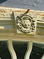
coat of arms

entrance

barn
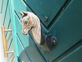
Door handle


literature
Heribert Becker: Herrenhöhe - Rural business in the Bergisches Land two hundred years ago. In: ACHERA, contributions to the history of the city of Overath, volume 4. Ed. Bergischer Geschichtsverein eV Department Overath 1988, pp. 16–24
Web links
Individual evidence
- ↑ Jörg Poettgen (Red.): Street names tell stories . Edited by Bergischer Geschichtsverein Overath, 2014, p. 15
- ^ Wilhelm Fabricius : Explanations for the Historical Atlas of the Rhine Province ; Second volume: The map of 1789. Division and development of the territories from 1600 to 1794 ; Bonn; 1898
- ^ Herbert Nicke : The Heidenstrasse. History and landscape along the historic highway from Cologne to Kassel . In: Land and history between Berg, Wildenburg and South Westphalia . tape 6 . Galunder, Wiehl 2001, ISBN 3-931251-74-8 , pp. 38 f .
- ↑ Alexander A. Mützell: New topographical-statistical-geographical dictionary of the Prussian state . tape 2 . Karl August Künnel, Halle 1821.
- ↑ Friedrich von Restorff : Topographical-statistical description of the Royal Prussian Rhine Province , Nicolai, Berlin and Stettin 1830
- ↑ Overview of the components and list of all the localities and individually named properties of the government district of Cologne: by districts, mayor's offices and parishes, with information on the number of people and the residential buildings, as well as the Confessions, Jurisdictions, Military and former state conditions. / ed. from the Royal Government of Cologne [Cologne], [1845]
- ↑ Royal Statistical Bureau Prussia (ed.): The communities and manor districts of the Prussian state and their population . The Rhine Province, No. XI . Berlin 1874.
- ↑ Königliches Statistisches Bureau (Prussia) (Ed.): Community encyclopedia for the Rhineland Province, based on the materials of the census of December 1, 1885 and other official sources, (Community encyclopedia for the Kingdom of Prussia, Volume XII), Berlin 1888.
- ↑ Königliches Statistisches Bureau (Prussia) (Ed.): Community encyclopedia for the Rhineland Province, based on the materials of the census of December 1, 1895 and other official sources, (Community encyclopedia for the Kingdom of Prussia, Volume XII), Berlin 1897.
- ↑ Royal Statistical Bureau (Prussia) (Ed.): Community encyclopedia for the Rhineland Province, based on the materials of the census of December 1, 1905 and other official sources, (Community encyclopedia for the Kingdom of Prussia, Volume XII), Berlin 1909
- ^ The Cologne Act in full. Retrieved June 7, 2016 .

Districts of Overath: Overath (core city) | Brombach | Heiligenhaus | Immekeppel | Marialinden | Steinenbrück | Untereschbach | Vilkerath
Districts of the core city: Aulhof | Bernsau | Bedding | Böke | Brambach | Broich | Bridge | Castle | Courtyard | Burgholz | Cyriax | Diepenbroich | Oak trees | Eulenthal | Ferrenberg | Griesenbar | Großbernsau | Gut Eichthal | Gut Ennenbach | Halfensbüchel | Halzemich | Hammer mill | Hasenberg | Höderath | Hooves | Hoof chair | Small bar | Kombach | Kotten | Kotterberg | Stuff | Kreutzhäuschen | Leyenhaus | Lölsberg | Meegen | Mees beam | Probst beam | Rappenhorn | Rittberg | Rottfeld | Schiefenthal | Speak | Vosswinkel | Warth | Water | Weberhöhe | Wolfshütte | Desert height | Wustsiefen
Districts of Brombach: Bilstein | Bökerberg | Brombacherberg | Hagen | Halfenslennefe | Map lennefe | Klefhaus | Klingerath | Oberbrombach | Shrub | Unterilstein | Unterbrombach
Districts of Heiligenhaus: Birken | Burned | Grand Duke | Large Schwamborn | Heather | Kleinschwamborn | Linden tree | Neuenhausen | Steinberg | Stitch | Wiedenhof
Districts of Immekeppel: Brodhausen | Büscherhöfchen | Hasenbüchel | Huferberg | Immekeppelerteich | Kielshöfchen | Leffelsend | Melessen | Mittelsteeg | Obersteeg | Schmitzbüchel | Thal | shore
Districts of Marialinden: Abelsnaaf | Birkenhof | Bixnaaf | Bixnaafermühle | Blindenaaf | Blind eagle mill | Breidenassel | Breitenstein | Büchel | Büscherhöfchen | Buschhoven | Dahl | Flag | Falkemich | Federath | Fisherman's Mill | Großoderscheid | Nicholas pit | Hagen | Hardt | Hentgesnaaf | Height | Kaltenborn | Cherry tree | Kleinoderscheid | Krahwinkel | Staple height | Kulhoven | Landwehr | Linden tree | Lombachsmühle | Lorkenhöhe | Meegen | Niedergrützenbach | Obergrützenbach | Oderscheiderberg | Oderscheiderfeld | Schalken | Schlingenthal | Schlingenthaler Mill | Schommelsnaaf | Threshold baker mill | Siebelsnaaf | Siefen | Tixhoven | Four bridges | Vilshoven | Weyerhof | Weißenstein | Windhausen | Wüststeimel
Districts of Steinenbrück: Altenbrück | Büchel | Bush | Frielinghausen | Großdresbach | Grosshurden | Großlöderich | Heidermühle | Cat me | Klefberg | Kleindresbach | Kleinhurden | Lokenbach | Central cup | Garbage wood | Nallingen | Neichen | Neuhurden | Oberbech | Obergründemme | Schmitzlöderich | Steeg | Stichermühle | Lower plate | Underground me
Districts of Untereschbach: Daubenbüchel | Large book wood | Grünewald | Holzerhof | Mittelauel | Oberauel | Unterauel
Districts of Vilkerath: Aggerhof | Aggermühle | Alemich | Bengelshöhe | Bochmühle | Semolina | Herrenhöhe | Kepplerburg | Klef | Kreutzweg | Krombach | Neuenhaus | Oberhasbach | Oberheide | Obermiebach | Obervilkerath | Rott | Stone house | Unterhasbach | Unterheide | Untermiebach | Untervilkerath