
Alsergrund
|
Alsergrund IX. Viennese district |
|
|---|---|
| coat of arms | map |
 |
 .svg) |
| Geographic location : | 48 ° 14 ' N , 16 ° 21' E |
| Surface: | 2.99 km² |
| Residents: | 41,884 (January 1, 2020) |
| Population density : | 14,008 inhabitants / km² |
| Postal code : | 1090 |
| Address of the district council: |
Währinger Strasse 43 1090 Vienna |
| Address of the district office: |
Elterleinplatz 14 1170 Vienna |
| Website: | www.wien.gv.at |
| politics | |
| District Head : | Saya Ahmad ( SPÖ ) |
|
District council election 2015 |
A total of 40 seats |
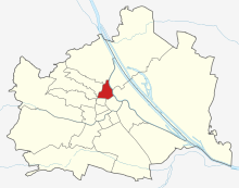
| Map: Alsergrund with parts of the district | |

|
|
The Alsergrund is 9 Wiener district and is within the belt , which in place of the former Linienwall was applied. The district name is used with article, the preposition am is used instead of in / im to refer to the district area .
geography
The 9th district, Alsergrund, is located in the northern center of Vienna. It is 2.99 km² in size, making it the seventh smallest district in Vienna. The district reaches its greatest north-south extension with 2.35 km from the Gürtelbrücke to Universitätsstraße . The largest east-west extension is between Augartenbrücke and Zimmermannplatz (2 km).
The district is bordered by the Hernalser and Währinger belts as well as the Heiligenstädter Straße in the west and northwest, the Danube Canal in the east and the street Maria-Theresien-Straße - Universitätsstraße - Alser Straße in the south. Neighboring districts are Döbling in the north, Währing and Hernals in the west and Josefstadt and the inner city in the south. In the east, the Alsergrund is separated from the Brigittenau and Leopoldstadt by the Danube Canal .
topography
The original topography of the district area can only be recognized to a limited extent today due to the heavy construction. The greatest difference in altitude is between Bauernfeldplatz (163 meters) and the Michelbeuern underground station (202 meters).
The arms of the Danube were important for the formation of the area . In addition to the Danube Canal (formerly also known as the Vienna Arm ), the Salzgriesarm flowed through what is now the district area. This originally branched off in Nussdorf and flowed through roughly today's line from Heiligenstädter Straße – Liechtensteinstraße – Salzgries, where it again emptied into the Danube Canal. The Obere Werd , an island that also comprised the Spittelau and the Rossau , was built between the Danube Canal and the Salzgriesarm . From the 13th century the Danube arm silted up more and more, so that in 1750 the course of the river consisted only of a shallow, narrow arm, which was finally filled in. The edge of the bank is still recognizable today through the sloping terrain between Nussdorfer Strasse or Währinger Strasse and Liechtensteinstrasse, which is compensated for by several staircases (e.g. Strudlhofstiege ).
The canalised Vienna Woods brooks were also characteristic of the district . The most striking was the Alserbach , which merged with the Währinger Bach at today's intersection of Nussdorfer Straße / Alserbachstraße and often caused flooding, especially in the Lichtental . The Döblinger Bach , which rises in the cottage , ran through the Althangrund .
The foothills of the Vienna Woods also formed several hills on the Alsergrund, some of which were used for viticulture in the Middle Ages. The Schottenpoint was in the area of today's Berggasse, the Herzogspoint near Lazarettgasse and the Sechsschimmelberg in the area of the Sechsschimmelgasse.
District parts

_-_Fernw%C3%A4rme_Wien,_Verwaltungsgeb%C3%A4ude_(1).JPG)
The Alsergrund district was formed from seven suburbs in 1850. The names of the suburbs are still preserved today in the names, but also in the consciousness of many residents.
In the north-east of the district is the Althangrund , which is mainly home to public facilities and infrastructure such as the Franz-Josefs-Bahnhof , the former Vienna University of Economics and Business , the institutes for geosciences, mathematics, pharmacy and biology of the University of Vienna and the Federal Office building at Josef-Holaubek-Platz is installed. In the north there is also the Spittelau with the Spittelau waste incineration plant .
The Rossau follows south of the Althangrund , which is largely built up with residential buildings. The most important facilities include the Rossau barracks , the Servite district including the Servite monastery and the Jewish cemetery in Seegasse. The Liechtenstein Garden Palace also belongs to Rossau and not to the north of the Lichtental , a residential area with the parish church of the same name , which became known as Franz Schubert's place of work.
In the south of the district is the Alservorstadt , the southern part of which was added to the 8th district, Josefstadt , in 1861 . The part of the district is extensively developed with university facilities such as the university campus and the Medical University of Vienna . In addition, the Votive Church and the St. Anna Children's Hospital are located in Alservorstadt .
In the west, on the Gürtel, lies the Michelbeuern part of the district , the southern part of which is practically completely occupied by the Vienna General Hospital. To the north is the Himmelpfortgrund . This part of the district is built almost exclusively with residential houses, but also with the Hera sanatorium .
The Thurygrund, which is divided into two parts, centrally and to the west, is also mainly residential.
There is also a breakdown of the district area into the counting districts of the official statistics, in which the counting areas of the municipality are summarized. The six counting districts on Alsergrund are Lichtental-Spittelau, Rossau, General Hospital, Nussdorfer Straße-Volksoper, Liechtensteinstraße and Universitätsviertel.
use
The areas of the Alsergrund district are almost exclusively taken up by construction and traffic areas. 58.9% of the densely built-up district area alone is in the building area (Vienna 33.32%), with the proportion of cultural, sports, religious and public institutions with a total of 23.9% of the district area the highest value of a Vienna district represents. Almost all of the rest of the building area is made up of residential areas, with commercial building areas taking up a negligibly small proportion of the district area. 34.6% of the district is built up with traffic areas (Vienna 13.7%), while green areas (mainly parks) only make up 6.5% (Vienna 48.3%). Agricultural land does not exist in the area that was previously partly used for viticulture, as do meadows and allotments. The Alsergrund now has no more water, as the water surface of the Danube Canal belongs to Leopoldstadt or Brigittenau and the former streams were canalized. At the Alsergrund in the Sensengasse there is a "city forest" (untypical for inner-city districts). In terms of area, however, it is so small that it is rarely shown statistically.
history
→ Main article: History of the Alsergrund
Roman times and early Middle Ages
The earliest excavations on Alsergrund date back to Roman times, when the Limes led through the district. Remains of the street, foundation walls of a Limes tower, remnants of the camp suburb as well as some votive stones and altars are among the surviving remains from this period .
The first settlements took place around the year 800 by Bavarian colonists who founded St. Johann an der Als, one of several base-like church settlements along the Limes. Another early settlement point was in today's Michelbeuern district , where a courtyard of the Benedictine Abbey of St. Michael zu Beuern was first mentioned in 1072.
The Alsergrund in the High and Late Middle Ages
A first settlement (Siechenals) developed around St. Johann an der Als in the High Middle Ages, which had a hospital and a church on a hill to the right of the Als. In 1158 Heinrich II. Jasomirgott handed over the property and the parish rights of the area between the Tiefen Graben , the church St. Johann and the Als up to the confluence with the Danube to the Schottenstift . The most important source of income in the area was viticulture at the so-called "Schottenpoint".
A small fishing village also developed on today's Danube Canal, the church of which was first mentioned in 1255 as St. Johann im Werd . At Schottenpoint, the Maria Magdalen monastery is also occupied in 1239, and the Neuburgerhof (Klosterneuburger Hof) of the Klosterneuburg monastery was in close proximity . In addition to viticulture, loess was also mined and bricks were produced. One of the ovens started a major fire in 1276, which not only destroyed the fishing village but also the city of Vienna. Only 150 houses in the city were spared.
The fishing village was subsequently rebuilt, and in the 13th and 14th centuries it was owned by different monasteries, constantly changing. The so-called fisherman's suburb , however, had its own parish church. The inhabitants lived mainly from fishing. In 1477 and 1485, today's district area was occupied by the Hungarian king Matthias Corvinus , who besieged the city of Vienna. In 1486 Matthias Corvinus was finally able to move into Vienna.
The Alsergrund in the early modern era
When the Turks under Suleyman II reached Vienna in 1529 , the outer defenses were abandoned. By setting the suburbs on fire, the Turks were to be deprived of their cover options, whereby the measure in today's district area included the Maria Magdalena monastery, the Klosterneuburger Hof, the church of St. Johann im Werd, as well as the church and the hospital of Siechenals fell victim to the village of the same name.
The former defenses were demolished in 1538 and a glacis was built around the city . The city area was redeveloped through straightened road axes and vineyards were laid out on the former monastery area. While the village of Siechenals was deserted, the hospital and the church were rebuilt. On the Danube Canal is also settled mid-16th century glassworks on. Due to the expansion of the glacis, the fishing village on the Danube Canal had to be demolished.
The still existing character of Rossau changed in the course of the 17th century through the establishment of second homes by wealthy citizens and nobles as well as the settlement of orders in the course of the Counter Reformation. The settlement also increasingly affected other parts of the district, but in the middle of the 17th century only the area up to the lower reaches of the Als was loosened up.
The Alsergrund also became more and more important as a center for hospitals and infection houses. The old military hospital in today's Arne-Karlsson-Park , whose predecessor was the infirmary , comprised two buildings with the church in the middle. If there was no epidemic, the farm was given to tenants. However, when the plague was introduced from Hungary in 1678, all precautionary measures failed. By December 1679, around 64,000 people were buried in the district alone. Shortly afterwards, the Second Turkish Siege of Vienna in 1683 once again led to the destruction of the suburbs that had been set on fire by the defenders. The subsequent reconstruction led at the end of the 17th century to the establishment of the Lower Austrian landscape academy, a soldiers' hospital (later Old General Hospital) and the Trinitarian monastery (White Spaniards). At the same time, the suburbs were rebuilt larger and more generous under the protection of the line wall built in 1704 .
18th century
In the 18th century there was a building boom, with nobles erecting their palaces on the favorable grounds outside the city walls, especially in the southern Alservorstadt. The northern Alsergrund continued to develop into a center for hospitals and nursing homes and could parcel out the landlords and fields of artisans and farmers cultivate with houses. Even Johann Adam Andreas Prince of Liechtenstein built in Rossau a great palace (later Liechtenstein Museum ) and established the basic rule Lichtental that he block from the 1699th
In addition, the City of Vienna acquired the Palais Althan and the property belonging to it in 1713, which was released for settlement in 1724 and developed into the suburb of Althangrund . A number of church buildings were also built in the first quarter of the 18th century. In addition to the Spanish Hospital , the “Santa Maria de Mercede” church and the Lichtentaler parish church were built while the Servite Church was renovated, the Peregrini Chapel was added and the destroyed Black Spaniard monastery was rebuilt elsewhere.
The first manufacturers also settled in the suburbs in the 18th century. The first porcelain manufacture started in Rossau (Liechtensteinstrasse 43) in 1718 , and a calico factory was added in close proximity in 1754 . In Lichtental, weaving was numerically the most important trade, while Michelbeuern -, Himmelpfort - and northern Thurygrund had the greatest density of brickworks in and around Vienna. In addition, the Alsergrund became a center of silkworm breeding , while there were several mills on the Als .
Under Maria Theresa and her son Joseph II , some important structures such as the Alser barracks , the kk rifle factory , the kk military garrison main hospital and the Josephinum were built. After a visit to the Grossarmenhaus, Joseph II also ordered the abolition of the facility in 1783 and reopened the facility in 1784 as the "General Hospital" ( Old General Hospital ). In the course of the Josephine reforms, the term of office of Joseph II also led to the abolition of the Black Spaniard monastery and the monastery of the Trinitarians , which was taken over by the Minorites. After the abbey of the Himmelpfortnerinnen in the inner city was dissolved, its manorial power became state property, and the name Himmelpfortgrund later became natural for the area . The Michelbeuerngrund was created on the manorial estate of the Michaelbeuern Monastery .
However, the ever denser development of the area also led to an increased tradition of floods, which hit the lower suburbs of Althangrund , Lichtental and Rossau in particular in the late 18th century .
19th century
After fires and an outbreak of plague as a result of the occupation by French troops during the Napoleonic wars had ravaged the Alsergrund in 1805 and 1809 , the economic operations such as the porcelain factories did not recover until 1815.
In the following Biedermeier period, among other things, the work of Franz Schubert , who was born here, as well as dance events in the numerous restaurants in the Lichtental or Rossau, in which Joseph Lanner and Johann Strauss' father played, among others . In addition, major projects such as the St. Anna Children's Hospital and the mental hospital on the Brünnlfeld were implemented during this time . The Als was vaulted and the Michelbeuerngrund built with houses and factories.
To improve the water supply, the Kaiser-Ferdinand-Wasserleitung was built from 1836 onwards . Economically, the Rossau developed during the Biedermeier period into one of the most important centers of wagon construction and saddlery . Numerous book printers and typesetters settled in the Alservorstadt . But even during this time, the later district area was not spared disasters. In the winter of 1829/30, a massive ice surge in the Danube and Danube Canal claimed 25 lives in the district.
The exploitation of the workers in the early days of industrialization led to the formation of numerous slums around Vienna, including the Lichtental and the Thurygrund in the first place . After massive increases in food prices and the hunger winter of 1847/48, there was the bourgeois March Revolution and the subsequent Vienna October Revolution , with the imperial troops advancing in particular over the Alsergrund to Vienna and the fighting on the Nussdorf Line causing severe damage to houses in the Lichtental and in the Spittelau.
After the government decision to subordinate 34 suburbs to the Vienna City Council in 1849, the incorporation de jure came into force in 1850. The already densely built-up area between the city wall and line wall came to Vienna. Today's district area arose from the previous suburbs of Althangrund , Himmelpfortgrund , Lichtental, Michelbeuern , Rossau and Thurygrund. Then there was the Alservorstadt , which was the largest suburb that gave the new district its name, but from which the part south of Alser Straße was separated in 1861 and made what is now the 8th district.
After Margareten's separation from the 4th district, Wieden , in 1861, the original 8th district became today's 9th district, as the previous districts 5–8 were renumbered 6–9 in order to free the number 5 for Margareten.
At the time of incorporation, in 1850, the Alsergrund area was still built in very different densities. There was unobstructed space in particular between Spital- and Porzellangasse and in the peripheral areas such as the flood-threatened zone on the Danube Canal . The merging of the seven suburbs created a social melting pot in which the residents of the doctors' quarter of Alservorstadt lived as well as the brickworkers from Michelbeuerngrund, the stroblers from Althangrund, the woodworkers from Rossau, the laundry girls from Himmelpfortgrund, the Lichtental craftsmen or the Thurygrund day laborers . Then there were the Slovaks of the Krowotendörfels and the Jews of Rossau.

The Wilhelminian era (around 1850 to 1914) generally led to a fundamental change in the fabric of the building, with numerous representative buildings such as rental palaces and luxury apartment buildings for the upper class being built near the newly created Ringstrasse during the period of high founders (1870 to 1890) . Towards the Gürtel, however, the district area was built with rental houses of the Bassena type .
Important development areas in the new district were the previous no-building zones on the glacis and around the line wall. In the years 1854–1859, large residential buildings such as Palais Schlick and Palais Festetics were built on the Rossauer Glacis on 71 building sites between Berggasse and Türkenstrasse . In 1856 construction began on the Votive Church , and in 1861 the provisional parliament building was built at the beginning of Währinger Strasse . The establishment of the Rossau barracks and the municipal district office in Währinger Strasse also fell during this period.
The development of the district area on the Danube Canal took place only after the turn of the century, when z. B. around the Franz-Josefs-Bahnhof the Spittelauer Platz with numerous Art Nouveau buildings was created. The Nussdorfer Strasse market hall was built to improve local supply .
20th century

In 1905 the district boundary, which had been one block east of the belt until then, was relocated to the belt, where it has since run along the western edge of the Stadtbahn viaduct, now the U-Bahn viaduct. This moved the Volksoper from the 18th to the 9th district.
The economic crisis after the First World War and the subsequent global economic crisis led to the establishment of the child transfer point in the district in "Red Vienna" , whereby children were accepted due to homelessness, neglect or endangerment by their parents. The housing shortage was met with the construction of community buildings such as the Gall-Hof , the Sigmund-Freud Hof and the Wagner-Jauregg-Hof (today's names!).
When the National Socialists came to power in 1938, numerous ownership structures in the district were changed. The Polyclinic and the General Hospital became the property of the City of Vienna, and the St. Anna Children's Hospital was incorporated into the administration of the German Red Cross . In the Wasagymnasium, the district administration of Niederdonau was also accommodated, as they did not want to reside in the still undeveloped district capital Krems .
The Nazi regime and its Austrian supporters immediately began massive discrimination, disenfranchisement, robbery and persecution of the Jewish population. The (Jewish) Sanatorium Loew was closed, the Jewish director of the AKH, Otto Glaser, was relieved of his office, as were his Jewish medical colleagues. The community synagogue on Müllnergasse was set on fire by an SS troop during the November pogrom in 1938 . Whereas in 1923 25.1% of the district population (23,746 people) and in 1934 23.3% (around 19,400 people) had committed themselves to Judaism, on October 1, 1939 only 12,191 Jews were registered in the district area and in the neighboring 8th district . In 1943 only 7,242 people of Jewish faith remained on the Alsergrund. The majority of them were subsequently murdered in the National Socialist concentration camps.
To defend buildings that were important to the war effort, stands for light flak were erected above the Franz-Josefs-Bahnhof , the Michelbeuern substation, the National Bank and the bridges over the Danube Canal . The destruction caused by the Allied air raids and the ground fighting during the Battle of Vienna in April 1945 between the Red Army , the Wehrmacht and the Waffen SS led to the damage to 560 of the approximately 1,000 houses in the district area. 1491 apartments were unusable at the end of the war.
The Alsergrund, like all of Vienna conquered by the Red Army, came under the administration of the United States Forces of Austria on September 1, 1945 according to an agreement between the Allies. The Franz-Josefs-Bahnhof and a small field airport on the Spittelauer Lände were used to supply the US sector in Vienna. The reconstruction was financed by the state through the housing reconstruction fund through long-term loans. From 1954, residential construction was additionally promoted by the Housing Promotion Act. In addition to municipal housing, the construction of owner-occupied and cooperative apartments was also supported. In 1962, the reconstruction of Lichtental began. For this purpose, low old buildings were demolished and the properties combined with vacant lots to form larger residential units. Numerous community buildings were erected, as well as green spaces and the Lichtentaler Park.
From a political point of view, the Alsergrund district was subject to constant change. The party with the highest number of votes was alternately the SPÖ and the ÖVP . The SPÖ has been the district chairman without interruption since 1991, and in 2005 the ÖVP was replaced by the Greens as the second largest party .
population
|
Population development

|
Population development
The population on Alsergrund was 65,910 in 1869, 19 years after the district was founded. As a result of the building boom in the Wilhelminian era , the development of previously undeveloped areas on the former Glacis , Linienwall and Danube Canal and the replacement of old buildings with interest barracks , the population almost doubled to 112,042 residents by 1910. Then began a gradual decline in the resident population due to the increasing demand for living space. The Alsergrund suffered a particularly drastic collapse in the 1930s and 1940s due to the expulsion and deportation of the large Jewish portion of the district population. After a brief increase after World War II, the population dropped to 37,821 by 2001, a third of the peak. In recent years, however, the population has stabilized again and increased slightly.
Population structure
The age structure of the Alsergrund population in 2001 differed from the Viennese average in only a few areas. Greater divergences occurred in particular among children and young adults. While 11.8% of the population at Alsergrund were under 15 years old in 2001, the value in Vienna was significantly higher at 14.7%. In contrast, the proportion of the population between the ages of 20 and 29 was 16.3%, above the Vienna average of 12.8%, mainly due to the high number of students living on the Alsergrund. The gender distribution in the district area was with a share of 46.5% men and 53.5% women in the range of the Viennese average, while the Alsergrunders were married less than the average Viennese with 36.0% compared to 41.2%.
Origin and language
The proportion of foreign residents in the district was 22.5% in 2005 and is showing an upward trend (2001: 19.3%). The highest proportion of foreigners in 2005 was made up of around 4.5% of the district population, citizens of Serbia and Montenegro . Another 2.5% were German , 1.5% Turkish , 1.1% Polish and 1.1 each Croatian or Bosnian citizens. In 2001, a total of 27.3% of Alsergrund residents were not born in Austria. 6.1% therefore spoke Serbian as the colloquial language , 3.0% Turkish and 2.6% Croatian .
religion
The religion of the population of the Alsergrund corresponds essentially to the average of Vienna. Only the proportion of the Islamic population is well below the average. In the 2001 census, 48.9% of residents said they belong to the Roman Catholic Church . There are four Roman Catholic parishes in the municipality, which belong to the city dean's office 8/9 . 6.2% of the population were of the Islamic faith, 5.9% belonged to the Orthodox Church and 4.9% were Protestants . 24.7% of the district population were without a religion, 6.6% did not give any religious beliefs. Today 0.7% of the population still profess the Jewish faith . The Alsergrund is thus the district with the fourth highest proportion of Jews in Vienna .
politics
| District chairman since 1945 | |
|---|---|
| Heinrich Hart ( KPÖ ) | 4 / 1945-1946 |
| Johann Rajnoha ( SPÖ ) | 1946-1950 |
| Rudolf Wohlmuth ( ÖVP ) | 1950-1954 |
| Johann Rajnoha ( SPÖ ) | 1954-1959 |
| Roman Köchl ( ÖVP ) | 1959–2 / 1964 |
| Franz Bauer ( ÖVP ) | 3 / 1964-11 / 1964 |
| Roman Köchl ( ÖVP ) | 11 / 1964-1969 |
| Karl Schmiedbauer ( SPÖ ) | 1969-1988 |
| Wolfgang Schmied ( ÖVP ) | 1978-1991 |
| Johann Benke ( SPÖ ) | 1991-2003 |
| Martina Malyar ( SPÖ ) | 2003 - June 25, 2018 |
| Saya Ahmad ( SPÖ ) | from June 27, 2018 |
At the Alsergrund, after the Second World War, neither the SPÖ nor the ÖVP were able to become the party with the most votes for more than two periods. It was not until 1978 that the ÖVP managed to maintain its claim to leadership over three periods. In 1991 the SPÖ replaced the ÖVP as the strongest party and has been the district chairman ever since. Until 1987, the SPÖ and ÖVP together always achieved more than 80% of the votes, the FPÖ and KPÖ played a subordinate role. In 1991 the rise of the FPÖ and the Greens began , gaining 16.7% and 13.9% of the vote, respectively. In 1996, the start of the Liberal Forum , which immediately reached 9.5%, cost the major parties additional votes. While the Freedom Party lost more than half of its votes in the 2001 and 2005 elections and shrank below the 10 percent mark, the Greens continued their rise and gained around 7 to 8 percentage points in the elections. In 2005 the Greens also overtook the ÖVP and since 2010 have only been around 4 percentage points behind the SPÖ, which was able to gain significantly again due to the losses of the Freedom Party, especially in 2001.
Shortly after the 2010 district council elections, a member of the Greens split from his party because of differences within factions and has since acted as a “wild” MP. In practice, he switched to the SPÖ (which now has 15 seats), but due to the Vienna City Constitution, it is not possible to speak of a transfer to the Social Democratic parliamentary group.
| year | SPÖ | ÖVP | FPÖ | Green | LIF | BZÖ | Others |
|---|---|---|---|---|---|---|---|
| 1996 | 27.80 | 26.83 | 19.80 | 14.58 | 9.45 | - | 1.54 |
| 2001 | 32.50 | 26.03 | 14.59 | 21.23 | 4.11 | - | 1.54 |
| 2005 | 33.81 | 25.52 | 8.23 | 29.43 | 0.85 | 0.9 | 1.3 |
| 2010 | 32.17 | 21.99 | 12.6 | 28.51 | 1.57 | 1.2 | 2.0 |
coat of arms
The district coat of arms was designed by Hugo Gerard Ströhl in 1904 and is made up of the seals of the former suburbs. The shield in the center of the coat of arms stands for the eponymous district, the Alservorstadt . It shows a magpie sitting on a branch against a yellow background and stands for the Alserbach that gives it its name . This was colloquially called Alsterbach (= Elster). The upper left part of the coat of arms stands for the Michelbeuerngrund , whose coat of arms originally also showed a magpie. In 1986 this part was replaced by the coat of arms of the original landlord (Michaelbeuern Abbey) with two wings of the Archangel Michael in a divided, red and blue field. The middle field in the top row stands for the district of Himmelpfortgrund and shows the Easter lamb with a cross flag. The representation was derived from the seal of the landlords of the Himmelpfort monastery. In the upper right field there is a depiction of John the Baptist with a church model, lamb and flag. It symbolizes the namesake of the founder of the Thurygrund , Johann Thury. The left field in the lower row stands for the Lichtental district . It is a speaking coat of arms with a steep, sunlit valley with a house perched on both sides. In addition, a deer with a cross in its antlers symbolizes the Althang ground . Christoph Johann Graf Althan was the highest court and country hunter master . In the last field in the lower right area, trees on a blue background symbolize the former meadow landscape of the Rossau .
Economy and Infrastructure
traffic
_-_Franz-Josefs-Bahnhof_(2).JPG)
The Alsergrund is very close to public transport operated by Wiener Linien . The Alsergrund has a connection to three underground lines with nine stations along its district border. The U6 runs along the western district border (Gürtel), the U4 runs along the Danube Canal in the east and the U2 runs in the south. The tram lines 37 ( Hohe Warte ), 38 ( Grinzing ), 40 ( Gersthof ), 41 ( Pötzleinsdorf ), 42 (Antonigasse), 43 ( Neuwaldegg ) and 44 ( Dornbach ) lead, starting from Schottentor , over the main traffic axes to the outer districts. Only lines 5 ( Praterstern - Westbahnhof ) and 33 (Josefstädter Straße - Floridsdorfer Brücke ) run radially through the district. In addition, the D line connects the Alsergrund to the main train station , the 40A bus line goes from the stock exchange to Döbling. The Franz-Josefs-Bahnhof offers, among other things with the S 40 , rail traffic to the north-western Lower Austria .
The two most important thoroughfares along the district are the Gürtel and the Rossauer and Spittelauer Lände along the Danube Canal. Other important thoroughfares and connecting roads are Liechtensteinstrasse, Nussdorfer Strasse, Währinger Strasse , Alser Strasse , Alserbachstrasse, Universitätsstrasse and Spitalgasse.
The differences in level south and north of the Palais Clam-Gallas made some stairs necessary; The Strudlhofstiege was best known . The area between Berggasse and Nussdorfer Straße was also blocked to public traffic by blocking Boltzmanngasse . In order to secure the area of the American embassy (Boltzmanngasse 16), only a narrow footpath was left there for the public.
education

The Alsergrund has a dense network of educational institutions with numerous university facilities. In the north of the district is the University Center Althanstrasse with the institutes of the geosciences, mathematics, pharmacy and biology faculties of the University of Vienna . (The Vienna University of Economics and Business , which was moved to a new building here at Liechtenwerder Platz in 1982, moved into new buildings in the 2nd district in 2013.) The Faculties of Chemistry and Physics of the University of Vienna are located on Währinger Straße. The Medical University of Vienna in Spitalgasse has the largest number of places for medical students in the entire German-speaking area. There are also numerous institutes of the University of Vienna on the campus of the University of Vienna, on the site of the Old General Hospital.
One of the best-known schools in the 9th district is the Lycée Français de Vienne , which offers a French-language preschool, elementary school and grammar school. Other high schools are the Wasa-Gymnasium and the Erich-Fried-Realgymnasium. The Higher Education Institute for Fashion and Business ( HLMW9 Michelbeuern ) is located with two buildings in Michelbeuerngasse. At this school, pupils in the branches of fashion and clothing or cultural tourism can take the Matura. There are also several elementary and secondary schools as well as a special school in the district area.
Healthcare
_-_AKH,_Haupteingang.JPG)
With the general hospital in the southern half of the district, the 9th district has always been home to a center for Vienna's health care system. Already at the turn of the 19th and 20th centuries, many doctors settled near the hospital, so that the neighboring areas of Alsergrund and Josefstadt became known as the medical district . The private hospitals Goldenes Kreuz and Wiener Privatklinik are also in the immediate vicinity of the new AKH ; until 1998 the municipal general polyclinic also existed here . A few blocks away is the St. Anna Children's Hospital .
The Hera sanatorium , the Evangelical Hospital and the Pramergasse nursing home run by Caritas Socialis are located in the northern part of the district and away from the medical district .
safety
Alsergrund three are police stations of the Federal Police established. They are located at Boltzmanngasse 20, Otto-Wagner-Platz 4 and Julius-Tandler-Platz 3. Organizationally, they belong to the Josefstadt City Police Command, which is responsible for the districts of Neubau, Josefstadt and Alsergrund.
Culture and sights
Theater and opera
.JPG)
- The arc
- Experiment at Liechtenwerd
- the Fundus - cellar theater
- International Theater Vienna
- Schauspielhaus Vienna
- Studio Molière (Vienna)
- Theater am Alsergrund
- Theater Center Forum
- Volksoper
- Workshop and culture house
- Schubert theater
Museums
The Alsergrund district has numerous museums. The Sigmund Freud Museum at Berggasse 19 was set up in the former apartment of the well-known psychoanalyst. A museum was also set up in the house where Franz Schubert was born. In addition to the life of the composer, the museum is also dedicated to the work of Adalbert Stifter . The Alsergrund District Museum is dedicated to the history of the district and its famous residents; the Money Museum is located in the main building of the Austrian National Bank. The long tradition of health care on Alsergrund gave the district numerous museums on this topic. In addition to the Federal Pathological-Anatomical Museum ( Narrenturm ), the district is home to the Dental Museum (University Dental Clinic), the Vienna Pharmaceutical and Drug Museum, the Medical History Museum ( Josephinum ) and the Museum of the Institute for Forensic Medicine. In addition, a museum is dedicated to the Lohner wagon construction company. In 2015 the Strauss Museum opened in Müllnergasse with a permanent exhibition on the family history of the Strauss musician dynasty.
Attractions

Churches
The Vienna Votive Church , built in memory of the failed assassination attempt on Emperor Franz Joseph I , is the best-known and largest church in the district. In the Lichtentaler parish church (also Schubertkirche ), which dates from the first half of the 18th century, Schubert's mass in F major was performed for the first time . The Servitenkirche (parish church Rossau) is one of the most culturally and historically important suburban churches of Vienna from the early baroque period; there is also the Peregrini Chapel with significant frescoes by Joseph Adam Ritter von Mölk .
The Canisius Church, which dominates the Himmelpfortgrund, was built around 1900. Because of the difference in level between the higher Währinger Strasse and Liechtensteinstrasse, there are several staircases in this area. The Strudlhofstiege was immortalized by Heimito von Doderer in his novel of the same name.
additional
The Liechtenstein Museum was housed in the Liechtenstein Garden Palace from 2004 to 2011 . The Palais Clam-Gallas has an extensive English garden on Währinger Straße. The nearby Josephinum now houses the Institute for the History of Medicine. The Hotel Regina is located in the Palais Angerer on Rooseveltplatz.
One of the most modern sights is the Spittelau waste incineration plant , which was redesigned in 1987 by Friedensreich Hundertwasser . The Nussdorfer Straße market hall , which is a listed building, is also worth seeing .
The Rossau and Alservorstadt east of Spitalgasse are part of the World Heritage Site of the Historic Center of Vienna . The vast majority is part of its outer zone. The northern border of the core zone on Alsergrund runs along Garnisongasse, Schwarzspanierstrasse, Berggasse, Schlickgasse and Türkenstrasse.
Parks and cemeteries
The largest park in the district is the Sigmund-Freud-Park with the Votive Park , which are separated by a street and together cover around 29,000 m². The green area was designed after the Votive Church was built. In 1961 the park was provided with an underground car park and the southeastern part was renamed Sigmund-Freud-Park. A circle of trees commemorates the 40th anniversary of the founding of the EU. The second largest park on Alsergrund is Arne-Karlsson-Park with around 12,500 m². Originally the settlement of St. Johannes an der Als was located on the site, the park itself was opened in 1928. The Liechtenstein Park around the Palais Liechtenstein is about half the size. The park is privately owned, but partly open to the public and has a children's playground. Other larger parks are located at the Oesterreichische Nationalbank (Ostarrichipark), in the Lichtental district (Lichtentalerpark) and behind the Roßauer barracks ( Erwin-Ringel -Park). There are also some “Beserlparks” in the district area.
Originally there were several cemeteries in the district area. In addition to the cemeteries around the parish churches, the Kaiserliche Gottesacker (today the site of the Old General Hospital) was one of the most important cemeteries. In addition, due to the numerous health facilities, there were many epidemic cemeteries and cemeteries for the deceased patients of the health facilities such as the New Schottenfriedhof in the district area. Joseph II had all cemeteries within the line wall closed at the end of the 18th century . They were converted into parks or built over. Only the Jewish cemetery in Roßau was preserved due to the Jewish religious laws.
See also: List of Vienna's parks and gardens
Sports
The Alsergrund has a single sports field. As part of the construction of the Sensengasse residential garden, the federally owned outdoor sports area will be rebuilt and equipped with a grass field and a running track. In addition, the facility will have four gyms that will be built below the level.
Personalities
_-_Schuberthaus_(1).JPG)
- Peter Alexander (1926–2011), singer, actor and entertainer
- Franz Alt (1824–1914), vedute painter
- Jakob Alt (1789–1872), landscape painter, draftsman and lithographer
- Rudolf von Alt (1812–1905), painter and watercolorist
- Ludwig van Beethoven (1770–1827), composer and pianist
- Heimito von Doderer (1896–1966), writer
- Anna Freud (1895–1982), psychoanalyst
- Sigmund Freud (1856–1939), neurologist, depth psychologist, cultural theorist and critic of religion
- Erich Fried (1921–1988), poet, translator and essayist
- Theodor Herzl (1860–1904), writer, publicist and journalist
- Martha Kyrle (1917–2017), medical doctor and philanthropist
- Siegi Lindenmayr (* 1956), politician
- Franz Löblich (1827–1897), entrepreneur and politician
- Franz Matsch (1861–1942), painter and sculptor
- Jörg Mauthe (1924–1986), journalist, writer and cultural politician
- Günther Paal (* 1962), cabaret artist and musician
- Leo Perutz (1882–1957), writer
- Rudolf Prikryl (1896–1965), “three-day mayor” of Vienna
- Helmut Qualtinger (1928–1986), actor, writer, cabaret artist and reciter
- Arnold Schönberg (1874–1951), composer, music theorist, composition teacher, painter, poet and inventor
- Arthur Schnitzler (1862–1931), doctor, storyteller and playwright
- Franz Schubert (1797–1828), composer
- Erwin Steinhauer (* 1951), actor and cabaret artist
- Julius Tandler (1869–1936), anatomist and physician
- Friedrich Torberg (1908–1979), writer, journalist, publicist, screenwriter
- Alfred Wolf (* 1923), local history specialist
Town twinning
Individual evidence
- ↑ Statistics Austria - Population at the beginning of 2002–2020 by municipalities (area status 01/01/2020)
- ↑ District council elections 2015
- ↑ a b Wolf: Alsergrund. District of Poets and Thinkers . P. 77
- ↑ Christian Gantner: Vom Bach zum Bachkanal , Vienna 2004, ISBN 3-200-00259-X , p. 44 ff.
- ↑ (PDF) Vienna Statistics (MA 5): Types of use by district ( Memento from September 29, 2007 in the Internet Archive )
- ↑ Urban area according to usage classes and districts in 2013
- ↑ Data according to Statistics Austria (PDF; 12 kB)
- ↑ Kurt Klein: Historisches Ortslexikon - Wien ( Memento from July 21, 2015 in the Internet Archive ) (PDF; 404 kB), database: June 30, 2008, Vienna Institute of Demography ( Memento from April 6, 2016 in the Internet Archive ), Austrian Academy of Science
- ↑ a b c Statistics Austria (2001 Census) (PDF; 10 kB) , (PDF; 11 kB)
- ↑ MA 5 Resident Population by Nationality and District 2001-2005 ( Memento from June 17, 2009 in the Internet Archive )
- ^ Kurier: Saya Ahmad becomes the new district chief . Article dated March 12, 2018, accessed March 13, 2018.
- ↑ Wolf: Alsergrund. District of Poets and Thinkers . P. 74
- ↑ Report on meinBezirk.at
- ^ City of Vienna - Viennese municipal and district council elections
- ↑ Wolf: Alsergrund. District of Poets and Thinkers . P. 34
- ↑ Mario Schwarz and Manfred Wehdorn : 101 Restorations in Vienna (2000), page 186.
literature
- Felix Czeike: Viennese district culture guide: IX. Alsergrund. Jugend und Volk, Vienna 1979, ISBN 3-7141-6219-4 .
- Carola Leitner (ed.): Alsergrund: Vienna's 9th district in old photographs. Ueberreuter, Vienna 2006, ISBN 3-8000-7176-2 .
- Hans Mück: Sources on the history of the Alsergrund district. Association for the History of the City of Vienna , Vienna 1978.
- Alfred Wolf : Alsergrund. District of Poets and Thinkers. Mohl, Vienna 1993, ISBN 3-900272-48-4 .
- Alfred Wolf: Alsergrund Chronicle. From Roman times to the end of the monarchy. Vienna 1981.
- Alfred Wolf: Vienna Alsergrund. Sutton Verlag, Erfurt 2007, ISBN 978-3-86680-174-5 .
See also
Web links
1., Inner City | 2., Leopoldstadt | 3rd, highway | 4., Wieden | 5th, Margareten | 6., Mariahilf | 7., new building | 8., Josefstadt | 9., Alsergrund | 10., Favorites | 11., Simmering | 12., Meidling | 13., Hietzing | 14., Penzing | 15., Rudolfsheim-Fünfhaus | 16., Ottakring | 17th, Hernals | 18., Währing | 19., Döbling | 20th, Brigittenau | 21., Floridsdorf | 22., Donaustadt | 23rd, Liesing