
Bielefeld district
| coat of arms | Germany map |
|---|---|

|

Coordinates: 52 ° 1 ′ N , 8 ° 31 ′ E |
| Basic data (as of 1972) | |
| Existing period: | 1816-1972 |
| State : | North Rhine-Westphalia |
| Administrative region : | Detmold |
| Regional association : | Westphalia-Lippe |
| Administrative headquarters : | Bielefeld |
| Area : | 273.45 km 2 |
| Residents: | 167,100 (Dec. 31, 1971) |
| Population density : | 611 inhabitants per km 2 |
| License plate : | BI |
| Circle key : | 05 7 31 |
| Circle structure: | 22 municipalities |
| District Administrator : | Klaus Schwickert ( SPD ) |
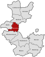
| Location of the Bielefeld district in North Rhine-Westphalia | |
  |
|
The Bielefeld district was a district that existed from 1816 to 1972 , initially in the Minden administrative district belonging to the Prussian province of Westphalia and from 1946/47 in the Detmold administrative district in North Rhine-Westphalia . Most recently, it included the immediate vicinity of the city of Bielefeld . The city itself had belonged to the district until 1878 and was then spun off as a separate city district , but still housed the district administrative authorities . From 1878 to 1969 the district was officially called the district of Bielefeld . On January 1, 1973, the district area fell largely to the city of Bielefeld as a result of the municipal reorganization , otherwise to the Gütersloh district .
geography
location
The Bielefeld district lay on both sides of the Teutoburg Forest and with its north-eastern half it had a share in the Ravensberger Mulde and in the south-west on the Ems sand plain .
Neighboring areas
In 1972 the district bordered clockwise to the north, starting with the districts of Herford , Lemgo , Detmold , Paderborn , Wiedenbrück and Halle (Westphalia) and the independent city of Bielefeld, which it encompassed as an enclave .
history
prehistory
The district area originally belonged to the Grafschaft Ravensberg , which had belonged to Brandenburg-Prussia since 1648 . From 1719 to 1807 it was in the Prussian administrative area of Minden-Ravensberg and covered the greater part of the Sparrenberg office with the city of Bielefeld and parts of the bailiwicks of Heepen, Schildesche, Brackwede and Werther. After the occupation by Napoleonic France , the district was part of the Bielefeld district of the Weser department in the Kingdom of Westphalia since 1807 . Cantons were formed from the old bailiwicks, including the Bielefeld, Brackwede, Heepen, Schildesche and Werther cantons in the Bielefeld area.
In 1811 there were changes to the administrative structure, as the area of the Bielefeld district north of the Johannisbach was annexed by France . Jöllenbeck , Theesen , Vilsendorf and Brake now belonged to the French canton of Enger in the Minden arrondissement of the department of the Upper Ems .
In the reduced district of Bielefeld, which now belonged to the Fulda department of the Kingdom of Westphalia, there were also some changes. The Dornberg farmers came from the canton of Werther to the canton of Schildesche. The canton of Heepen gave Milse to the canton of Schildesche and Heepen-Senne, which was henceforth called Senne II , to the canton of Brackwede. The canton of Brackwede lost Steinhagen to the canton of Brockhagen.
After the reconquest by Prussia in 1813, the entire Ravensberger Land initially belonged to the civil government between the Weser and Rhine and from 1815 to the new Prussian province of Westphalia . Most of the cantons and mayor's offices established during the Napoleonic period continued to exist unchanged.
1816-1841
The administrative district of Minden , founded in 1816 , one of three administrative districts in the province of Westphalia, was divided into twelve districts with effect from November 1, 1816 by ordinance of the royal government in Minden of October 18, 1816, including the district of Bielefeld with its seat in Bielefeld. The district was formed from the canton of Bielefeld, the canton of Brackwede, the canton of Schildesche including Theesen, Vilsendorf and Brake and the canton of Heepen except Elverdissen , which came to the Herford district . The district was divided into a city and five other "communities", among which Brackwede, Heepen and Schildesche had the rank of mayor's office. Isselhorst was co-administered by the Brackwede mayor and Dornberg by the Schildesche mayor.
Below this level there were villages, peasants and estates that were not consistently constituted as communities in today's sense:

| Administrative district | Places, farmers, goods |
|---|---|
| Bielefeld | City and Feldmark Bielefeld |
| Brackwede (Mayor's Office) | Brackwede , Brock , source , suburb of Gadderbaum , Sandhagen , Senne I , Senne II , Ummeln |
| Dornberg | Babenhausen , Deppendorf (from 1817), Großdornberg , Hoberge , Kirchdornberg , Niederdornberg , Gut Urentrup |
| Heepen (Mayor's Office) | Altenhagen , Brönninghausen , Gräfinghagen , Heepen , Hillegossen , Lämershagen , Lippe , Lübrassen , Gut Lübrassen , Gut Eckendorf (partially), Milse , Gut Milse, Gut Niedermühlen (until 1828), Oldentrup , Sieker , Stieghorst , Ubbedissen |
| Isselhorst | Ebbesloh , Hollen , Holtkamp , Isselhorst , Niehorst |
| Jöllenbeck (Mayor's Office, from 1832) | Niederjöllenbeck , Oberjöllenbeck (from 1832) |
| Schildesche (mayor's office) | Brake , Gellershagen , Weichbild (village) Schildesche , Gut Brodhagen, peasantry Schildesche , Stift Schildesche, Arrode Schildesche, Theesen , Vilsendorf |
On April 20, 1817, the Deppendorf peasantry was reclassified from the Halle (Westphalia) district to the Bielefeld district. In 1828 Gut Niedermühlen was incorporated into the Feldmark of the city of Bielefeld. On January 1, 1832, the Jöllenbeck mayor's office with the villages of Niederjöllenbeck and Oberjöllenbeck was reclassified from the Herford district to the Bielefeld district, as was an area of 2 km² from Elverdissen to Brake.
Unusually for the time, the administrative structure of the district of Bielefeld did not follow the church structure everywhere. Ubbedissen, Lämershagen, Graefinghagen and Senne II were parish in the Protestant parish of Oerlinghausen , although Oerlinghausen itself has always not belonged to Ravensberg, but to the Principality of Lippe . This allocation only changed in the second half of the 19th century with the establishment of their own parishes in Ubbedissen and Senne II. The suburb of Gadderbaum was parish off to Bielefeld despite its political affiliation to Brackwede. Otherwise, the political administrative districts essentially corresponded to the size of the parishes of the same name.
1841-1930
With the introduction of the Westphalian rural community order in 1841, the previous administrative districts became offices . Below this level have now to 1845 nationwide communities constituted in terms of the rural community order. Among other things, the Lübrassen farmers in the municipality of Heepen and the Lippe farmers in the municipality of Ubbedissen went up. The municipality of Hoberge-Uerentrup was formed from Hoberge and the Uerentrup estate, the municipality of Niederdornberg-Deppendorf was formed from Niederdornberg and Deppendorf, and the municipality of Lämershagen-Graefinghagen was formed from Lämershagen and Graefinghagen . Thereafter, the district of Bielefeld was divided into an office-free city and six offices with 34 official municipalities:
| Office | Municipalities (as of 1845) |
|---|---|
| free of charge | City of Bielefeld |
| Brackwede | Brackwede, Gadderbaum-Sandhagen, source, Senne I, Senne II, Ummeln |
| Dornberg | Babenhausen, Großdornberg, Hoberge-Uerentrup, Kirchdornberg, Niederdornberg-Deppendorf |
| Heepen | Altenhagen, Brönninghausen, Heepen, Hillegossen, Lämershagen-Graefinghagen, Oldentrup, Sieker, Stieghorst, Ubbedissen |
| Isselhorst | Ebbesloh, Hollen, Holtkamp, Isselhorst, Niehorst |
| Jöllenbeck | Niederjöllenbeck, Oberjöllenbeck |
| Shield ash | Brake, Gellershagen, Milse, Schildesche farmers, Weichbild (village) Schildesche, Theesen, Vilsendorf |
The Isselhorst Office was merged with the Brackwede Office in 1847 to form the Brackwede-Isselhorst Office, which a few years later was only called the Brackwede Office. The offices of Schildesche and Jöllenbeck were partly administered by a bailiff in personal union. In 1883 Sandhagen-Gadderbaum was spun off from the Brackwede Office and from then on formed the Gadderbaum Office . The place name Sandhagen has since fallen out of use.
In 1878 the city of Bielefeld was spun off from the district as an urban district. The district administration of the remainder of the district renamed "Landkreis Bielefeld" remained in Bielefeld. In 1893, Milse was transferred from the Schildesche office to the Heepen office. On April 1, 1900, the suburban part of Gadderbaum, an area of 2.33 km², was incorporated into the city of Bielefeld; likewise on August 1, 1907, a 2.01 km² area from Quelle on the east side of the Bielefelder Pass .
Location of the district in the administrative district of Minden 1832–1947 (Bielefeld district from 1878; not shown)

Location and territorial status of the city and rural district 1878–1907

Location and territorial status of the city and rural district 1907–1930

_beschriftet_Bielefeld.svg)
_beschriftet_Bielefeld.svg)
1930-1969
_beschriftet_Bielefeld.svg)

On October 1, 1930, there was an extensive municipal reorganization, the main purpose of which was to enlarge the city of Bielefeld:
- 0.79 km² in the west of Hoberge-Uerentrup were incorporated into Bielefeld.
- Großdornberg gave the Wellensiek residential area with 0.51 km² to Bielefeld.
- The largest part of Gellershagen with 3.62 km² was incorporated into Bielefeld; the remaining 1.74 km² fell to Babenhausen.
- Theesen gave his sub - Theesen and 1.34 km² large southern part to Bielefeld.
- The village of Schildesche with 4.01 km² was completely incorporated into Bielefeld.
- The largest part of the Schildesche peasantry with 4.07 km² was incorporated into Bielefeld; 1.87 km² fell to Vilsendorf and 0.98 km² to Brake.
- Heepen gave 3.20 km² large areas to the Heeper Fichten and in the Baumheide area to Bielefeld.
- Oldentrup gave 0.07 km² to Bielefeld.
- Sieker was completely incorporated into Bielefeld with 6.59 km².
- The largest part of Stieghorst with 5.08 km² was incorporated into Bielefeld; the remaining 0.26 km² came to Senne I.
Gellershagen, Bauerschaft and Dorf Schildesche, Sieker and Stieghorst were no longer independent communities. Due to the incorporation of the greater part of the Schildesche office into the city of Bielefeld, the office was dissolved; Brake came to the Heepen office and Theesen and Vilsendorf to the Jöllenbeck office. The district is now divided into 5 offices with 29 municipalities:
| Office | Municipalities (as of October 1, 1930) |
|---|---|
| Brackwede | Brackwede, Ebbesloh, Hollen, Holtkamp, Isselhorst, Niehorst, Quelle, Senne I, Senne II, Ummeln |
| Dornberg | Babenhausen, Großdornberg, Hoberge-Uerentrup, Kirchdornberg, Niederdornberg-Deppendorf |
| Heepen | Altenhagen, Brake, Brönninghausen, Heepen, Hillegossen, Lämershagen-Graefinghagen, Milse, Oldentrup, Ubbedissen |
| Gadderbaum | Gadderbaum |
| Jöllenbeck | Niederjöllenbeck, Oberjöllenbeck, Theesen, Vilsendorf |
In 1934, Gadderbaum lost its status as an office and became a municipality with its own local police department .
With the official dissolution of Prussia and thus the province of Westphalia by the Allied Control Council in 1947 and the previous establishment of the state of North Rhine-Westphalia in 1946, the administrative district of Minden and thus the district of Bielefeld became part of the new state of North Rhine-Westphalia. With the accession of the state of Lippe to the state of North Rhine-Westphalia in 1947 (formally completed in 1948), the administrative district of Minden was enlarged to include the Lippe areas in 1947. The district now called the Detmold administrative district (briefly and initially referred to as the Minden-Lippe district) after the new administrative center belonged to the Bielefeld district until its dissolution.
Nieder- and Oberjöllenbeck were merged on August 10, 1952 to form the municipality of Jöllenbeck . Brackwede was granted city rights in 1956 and became vacant in 1959. The seat of the Brackwede office remained in Brackwede.
On December 31, 1961, 0.54 km² of the community of Babenhausen were reclassified to Bielefeld. In 1963 Else Zimmermann ( SPD ) was elected district administrator for the Bielefeld district. She was the first district administrator in a district in the Federal Republic of Germany.
On January 1, 1965, Brake gave an area of 0.56 km² to Bielefeld in the Baumheide area.
In 1965, Senne II also received city rights and was renamed "Sennestadt". From October 1, 1969, the district was called "District Bielefeld".

1930 - 9 Aug 1952: Nieder- and Oberjöllenbeck still independent communities

Aug 10, 1952 - 1959: The Jöllenbeck community was established in 1952

1959–1964: Brackwede became vacant in 1959

The district from January 1, 1970 to December 31, 1972


1970-1973


As part of the North Rhine-Westphalian territorial reform , in the course of the implementation of the " Law on the reorganization of the Wiedenbrück district and parts of the Bielefeld district" of December 4, 1969, on January 1, 1970, some reunions both within the district and between the Bielefeld district and the neighboring circles:
- Ebbesloh, Hollen, most of Isselhorst, Niehorst and a small part of Ummeln were incorporated into the town of Gütersloh ( Wiedenbrück district ).
- The new community of Schloß Holte-Stukenbrock , which was formed from the communities of Schloß Holte ( Verl office , Wiedenbrück district), Stukenbrock ( Neuhaus castle district, Paderborn district) and a small part of Sende (Verl) was incorporated into the Bielefeld district.
- Another small part of Sende was incorporated into Sennestadt.
- Holtkamp, Quelle and Ummeln as well as a small part of Isselhorst were incorporated into the town of Brackwede.
- The Brackwede office was dissolved; The city of Sennestadt became the legal successor. Senne I and Sennestadt became vacant.
Before its dissolution, the Bielefeld district was finally divided into five unofficial cities and municipalities as well as 17 official municipalities in three offices:
| Office | Municipalities (as of December 31, 1972) |
|---|---|
| free of charge | Brackwede (town), Gadderbaum , Schloß Holte-Stukenbrock , Senne I , Sennestadt (town) |
| Dornberg | Babenhausen , Großdornberg , Hoberge-Uerentrup , Kirchdornberg , Niederdornberg-Deppendorf |
| Heepen | Altenhagen , Brake , Brönninghausen , Heepen , Hillegossen , Lämershagen-Graefinghagen , Milse , Oldentrup , Ubbedissen |
| Jöllenbeck | Jöllenbeck , Theesen , Vilsendorf |
The territorial reform in the Bielefeld area was concluded with the "Law on the reorganization of the municipalities and districts of the reorganization area Bielefeld ( Bielefeld Law )" of October 24, 1972, through which the following changes came into force on January 1, 1973:
- The cities of Bielefeld, Brackwede and Sennestadt, the communities of Gadderbaum, Babenhausen, Großdornberg, Kirchdornberg, Niederdornberg-Deppendorf, Altenhagen, Brake, Brönninghausen, Heepen, Hillegossen, Lämershagen-Gräfinghagen, Milse, Oldentrup, Ubbedissen, Jöllenbeck, Theesen and Vilsendorf as well as the largest Parts of the communities Senne I, Hoberge-Uerentrup and Schröttinghausen (Halle (Westphalia)) were merged to form the new independent city of Bielefeld. Furthermore, smaller parts of the cities and communities Häger , Isingdorf , Steinhagen (all of Halle (Westphalia)) and Spenge (Herford district) were incorporated.
- In addition, the division of Bielefeld into the seven urban districts of Brackwede, Senne, Gadderbaum, Dornberg, Heepen, Jöllenbeck and Sennestadt was determined in addition to the core city (center) . Later two more districts were established with Schildesche and Stieghorst.
- Holte-Stukenbrock Castle was incorporated into the newly founded Gütersloh district.
- A small part of Senne I was transferred to the town of Gütersloh and a small part of Hoberge-Uerentrup to the newly founded municipality of Steinhagen (both district of Gütersloh).
- The district of Bielefeld and the offices of Dornberg, Heepen and Jöllenbeck were dissolved; The legal successor is the city of Bielefeld.
Population development

The following overview shows the population of the Bielefeld district by area. Changes to the territorial status resulted mainly from the incorporation of the municipalities of Nieder- and Oberjöllenbeck and the separation of parts of the municipality of Brake in 1832, the separation of the city of Bielefeld in 1878, and the reclassification of various municipalities and parts of the municipality into the city of Bielefeld in 1900, 1907, 1930, 1961 and 1965 and the incorporation of the community of Schloß Holte-Stukenbrock 1970. The figures are census results or their extrapolation. From 1871 and 1946, the figures relate to the local population and from 1925 to the resident population . Before 1871, the population figures were determined using inconsistent survey methods.
|
|
|
politics
Results of the district elections from 1946
The list only shows parties and constituencies that received at least two percent of the votes in the respective election.
Share of votes of the parties in percent
| year | SPD | CDU | FDP | BHE | KPD |
|---|---|---|---|---|---|
| 1946 | 55.1 | 34.0 | 4.3 | ||
| 1948 | 52.8 | 39.4 | 3.2 | 4.6 | |
| 1952 | 51.1 | 36.1 | 9.98 | 2.3 | |
| 1956 | 55.1 | 27.0 | 12.7 | 5.2 | |
| 1961 | 53.3 | 35.2 | 11.5 | ||
| 1964 | 55.6 | 34.5 | 9.9 | ||
| 1970 |
District administrators
- 1817–1837 Franz von Borries
- 1837–1876 Wilhelm von Ditfurth
- 1876–1877 Max von Wurmb
- 1877–1878 Rudolf von Borries (acting)
- 1878–1909 Franz von Ditfurth
- 1910–1937 August Beckhaus ( DNVP , DVP , NSDAP )
- 1938–1943 Heinrich Martin Rütten ( NSDAP )
- 1943–1945 Erich Hartmann ( NSDAP )
- 1945 Artur Ladebeck (SPD)
- 1946–1947 Kurt Baurichter (SPD)
- 1947–1961 Franz Specht (SPD)
- 1961–1963 Erich Deppermann (SPD)
- 1963–1967 Else Zimmermann (SPD)
- 1967–1972 Klaus Schwickert (SPD)
coat of arms
.jpg)
The coat of arms of the district, approved on August 23, 1961, showed three red rafters in silver, the two lower rafters covered with a cog wheel, between the two upper three flax flowers. The rafters are borrowed from the coat of arms of the Grafschaft Ravensberg and are one of the most common symbols in the municipal and district coats of arms in Minden-Ravensberg . The flax blossoms allude to the importance of the linen weaving industry in the Ravensberger Land and beyond. Bielefeld in particular was the location of large spinning mills such as the Ravensberger Spinnerei . The gear symbolizes the industry in the district, as the district was one of the industrial centers of East Westphalia .
License Plate
On July 1, 1956, the district was assigned the distinctive sign BI when the vehicle registration number was introduced. It is still issued in the city of Bielefeld to this day.
literature
- Wilhelm von Ditfurth : Report on the statistical and other conditions as well as on the results of the administration of the Bielefeld district for the period from 1837 up to and including 1859. Bielefeld 1860 ( ULB Münster ).
- Wilhelm von Ditfurth: Statistical representation of the district of Bielefeld. Bielefeld 1863, 1871 ( ULB Münster ).
- Gustav Engel : The city and district of Bielefeld (= district and city handbooks of the Westphalian Heimatbund , issue 11). Munster 1950.
- Fritz Koppe: Bielefeld, city and district (= nature conservation guide of the Westphalian Heimatbund , issue 7). Munster 1963.
Sources and web links
- Territorial development of the Bielefeld district
- Population of the municipalities of the district 1864
- Population of the municipalities in the district in 1910
- Population of the municipalities of the district in 1925 and 1939
Individual evidence
- ^ Federal Statistical Office (ed.): Historical municipality directory for the Federal Republic of Germany. Name, border and key number changes in municipalities, counties and administrative districts from May 27, 1970 to December 31, 1982 . W. Kohlhammer, Stuttgart / Mainz 1983, ISBN 3-17-003263-1 , p. 320 .
- ^ Division of the Bielefeld district. In: Law Bülletin of the Kingdom of Westphalia. May 18, 1808, pp. 137 ff. , Accessed on April 13, 2010 (digitized version).
- ^ Albrecht Lasius: The French imperial state under the government of the imperial Napoleon the great. (Digitalisat) 1812, p. 204 , accessed on April 21, 2010 .
- ^ Territorial division of the Bielefeld district. In: Gesetz-Bülletin des Kingdom of Westphalia Volume 2. November 20, 1812, p. 421 , accessed on April 13, 2010 (digitized version).
- ^ Map of Bielefeld with neighboring communities. In: Online map service of the city of Bielefeld. 1827, Retrieved April 14, 2010 .
- ↑ Information on the historical map from 1827; Paragraph administrative division. Land surveying and land registry office of the city of Bielefeld, 2005, accessed on April 14, 2010 .
- ^ Alfred Bruns (ed.): Westfalenlexikon 1832-1835 . Reprints for the Westphalian archive maintenance. Westphalian State Office for Archive Maintenance, Münster 1978.
- ↑ a b Seemann: Geographical-statistical-topographical overview of the administrative district of Minden. (PDF; 802 kB) 1843, pp. 52–57 , accessed on April 23, 2010 .
- ^ Rural municipality regulations for the province of Westphalia. (Digitized; PDF; 1.6 MB) In: Collection of Laws for the Royal Prussian States. October 31, 1841, accessed April 14, 2010 .
- ↑ Ordinance No. 713. (digitized version ) In: Official Journal of the Minden Government. November 17, 1843, p. 360 , accessed April 22, 2010 .
- ^ Parish division of the Dornberg district. In: Official Journal of the Minden Government. September 8, 1845, accessed April 22, 2010 .
- ↑ Topographical-statistical manual of the government district of Minden. (Digitized version) 1866, p. 12 , accessed on April 22, 2010 .
- ↑ a b c Bielefeld district (ed.): 150 years Bielefeld district . 1966.
- ^ Law on the expansion of the Bielefeld district. (PDF; 7 kB) In: Collection of laws for the Royal Prussian States. June 11, 1930, p. § 1 , accessed April 14, 2010 .
- ↑ Announcement of the new version of the district regulations for the state of North Rhine-Westphalia from August 11, 1969 in the Law and Ordinance Gazette for the state of North Rhine-Westphalia, year 1969, No. 2021, p. 670 ff.
- ↑ Law on the restructuring of the Wiedenbrück district and parts of the Bielefeld district. In : recht.nrw.de. December 4, 1969, Retrieved May 1, 2010 .
- ^ Federal Statistical Office (ed.): Historical municipality directory for the Federal Republic of Germany. Name, border and key number changes in municipalities, counties and administrative districts from May 27, 1970 to December 31, 1982 . W. Kohlhammer, Stuttgart / Mainz 1983, ISBN 3-17-003263-1 , p. 320 .
- ↑ State Statistical Office of North Rhine-Westphalia: Municipal statistics of the State of North Rhine-Westphalia: population development 1816–1871 . Düsseldorf 1966, pp. 56-59.
- ↑ State Statistical Office of North Rhine-Westphalia: Municipal statistics of the State of North Rhine-Westphalia: Population development 1871–1961 . Düsseldorf 1964, pp. 64-65.
- ↑ State Statistical Office of North Rhine-Westphalia: The resident population in the municipalities of North Rhine-Westphalia 1970: Results of the census on May 27, 1970 . Düsseldorf 1972, p. 41.
- ↑ Statistical Yearbook for the Federal Republic of Germany 1973
- ↑ Source: respective issue of the State Statistical Office (LDS NRW), Mauerstr. 51, Düsseldorf, with the election results at the district level.

Before the founding of North Rhine-Westphalia in what is now North Rhine-Westphalia, the (rural) districts: Bilstein | Blankenheim | Bochum | Brakel | Frets | Dortmund | Duisburg | Düsseldorf | Elberfeld | Eslohe | Food | Geilenkirchen | Gelsenkirchen | Gemünd | Gimborn | Gladbach | Grevenbroich-Neuss | Gummersbach | Hagen | Hamm | Hattingen | Heinsberg (1816-1932) | Homburg | Hörde | Kempen | Krefeld | Lechenich | Lennep | Medebach | Mettmann | Mülheim am Rhein | Mülheim an der Ruhr | Neuss | Opladen | Rahden | Rheinbach | Rheinberg | Ruhrort | Schwelm | Solingen | Solingen-Lennep | Uckerath | Waldbröl | Wipperfürth
Former North Rhine-Westphalian (rural) districts: Aachen (1816–1971) | Aachen (1972–2009) | Ahaus | Altena | Arnsberg | Beckum | Bergheim (Erft) | Bielefeld | Bonn | Borken (1816–1974) | Brilon | Büren | Coesfeld (1816–1974) | Detmold | Dinslaken | Düren (1816–1971) | Düsseldorf-Mettmann | Erkelenz | Geilenkirchen-Heinsberg | Geldern | Grevenbroich | Halle (Westphalia) | Höxter (1816–1974) | Iserlohn | Jülich | Kempen-Krefeld | Cologne | Lemgo | Lippstadt | Lübbecke | Lüdenscheid | Lüdinghausen | Meschede | Minden | Moers | Monschau | Munster | Paderborn (1816–1974) | Rees | Rhein-Wupper-Kreis | Schleiden | Selfkantkreis Geilenkirchen-Heinsberg | Victories | Siegkreis | Soest (1817–1974) | Steinfurt (1816–1974) | Tecklenburg | Unna (1930–1974) | Warburg | Warendorf (1816–1974) | Wiedenbrück | Wittgenstein

Districts: Ahaus | Altena | Arnsberg | Beckum | Bielefeld | Bilstein | Bochum | Bark | Brakel | Brilon | Frets | Büren | Coesfeld | Dortmund | Ennepe-Ruhr district | Eslohe | Gelsenkirchen | Hagen | Halle (Westphalia) | Hamm | Hattingen | Herford | Hörde | Höxter | Iserlohn | Lippstadt | Lübbecke | Lüdinghausen | Medebach | Meschede | Minden | Munster | Olpe | Paderborn | Rahden | Recklinghausen | Schwelm | Victories | Soest | Steinfurt | Tecklenburg | Unna | Warburg | Warendorf | Wiedenbrück | Wittgenstein
City districts: Bielefeld | Bocholt | Bochum | Bottrop | Buer | Castrop-Rauxel | Dortmund | Gelsenkirchen | Gelsenkirchen-Buer | Gladbeck | Hagen | Hamm | Herford | Herne | Hörde | Iserlohn | Lüdenscheid | Lünen | Minden | Munster | Osterfeld | Recklinghausen | Victories | Wanne-Eickel | Wattenscheid | Witten