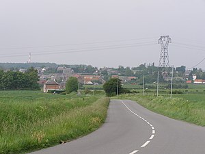
Cerfontaine (North)
| Cerfontaine | ||
|---|---|---|

|
|
|
| region | Hauts-de-France | |
| Department | North | |
| Arrondissement | Avesnes-sur-Helpe | |
| Canton | Fourmies | |
| Community association | Maubeuge Val de Sambre | |
| Coordinates | 50 ° 16 ′ N , 4 ° 2 ′ E | |
| height | 135-183 m | |
| surface | 3.87 km 2 | |
| Residents | 688 (January 1, 2017) | |
| Population density | 178 inhabitants / km 2 | |
| Post Code | 59680 | |
| INSEE code | 59142 | |
 Cerfontaine |
||
Cerfontaine is a commune in northern France . It belongs to the Hauts-de-France region , in the Nord department , in the Avesnes-sur-Helpe arrondissement and in the Fourmies canton . It is bordered by Rousies to the north-west, Recquignies to the north-east, Colleret to the east, Ferrière-la-Petite to the south and Ferrière-la-Grande to the west . Earlier place names were Serfontaine, Serrefontaine and Sierrefontaine.
Attractions
- church
- Fort of Cerfontaine
Population development
| year | 1962 | 1968 | 1975 | 1982 | 1990 | 1999 | 2008 | 2013 |
|---|---|---|---|---|---|---|---|---|
| Residents | 603 | 578 | 641 | 588 | 526 | 559 | 565 | 626 |
literature
- Le Patrimoine des Communes du Nord. Flohic Editions, Volume 2, Paris 2001, ISBN 2-84234-119-8 , pp. 1228-1229.
Web links
Commons : Cerfontaine - Collection of images, videos and audio files
- Monuments historiques (objects) in Cerfontaine (north) in the base Palissy of the French Ministry of Culture


