
Dompierre-sur-Helpe
| Dompierre-sur-Helpe | ||
|---|---|---|
.svg)
|
|
|
| region | Hauts-de-France | |
| Department | North | |
| Arrondissement | Avesnes-sur-Helpe | |
| Canton | Avesnes-sur-Helpe | |
| Community association | Coeur de l'Avesnois | |
| Coordinates | 50 ° 9 ′ N , 3 ° 52 ′ E | |
| height | 132-191 m | |
| surface | 13.2 km 2 | |
| Residents | 860 (January 1, 2017) | |
| Population density | 65 inhabitants / km 2 | |
| Post Code | 59440 | |
| INSEE code | 59177 | |
| Website | http://www.dompierresurhelpe.fr/ | |
_mairie.jpg) Mairie Dompierre-sur-Helpe |
||

Dompierre-sur-Helpe is a commune in the French department of Nord in the region of Hauts-de-France . It belongs to the canton of Avesnes-sur-Helpe (until 2015: Canton Avesnes-sur-Helpe-Nord ) in the arrondissement of Avesnes-sur-Helpe . It borders in the north on Leval and Monceau-Saint-Waast , in the northeast on Saint-Remy-Chaussée (point of contact), in the east on Saint-Hilaire-sur-Helpe , in the south on Petit-Fayt , in the south-west on Marbaix and in the north-west at Taisnières-en-Thiérache and Noyelles-sur-Sambre .
The village is affected by the Helpe Majeure .
Population development
| year | 1962 | 1968 | 1975 | 1982 | 1990 | 1999 | 2008 | 2013 |
|---|---|---|---|---|---|---|---|---|
| Residents | 916 | 958 | 1152 | 1177 | 1157 | 1036 | 946 | 894 |
Attractions
See also: List of Monuments historiques in Dompierre-sur-Helpe
- Saint Etton Church
- Wayside shrines
- War memorial

Saint Etton Church

Stained glass on a window of the Saint-Etton church
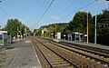
Dompierre-sur-Helpe train station
_%C3%A9glise_Saint-Etton,_chevet.jpg)
_vie_de_Saint_Etton,_vitrail_01.jpg)

literature
- Le Patrimoine des Communes du Nord. Flohic Editions, Volume 1, Paris 2001, ISBN 2-84234-119-8 , pp. 133-135.
Web links
Commons : Dompierre-sur-Helpe - collection of images, videos and audio files