Floyon
| Floyon | ||
|---|---|---|

|
|
|
| region | Hauts-de-France | |
| Department | North | |
| Arrondissement | Avesnes-sur-Helpe | |
| Community association | Coeur de l'Avesnois | |
| Coordinates | 50 ° 2 ' N , 3 ° 53' E | |
| height | 155-234 m | |
| surface | 17.47 km 2 | |
| Residents | 532 (January 1, 2017) | |
| Population density | 30 inhabitants / km 2 | |
| Post Code | 59219 | |
| INSEE code | 59241 | |
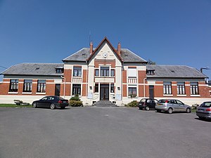
 Mairie Floyon |
||
Floyon is a French municipality with 532 inhabitants (January 1, 2017) in Nord in the region of Hauts-de-France . It belongs to the arrondissement of Avesnes-sur-Helpe and to the municipality of Cœur de l'Avesnois .
geography
The municipality of Floyon is located in the Thiérache , a landscape in the western foothills of the Ardennes , about 50 kilometers northeast of Saint-Quentin and about 20 kilometers west of the border with Belgium . In the south, the municipality borders on the Aisne department . The municipal area of 17.47 km² consists largely of arable and pasture land. Only in the southeast is an approximately 100 hectare forest area ( Bois de la Houssoye ).
Floyon includes the districts of Les Réteaux, Plouy and Chevireuil as well as smaller hamlets and individual farms.
Neighboring communities of Floyon are Étrœungt in the north-east, Larouillies in the east, La Flamengrie and Papleux in the south, Fontenelle in the south-west and Cartignies in the north-west.
history
The place appears for the first time as a flon in a document in 1131 . The settlement goes back much further. Ursmar von Lobbes was born on July 27, 644 in what is now Fontenelle, then associated with Floyon . He was a Benedictine , abbot , choir bishop and missionary . He is venerated as a saint in the Roman Catholic Church .
Like many other villages in the Thiérache border region, Floyon was repeatedly exposed to the incursion of marauding mercenary troops, especially in the 16th and 17th centuries. Numerous fortifications date from this time, such as a castle (destroyed during the French Revolution) and the fortified church in the village.
On August 16, 1789, the parish of Floyon was constituted, making it the first in the region.
Population development
| year | 1962 | 1968 | 1975 | 1982 | 1990 | 1999 | 2007 | 2017 | |
|---|---|---|---|---|---|---|---|---|---|
| Residents | 682 | 742 | 618 | 554 | 513 | 515 | 496 | 532 | |
| Sources: Cassini and INSEE | |||||||||
Attractions
Parts of the bell tower of the fortified church St. Martin date from the year 1573. After destruction and severe damage in the 15th, late 16th and 17th centuries, the church was rebuilt again and again.
See also: List of Monuments historiques in Floyon
Economy and Infrastructure
There are 28 farms in the community (cereal cultivation, dairy farming, cattle, sheep, goats and poultry breeding).
The D 965 road from Le Nouvion-en-Thiérache to Étrœungt runs through the municipality of Floyon . National Road 2 runs from Maubeuge to Paris two kilometers east of Floyon . The train station on Avesnes-sur-Helpe, twelve kilometers away, is on the Lille – Hirson railway line .
literature
- Le Patrimoine des Communes du Nord. Flohic Editions, Volume 1, Paris 2001, ISBN 2-84234-119-8 , pp. 146-147.

