
Flaumont Waudrechies
| Flaumont Waudrechies | ||
|---|---|---|
_Nord-France.svg)
|
|
|
| region | Hauts-de-France | |
| Department | North | |
| Arrondissement | Avesnes-sur-Helpe | |
| Canton | Fourmies | |
| Community association | Coeur de l'Avesnois | |
| Coordinates | 50 ° 8 ′ N , 3 ° 58 ′ E | |
| height | 147-204 m | |
| surface | 5.70 km 2 | |
| Residents | 382 (January 1, 2017) | |
| Population density | 67 inhabitants / km 2 | |
| Post Code | 59440 | |
| INSEE code | 59233 | |
 Mairie Flaumont-Waudrechies |
||

Flaumont-Waudrechies is a commune in northern France . It belongs to the Hauts-de-France region , the Nord department , the Avesnes-sur-Helpe arrondissement and the Fourmies canton (until 2015: Avesnes-sur-Helpe canton ). It borders on Bas-Lieu to the west and north, Beugnies and Felleries to the northeast, Sémeries to the east and Avesnelles to the south . The residents call themselves Flaumontois or Flaumontoises .
From July 20, 1901 to August 16, 1941, the railway line from Avesnes-sur-Helpe to Sars-Poteries was in operation, which also served Flaumont-Waudrechies.
Population development
| year | 1962 | 1968 | 1975 | 1982 | 1990 | 1999 | 2008 | 2013 |
|---|---|---|---|---|---|---|---|---|
| Residents | 431 | 392 | 320 | 315 | 352 | 353 | 368 | 385 |
Attractions
See also: List of Monuments historiques in Flaumont-Waudrechies
- Saint-Victor church in Flaumont
- Chapel of Sainte-Aldegonde in Waudrechies, Monument historique
- Duchesne wayside shrine , also a monument historique, and other wayside shrines
- War memorial
- Oppidum
- Concert space
- Watermill from 1745

Chapel of Sainte-Aldegonde
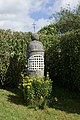
Wayside shrine from Duchesne


literature
- Le Patrimoine des Communes du Nord. Flohic Editions, Volume 1, Paris 2001, ISBN 2-84234-119-8 , pp. 142-144.
Web links
Commons : Flaumont-Waudrechies - Collection of images, videos and audio files