List of streets and squares in Bad Reichenhall
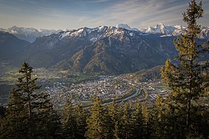
The list of streets and squares in the city of Bad Reichenhall describes the street system including named paths with the corresponding historical references. It does not claim to be complete.
introduction
historical development
The development of the streets and squares of the city of Bad Reichenhall has been subject to constant change over centuries and is still - even if only to a very small extent - to this day. The most important branch of the city's economy - the production of salt from brine in the saline - and the accompanying fire disasters that last struck the city and its residents in 1834 were decisive for the cityscape . In the more recent past it was the spa operation and the associated buildings of baths, sanatoriums, sanatoriums, villas and hotels from the middle of the 19th century as well as the bombing of the city on April 25, 1945 by allied bomber groups.
From the end of the Second World War , there was extensive creation of living space for the city's growing population , especially in the then independent municipalities of Karlstein and Marzoll , which were now part of the city. Between 1951 and 1968 the bypass road ( B20 / B21 / Loferer Straße) was gradually built, which bypasses long-distance traffic to and from Salzburg , Salzburg's Pinzgau and Tyrol as well as the German Alpine Road towards Inzell , Ruhpolding and Traunstein .
Shortly afterwards, the original main traffic axis through the city (Salzburger Strasse, Ludwigstrasse, Salinenstrasse, Tiroler Strasse, Tiroler Tor) in the area of the upper Salzburger Strasse and Ludwigstrasse was designated as a pedestrian zone . Except for the last remaining level crossings in the city area on Teisendorfer and Frühlingstrasse, all crossings were replaced by underpasses, the crossing at Tiroler Tor was omitted without replacement. Today, road traffic mainly moves through the city via the Münchner Allee, Bahnhofplatz, Bahnhofstrasse, Wittelsbacherstrasse, Innsbrucker Strasse, Anton-Winkler-Strasse and Berchtesgadener Strasse. The Kretabrücke and the traffic distributor south were built in the 1960s and 1970s. The traffic towards Thumsee and German Alpine Road is not running since more about the listed Luitpoldbrücke and the old Thumseestraße but on Crete bridge and the newly established state road 2101 . At the beginning of the 1990s, Rathausplatz and Poststrasse were also designated as pedestrian zones, but are also open to cyclists. In the mid-1990s, the traffic light at the Gablenknode was removed and replaced by a spacious traffic distribution board with sanders and an underpass to counteract the daily traffic jams at rush hour.
Many of the streets in Bad Reichenhall have had different names over the years. This was due to both social and economic changes within the city. A milk square (today Waaggasse behind the old town hall) or a horse pond (today Unterer Lindenplatz) have lost their importance over time. Also due to major restructuring within the city after fires - especially after the last great city fire in 1834 - the names of the streets changed. The last big changes happened during and after the time of the Third Reich when the names of Jewish citizens were banned from street names and many streets were named after personalities of the Third Reich. These changes were partially reversed after the end of World War II, and the streets were partially given new or different names. However, the names of fellow Jewish citizens found their way back into the city only slowly. Even after the regional reform , some of the streets had to be renamed to avoid double street names after the incorporation of Karlstein and Marzoll .
Street names

The allocation of street names follows the pattern that can be found in many other German cities. Some of the arterial roads were named after the places or countries in which they lead or led ( Salzburger Strasse, Tiroler Strasse, Berchtesgadener Strasse). Others are named after nearby buildings (e.g. Salinenstrasse after the old salt works , Am Münster after the Minster St. Zeno , the Schloßberg after the Marzoll Castle ) or the Rathausplatz. Many are dedicated to people who either worked in Bad Reichenhall (e.g. Wörgötterplatz, Max-Zugschwerdt-Straße, Reichenbachstraße, Karl-Weiß-Straße, Alfred-Nathan-Straße, Hofrat-Harl-Straße) or who are accordingly famous (e.g. Ludwig-Thoma-Straße, Adalbert-Stifter-Straße, Barbarossastraße, Beethovenstraße, Goethestraße, Von-Martius-Straße). Schmalschlägerstrasse in Karlstein is the only street in the city that is named after its builder. Many yard, house and field names (e.g. Am Eisenbichl, Froschhamer Weg, Weitwiesenring, Vogelthennstraße, Rauchbichl, Langackerstraße or Garneiweg) as well as some of the mountains surrounding the city can be found in the street names (e.g. Staufenstraße , Zwieselstrasse, Müllnerhorngasse, Untersbergstrasse).
The streets of flowers and trees in the new development areas of the 1960s, 1970s and 1980s have something special. At that time, the city decided which areas would have flower or tree names; the residents were allowed to decide on the street names themselves. And so it happens that instead of alpine flowers typical of the area such as edelweiss, gentian, buttercup or thistle, the streets now bear the names of tulip, lily, carnation, aster and roses.
Other streets with so-called art names are in Bad Reichenhall z. B. the mountain path, the garden path or the flower path. It was neglected to dedicate streets to people who have a very strong historical connection to the city. In the specific case, these include Wilhelm Barth (director of the Philharmonie), Ernst Baumann (well-known mountain and sports photographer, who also photographed hundreds of motifs for Reichenhaller postcards ), Johann Sebastian von Clais (renovator of the Bavarian saltworks), Georg von Cornet ( Tuberculosis researcher ), Wiguleus Fröschl von Marzoll ( Prince-Bishop of Passau), Joseph Gungl (founder of the Reichenhaller Kurorchester), Sebastian Hinterseer (important alternative practitioner), Josef "Pewo" Pertsch (one of the best alpine ski racers of his time, held the record for the north descent for a long time des Predigtstuhls , fell in 1941 at the age of 21 at the foot of Mount Olympus ), Anderl Hinterstoißer (famous climber, had an accident on the north face of the Eiger ), Viktoria Savs (front soldier in World War I , the “hero girl of the Three Peaks”), Josef Maurer (archaeologist, headed the important excavations in Langackertal and on today's Schmalschlägerstrasse ), Fritz Schön (important Za hnmediziner), Alois Seethaler (hotelier and initiator of numerous facilities) as well as Fritz Hofmann (city home keeper, initiator for founding the Association for Local History Bad Reichenhall and the surrounding area ).
The pulmonary specialist Gustav Ortenau had to flee Bad Reichenhall in 1938 due to his Jewish descent, and the Ortenau Park was dedicated to the doctor popular with the townspeople.
Signage

Since the 1970s, light gray, rectangular street signs made of an aluminum alloy with black print in block letters have usually been used in Bad Reichenhall . These signs are erected on their own masts or attached to existing street lamps or traffic light masts, provided they are in a suitable location. Before the 1970s, blue enameled tin signs with white writing and a white frame were used. These old signs are rarely found. However, they were not always replaced in areas with old housing. A hyphenated spelling was often used for these signs, so instead of Turnergasse there is still Turner-Gasse on the facade of the former Tigerwirt and at the kindergarten in St. Zeno Kloster-Straße and Hubertus-Straße instead of Klosterstraße and Hubertusstraße .
Langenfeldstrasse has a special feature. This is partly in the area of the city of Bad Reichenhall, partly in the area of the neighboring municipality of Bayerisch Gmain . Access to this dead end is only possible via Bayerisch Gmain, which is why another sign is used here. Bayerisch Gmain uses the same modern materials as Bad Reichenhall, but the appearance is based on older street signs and is still done in white letters on a blue background.
House numbers
The allocation of house numbers follows the usual pattern in which the houses with an even house number are arranged on one side of the street and the houses with the odd house number on the other side. In areas with old housing stock or in very winding streets / alleys, however, this pattern can be deviated from. B. in the old salt works , the Dreifaltigkeitsgasse or in Glück im Winkel . The districts of Thumsee and Nonn of the formerly independent municipality of Karlstein only have house numbers without the addition in , on or street , square or alley . The houses are numbered consecutively, and there is not always a clear distinction between even and odd house numbers. Nonn is divided into the Nonner Unterland near the Nonner Stadium and the Nonner Kircherl and the Nonner Oberland , which lies between the sports field of the barracks , the Padinger Alm and the Listwirt. In addition to Nonn, there are only three-digit house numbers in the Reichenhaller urban area on Frühlingstraße and in the Marzoll district on Reichenhaller Straße.
particularities
Streets can usually be recognized as such as address designations due to their name. In Bad Reichenhall, however, there are around a dozen such addresses that are used without a corresponding addition such as street , avenue , lane , path , promenade , square or in and on . These are Alte Saline , Bruckthal , Buchenhof , Fischerbräuwiese , Glück im Winkel , Nesselgraben , Nonn , Nonner Au , Rauchbichl , Rehwinkel and Thumsee .
Overview of the streets and squares in Bad Reichenhall
The following table gives an overview of the existing streets and squares in Bad Reichenhall as well as some related information. In detail these are:
- Name / geoposition : current name of the street or square. Via the link "Location", the street or the square can be displayed on various map services.
- Name origin : origin or reference of the name. There is no explanation for obvious names such as Bahnhofstrasse .
- Location : Indication of the start and end point for streets or important roads leading to it from squares.
- Notes : Further information on nearby institutions, the history of the street, historical names, architectural monuments, etc. The list of architectural monuments in Bad Reichenhall contains all of the town's monuments, sorted by districts and streets and illustrated throughout.
- Former or no longer valid street names are in italics in this column .
- Image : Photo of the street / square or an important object located there. More pictures can be found in the gallery of streets and squares in Bad Reichenhall on Wikimedia Commons.
| Name / geoposition | Origin of name | location | Remarks | image |
|---|---|---|---|---|
| Adalbert-Stifter-Strasse (location) |
Named after the Austrian poet and painter Adalbert Stifter . | Connection from Ludwig-Thoma-Straße to Frühlingstraße. |

|
|
| Adolf-Bühler-Weg (location) |
Adolf Bühler, bookseller, publisher, cartographer, historian, born August 25, 1931 in Landau / Pfalz , † April 15, 1908 in Bad Reichenhall. Bühler was captain of the Jäger Battalion on the Gruttenstein from 1854 to 1866 . He wrote several guides for Bad Reichenhall that were outstanding at the time. He was a co-founder and teacher at the advanced training school and founder of the historical association. | Connects Kaiserplatz with Kurstraße, mainly a pedestrian connection. | Was called Promenadestrasse until around 1920 and Parkweg until 1932 . |

|
| Adolf-Schmid-Strasse (location) |
Dr. Adolf Schmid, honorary citizen, born September 29, 1846 in Erlangen , † December 14, 1908 in Berlin , Königl. Councilor, spa doctor. From 1873 he promoted the development of the spa, introduced hydrotherapy as the most important spa treatment and founded a children's sanatorium. | Branches off from Salzburger Strasse and takes the Richard-Wagner-Strasse and Beethovenstrasse junction to the city limits. | Was called Gmainer Straße until around 1920 . Ends shortly after Beethovenstraße for multi-lane vehicles, pedestrians and cyclists can however pass the barrier. |

|
| Adolph-Kolping-Weg (location) |
Named after Adolph Kolping , founder of the Kolping Society. | Connects the Domprobst-von-Lechner-Platz with the Herzog-Georgen-Straße. | Footpath |

|
| Aegidigäßchen (location) |
According to St. Aegidius , patron of the church of the same name . | Located between Poststrasse and Aegidiplatz. | Runs under the passage of the Aegidi Church. |

|
| Aegidiplatz (location) |
According to St. Aegidius , patron of the church of the same name. | Located between Poststrasse and Ludwigstrasse, behind the St. Agidius Church and in front of the Old Fire House (today adult education center). | The Aegidiplatz may only with special permission with motor vehicles be driven. There is the Bad Reichenhall adult education center, which is housed in the city's old fire house. |

|
| Ahornstrasse (location) |
Plant genus of the maples | Leads from Thumseestrasse at the Saalach power station to the confluence with Lilienstraße. | The Ahornstraße is in a 30 km / h zone . |

|
| Alfred-Nathan-Strasse (location) |
After Alfred Nathan , former citizen and benefactor of the city. | Connecting road between Traunfeldstrasse and Paepkestrasse. | Alfred-Nathan-Strasse was formerly known as Pfälzer Strasse . |

|
| Alte Saline (location) |
Building ensemble of the old salt works | Buildings belonging to the old saltworks such as brewhouses, brine reserves, warehouses and workshops. | The saltworks and the attached buildings are under ensemble protection . The northern and southern courtyards can be accessed, in the northern there are u. a. Retailers, a pharmacy, a medical center and physiotherapists. In the south inner courtyard is the seat of the owner, a local developer and the Reichenhall Academy. In the central courtyard there is the main well, in which brine is still extracted, is located next to magazines, brine reserves and brewhouses. The main well and large parts of the underground facilities can be visited on guided tours. |

|
| At the capture (location) |
The capture is located between the barracks and the Nonner Stadium. | Traffic-free area |

|
|
| Am Eisenbichl (location) |
After the Eisenbichlerhof, Eisenbichl is also an old field name . | Connection between Staufenstrasse and Zwieselstrasse. |

|
|
| Amerangstrasse (location) |
Named after a former noble family and a former castle in Karlstein . | Connects Thumseestrasse with Staatsstrasse 2101 , crosses Pflegerpointstrasse. | Amerangstraße is in a 30 km / h zone . |

|
| Am Goring (location) |
Field name | Leading from Rainthalstraße in a circular shape through a residential area back to the starting point, connection to the An der Schanz street. |

|
|
| At the power plant (location) |
Named after the Saalach power plant . | Dead end, branches off from Thumseestrasse in a southerly direction and ends at the Saalach power plant. | This is where the Saalach power plant is located, one of the oldest railway power plants still in service in Germany. The power plant, including the transformer houses, operations manager building, underwater canal, bridge over the canal, dam wall, inlet structure and moated castle is a listed building . |

|
| Am Kreuzweg (location) |
Runs parallel to Untersbergstrasse from Märzfeld to Rainthalstrasse and crosses Kohlerbachstrasse. |

|
||
| Am Münster (location) |
Named after the minster St. Zeno . | Residential building on the corner of Salzburgerstrasse and Zenostrasse. |

|
|
| Am Schroffen (location) |
Field name, later also the name of Gasthof Schroffen . | Dead end, branches off from Schroffenstrasse. | The Schroffen was from the opening in the first years of the 20th century a figurehead and popular destination in the city. In addition, many events such as carnival celebrations or folklore evenings were held in the inn with an attached gentian distillery . After the family of the founder and builder Hans Linder sold the Schroff , the number of visitors also fell significantly. A restaurant was last operated until around 2010. The large hall has been closed since the early 1990s due to the risk of collapse, and some of the gentian distillery has already fallen into disrepair. The Enzian distillery was relocated to Hallein near Salzburg a long time ago ; it is now owned by the Grassl Enzian distillery from Berchtesgaden and still produces Enzian and other spirits under its own name. |

|
| Am Ulmenhain (location) |
Elm plant genus | Settlement on Salzburger Strasse between Glasergasse, Loferer Strasse and Münchner Allee. | The Reichenhall High Court was once located there. |

|
| Am Weißbach (location) |
Named after the stream of the same name . | Dead end , branching off the border road in a northerly direction. |

|
|
| At the Schanz (location) |
Named after the early historical earthwork there. | Dead end, branching off from Rainthalstrasse. | The Viereckschanze of the early modern times , after which the street is named, is located in the immediate vicinity and is registered as a ground monument with the number D-1-8243-0109 in the list of monuments. |

|
| Anton-Winkler-Strasse (location) |
Spiritual Councilor Anton Winkler, born October 1, 1907 in Palling , † February 23, 1992 in Bad Reichenhall, parish priest of St. Nikolaus , honorary citizen. | Extension between Innsbrucker and Berchtesgadener Straße. | Originally Schützenstraße and later part of Innsbrucker Straße . Directly on Anton-Winkler-Straße is the parish church of St. Nikolaus, the exit of the former Tyrolean gate and parts of the medieval city wall of Reichenhall . |

|
| Asternweg (location) |
Based on the genus of asters | Connection between Rosenstrasse and Nelkenstrasse. | The Asternweg is located in a 30 km / h zone . |

|
| Auenstrasse (location) |
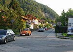
Located in the immediate vicinity of the Saalachauen . | Located between Grabenbachstrasse and Teisendorfer Strasse. |
|
|
| Baderstrasse (location) |
Michael Bader, * 1829, † 1898, hotel owner and building contractor from Munich, built the hotels Deutscher Kaiser , Goldener Löwe and Panorama as well as various houses and villas. | Dead end with connections to Tivoli- and Adolf-Schmid-Straße. |

|
|
| Bahnhofplatz (location) |
Forecourt of the main train station. |
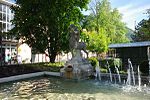 Centaur fountain in front of the train station, donated by Alfred Nathan |
||
| Bahnhofstrasse (location) |
Extension of Münchner Allee, continues on Kurstrasse to Liebigstrasse. At the Frühlingstrasse, the Bahnhofstrasse branches off into the Wittelsbacher Strasse, which continues to the Innsbrucker Strasse. | During the Nazi era (approx. 1938–1945) the upper Bahnhofstrasse was renamed Franz-von-Epp-Strasse (after Franz Ritter von Epp ). The area north of the spa garden between Frühlingstrasse and Kurstrasse is now a pedestrian zone. |

|
|
| Barbarossastraße (location) |
After the German Emperor Friedrich Barbarossa . | Connects Salzburger Strasse with Münchner Allee. |

|
|
| Beethovenstrasse (location) |
Named after the composer Ludwig van Beethoven . | Branches off from Adolf-Schmid-Straße, runs above Richard-Wagner-Straße and ends in a footpath into Kirchholz. | Parts of Beethovenstrasse are in the neighboring community of Bayerisch Gmain . However, access is only possible via Bad Reichenhall and Adolf-Schmid-Straße. |

|
| Berchtesgadener Strasse (location) |
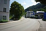
Arterial road towards Berchtesgaden . | Extension of Anton-Winkler-Straße from Kirchberg station in the direction of Berchtesgaden via Bayerisch Gmain . | The gas works was once located on Berchtesgadener Strasse . |
|
| Bergweg (location) |
Branches from Rosengasse and Heilingbrunnerstraße in the direction of Gmainer Höhe, ends in a footpath. | Since around 1930, previously Oberer Gartenweg or Lugerweg . |

|
|
| Birkenstrasse (location) |
Based on the birch genus | Connects Thumsee-, Pflegerpoint- and Ahornstraße. | The residential areas in this area are consistently designated as a 30 km / h zone . |

|
| Blumenweg (location) |
Dead end, branches off from the border road in a northerly direction. |

|
||
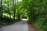
| Bruckthal (location) |
Field name | Branches from Langackerstraße in a northerly direction, continues as a forest road to List-Anger and Listsee . |
|
|
| Buchenhof (location) |
Named after the Buchenhof that is located there. | Shortly before the Schwarzbach border crossing, branch off from the B21 to Buchenhof, dead end. |

|
|
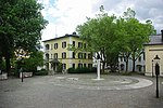
| Domprobst-Anton-von-Lechner-Platz (location) |
Dr. Anton von Lechner, born February 15, 1844 in Altenbach (municipality of Kumhausen near Landshut ), † January 7, 1914 in Munich , honorary citizen, pastor. | Square in front of the parish church of St. Nicholas . | This place was called Kirchplatz until around 1920 . The parish church of St. Nicholas was the largest church in the city at that time, as the parish of St. Zeno was not incorporated into the city until 1910. An unofficial, abbreviated spelling - especially on the street signs - is: Domprobst-von-Lechner-Platz . |
|
| Dr.-Carl-Schöppner-Strasse (location) |
Dr. C. Schöppner, born July 11, 1865 in Neustadt, † August 22, 1949 in Bad Reichenhall. Spa doctor and founder of the voluntary medical team, member of the voluntary fire brigade, board member of the Liedertafel, founded the Reichenhaller Schlaraffia and was very involved in the association of spa doctors and the society for internal medicine. Son-in-law of Ernst Mack, who in turn was the son of Mathias Mack . | Dead end, branches off from Franz-Josef-Straße in a westerly direction. | This street was already used during the lifetime of Dr. C. Schöppner named after him and was previously called Fallbacherstraße . |

|
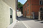
| Dreifaltigkeitsgasse (location) |
According to the Christian doctrine of the Trinity | Dead end, branches off from Untere Lindenplatz east of the old salt works in a southerly direction. From there, a footpath leads to Gruttenstein Castle . | In Dreifaltigkeitsgasse there are four listed two-story houses from the 17th and 18th centuries. |
|
| Dr.-Kühne-Strasse (location) |
Dr. Otto Kühne, * July 24, 1891, † November 7, 1954, senior physician at the Städt. Hospital . Contribution to the development of antibiotic therapy for chronic bronchitis. | Parallel street to Reichenbachstraße from Riedelstraße to Franz-Josef-Straße. | Until around 1950: plane path . |

|
| Edelweissstrasse (location) |
Named after the edelweiss . | Dead end, branches off from Mayerhofstrasse in a north-easterly direction. |

|
|
| Egerländer Weg (location) |
Connection from Rinckstraße to Hubertusstraße along Kirchholz. | Footpath was called Kellerweg until 1980 , Bühlerweg until 1950 and Unterer Gartenweg until around 1920 . |

|
|
| Erasmus-Grasser-Promenade (location) |
Named after the sculptor Erasmus Grasser , who fundamentally renovated and technically improved the city's saltworks at the beginning of the 16th century. | Located between Salzburger Strasse and Münchner Allee | Use for motor vehicles is not permitted. |

|
| Fagererweg (location) |
After the Fagererhof and an old field name (Fager / Vager). | Leads from the confluence of Sieben-Palfen-Weg in Schmalschlägerstraße to Zwieselstraße | The Fagererweg is unpaved. |

|
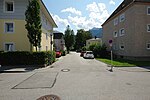
| Fallbacherstraße (location) |
Josef Fallbacher, * 1860 in Bad Reichenhall, † 1938 in Chicago. Benefactor and honorary citizen. | Dead end, branches off from Friedrich-von-Schenk-Straße to the southeast. | There were some saltworks here. Two preserved houses are under monument protection. |
|
| Fischerbräuwiese (location) |
After the former Fischerbräu brewery . | Dead end, residential area between Reichenbachstrasse and Sebastian-Stolz-Strasse. | Dead end. The meadows of the Fischerbräu , one of the city's many breweries, used to be located here. At last there was the inn with a hall, which was demolished at the end of the 1980s. |

|
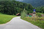
| Fischzuchtstrasse (location) |
There is a fish farm there . | Leads from Langackerstraße to Poschengrund. |
|
|
|
Florianiplatz (location) |
After St. Florian . The oldest part of Bad Reichenhall, which was spared from the great fire in 1834 . | Access from Oberer Lindenplatz or from Sebastianigasse. | Since there is or was no corresponding place of worship here, St. Florian as the namesake should still be plausible, as the Dingviertel around this square was spared several times from serious city fires. Today there is a cast-iron fountain from the end of the 19th century with the statue of Florian. Today the square is under ensemble protection , most of the houses and the fountain are under monument protection. The Florianiplatz is closed to motor vehicles. Also in the past: Floriani-Gasse . |
 more pictures |
| Forstamtstrasse (location) |
This road once led to the forestry office, which was located outside the city wall . | Dead end, branches off from Gabelsbergerstraße in a westerly direction, pedestrian connection to Spitalgasse. | The Forstamtstraße is located outside the medieval town fortifications of Bad Reichenhall, of which large parts are still preserved at this point. |

|
| Franz-Josef-Strasse (location) |
According to Emperor Franz Joseph I. His wife Elisabeth of Austria-Hungary visited the Berchtesgadener Land and Reichenhall often and with pleasure. | Connects Riedel- and Dr.-Kühne-Strasse. |

|
|
| Friedrich-Ebert-Allee (location) |
Named after Friedrich Ebert , first President of the Weimar Republic. | Connects the Weißstraße and the Goethestraße, leads past the Rupertuspark and continues as a pedestrian and cycle path to the Saalachau . | The southern part of this street was called from 1920 to the 1930s: Alfred-Nathan-Straße and before that from 1870 Gradierhausstraße . When the names of Jewish citizens were erased from street names when the National Socialists came to power, this street (named after the honorary citizen and benefactor of the city Alfred Nathan ) was renamed Friedrich-Ebert-Allee. After the end of the Second World War, however, the street name was retained, and only after a long hesitation was a street dedicated to Nathan again, today's Alfred-Nathan-Straße , which is located in the immediate vicinity of Friedrich-Ebert-Allee. The northern part was called Stauffenstrasse until 1938 . |

|
| Friedrich-von-Schenk-Strasse (location) |
Friedrich Freiherr von Schenk , born July 17, 1784, † December 12, 1866 in Munich. General administrator of the Bavarian saltworks 1844–1855, great service to the Bad Reichenhall saltworks. | Connects Kurfürstenstrasse with the Großer Grund, extension of Hofrat-Harl-Strasse. |

|
|
| Fritzerweg (location) |
Named after the Fritzer sawmill. | Connection road from Ludwig-Thoma-Straße to Loferer Straße | Partly only by foot. |

|
| Froschhamer Weg (location) |
Froschham, former district of St. Zeno , the name of the Froschham Guild eV , which is still active today, goes back to the district. | Starts on the forest path and ends on the footpath and bike path in the direction of Marzoll , crosses Mayerhofstraße. |

|
|
| Spring road (location) |
At the Kurgastzentrum branches off from Bahnhofstrasse / Wittelsbacherstrasse and, after the level crossing, runs in a north-easterly direction to Grabenbachstrasse. | Until around 1900: Green Lane . The Frühlingstrasse is one of the few streets in Bad Reichenhall that is so long that the house numbers have to be three-digit. The length of the street is about 2 km, making it one of the longest streets in the city. |

|
|
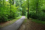
| Fuchsweg (location) |
The connecting path from the Nonner Au to the Nonner Unterland lies between the Nonner Stadium and the tennis courts. | Footpath in the Nonner Au. |
|
|
| Fürschlachtweg (location) |
From here the wood was distributed to the storage grounds of the salt works after the Trift . | Connection route from Reichenbachstraße to Friedrich-von-Schenk-Straße. | Footpath, only local traffic. |
 The Geisterhäusl , the only building on Fürschlachtweg |
| Gabelsbergerstrasse (location) |
After the German stenographer Franz Xaver Gabelsberger . | Connects Liebigstrasse and Forstamtstrasse. | One-way street, may only be used from the direction of Liebigstraße. |

|
| Ganghoferstraße (location) |
After the German writer Ludwig Ganghofer . | Connects Schiller- and Ludwig-Thoma-Straße. |

|
|
| Gangway (location) |
From Staufenstrasse through Weitwiese (behind the barracks) to Staatsstrasse 2101 and on to Nonner Strasse. | From 1965, previously on Weitwiesenweg . Not approved for motor vehicles - with the exception of agricultural vehicles. |

|
|
| Garneiweg (location) |
Old field name | Starts at the last residential buildings on Thumsee and leads to Sieben-Palfen-Weg and ends near Langackerstraße in Zwieselstraße. | Footpath / forest road |

|
| Gartenweg (location) |
Connects the Adolf-Bühler-Weg via the Dr.-Ortenau-Park with the Bahnhofstrasse. | Footpath / residential street, in the area of the Ortenau park only for pedestrians. |

|
|
| Gauglgasse (location) |
Old farm name | Connects the Grenzlandstraße with the Reichenhaller Straße (at the junction with the B21). |

|
|
| Gebersbergstrasse (location) |
Named after the Gebersberg . | Leads from Staufenstrasse to St.-Pankraz-Strasse. |

|
|
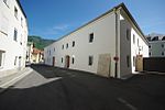
| Getreidegasse (location) |
After the former grain store , today the town's local museum . | Located between Poststrasse and Angerl. |
|
|
| Trades Street (location) |
The wealthy Reichenhaller boilers who were responsible for salt processing and trading until 1500 were once called trades . And today's Ludwigstrasse was also known as the Trades Gasse until the beginning of the 20th century . The name of the trade street in the industrial area of Reichenhall does not go back to this old name, but takes up the term of the medieval trades , which describes traders in general. | After the Loferer Straße overpass, branches off from Frühlingstraße, runs parallel to Saalachdammweg and joins Frühlingstraße again. |

|
|
| Glasergasse (location) |
Dead end, connects Am Ulmenhain with Salzburger Straße. |

|
||
| Luck in the corner (location) |
After the name of the settlement complex Glück im Winkel | Access from Florianiplatz via Peter-und-Paul-Gasse. | First workers' settlement after 1919 in Bad Reichenhall, co-founder was Sebastian Stolz . |

|
| Gmainer Strasse (location) |
According to the neighboring municipality of Bayerisch Gmain | Dead end. Branches off Berchtesgadener Straße and ends at Streitbichlhof. | Paved residential street for the residents of Gruttenstein Castle and the Streitbichlhof, otherwise closed to motor vehicles. Partly runs below the city wall between the still-preserved Powder Tower and Gruttenstein Castle. Also: Gmainer Weg . The Adolf-Schmid-Strasse was called to about 1,920 street Gmainer . |

|
| Goethestrasse (location) |
Named after the German poet and naturalist Johann Wolfgang von Goethe . | Connecting road between Reichenbachstrasse and Friedrich-Ebert-Allee. | The western part was called Hohenzollernstrasse before 1945 , after the Hohenzollern house , the eastern part was called Söllnerweg (after the former mayor Fritz Söllner). |

|
| Grabenbachstrasse (location) |
After the Grabenbach , an artificially created canal at the beginning of the 16th century, which for the most part drains the fresh water from the saline to the Saalach underground . | Connects the lower Frühlingstrasse with the Teisendorfer Strasse. | The Grabenbach comes to the surface directly at the northern traffic distribution point and then runs on the other side of the Freilassing – Berchtesgaden railway parallel to Frühlingstrasse and Grabenbachstrasse. |

|
| Grenzlandstrasse (location) |
The Marzoll district largely borders on Austria | Leads from Kreisstraße 4 to Marzoll. |

|
|
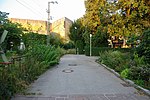
| Grundnerweg (location) |
Michael Grundner, born April 18, 1848 in Reichenhall, † January 12, 1923 there. 1875 founder of the first banking business and later of a housing agency for spa guests in Bad Reichenhall. | Walk from Friedrich-Ebert-Allee to Frühlingstrasse, along the railway. |
|
|
| Gruttensteingasse (location) |
After Gruttenstein Castle . | Access from Oberer Lindenplatz and Florianiplatz. | Located in the immediate vicinity of Florianiplatz, Gruttensteingasse was also often spared from city fires, which is why mostly old buildings have survived here. The oldest house is from the 16th or 17th century. Traffic-calmed area . |

|
| Häuslstrasse (location) |
Johann Häusl, born August 22, 1855 in Piding, † August 24, 1930 in Bad Reichenhall. He was the last mayor of St. Zeno and later the second mayor of Bad Reichenhall. | Loferer Strasse connecting street to Frühlingstrasse and Münchner Allee. | Also: Johann-Häusl-Straße . |

|
| Haidergasse (location) |
Branches off to the north of Untersbergstrasse |

|
||
| Hainbuchenplatz (location) |
Based on the hornbeam plant genus | Located between the Von-Martius-Straße / Nonner Straße intersection and the beginning of the Nonner Oberland, runs parallel to Nonner Straße. |

|
|
| Hainbuchenstrasse (location) |
Based on the hornbeam plant genus | Dead end, branches off from Von-Martius-Straße in a north-westerly direction. |

|
|
| Hallgrafenstrasse (location) |
The Hallgraves from the old Bavarian noble family of Plainer and Peilsteiner were ordered by the emperors around 900 to 1240 to protect the Reichenhall salt works. They also exercised the jurisdiction. | Dead end, branches off the Reichenbachstraße in southwest. Direction off. | The slaughterhouse of Bad Reichenhall used to be located there, far outside the city. Today, in addition to many residential buildings, the town is also located there. Bauhof and Stadtwerke. |

|
| Hammerschmiedweg (location) |
After the hammer mill of the salt works, which was, however, much further south-east. | Dead end, extension of Traunfeldstrasse, leads from Loferer Strasse to Saalachau. | The Städt is located on Hammerschmiedweg. Spa nursery and a parking space for mobile homes. |

|
| Heilingbrunnerstrasse (location) |
Gottfried Heilingbrunner, * 1850, † December 21, 1908 in Bad Reichenhall. Head teacher, co-founder and head of the advanced training school (vocational school) 1871–1907. 25 years choirmaster of the Liedertafel. The boys' school (now elementary school) also bears his name | Extension of the Rosengasse to Wisbacherstraße. | The southern part of Heilingbrunnerstraße was formerly called Katzenwinkel , the northern part of Leitgartenweg . Today the school named after Gottfried Heilingbrunner is located in this street. Traffic-calmed area, entrance only from the direction of Rosengasse, for bicycles also from the direction of Max-Zugschwerdt-Straße. |

|
| Heimfeld (location) |
Dead end, branching off from Untersbergstrasse. |

|
||
| Herzog-Georgen-Strasse (location) |
Duke Georg the Rich bought all salt boilers in Bad Reichenhall from 1494–1501. | Connects the Kammerbote- with the upper Salinenstraße |

|
|
| Hessingsteig (location) |
Friedrich Ritter von Hessing , born June 15, 1838, † March 15, 1918, royal councilor, famous orthopedist. Extensive estates built in Bad Reichenhall (e.g. on Friedrichshöhe and Schönen Aussicht , today a fire station ), including a railroad to Königshöhe (now a painter's house ), honorary citizen of the city. | Footpath, connects Adolf-Schmid-Straße with Richard-Wagner-Straße. |

|
|
| Heubergstrasse (location) |
After the Fuderheuberg | Dead end, branching off from the border road. |

|
|
| Hirschmühlenweg (location) |
Named after the former mill on the former Kirchberger Mühlbach. | Dead end from Kiblinger Strasse to Haus am Fels , now Club Angelina . | The Hirsch Mill and the Sepperl Mill were the first mills that were fed by the former Kirchberger Mühlbach. Other were the watch mill and the hot mill. The building of the Hirschmühle has stood the test of time, an inscription on the building still reminds of its original function. |

|
| Hochfeldstrasse (location) |
Branches off the border road in an arched direction. |

|
||
| Hofrat-Harl-Strasse (location) |
Dr. Caspar Harl, born May 3, 1856 in Bad Reichenhall, † July 12, 1927. From 1885 hospital doctor. Honorary citizen of the city. | Connects Kurfürstenstrasse with Maximilianstrasse, extension of Friedrich-von-Schenk-Strasse. | Traffic-free area |

|
| Holzfeldweg (location) |
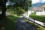
The name goes back to the wood drift used to supply fuel to the salt works. | Connects the Leitererweg with Innsbrucker Straße. | Before 1970 the Holzfeldweg still belonged to the Hammergrund , footpath. |
|
| Hubertusstraße (location) |
After Saint Hubertus , patron saint of hunters | Branches off Salzburger Strasse at the St. Zeno Minster and leads as a cul-de-sac to Kirchholz. | The former forestry office building of St. Zeno is located in the parallel Klosterstraße. |

|
| Im Angerl (location) |
After the Angerltor which was here on the anger of the medieval city. | Access via Wörgötterplatz, Getreidegasse or from Innsbrucker Straße. | Under the protection of the city wall , there was a slightly inclined agricultural area ( Mhd. Anger ), which ensured the city's supply in the event of a siege, at least for a short time. The gate located at this point in the city wall was also called Angertürl or Angerltor . But it was also called Salzmaiertor because the Salzmeier (for centuries the most important official of the city) entered the city through this gate. Other common but unofficial names of the street: Angerl , Am Angerl . |

|
| In the big reason (location) |
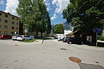
Former drift space of Saline. | Residential area south of Pechmannstrasse. |
|
|
| Im Hammergrund (location) |
Former place of the Saline. | One-way street, branches off from Friedrich-von-Schenk-Straße in a southerly direction and leads back to it in an arch. |

|
|
| Im Poschengrund (location) |
Old field name | Following the Fuschzuchtstraße leads to Poschenmühle. |

|
|
| In Spitzgrund (location) |
Former place of the Saline. | Residential area north of Pechmannstrasse. | Traffic-free area |

|
| Innsbrucker Strasse (location) |
After the Tyrolean capital Innsbruck | Runs parallel to the railway line, direct extension of Wittelsbacherstraße from Liebigstraße and Anton-Winkler-Straße from Stachus (road junction B20). | A large part of Innsbrucker Strasse was not built until 1910, when the city's mill streams were filled with the excavated material from the underwater canal of the Saalach power station . Until 1950 it was divided from north to south into: Innsbrucker Straße , Kanalstraße , Rupertistraße , and until 1910 in Innsbrucker Straße , Lindenstraße , Triftbachstraße , Hammerschmiedstraße . For a long time, the workshops and administration of the Reichenhaller Stadtwerke ( Lichtwerk ) were located on Innsbrucker Straße, as well as the E-Werk II at the beginning of the 20th century . |

|
| Jahngasse (location) |
After Friedrich Ludwig Jahn , known as gymnastics father Jahn . | Connection path from Poststrasse to Aegidiplatz. | Only for pedestrians |

|
| Jochbergweg (location) |
After the Jochberg, which is a western extension of the Zwiesel . | Extension of Bruckthalstrasse . | Forest road |

|
| Kaiserplatz (location) |
After the German Emperor Wilhelm I. | Between Ludwigstrasse and Bahnhofstrasse. | Until 1910: Poststrasse , the Deutscher Kaiser building complex is located there. |

|
| Kammerbotenstrasse (location) |
Once accommodation for the Duke of Bavaria's messengers to the Saline ( Kammerbotenviertel ). | Connects the Salinenstrasse with the Innsbrucker Strasse. | The chamber messenger district had its own gate, through which almost exclusively the duke's messengers entered the city: the chamber messenger gate . Outside the city, where the Stachus is today (traffic junction, unofficial name after the square of the same name in Munich) and directly in front of the Kammerbotentor and today's Kammerbotenstrasse was the Lindenbühel . On its hill was the village linden tree, under which one met in the Middle Ages for regular legal advice and jurisprudence. The square was also used as a place of execution, where the arsonist Christine, who caused the great city fire of 1515, was publicly executed by burning. Based on the linden tree, the street north was also called Lindenstrasse for a long time . In 1934, however, the linden tree was felled, the hill removed and the square became an important traffic junction. During the air raid on the city on April 25, 1945, the messenger district was almost completely destroyed and rebuilt after the war. |

|
| Kanalstrasse (location) |
Part of the former Weißgerberbach, which was canalised here and formed the moat in front of the city wall . | Connects the former exits of the medieval city fortifications at Angerl and Wörgötterplatz. | Many well-preserved parts of the city wall can be found along the Kanalstrasse between Wörgötterplatz and Angerl. |

|
| Karl-Weiß-Strasse (location) |
Karl Weiß, born April 26, 1885 in Zwiesel , † August 25, 1966 in Bad Reichenhall. Legally qualified 1st Mayor of Bad Reichenhall from December 1, 1926 to March 1, 1946. Honorary citizen and holder of the Cross of Merit 1st Class of the Order of Merit of the Federal Republic of Germany. | Cross street from Hallgrafenstraße to Sebastian-Stolz-Straße. |

|
|
| Kellerweg (location) |
Connects Adolf-Schmid-Straße and Rinckstraße. | Partly closed to motor vehicles. |

|
|
| Keltenring (location) |
Named after the ethnic group of the Celts . | Branches off the border road in a northerly direction and leads back to it in an arch. | The Celts maintained extensive settlements in and around Bad Reichenhall, this is historically proven by relevant archaeological finds. In the immediate vicinity of the Keltenring, on the northeast corner of Olympiaring / Grenzlandstrasse, there is a Bronze Age settlement, which is entered in the list of monuments as a ground monument with the number D-1-8243-0081. |

|
| Kiblinger Strasse (location) |
After the whey Bauer Kibling named | Branches from the Luitpoldbrücke on the west bank of the Saalach south, leads to the valley station of the Predigtstuhlbahn and to the Schroffen . | The eponymous whey farmer was founded at the beginning of the 20th century, when the Saalach was dammed in its valley between Kibling and Baumgarten to provide energy for the newly built Saalach power plant . In addition to the dam wall and the inlet structure of the Saalach power plant, there are only a few residential buildings and two former restaurants in Kibling. The street ends as a dead end at the former Gasthaus Kibling , which, like all other buildings, including the barrier and inlet structure, is located in the neighboring community of Schneizlreuth . |

|
| Kirchberger Ring (location) |
After the Kirchberg district . | Ringstrasse, branches off from Rosenstrasse and leads back to it. |

|
|
| Kirchengasse (location) |
Alley behind the parish church of St. Nicholas . | Dead end, branches off from Tiroler Straße in a north-westerly direction. | formerly: Kirchengäßl |

|
| Kirchholzstrasse (location) |
Old field name ( Kirchholz ). | Dead end, southeast side street of Salzburger Strasse below the St. Zeno cemetery. |

|
|
| Klingerweg (location) |
Once the fields of the Klingerbauer. | Branches from Münchner Allee in a southerly direction. |

|
|
| Klosterstrasse (location) |
Named after the local monastery of St. Zeno . | Leads from the monastery of St. Zeno to the church wood. Dead end street ends in a footpath to the church wood. | There are numerous listed buildings on Klosterstraße, all of which belong to the monastery: the St. Zeno Minster, the largest Romanesque basilica in Upper Bavaria, as well as the monastery and residential buildings and the provost floor. The Maria Ward Realschule Reichenhall is also housed in the buildings. |

|
| Königsweg (location) |
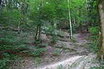
Presumably named after King Maximilian II of Bavaria . | From the forest path to Hubertusstraße along the Kirchholz. | Footpath |
|
| Kohlerbachstrasse (location) |
After the Kohlerbach | Connects the Untersbergstrasse with the Grenzlandstrasse. |

|
|
| Kugelbachweg (location) |
After the farm located there, the Kugelbach farmers. | From Thumseestrasse at Brunnhaus Fager to Kugelbachbauer and on to Paul-Gruber-Haus. | Kugelbachweg is only a public road for the first 250 m. From the hiking car park, the path is marked as a forest road. The streets to Kugelbachbauer and Paul-Gruber-Haus are closed to public traffic. The Amalienruhe and the Kugelbachalm are under monument protection. The Kugelbachbauer is still entertained, the Paul-Gruber-Haus of Naturfreunde Reichenhall can be rented for overnight stays on request. |

|
| Kurfürstenstrasse (location) |
Under Carl Theodor von Bayern , generous facilities for the promotion and evacuation of the brine were created in Reichenhall. The extensive drift systems were also built under his government . The high-percentage brine spring, which rises at the foot of the Gruttenstein rock, was named in his honor ( Carl Theodor salt spring ). | Connection road, begins between Innsbrucker and Wittelsbacherstraße as an extension of Liebigstraße, crosses under the railway line and leads to Loferer Straße ( B20 / B21 ). | Was called Nonner Weg until around 1910 . |

|
| Kurstrasse (location) |
Connects the Salzburger Strasse with the Bahnhofstrasse at the Kurgarten and the Staatl. Kurhaus. Mostly part of the pedestrian zone, open to cyclists. | Kurstrasse was renamed Adolf-Hitler-Strasse during the Nazi era . Today it forms part of the pedestrian zone. The old state spa house, the spa park with graduation house and foyer and a Protestant church are located on Kurstrasse . The church - like the Kurhaus and the spa garden with graduation tower and foyer - is a listed building. |

|
|
| Langackerstraße (location) |
Hallway and courtyard name | Extension of Bruckthal to the fish farm . | In Langackertal was during the La Tene period a Celtic cultural center. |

|
| Lange Gasse (location) |
From the confluence of Staufenstrasse with Fischzuchtstrasse behind the barracks along to Staatsstrasse 2101. |

|
||
| Langenfeldstrasse (location) |
Dead end, branches off from Reichenhaller Strasse (municipality of Bayerisch Gmain ) in southwest. Direction off. | Can be reached on foot via Adolf-Schmid-Straße, for vehicles only via Bayerisch Gmain. |

|
|
| Ladder path (location) |
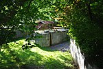
Ladder was an old term for carters who brought the wood needed for the pans of the brewhouses in the salt works with horse and cart. | Walk from Friedrich-von-Schenk-Strasse to Reichenbachstrasse. | In the area of the ladder path there are embankment walls made of marble ashlar from the city's former trift systems as well as barriers and bridges. |
|
| Liebigstrasse (location) |
After the German doctor Georg von Liebig , who helped organize the spa in Bad Reichenhall and is considered the founder of bathing culture. | Connects Innsbrucker Straße and Kaiserplatz. | In Liebigstrasse there are two listed objects, a villa and a house from the heyday of the spa in Bad Reichenhall at the end of the 19th century. |

|
| Lilienstraße (location) |
Named after the plant genus of the lily | Extension of Birkenstraße, branches off into Thumsee- and Rosenstraße. | The residential areas in this area are consistently designated as a 30 km / h zone . |

|
| Lindenweg (location) |
After the genus of linden trees | Ringstrasse, side street of Ahornstrasse. | The residential areas in this area are consistently designated as a 30 km / h zone . |

|
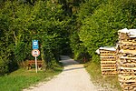
| Listseestrasse (location) |
Named after the Listsee . | Extension of the road to the Nonner Oberland between Listwirt and Listsee. | Forest road |
|
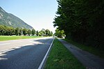
| Loferer Strasse (location) |
Bundesstrasse 20 and 21 in the direction of Lofer . | Part of the B20 / B21 between Saalachsee and Verkehrsverteiler Nord, bypassing the city of Bad Reichenhall in the Saalach bend to accommodate long-distance traffic. | Expanded into a bypass road since around 1970, previously Ramsauer Strasse , Kassierfeldweg , Hessweg , Dammweg (from south to north). |
|
| Ludwigstrasse (location) |
Named after I. King Ludwig . | Connects to Salinenstraße in a northerly direction, connection to Salzburger Straße. | Up until the 20th century, Ludwigstrasse was called Arbeiterengasse (not to be confused with today's Handwerkenstrasse ). The name comes from the Reichenhaller Siedeherren ( trades ) who lived here until around 1500. The mighty patrician farms had their palaces directly on what was then the main thoroughfare of the city. It is unusual that this name lasted until after 1900 even after the boilers disappeared around 1500. Until the construction of the bypass road ( Loferer Straße , B20 / 21) and Münchner Allee in the 1960s, Ludwigstraße was the city's main traffic axis, but was soon converted into a pedestrian zone. Today there are still several old spa guest houses as well as residential and commercial buildings such as the Reber company café , which are listed buildings. |

|
| Ludwig-Thoma-Strasse (location) |
After the writer Ludwig Thoma . | Runs parallel to Loferer Straße (B20 / 21), connects Traunfeldstraße with Vogelthennstraße. |

|
|
| Luitpoldstrasse (location) |
After the Prince Regent Luitpold of Bavaria . | Connection between Bahnhofstrasse and Goethestrasse. | Until around 1910: Äußere Kurstraße . Many old villas and guest houses from the heyday of the cure in Bad Reichenhall at the end of the 19th century have been preserved in Luitpoldstrasse. Most of these buildings are now listed. |

|
| Mackstrasse (location) |
After Mathias Mack , born November 13, 1811 in Kelheim , † November 19, 1882 in Bad Reichenhall, pharmacist and mayor 1845–1855. Inventor of mountain pine oil and builder of the Dianabad spa house . Pioneer of the spa. The Mack family continued to run the pharmacy and expanded the production of mountain pine oil. | Connects the northern exit of the spa garden with Rinckstrasse and Mozartstrasse, dead end. | In the Mackstraße there are still listed spa guest houses from around 1900. |

|
| Märzfeld (location) |
Dead end, branching off from Untersbergstrasse in an easterly direction. |

|
||
| Marzoller Weg (location) |
Named after the Reichenhall district of Marzoll | Branches off from Salzburger Straße and connects it with Mayerhofweg. |

|
|
| Maximilianstrasse (location) |
After King Maximilian II of Bavaria . He stayed in Reichenhall for a cure in 1848 and in later years, thus making the still young spa business known in the city. | Connecting road between Wittelsbacher- and Goethestrasse. | There are several mansions that are under monument protection in Maximilianstrasse. |

|
| Max-Zugschwerdt-Strasse (location) |
Max Zugschwerdt, born January 12, 1807 in Ottobeuren, † October 28, 1859 in Bad Reichenhall. Founder of the Reichenhaller Zeitung (from January 2nd, 1841 first edition of the weekly newspaper for the Royal District Court of Reichenhall , from 1850 Grenzbote ) | Connecting road between Kaiserplatz, Ludwigstrasse and Heilingbrunnerstrasse. | Since around 1960, before: Dianastraße . The Dianapassage residential and business complex has been located on the corner of Ludwig- and Max-Zugschwerdt-Straße since the 1980s . |

|
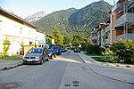
| Mayerhofstrasse (location) |
Old house name, which today also describes the whole area. | Eastern side street of the lower Salzburger Strasse. | The Mayerhof Inn was located in the street for a long time , but it has since been demolished. |
|
| Moosbachstrasse (location) |
Connects Rainthalstraße with Kohlerbachstraße. |

|
||
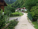
| Moserweg (location) |
Hallway and house name | Dead-end street, leads from Staatsstrasse 2101 (Thumseestrasse) to Schmalschlägerstrasse and ends at the school yard of the Karlstein primary school. Mostly not tarred. | The Moserwirt inn is now a listed building, but has not been served for several years. Above the Moserweg, on the Haiderburgstein , there were parts of the prehistoric settlement areas of Karlstein , the coins minted here in the Urnfield period are known today as the "small silver Karlsteiner Art". |
|
| Mozartstrasse (location) |
After Wolfgang Amadeus Mozart , who stopped in Bad Reichenhall several times. Both he and his father mentioned the city in writing. | Connecting road between Bahnhofplatz and Salzburger Straße. | Since around 1920, before: Bahnhofzufuhr-Straße . |

|
| Mühlenstrasse (location) |
After the nearby Obermühle . | Dead end, branching off from Tumpenstrasse. |

|
|
| Müllnerhorngasse (location) |
Named after the summit of the Müllnerberg . | Side street of Thumseestrasse in a southern direction. |

|
|
| Münchner Allee (location) |
Named after the Bavarian capital, Munich | Extension of Bahnhofstrasse from Bahnhofplatz to the B21 at the north junction. | Münchner Allee, along with Bahnhofstrasse, Wittelsbacherstrasse, Innsbrucker Strasse, Anton-Winkler-Strasse and Berchtesgadener Strasse, forms the main traffic axis through the city of Salzburg in the direction of Berchtesgaden . Before the construction of the bypass road (B20 / 21) and the rededication of Ludwigstrasse into a pedestrian zone, most of the traffic flowed via Salzburger Strasse, Ludwigstrasse, Salinenstrasse and Tiroler Strasse. In the course of the new building, many apartment blocks were built along Münchner Allee and the ice skating and swimming pool were built. |

|
| Nelkenstrasse (location) |
According to the genus of carnations | Connects the eastern endpoints of Lilienstrasse and Rosenstrasse. | Residential area, Tempo 30 zone |

|
| Nesselgraben (location) |
Dead end, branches off to the west of the Thumsess in a southerly direction from Thumseestrasse | The on-site shooting range of the Hochstaufen barracks is located here . In earlier times, the brine was pumped from the salt works in Reichenhall via the Antoniberg to the salt works in Traunstein with two well houses . ( Brine pipeline Bad Reichenhall - Traunstein). |

|
|
| Nikolaiweg (location) |
After the parish church of St. Nicholas there . | Runs parallel to Innsbrucker Straße from Kammerbotenstraße to the parish church of St. Nikolaus . | Mostly runs along a preserved part of the medieval town fortifications of Bad Reichenhall. |

|
| Nonn (location) |
Nonn , a former district of Karlstein. | The district has no street names, the houses are numbered consecutively. A distinction is made between the Nonner Unterland (eastern part) and the Nonner Oberland (western, higher part). |

|
|
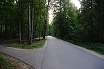
| Nonner Au (location) |
Named after the district of Nonn | Alluvial forest north of the Saalach at Nonner Steg with a sports stadium and tennis facility. |
|
|
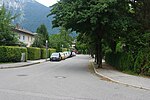
| Nonner Strasse (location) |
Named after the district of Nonn | Runs from Thumseestrasse near the old people's home to the northern end of the Hochstaufen barracks | This street was initially called Trautenweg . After the barracks were built in the 1930s, the path was renamed Col di Lana Street (after the Col di Lana and in memory of the battles of mountain troops in the Alps in the First World War). After the end of World War II, this type of hero worship was removed from the street name and renamed Nonner Straße. The southern part from today's old people's home to the height of the Crete Bridge was formed by the Kirchberger Mühlbach until the beginning of the 20th century . Here Konrad Fischer operated the first AC power plant in Germany and the first electric power plant in Bavaria, the Elektricitäts-Werke Reichenhall . After the construction of the Saalach power plant from 1910, there was no water for the Mühlbach, the course of the stream was filled with the excavation of the underwater canal of the power plant and as a result, today's Nonner Straße was created there. |
|
| Oberer Lindenplatz (location) |
After the genus of linden trees | In the upper town, at the southwest exit of the old salt works . |

|
|
| Olympiaring (location) |
Named on the occasion of the 1972 Summer Olympics in Munich. | Leads in a semicircle from Kreisstraße 4 to Grenzlandstraße. |

|
|
| Ottilienstraße (location) |
Ottilie Trätzl, * 1838 in Frontenhausen , † October 19, 1912 in Bad Reichenhall. She promoted artistic and economic endeavors and is considered to be a great benefactress of the city. She donated the street lighting in St. Zeno and donated large sums for the local song wreath and the fire department. She also donated large sums to the poor house building fund, for poor relief and for apprentice protection. The city received 34,000 marks from the sale of Villa Kreszenzia after her death. | Connects Salzburger Strasse with Mackstrasse. | The listed Villa Mozart from around 1900 is located on Ottilienstraße . |

|
| Paepkestrasse (location) |
Gustav Paepke, born June 7, 1853 in Crivitz near Mecklenburg, † August 23, 1933 in Bad Reichenhall. Director of the spa chapel. He composed numerous works, including the March Hoch Reichenhall and the waltz Reichenhall Memories . In 1903 he received the gold medal for art and science. | Runs east of Luitpoldpark from Grundnerweg to the health care facility on Alfred-Nathan-Straße. | On the east side of the street opposite the Luitpoldpark, Paepkestrasse is lined with exclusively neo-baroque villas by Jakob Dürk from the 1920s, all of which are listed. |

|
| Panoramaweg (location) |
Connects the Egerländer Weg with the Königsweg. | Footpath in Kirchholz . |

|
|
| Pechmannstrasse (location) |
After Wilhelm Freiherr von Pechmann, co-founder (with Ernst Rinck, his brother-in-law) of the Axelmannstein brine bath | Connects the Kurfürstenstrasse with the Reichenbachstrasse, extension of the Weißstrasse. |

|
|
| Peilsteinstrasse (location) |
Named after the noble family of Peilsteiners , who were the Hallgraves in Reichenhall and who built Karlstein Castle. | Dead end, connects Nonner Strasse with Schoedtlweg. |

|
|
| Pestalozziweg (location) |
Connects the Schroff with the Thumseestrasse at the Saalach power station . | Footpath |

|
|
| Peter-und-Paul-Gasse (location) |
There were two small churches here outside the city wall, consecrated to St. Peter and St. Paul and which stood there until shortly after 1800. However, they fell victim to the work of destruction of secularization . | Dead end, from Florianiplatz luckily in the corner and to the former gasworks. | This is also where the Peter and Paul Thörl was located in the city wall. The tower of the medieval city fortifications there also bears this name and still exists today. |

|
| Pfannhauserweg (location) |
Named after the working group at the salt works ( those who work on the salt pans ). | Access from Gruttensteingasse and Dreifaltigkeitsgasse via stairs at the old salt works . | The Pfannhauserweg was called Gruttensteinweg until 1950 and then Schloßweg until 1970 . However, in the 20th century this old working group of the saline was reconsidered and the name was changed. The fire watchtower of the old salt works and Gruttenstein Castle are located on Pfannhauserweg, both objects are under monument protection. |

|
| Pflegerpointstrasse (location) |
Field name in the meadow. | Runs from Birkenstrasse via Amerangstrasse to Reifenstuelstrasse. | In contrast to the sunny southern slopes of Nonn and Karlstein , the area around Pflegerpointstrasse is partly in the shadow of the mountains all day in the winter months due to its proximity to the slopes of the Müllnerberg . Locals call this area derogatory, based on a direct seller of frozen products, bofrost-Viertel . |

|
| Postgasse (location) |
After the former Hotel Post. | Runs from Poststrasse at the main customs office to the so-called official staff. |

|
|
|
Poststrasse (location) |
In the upper part of Poststrasse were the stables for the post horses from Thurn und Taxis . | Runs from Kammerbotenstrasse via Rathausplatz to Kaiserplatz. | Initially only the upper part was called Poststraße and until the end of the 18th century it was called Kammerbothen Gasse . The middle part in the area of the Aegidikirche was formerly called Markt-Platz and was once the economic center of the city. The daily market took place here, where well-traveled traders offered their goods for sale. The lower part of today's Poststrasse was simply called Weite Gasse . Poststrasse has been a pedestrian zone with a city stream and fountain since 1992. The area between the Spitalkirche and Rathausplatz is now under ensemble protection . |
 more pictures |
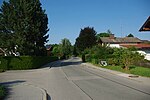
| Rainthalstraße (location) |
Field name | Runs from Untersbergstrasse in a north-easterly direction to Reichenhaller Strasse. | The heated municipal outdoor pool in Schwarzbach / Marzoll is located on Rainthalstraße. |
|
|
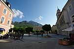
Rathausplatz (location) |
Only after the great fire of 1834 did the town hall square become a central square in the course of the rebuilding of the city. The old town hall was built around 1850 on the site of the old Boblmetzgerhaus , and the Arnschinkhaus , which housed the shops and stalls for the daily market, was still located on the square of the new town hall at that time . In 1905 the Wittelsbacherbrunnen was built and the market square was renamed Wittelsbacherplatz (after the house of the Wittelsbachers ). During the Nazi era, the town hall square was called the Platz der SA . Today the Rathausplatz is under ensemble protection and has been a pedestrian zone since 1992. |
 more pictures |
||
| Rauchbichl (location) |
Farm name | Dead end, branches off from Schmalschlägerstrasse north of Staufenstrasse. |

|
|
| Rehwinkel (location) |
According to the type of deer | Dead end, branches off from Schmalschlägerstraße in an easterly direction. |

|
|
| Reichenbachstrasse (location) |
After Georg Friedrich von Reichenbach , inventor of the water column machine. Built the brine pipeline to Rosenheim in 1809 and the brine pipeline from Berchtesgaden to Bad Reichenhall in 1817. And after Karl Reichenbach (* in Mannheim, † 1868 in Reichenhall), relative of Georg von Reichenbach. As master of the salt works, he received the order from King Ludwig I to build the new main well and the four new brewhouses of the salt works after the fire in 1834 . | As an extension of Kammerbotenstraße, leads through the railway underpass past the Neue Saline and the tennis courts to Loferer Straße. | The Bad Reichenhall saltworks have been located in Reichenbachstraße since the 1920s, and with more modern technology it gradually replaced salt production from brine in the old saltworks . For a long time the Fischerbräu , the brewery inn of one of the city's many breweries, was also on the street . After the inn with the large hall was demolished in the 1980s, only the street with the name Fischerbräuwiese reminds of it . In the further course, Reichenbachstrasse is lined with many residential buildings, most of which were built by the city as social housing. Across from the confluence with Riedelstraße, the Bad Reichenhall volunteer fire brigade has been housed since the 1970s; shortly before the confluence with Loferer Straße ( B20 / B21 ), a new building for the Bad Reichenhall mountain rescue service was built in the 2010s. The old Salinenstadl, which is located opposite the parking lot of the Neue Saline, was dismantled before a discount market was set up, rebuilt in the Salzburg open-air museum in neighboring Großgmain and can be viewed there. |

|
| Reichenhaller Strasse (location) |
From Teisendorfer Straße to the Schwarzbach border (also B 21 ). | One of the few streets in Bad Reichenhall with three-digit house numbers. At well over 4 km, it is the longest street in the entire city. |

|
|
| Reifenstuelstraße (location) |
After Hans and Simon Reiffenstuel, builders of the brine pipeline from Bad Reichenhall to Traunstein . | Parallel street to Pflegerpointstraße; branches off from the Alte Thumseestrasse shortly after Amerangstrasse and leads back to the Alte Thumseestrasse via the confluence of the Pflegerpointstrasse . Partly residential street. | In contrast to the sunny south-facing slopes of Nonn and Karlstein , the area around Reifenstuelstraße, due to its proximity to the slopes of the Müllnerberg , is partially shaded by the mountains all day in the winter months. Locals call this area derogatory, based on a direct seller of frozen products, bofrost-Viertel . |

|
| Richard-Wagner-Strasse (location) |
Named after the composer Richard Wagner . | Dead end, cross street of Adolf-Schmid-Straße. |

|
|
| Riedelstrasse (location) |
According to Emil von Riedel , Bavarian finance minister and honorary citizen of the city, he contributed to the construction of the Kurhaus and the new graduation tower through endorsement and approval. | Leads from Luitpoldstrasse via Kurfürstenstrasse to Städt. Hospital and on to Reichenbachstrasse. | Until 1933 the street was called Alfred-Nathan- Straße . The city. The hospital and some listed buildings are located on Riedelstrasse. |

|
| Rinckstrasse (location) |
Ernst Rinck, * December 15, 1801 in Hinterhermsdorf, † July 15, 1877 in Reichenhall, former Royal Saxon customs union inspector. Inherited the Axelmannstein and built a brine bath and a whey spa there. Was involved in the creation of the Dianabath with inhalation and pneumatic chamber together with Dr. Mack and Dr. Georg von Liebig. Ernst Rinck is therefore considered to be the co-founder of the spa, he is an honorary citizen of the city. | Runs from Bahnhofstrasse via Mackstrasse and Salzburger Strasse to Kirchholz . | The Rinckstraße is part of the Kurviertel ensemble , there are among other things three villas from the end of the 19th century, which were separately listed as historical monuments. |

|
| Römerstrasse (location) |
After the Roman villa that was excavated there. | Continuation of the Grenzlandstraße, leads to Untersbergstraße. | The name of the district of Marzoll goes back to an old Roman place name. |

|
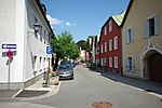
| Rosengasse (location) |
Named after the rose cultivars there. | Connects Untere Lindenplatz with Heilingbrunnerstraße. | The Rosengasse leads past the southern entrance to the garden of the Café Reber, at the western entrance of the street there is a residential building that is a listed building. |
|
| Rosenstrasse (location) |
According to the plant genus of roses | Leads from Nonner Straße to Lilienstraße, Kirchberger Ring and Nelkenstraße. | Residential area, continuous Tempo 30 zone |

|
| Rupertiweg (location) |
According to St. Rupert of Salzburg . | Dead end, branches off from Barbarossastraße in a southerly direction. |

|
|
| Saalachweg (location) |
After the Saalach | Walk east of the Luitpold Bridge to Südtiroler Platz . |

|
|
| Saalachstrasse (location) |
Named after the Saalach | Extension of Frühlingstrasse to Teisendorfer Strasse. |

|
|
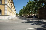
| Salinenstrasse (location) |
Named after the location of the brine springs and the city's saltworks | Ludwigstrasse / Tiroler Strasse street. | Before the big city fire in 1834 , the square in front of the old salt works was the center of the city next to a large salt store. At the Salzmagazinplatz , the salt from the saltworks was loaded onto countless wagons and transported in all directions. Today there is the official staff of the old salt works, which was built in the 1830s by Friedrich von Gärtner . |
|
| Salzburger Strasse (location) |
Former arterial road from the city towards Salzburg . | Extension of Ludwigstrasse. From the Hotel Luisenbad via the Axelmannstein , the St. Zeno Minster to the District Office. | The western part is now a pedestrian zone. Before the construction of the bypass road (Loferer Strasse, B20 / B21 ) and the opening of the pedestrian zone, the Salzburger Strasse - Ludwigstrasse - Salinenstrasse - Tiroler Strasse formed the main traffic axis through the city. Along the street there are numerous listed objects, in addition to the Hotel Axelmannstein , the Staatlich-Städtisches Kurmittelhaus and the St. Zeno Minster and the St. Zeno Cemetery , these are the Hofwirt, the Villa Karg (now part of the Karlsgymnasium) and several villas from the Time around 1900 in the western part and several farms in the eastern part. At 2.6 km it is one of the longest streets in the city. |

|
| Schachtstrasse (location) |
After an air shaft in the Grabenbach . | Connects the Post and Ludwigstrasse. | The former name was Flayer alley , probably after a slave driver ( Skinner ) named, who was based here. |

|
| Schillerstraße (location) |
Named after the German doctor and poet Friedrich Schiller . | Runs from Traunfeldstrasse in an easterly direction to over Vogelthennstrasse. |

|
|
| Schlechingerweg (location) |
Named after the Schlechinger farmhouse . | Branches from Münchner Allee in a southerly direction. |

|
|
| Schloßberg (location) |
Named after Marzoll Castle . | Dead-end street, begins on Römerstrasse and runs south to the state border | In addition to Marzoll Castle, there is the Catholic Parish Church of St. Valentin and two other listed objects on the Schloßberg. |

|
| Schmalschlägerstrasse (location) |
Named after the builder of the street: Johann Schmalschläger, master builder v. Borlinghausen. | Runs from State Road 2101 in a north-westerly direction up to Mesnerbauern. | In addition to the elementary school and kindergarten Karlstein, the pilgrimage church St. Pankraz , the castle ruin Karlstein , the Schlössl and other buildings that are under monument protection are located on Schmalschlägerstraße . The prehistoric settlement areas of Karlstein were also located on Schmalschlägerstrasse , the archaeological investigations of which brought important knowledge about the settlement of the valley basin during the Stone, Bronze and Iron Ages. |

|
| Schoedtlweg (location) |
Named after a villa owner. | Footpath from the Luitpoldbrücke to Peilsteinstrasse. |

|
|
| Schönauer Weg (location) |
Footpath and bike path, runs from the Von-Martius-, Staufen- and Langackerstraße junction to Hainbuchenplatz. |

|
||
| Schroffenstrasse (location) |
Field name, later also the name of Gasthof Schroffen with a gentian distillery. | Dead end. Branches from Kiblinger Straße near the Predigtstuhlbahn and leads to the former Gasthof Schroffen. |

|
|
| Sebastianigasse (location) |
According to St. Sebastian named. | Connects the upper Tiroler Straße with the Florianiplatz. |

|
|
| Sebastian-Stolz-Strasse (location) |
Sebastian Stolz was for many years the 2nd mayor (SPD) and co-founder of the non-profit building cooperative and co-builder of the Glück im Winkel settlement | Connecting road between Reichenbachstrasse and Fischerbräuwiese (high-rise buildings). |

|
|
| Seebachstrasse (location) |
Named after the Seebach . | Starts at the junction from Langen Gasse and ends at Seebach. |

|
|
| Sieben-Palfen-Weg (location) |
Named after the mountain Sieben Palfen . | Dead end, runs in a north-easterly direction from Schmalschlägerstrasse to Fellnerbauern. |

|
|
| Söllnerweg (location) |
Named after the former 1st mayor of the city Fritz Söllner (1869–1926). | Connects Traunfeldstrasse with Paepkestrasse. | Mostly on foot |

|
| Sonnenstrasse (location) |
Branches off to the west from Zwieselstrasse. |

|
||
| Spitalgasse (location) |
Named after the St. Johann Spital Church and the abandoned citizen hospital. | Connecting road between Bahnhofstrasse and Poststrasse. |

|
|
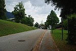
| Staufenstrasse (location) |
After Bad Reichenhall's local mountain, the Staufen | Runs from Schmalschlägerstraße to Langackerstraße. | Was called the Holz-Abfuhr-Weg until around 1950 . |
|
| Strailachweg (location) |
Field name | Runs from the Staufensteg to the Gablerhof in the Nonner Unterland. | Footpath / forest road |

|
| St.-Pankraz-Straße (location) |
Named after the namesake of the pilgrimage church St. Pankraz | Branch off Zwieselstrasse and lead over Gebersbergstrasse to Staufenstrasse. |

|
|
| Südtiroler Platz (location) |
In memory of the mountain railway pioneers Anton Welponer and Luis Zuegg and in solidarity for South Tyrol, which was lost to Italy in 1918 . | At the valley station of the Predigtstuhlbahn . | Here is the valley station of the listed Predigtstuhlbahn, which is the oldest originally preserved large cabin cable car in the world. |

|
| Teisendorfer Strasse (location) |
Named after the Teisendorf market , but the street is not an arterial road in that direction | Connects Grabenbachstrasse with the B 21 . | Because there are an unusually large number of manhole covers in the very short Teisendorfer Straße , it is popularly known as Manhole Cover Street . |

|
| Thumsee (location) |
Named after the Thumsee | At the Thumsee. | Landscape protection area, local recreation area and swimming lake. The houses are numbered consecutively without any additional information. Partly also at the Thumsee . |

|
| Thumseestrasse (location) |
Named after the Thumsee | Leads from the Luitpold Bridge over Karlstein to Thumsee. | Before the construction of State Road 2101 and the Kretabrücke, Thumseestrasse was the main traffic connection between the Gasthof Kaitl and the Luitpoldbrücke from Bad Reichenhall via Inzell in the direction of Traunstein . For better differentiation, this area of the street is popularly called Alte Thumseestrasse . Formerly also Alte Reichenhaller Straße and until around 1920 Traunsteiner Straße. At around 1.8 km, it is one of the longest streets in the entire city. |

|
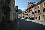
| Tiroler Strasse (location) |
Named after the Tiroler Tor, a main gate in the city wall of Bad Reichenhall. | Extended Salinenstraße to Anton-Winkler-Straße ( B 20 ) | Until around 1800: Oberste Gasse . The main traffic route from Salzburg to Tyrol led through the town of Bad Reichenhall, whereby the gate at this point at the end of the street clearly indicated the direction (to Tyrol). The name Straubinger Tor is less well-known , as one also traveled through the gate in the direction of Lower Bavaria. Until the construction of Loferer Straße (bypass) and the relocation of traffic through the city to Münchner Allee, the Tiroler Tor was the southern traffic junction of the city. Here the traffic branched off onto the road to Berchtesgaden. In the direction of the Saalachsee there was a level crossing where there is now a gas station. For a long time, the Tiroler Tor restaurant on Tiroler Strasse was reminiscent of the former city gate. |
|
| Tivolistraße (location) |
Named after the Hotel Tivoli. | Runs from Wisbacher- to Adolf-Schmid- and Baderstrasse. | Until about 1910: Kellerweg . |

|
| Tivoiliweg (location) |
Named after the Hotel Tivoli. | Footpath, branches off from Tivolistraße in a southeastern direction. |

|
|
| Traunfeldstrasse (location) |
Old field name in St. Zeno . | Branches off Frühlingstraße and leads to Loferer Straße (B20 / B21). | In the past: Mühlenstraße , after the Traunfeldmühle, which was there. |

|
| Triftmeisterau (location) |
According to the trift master, who oversaw the timber drift on the Saalach for the firewood from the salt works. | West of Loferer Straße (between Luitpoldbrücke and Kretabrücke). |

|
|
| Triftmeisterweg (location) |
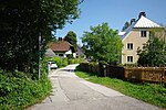
Branches from Reichenbachstraße at the new salt works to the west (further as a footpath along Loferer Straße). |
|
||
| Tulpenstrasse (location) |
Based on the genus of tulips | Dead end from Lilienstraße to the row house complex on Thumseestraße. |

|
|
| Tumpenstrasse (location) |
Field name on Tumpen . | From Grenzlandstraße in the direction of Bayerisch Gmain (also Kreisstraße 4). |

|
|
| Turnergasse (location) |
Connects Ludwigstrasse with Rosengasse. |

|
||
| Unterer Lindenplatz (location) |
After the genus of linden trees | Connects Ludwigstrasse with Rosengasse. | Until around 1850 this place was called In der Schwemme . In the immediate vicinity of the saltworks and the market square (today Poststrasse ) there was a horse pond in which the dirty horses could be cleaned. Today there is a war memorial with a fountain on Untere Lindenplatz. |

|
| Untersbergstrasse (location) |
Named after the Untersberg | Runs from Reichenhaller Strasse to Römerstrasse. |

|
|
| Vogelthennstrasse (location) |
Named after the old Vogelthenn farm. | Connecting road from the spring road to the Loferer road. |

|
|
| Von-Heinleth-Strasse (location) |
Dr. med. Karl von Heinleth, * 7. July 1863 in Munich . Surgeon and medical councilor, in Bad Reichenhall from 1895 to 1931. Founder and director of the first sanatorium in 1911. Promoted the construction of the Saalach power plant and the use of the Kaiser Karl drinking spring for spa purposes. Inventor of the first portable first aid kit . First automobile driver in Bad Reichenhall and first color photographer (Lumiere process). | Connects spring and Paepkestrasse. | Was called Zweibrückenstrasse until around 1960 |

|
| Von-Martius-Strasse (location) |
Named after Carl Friedrich Philipp von Martius , German naturalist, botanist and ethnographer. | Runs from Lange Gasse to Nonner Straße. |

|
|
| Waaggasse (location) |
The urban scales once stood here. | Located behind the old town hall between Wörgötterplatz and Gasthof Bürgerbräu. | The milk market , where the milk trade was carried out, used to be located here. The street was therefore called the milk market until the 20th century and Milchgasse from the 12th century until 1840 . |

|
| Forest path (location) |
From the Salzburger Straße branching off along the Kirchholz to the Froschhamerweg. |

|
||
| Weißstrasse (location) |
Josef Weiß, born February 3, 1851 in Windberg near Straubing , † January 14, 1910 in Bad Reichenhall. Iron merchants from Bogen near Straubing. Married in 1879 into the Wasserman family, in 1891 he was elected to the city's magistrate, he was mayor from 1894 to 1899. Under his leadership, the city acquired the gas works and the Reichenhall electricity works, which were previously privately owned . | Extension of Pechmannstrasse, runs from Kurfürstenstrasse to Paepkestrasse. | Between Friedrich-Ebert-Allee and Paepkestrasse along the Rupertuspark only for cyclists and pedestrians. |

|
| Weitwiesenring (location) |
Field name Weitwiese . | Branches off Von-Martius-Straße and leads back to it in an arch. |

|
|
| Werkmeisterweg (location) |
Former property of the foreman . | Dead end, branches off from Münchner Allee in a southerly direction. |

|
|
| Wisbacherstraße (location) |
Franz Wisbacher, * 29. January 1849 in Ainring , accident on June 27, 1912 in Hammerau . Teacher and organist in St. Zeno, local poet. Composed the Reichenhaller Lied mountain-enclosed on three sides (melody by Karl Hünn). | Connects Ludwigstrasse to Tivolistrasse. | Formerly: Promenadestrasse , from the 1920s: Hindenburgstrasse . After the end of the Nazi regime, the street was renamed Wisbacherstraße in 1947 . |

|
| Wittelsbacherstraße (location) |
Named after the noble Wittelsbach family, they were electors from 1623 and kings of Bavaria from 1806. | Extension of Innsbrucker Strasse from Liebigstrasse to Frühlingstrasse. | Until 1910: Gradirbachstrasse . |

|
| Wörgötterplatz (location) |
Named after the postman Wörgötter. | Between Poststrasse and Kanalstrasse and Innsbrucker Strasse. | The Weißgerbertor (also Mittertor or Schlaiztor ) used to be located here, as this is where the city's tanners' quarter was located on the so-called Mühlbach . |

|
| Zenostraße (location) |
After the namesake of the monastery and church, St. Zeno . | Connects Salzburger Strasse with Münchner Allee. | The middle school, the elementary school St. Zeno and the campus Reichenhall of the IUBH are located on Zenostraße . |

|
| Zunftweg (location) |
According to the Froschham Guild, which has existed for over 500 years. | Branches from Münchner Allee in a southerly direction. |

|
|
| Zwieselstrasse (location) |
Named after the Zwiesel . | Branches from Staufenstrasse and runs to Bruckthal. |

|
See also
- List of honorary citizens of Bad Reichenhall
- List of architectural monuments in Bad Reichenhall
- List of ground monuments in Bad Reichenhall
Web links
Individual evidence
- ↑ Johannes Lang: History of Bad Reichenhall , p. 806
- ↑ a b c Johannes Lang: Street names as a mirror of time, home pages of the Reichenhaller Tagblatt from October 28, 2006
- ^ Address book Bad Reichenhall, Bayerisch Gmain, Piding, version 2018/19
literature
- Johannes Lang : History of Bad Reichenhall. Ph.CW Schmidt, Neustadt / Aisch 2009, ISBN 978-3-87707-759-7 .
- Johannes Lang: Street names as a mirror of the times in the homeland sheets , supplement of the Reichenhaller Tagblatt from October 28, 2006
- FX singer: Reichenhaller streets and their names in the homeland papers , supplement of the Reichenhaller Tagblatt ; March and August 2008
- City of Bad Reichenhall - address book; List of all street names with a description of the location and the origin of the name


