Ondres
| Ondres | ||
|---|---|---|
|
|
||
| region | Nouvelle-Aquitaine | |
| Department | Country | |
| Arrondissement | Dax | |
| Canton | Seignanx | |
| Community association | Seignanx | |
| Coordinates | 43 ° 34 ′ N , 1 ° 27 ′ W | |
| height | 3–53 m | |
| surface | 15.13 km 2 | |
| Residents | 5,358 (January 1, 2017) | |
| Population density | 354 inhabitants / km 2 | |
| Post Code | 40440 | |
| INSEE code | 40209 | |
| Website | www.ondres.fr/ | |
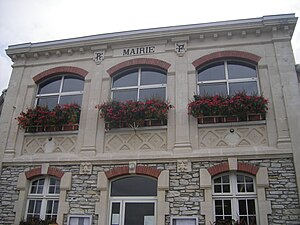
 Ondres Town Hall |
||
Ondres is a French commune with 5,358 inhabitants (as of January 1, 2017) in the Landes department in the French region of Aquitaine . It belongs to the Arrondissement of Dax and is part of the canton of Seignanx .
geography
Ondres is located on the Côte d'Argent (German: Silver Coast), a coastal strip on the Bay of Biscay . The lake landscape in the municipality is fed by the Anguillière river . Ondres is surrounded by the neighboring communities Labenne in the north and northeast, Saint-Martin-de-Seignanx in the east and Tarnos in the south and southeast. In the west is the beach to the Atlantic Ocean .
The A63 autoroute and the former national route 810 run through the municipality . The station is on the Bordeaux – Irun railway line .
Population development
| year | 1962 | 1968 | 1975 | 1982 | 1990 | 1999 | 2006 | 2011 |
|---|---|---|---|---|---|---|---|---|
| Residents | 1,419 | 1,523 | 2,073 | 2,704 | 3,100 | 3,650 | 4,244 | 4,631 |
Attractions
- Saint-Pierre church
- La Roque Castle from around 1130.
- Lake landscape with the Etang de Beyre, the Lac de Garros, the Lac du Turc and the Lac de la Laguibe
Parish partnership
There is a partnership with the Spanish municipality of La Rambla in Andalusia.
Web links
Individual evidence
- ↑ INSEE ( page no longer available , search in web archives ) Info: The link was automatically marked as defective. Please check the link according to the instructions and then remove this notice.

