
Peyrehorade
| Peyrehorade | ||
|---|---|---|
.svg)
|
|
|
| region | Nouvelle-Aquitaine | |
| Department | Country | |
| Arrondissement | Dax | |
| Canton | Orthe et Arrigans | |
| Community association | Pays d'Orthe et Arrigans | |
| Coordinates | 43 ° 33 ′ N , 1 ° 6 ′ W | |
| height | 2–140 m | |
| surface | 16.11 km 2 | |
| Residents | 3,695 (January 1, 2017) | |
| Population density | 229 inhabitants / km 2 | |
| Post Code | 40300 | |
| INSEE code | 40224 | |
 Montréal Castle |
||

Peyrehorade ( Occitan Pèira Horada , Basque Peirahorada ) is a French municipality with 3695 inhabitants (as of January 1 2017) in the department of land in the region Nouvelle-Aquitaine . It belongs to the Arrondissement of Dax and the canton of Orthe et Arrigans .
geography
Peyrehorade is located on the northern edge of the French Basque Country and on the right bank of the Gaves Réunis river , which is created above the city by the confluence of the Gave de Pau with the Gave d'Oloron . To the west of the city center is the Lac de Sames , a small lake.
history
The first documented mention of the village comes from 1448.
Population development
| year | 1962 | 1968 | 1975 | 1982 | 1990 | 1999 | 2010 | 2017 |
| Residents | 2584 | 2591 | 2861 | 3093 | 3056 | 3017 | 3467 | 3695 |
Attractions
- Montréal Castle, 16th century castle
- Aspremont Castle , 11th century moth
- Saint Martin Church
Economy and Infrastructure
Peyrehorade is a tourist resort in which numerous service companies are established. In the industrial sector, two companies are active in the field of agronomy.
Wednesday is market day when live poultry and small livestock are sold.
Peyrehorade is connected to the SNCF railway network and a regional bus network. The next motorway junction on the Autoroute A64 is about 4 km to the south and is connected to the city center by the department road D 19. A bridge over the Gave de Pau connects the city with the village of Le Bioch .
Town twinning
Peyrehorade has a partnership with Saint-Louis in Alsace.
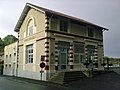
Tourist information

Multipurpose hall
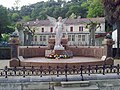
Memorial to those who died in war

Flea market in the multi-purpose hall


- The church

South side

Frontal view

Entrance area

garden

Bell tower

Church interior with chancel

Chancel with old choir stalls

Inside the church with a view of the organ


