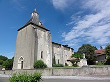
Taller
|
Taller Talèr |
||
|---|---|---|
|
|
||
| region | Nouvelle-Aquitaine | |
| Department | Country | |
| Arrondissement | Dax | |
| Canton | Cote d'Argent | |
| Community association | Côte Landes Nature | |
| Coordinates | 43 ° 52 ′ N , 1 ° 4 ′ W | |
| height | 57-89 m | |
| surface | 41.07 km 2 | |
| Residents | 606 (January 1, 2017) | |
| Population density | 15 inhabitants / km 2 | |
| Post Code | 40260 | |
| INSEE code | 40311 | |
 Taller Town Hall (Mairie) |
||
Taller ( Occitan : Taler ) is a French municipality with 606 inhabitants (as of January 1 2017) in the department of land in the region Nouvelle-Aquitaine . The municipality belongs to the Arrondissement of Dax and the canton of Côte d'Argent (until 2015: Canton Castets ). The inhabitants are called Tallésiens .
geography
Taller is about 18 kilometers north of Dax . Taller is surrounded by the neighboring communities of Lesperon in the north, Rion-des-Landes in the northeast, Laluque in the east and southeast, Gourbera in the south and Castets in the west.
The community is on the Via Turonensis , a variant of the Camino de Santiago .
history
In 982 or 983 (according to other data, 988) the battle of Taller took place here, in which Wilhelm II of Gascon defeated the Vikings and thus ended the ongoing raids in Gascon.
Population development
| 1962 | 1968 | 1975 | 1982 | 1990 | 1999 | 2006 | 2013 |
|---|---|---|---|---|---|---|---|
| 422 | 396 | 404 | 389 | 396 | 418 | 406 | 592 |
| Source: Cassini and INSEE | |||||||
Attractions
- Saint-Barthélemy church from the 16th century, monument historique

