
Dobling
|
Dobling XIX. Viennese district |
|
|---|---|
| coat of arms | map |
 |
 .svg) |
| Geographic location : | 48 ° 16 ' N , 16 ° 19' E |
| Surface: | 24.9 km² |
| Residents: | 73.901 (January 1, 2020) |
| Population density : | 2968 inhabitants / km² |
| Postal code : | 1190 |
| Address of the district council: |
Grinzinger Allee 6 1190 Vienna |
| Address of the district office: |
Martinstrasse 100 1180 Vienna |
| Website: | www.wien.gv.at |
| politics | |
| District Head : | Daniel Resch ( ÖVP ) |
|
District council election 2015 |
A total of 48 seats |
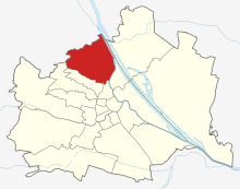
| Map: Döbling with parts of the district | |

|
|
Döbling is the 19th Vienna district , located in the northwest of Vienna on the edge of the Vienna Woods . The district was formed in 1892 from the former Vienna suburbs Unterdöbling , Oberdöbling , Grinzing , Heiligenstadt , Nussdorf , Josefsdorf , Sievering and Kahlenbergerdorf . In 1938 the district was expanded to include Neustift am Walde and Salmannsdorf , which previously belonged to the Währing district . Since then, a small part of Pötzleinsdorf has also belonged to Döbling, which is colloquially known as Glanzing . Today, Döbling, with its Vienna Woods villas, is considered to be a noble district, similar to Währing and Hietzing, and has significant viticulture. However, due to numerous community buildings such as the Karl-Marx-Hof or cooperative housing complexes, the population structure is more balanced than is often assumed.
geography
location

Döbling is located in the north-west of Vienna and encompasses the slope of the Vienna Woods towards the Danube and the Danube Canal , which border the district in the east. The Danube forms the border between Döbling and the Floridsdorf district , the Danube Canal to the Brigittenau district . At the Gürtel bridge over the Danube Canal, the district border branches off and separates Döbling in the south along the belt from the Alsergrund district . At Schrottenbachgasse, the district border branches off to the northwest and separates Döbling from the Währing district along the Währinger Park-Hasenauerstraße-Peter Jordan Straße-Starkfriedgasse- Sommerhaidenweg line . The short border to the Hernals district connects directly to the north.
use
32.6% (compared to the entire city of Vienna 33.3%) of the Döblingen district area is building land . 85.2% of these are residential building areas, while the proportion of industrial building areas is very low at 2.2% of the district area (Vienna 7.6%). With a green space share of 51.8% (Vienna 48.3%), Döbling is the fifth greenest district in Vienna . 14.9% of the district area is used for agriculture, with viticulture playing the largest role here around Grinzing , Nussdorf , Sievering , Neustift am Walde and Salmannsdorf. Another 25.4% of the district is forested , plus 5.3% meadows , 2.7% allotment gardens , 2.5% park areas and 0.9% sports and leisure areas. The remaining use of the district area is ultimately attributable to traffic areas with 11.0% and waterways with 4.6%, whereby the proportion of waterways in relation to the entire city of Vienna is higher and the proportion of traffic areas is lower.
mountains

Due to the large proportion of the Vienna Woods, there are numerous deciduous local mountains of Vienna in Döbling . They are on the border with Lower Austria and the neighboring districts. The highest peak is the Hermannskogel (542 m), but the Kahlenberg (484 m) and the neighboring Leopoldsberg (427 m) have become Döbling's landmarks . Other mountains in this area are the Reisenberg , Latisberg , Vogelsangberg , Dreimarkstein and Nussberg . There are also partially built-up elevations in Döbling, such as the Hohe Warte in Heiligenstadt, the Hungerberg in Grinzing and the Hackenberg in Sievering.
Rivers
Numerous streams have their source in the district, but today they are mostly built hard or run as brook channels . With the exception of the Waldbach, all of them originally flowed into the Danube Canal. Since the catchment areas of the streams lie in the sandstone area of the Vienna Woods , the streams can and could grow to many times their normal water volume. This repeatedly led to destructive floods, especially along the Krottenbach . The Krottenbach was the most important brook in Döbling and is practically completely run as a brook canal . In the area behind the Bundesgymnasium Billrothstraße it takes up the Arbesbach (Erbsenbach) running through Sievering , which is still open today in the upper reaches to Obersievering. The Nesselbach still runs open to the Krapfenwaldl before it joins the Reisenbergbach in Grinzing underground . The Reisenbergbach runs open until shortly before the center of Grinzing. The Schreiberbach to Nussdorf and the Waldbach near Kahlenbergerdorf are almost completely open . By contrast, the Döblinger Bach has completely disappeared due to its drainage . This originally originated in the Cottage and flowed into the Danube Canal in Spittelau .
District parts
Döbling was formed from several, previously independent communities. These are:
history
etymology
Döbling was first mentioned in 1114 as de Teopilic . The name is derived from the Slavic * topl'ika ("swampy water" or "swampy place"). The name Döbling indicates its location on the Krottenbach, with another possible interpretation derived from the Old Slavic toplica ("warm brook"). Later spellings of the place name were, for example, Toblich , Töbling and Tepling . When the district was formed in 1890/92, the name Döbling was finally adopted by the largest municipality of Oberdöbling for the entire district.
Döbling in antiquity

The Döbling district was settled around 5000 years ago, with the Döbling- Nussdorf - Heiligenstadt area, along with the Simmering - Landstrasse area, probably the oldest settlement area in the Vienna area. It is known that there was a well-fortified village on the Leopoldsberg with a defensive tower, where the residents of the surrounding villages gathered in case of danger. Little is known about the inhabitants of that time, science describes them as the bearers of the “Danubian culture”, but they were not Indo-Europeans . These penetrated the Vienna area only a thousand years later, whereby the local population mixed with the immigrant Illyrians and Celts . The work of the Romans in today's area of Döbling is documented by several finds. There was a fortified tower of the Limes in Heiligenstadt , a mithraium was found in Sievering and excavations in the Heiligenstadt church show a Roman cemetery. In Sievering there was a large quarry with a large workers' settlement during Roman times . Another source of income for the population was viticulture , which was probably already practiced before the Romans. Otherwise, people farmed for their own use.
Dobling in the Middle Ages
After the Romans withdrew, the further development of the villages in the area was in the dark, the villages were first mentioned in the 12th century. Gradually, the later communities of Unterdöbling , Oberdöbling , Heiligenstadt, Nussdorf, Sievering, the Kahlenbergerdorf , Josefsdorf , Salmannsdorf and Neustift am Walde emerged in the district area. In addition, there were other settlements in the district. In the 13th century there was a place Chlaitzing (Glanzing) on the southwest slope of the Hackenberg, of which only vineyards were mentioned in 1330, but no houses. Along the Hackhofergasse there was again a small, single-lined village called Altes Urfar. Ultimately, there was even Kogelbrunn on the Hermannskogel from 1200, which was mentioned for the last time in 1417.
The Döbling area in modern times
_-_Kirche_(2).JPG)
The villages of Döbling were devastated several times during modern times . When the siege of Vienna by Matthias Corvinus's army began in 1482 , his soldiers also plundered the surrounding villages. In 1529 the Turkish soldiers overran the villages of Döbling in the course of the first Turkish siege of Vienna , killing numerous residents and taking many away as slaves . However, while the churches were looted, most of the villages remained. The Thirty Years' War also brought economic hardship . The slump in wine exports and the tax hikes led to a severe impoverishment of the population. The great plague epidemic in 1679 claimed just as many victims in the villages as did the Second Turkish Siege of Vienna , which began in the summer of 1683 . On July 13, the Ottoman vanguard, the Tatars , stormed the villages of Dobling and sacked them. In the Battle of the Kahlenberg on September 12th the liberation of Vienna was finally decided when the relief army led by Jan Sobieski advanced across the Wienerwald heights into the rear of the Turkish besiegers.
In 1713 the plague came to Vienna again, with Sievering and Grinzing being particularly hard hit. While the numerous destruction and plague victims had inhibited the development of the district area for a long time, a steady rise began in the second half of the 18th century. The use of the area as an imperial hunting area made Oberdöbling in particular attractive to the nobility and Viennese citizens. Those who could afford it built a second home here . Similar to Hietzing , which benefited from the proximity to Schönbrunn Palace , the foundation stone for a special development of the suburb was laid here. Between 1765 and 1786, five new streets were built in Oberdöbling and four hunting lodges were built in what is now the district area.
The abolition of numerous orders by Joseph II. Also had an impact on the basic rule in Döbling, so that from the confiscated property of the Camaldolese (Kahlenberg), the Convent Tulln (Oberdöbling) and the pin Gaming (Untersievering) the establishment of parishes Nussdorf and Grinzing and the construction of the Döblinger cemetery could be financed. Also the place Josefsdorf entirely inspired by the lifting of the Kamaldulenserklosters Kahlenberg. The parishes of Oberdöbling, Nussdorf and Neustift am Walde, which were now independent of Heiligenstadt, gained their independence through the parish reform of Joseph II.
Döbling in the 19th century

The Napoleonic Wars brought difficult times for the area . After the victory in the Battle of Ulm in 1805, the French army advanced into Vienna and the soldiers plundered the villages; after the failed campaign against Bavaria , the French penetrated again into Vienna in 1809, and so the communities were plundered again and the French had to Feed the soldiers. After the Congress of Vienna , the proper surveying of the Döblingen area began. The work lasted from 1817 to 1819 and ended with the introduction of the cadastral communities and the fixing of the boundaries between the places. The growth brought about an initial boom in trade and industry in the rural villages. At the same time, the towns of Döbling developed into popular excursion destinations for the Viennese. The Heurigen and the Nussdorfer Brewery in particular attracted visitors behind the wall of lines .
During the revolution , Dobling remained on the verge of events. On October 20, 1848, the district was occupied by imperial troops, who built a bridge from Nussdorf and shelled the opposite bank. In the middle of the 19th century, the increasing popularity of the summer resort caused a real growth boom in the Döblinger villages. As a result of the additional need for housing, numerous residential buildings were built and the population of the villages almost tripled in just forty years. This also resulted in a modernization of the infrastructure. The first gas lights were installed in Döbling in the middle of the 19th century, and the Döbling gas works, built in 1856, supplied the area with gas.
Döbling becomes a district
The 19th district of Vienna, Döbling, was finally founded at the end of the 19th century. While the suburbs of Vienna had already been incorporated in 1850, the discussion about the incorporation of the suburbs began in the 1870s. Although the suburbs were against this step, the Lower Austrian state parliament decided to unite Vienna with its suburbs after Emperor Franz Joseph I made this wish in 1888 in a sensational speech in Währing . The corresponding law of December 19, 1890 was implemented by January 1, 1892 and united Unterdöbling, Oberdöbling, Grinzing (up to the ridge of the Vienna Woods , the rest came to Weidling ), Heiligenstadt, Nussdorf, Sievering, the Kahlenbergerdorf (with the exception of the northern Part of the mountain that came to Klosterneuburg ), Josefsdorf and part of Weidling (Fischerhaus, Jägerwiese, Schutzhaus Hermannskogel) to the 19th district of Vienna, Döbling. Due to the size of Oberdöbling, which had almost as many residents as the rest of the district, there was no discussion about the name of the new district. The places in the district had also largely grown together.
Döbling until the Second World War

The construction of the area between Döbling and Währing had already started in 1872 . An elegant residential area emerged, the first Viennese cottage . A building zone plan by the city administration was also supposed to limit the building height to two floors in almost all of Döbling. However, for fear of the loss of the industrial plants, the plan did not prevail, the area between Heiligenstädter Strasse and the Danube Canal was dedicated as an industrial area. The canalization of the Döblinger Brooks was also completed by 1895. They no longer flowed into the Danube Canal , but into the main collecting canal running parallel to the Danube Canal. The streams now largely disappeared from the surface and were used as stream channels to improve the sewer system. After the completion of the Second Vienna High Spring Water Pipeline in 1910, most of the houses were also connected to the water pipeline; previously, people had only been supplied via wells and drinking water vehicles.
The gas supply to the district had already started in 1856 through the gas works of ICGA , an English company. In 1911 the city of Vienna took over the supply and the works in Oberdöbling were removed. After the First World War , the creation of affordable and adequate living space became extremely important, which is why the social democratic city government in Döbling began with the massive construction of cheap community apartments. In 1923 the first community building with 60 apartments was built in Schegargasse, and the city invested in the construction of 2,801 apartments by 1930. The largest and best known project was the Karl-Marx-Hof .

In addition, the Social Democrats tried to improve social welfare through numerous institutions. The February fighting in 1934 was particularly difficult in the district. The main battle area was the Karl-Marx-Hof. The building was fired at with artillery for two days , and three other community buildings were stormed by the armed forces. After the suppression of the uprising, the social democrats consequently also lost the previously social democratic district head in Döbling. In order to alleviate unemployment, the federal government began building the Vienna Höhenstrasse in 1934 . The road was led in stages from Cobenzl to Kahlenberg and then to Klosterneuburg . When the National Socialists came to power, the Vienna district boundaries were reorganized. This also affected Döbling, as Neustift am Walde with Glanzing and Salmannsdorf came from Währing to Döbling.
The rule of the National Socialists , however, mainly brought suffering to the approximately 4,000 Döblinger Jews (7% of the district population). On November 10, 1938, the Döbling synagogue at Dollinergasse 3 was destroyed. The registered Jews who remained in Döbling in May 1939 were gradually deported to the concentration camps. During the war, around 5,000 Döblingers had to enter, not much more than half returned. Then there were the bombings that hit the district for the first time on July 8, 1944. 12 percent of the 20,960 apartments were destroyed or made uninhabitable. The area around the Heiligenstadt train station and the Hohe Warte were particularly hard hit.
Döbling after the Second World War
On April 8, 1945, Soviet troops entered the district from Klosterneuburg via Heiligenstädterstrasse and occupied it in full by April 9. Karl Mark was appointed the first district head of the 2nd Republic by the army commander and began to rebuild. During this time, the district largely lost its character as a juxtaposition of residential areas and workplaces. More and more businesses left the district, while the number of apartments rose from 20,000 at the end of the war to 39,608 apartments (2001). This development also meant that two thirds of the district's population had to commute to work in other parts of the city or the surrounding area. The City of Vienna also played a key role in the construction work, building around 7,000 additional municipal apartments by 1985. The largest municipal housing development in Döbling in the post-war period is the Copenhagen-Hof , which was built between 1956 and 1959 on the former site of the Döbling brewery and houses 436 apartments. The Crimea, part of Unterdöbling, also experienced a particular boom. The once disreputable slum was expanded into a high-quality residential area with its own parish. Another important building is the press house in Muthgasse , which was completed in 1963 (seat of the Kronen Zeitung ). The most important construction project at the moment is the construction of grounds around the Hohen Warte stadium. The district boundaries were changed twice in the 1990s: in 1995 to the municipal districts of Hernals and Währing, with Währing essentially losing a small residential area to Hernals and the Währing district boundary to Döbling being shortened in favor of the Hernals district boundary to Döbling, and in 1996 to the municipality of Brigittenau. The latter change of border meant a gain in territory for Döbling, which since then borders directly on the Danube Canal.
population
Population development
Source: Statistics.at

Population development
In 1832 there were 6,438 people in the district. Due to the growth of the suburbs in the 19th century, the number of the population doubled within 20 years and tripled by 1890. The number of residents continued to rise sharply until the First World War and continued to grow thanks to municipal housing. Residential construction provided growth in the district until the 1980s. After that, the district population began to decline slightly due to the increased housing needs until 2001, and has since grown again slightly in line with the Vienna-wide trend, to 69,924 residents at the beginning of 2015.
Population structure
Dobling's population is much older than the average in Vienna. The proportion of people aged 60 and over is very high at 29.9%; in the entire urban area this proportion is only 22.2%. One reason for the strong aging of Döbling is the high proportion of retirement homes in Döbling. The proportion of the female population is also above average at 55.1%, compared to just 52.4% in Vienna.
Origin and language
The share of Döblingers with foreign citizenship was 13.1% in 2003, around 4 percentage points below the average for Vienna. 2% of the Döblingers were citizens of Serbia or Montenegro , 1.6% are German citizens. They are followed by Turks (1.2%) as well as Poles , Bosniaks , Croats and Hungarians , whose share of the population is only between 0.5 and 0.3%. In 2001, around 20% of the Döblingers were born in another country, so only 82.8% of the Döblingers said German as their colloquial language. Another 2.8% spoke mainly Serbian , 1.6% Turkish , 1.2% Croatian and 1.1% Hungarian .
Creed
At 55.7%, the proportion of people with a Roman Catholic faith is around 6 percentage points above the average in Vienna. There are eleven Roman Catholic parishes in the municipality, which make up the 19 city dean's office . The supporters of the Evangelical Church are also above average at 6.5%. This is followed by 4.0% with an Islamic and 3.2% with an Orthodox creed. 23.8% of the people of Döbling are not confessed.
politics
| District Head | |||
|---|---|---|---|
| Josef Friedl | 1891-1894 | Karl Mark ( SPÖ ) | 4 / 45-10 / 45 |
| Johann Austrian | 1894-1895 | Karl Schwendner ( SPÖ ) | 10 / 45-1960 |
| Peter Langweber | 1895-1903 | Franz Opfermann ( SPÖ ) | 1960-1965 |
| Wenzel Kuhn | 1903-1919 | Franz Weber ( SPÖ ) | 1965-1975 |
| Josef Seleskowitsch | 1919-1934 | Richard Stockinger ( SPÖ ) | 1975-1988 |
| Franz Karasek | 1934-1938 | Adolf Tiller ( ÖVP ) | 1978-2018 |
| Adolf Judex | 1938-1939 | Daniel Resch (ÖVP) | 2018– |

The first elections after the introduction of universal suffrage brought a victory for the Social Democrats. They just got an absolute majority of the votes, followed by the Christian Socials with around 28% in second place. The dominance of the SPÖ remained until 1978. In that year, however, the ÖVP overtook the SPÖ, which since then has been the district chairman in Döbling with Adolf Tiller . In 1996 the lead of the ÖVP (37%) over the SPÖ (28%) was almost 10%. The SPÖ lost around 8% of its votes, from which the FPÖ and the LIF in particular benefited. The FPÖ came to around 18%, the Greens and the LIF when they first appeared at around 7%. The subsequent district council election in 2001 finally brought a victory for the SPÖ and the Greens. While the ÖVP fell slightly with 36.54%, the SPÖ gained around 4.5% to 32.61%. The FPÖ, on the other hand, slipped to 14.54%, while the Greens were just able to catch up with 12.63%. The LIF again lost more than half of its votes and achieved only one mandate with 3.15%. In the 2010 district council elections, the FPÖ grew strongly with gains of 6.3% and landed on 14.7% ahead of the Greens in third place, who only achieved 13.6% with losses of 0.3%. The ÖVP lost a lot with 4.3% and only got 36.4%, the SPÖ also lost a lot with 2.5% and only got 31.8%. The BZÖ was able to almost double through gains of 0.6% to now 1.3%, while the KPÖ de facto stagnated at 0.8% .
coat of arms
Döbling's coat of arms depicts the nine former coats of arms of the independent municipalities that were incorporated into Vienna in 1892. The former municipality of Oberdöbling is represented by the heart shield. The golden grape on a blue background symbolizes the viticulture practiced there. In the upper left part the coat of arms of Heiligenstadt is shown, which shows the Archangel Michael with a green dragon as the church patron of Heiligenstadt on a silver background . To the right of it follows the coat of arms of Unterdöbling , with St. Jacob as a coat of arms figure. He is the church patron of the Heiligenstadt parish church, to which Unterdöbling used to belong. In the upper right corner, the golden tree trunk with three golden nuts symbolizes the former municipality of Nussdorf , while the Salmannsdorf coat of arms with a picture of the martyr Sebastian can be found on the left in the middle . Sebastian is the patron of the Salmannsdorf chapel. To the right of the middle is the coat of arms of Neustift am Walde . It shows Saint Roch , the patron saint of the Neustift parish church. In the lower left corner, Saint Severin represents the wine village of Sievering . He is the patron of the Sieveringen parish church. The coat of arms of the Kahlenbergerdorf can also be found under the heart shield . It shows Saint George slaying the dragon, who is the patron saint of the Kahlenbergdorfer Church. The last part of the coat of arms in the lower right corner ultimately symbolizes the town of Grinzing . The man with the grapes shows the close ties to viticulture.
Culture and sights
Attractions
Vienna Woods
.JPG)


The most important tourist attraction in Döbling is the Kahlenberg on the edge of the Vienna Woods . The former hotel with its famous panorama terrace has meanwhile given way to a new building. Many tourists, especially Polish ones, also visit St. Joseph's Church or the Stefaniewarte on Kahlenberg . Other mountains worth seeing in Döbling are the neighboring Leopoldsberg with St. Leopold's Church and the highest mountain in Vienna, the Hermannskogel . Among the Döblingern and Viennese, however, the Cobenzl and the area Am Himmel with the so-called “Celtic” tree circle and the Sisi chapel also have some significance. The area of the Döblinger Wienerwald is accessible via the famous Wiener Höhenstraße .
Town centers and churches
The ten places from which Döbling was formed contribute a lot to the character of the district. The places in the outdoor areas in particular have been able to preserve large parts of their existence. The best examples here are certainly Grinzing, Salmannsdorf and the Kahlenbergerdorf, but much of the building fabric has also been preserved from the other town centers. As a result of the separate localities, numerous local churches also emerged in Döbling. The oldest church is the St. Jakob Church in Heiligenstadt. It was built on the ruins of a Roman church and is located on the Heiligenstädter Pfarrplatz, which has been preserved as an ensemble. As everywhere in Döbling, there are also numerous preserved wine taverns here. Grinzing, in particular, is popular with tourists because of the numerous Heurigen taverns, locals tend to come to Sievering, Nussdorf, Heiligenstadt, Neustift am Walde or the Kahlenbergerdorf.
More Attractions
Due to the close connections between artists and Döbling, numerous sights have been preserved in this context. Beethoven composed the 3rd symphony of the same name in the so-called Eroica House in Döblinger Hauptstrasse , and in Probusgasse he wrote the Heiligenstadt Testament and, among other things, parts of the 2nd symphony . The gravestones of the famous Viennese waltz musicians Johann Strauss and Joseph Lanner can be found in the Strauss-Lanner Park . Furthermore, one of the most unusual company buildings in Vienna can be found in Unterdöbling. The so-called Zacherlfabrik , a former insect powder factory , was built in the style of a mosque. Important sights from the 20th century have also been preserved in the district. The First Vienna FC 1894 stadium on Hohe Warte is the largest natural arena in Europe. Furthermore, one of the most famous municipal buildings in Vienna is located in Heiligenstadt, the Karl-Marx-Hof . The Hackenberg is home to what is probably the most beautiful drinking water tank in Vienna's water supply : the Hackenberg water tank , while the Krapfenwaldl water tank is inconspicuous .
Museums

The Döbling District Museum in Villa Wertheimstein is particularly dedicated to the district's history and also has its own wine-growing museum . Also Ludwig van Beethoven , the amount of time Oberdöbling and Heiligenstadt spent two museums are dedicated to the so-called Eroica and a house in the Probusgasse. The Austrian Language Island Museum founded by Maria Hornung is located in Oberdöbling and can only be visited by prior arrangement. The Institute for Prehistory and Early History, the Kahlenberger Museum ( Second Siege of the Turks ) and the Lehár-Schikaneder-Schlössl also have other exhibits that are worth seeing . Furthermore, excavations from Roman and early Christian times can be viewed in the St. Jakob Church in Heiligenstadt. The permanent exhibition "Das Rote Wien im Waschsalon" has been running in the Karl-Marx-Hof since 2010 and provides information on the history of Vienna in the 1920s and 30s.
Parks

The Döbling district now has a total of nine parks. The largest park is the Heiligenstadt Park with 9 hectares . Behind it follows the 6 hectares of Wertheimsteinpark , which lies in the valley of the Krottenbach, which is now vaulted and also has its own garden for the blind. The Hugo Wolf Park on the northern slope of Krottenbachstrasse is similarly large and offers a good view of the Krottenbach valley. An extensively maintained connecting park (“Fellingerpark am Hirschenbergerl”) also links Krottenbachstrasse with Billrothstrasse. A Japanese architect laid out the Setagaya Park on Hohe Warte in the style of a Japanese landscape, with the park symbolizing the friendship between Döbling and the Setagaya district in Tokyo . Similar to Währing , the original local cemetery in Döbling was also converted into a park. The Strauss - Lanner- Park today has the original gravestones of the two composers. Other smaller parks are the Raimund-Zoder-Park near Krottenbachstrasse, the Richard-Eybner-Park on the corner of Silbergasse / Billrothstrasse and the Saarpark in Unterdöbling .
Sports
The most important and best-known sports club is the First Vienna FC 1894 football club, the oldest football club in Austria. In the 1920s, operas and boxing matches were staged on the sports field on the Hohe Warte , and international matches such as those against Italy in 1923 were watched by up to 80,000 people in Europe's largest natural arena. Today the stadium is also the home arena of the top Austrian American football club, the Raiffeisen Vikings Vienna .
Döbling has three bathrooms. The largest is the year-round Döblinger Bad on the Hohe Warte , here there is both an outdoor and an indoor pool . There is also the Krapfenwaldlbad outdoor pool in the Vienna Woods , from whose sports pool you can admire the unique panorama of the city and the family pool (previously: children's outdoor pool ) in Hugo Wolf Park .
The Nussdorf AC has been playing on the sports field in Grinzingerstraße since 1914 .
The rowing club Austria is located in the Kuchelauer Hafen, the Sportunion Döbling offers numerous sports such as gymnastics, ball sports, badminton and martial arts. One of the Vienna ski jumps was located on Cobenzl .
Economy and Infrastructure
traffic

Public transport in Döbling was established in 1811 with a car line between Freyung and Heiligenstädter Bad. Further lines followed to Oberdöbling , Grinzing and Sievering . The carriages were horse-drawn wagons with about a dozen seats. In 1869 Oberdöbling was connected to Vienna by the fifth line of the Viennese horse tramway , and other lines followed. Between 1885 and 1903 a steam tramway also ran from the Döblinger Gürtel to Nussdorf . The cog railway to the Kahlenberg was opened in 1874, followed by the opening of the Vienna Stadtbahn with the stations Ober-Döbling , Unterdöbling and Heiligenstadt in 1898 .
The paving of the streets in the district began on a large scale in the last third of the 19th century and continued after the district was founded. Many trees and avenues were sacrificed for road construction. After the Second World War, there was a US Army airfield along the Danube Canal , which was abandoned in 1955.
The most important connections of Wiener Linien in the district today are the tram lines 37 (Hohe Warte), 38 (Grinzing) and D (Nussdorf) as well as the bus lines 35A (Salmannsdorf), 38A (Kahlenberg), 39A (Sievering) and 40A (Döblinger Friedhof) . In addition, Döbling has had a share in the U4 underground line (Heiligenstadt) since 1976 , with Heiligenstadt station becoming an important rail and bus hub in the direction of Klosterneuburg . Via Heiligenstadt and the stations Oberdöbling and Krottenbachstraße , Döbling also has a connection to the S45 S-Bahn line .
The most famous street in Döbling is the Höhenstraße on the Kahlenberg. Other important connecting and thoroughfares are Krottenbachstrasse , Billrothstrasse , Döblinger Hauptstrasse , Heiligenstädter Strasse , Grinzinger Strasse and Sieveringer Strasse.
Public facilities
There are two municipal libraries, on Billrothstrasse and in the Volksheim on Heiligenstädter Strasse.
There are two markets available to the residents of Döbling: the Nußdorfer Markt and the Sonnbergmarkt.
economy

The economy of the Döbling district was shaped by viticulture for centuries . The relevance of viticulture is also reflected in the fact that from the Middle Ages, the only social organization known to be the "Winzerzechen". These negotiated the wages of the workers and the wine prices and took care of the members and churches. Until the second half of the 19th century, the livelihood of the residents of the district was based on the cultivation and sale of wine. In addition, milk, eggs, meat, fruit and vegetables were delivered to Vienna. There were smaller mills on the streams and windmills on the hills . The Sieveringen quarry, which was subordinate to the Vienna City Administration, was also important.
From the middle of the 18th century, the first, larger commercial and industrial companies also settled in the district, especially in Nussdorf, Heiligenstadt and Oberdöbling. From 1800 onwards, a number of companies in the textile, leather and chemical industries were established. Even breweries were founded in the first half of the 19th century in Grinzing, Nussdorf and Oberdöbling, and particularly those experienced a significant upturn in Nussdorf. The dairy industry and its dairy farms remained important until the First World War , after which this branch of industry disappeared rapidly. In return, the importance of the Heurigen companies increased. In contrast to the businesses in the surrounding districts, these were able to hold up, also because the steep terrain in Döbling was less suitable for building.
The automobile factory Gräf & Stift in Sievering was one of the most important production companies from the beginning of the 20th century . In Unterdöbling, on the other hand, the Zacherl insect powder factory became very important. Another important company was the machine factory Heinrich in Heiligenstadt. After the Second World War, the characteristics of the district changed. More and more manufacturing companies (including Inführ Sekt to Klosterneuburg ) left the district. The best-known companies still in existence include the Kattus and Schlumberger sparkling wine cellars .
education

In 1890 there was only one middle school in the district, the Communal-Gymnasium on Gymnasiumstrasse. In 1914 the state secondary school in Krottenbachstrasse was added, later two more high schools were built in Billrothstrasse. The district has numerous public and private primary and secondary schools and the educational institute for kindergarten pedagogy “Maria Regina”. The educational program Vienna Bilingual Schooling is offered in three institutions: in the elementary school Grinzinger Straße, in the secondary school In der Krim and in the upper level of the Realgymnasium Krottenbachstraße. The Music School of the City of Vienna has an operating facility in Döblinger Hauptstrasse.
University institutions settled in the district at the end of the 19th century. In 1896, what would later become the University of Natural Resources and Life Sciences, Vienna was opened on Linnéplatz. In 1916 the kk Export Academy, founded in 1898, was located in Franz-Klein-Gasse , which was elevated to the University of World Trade in 1919, renamed the Vienna University of Economics in 1975 and relocated to the 9th district in 1982. After the university moved away, some of the facilities of the business university remained in the building. It is mainly used by the University of Vienna ; here are u. a. the Institute for Pre- and Protohistory and the Institute for Classical Archeology . The Center for Translation Studies of the University of Vienna is located in the part of the building on Gymnasiumstrasse .
In 2007 the Module University Vienna , a private university of the Vienna Chamber of Commerce with English as the language of instruction, was opened on the Kahlenberg .
Personalities
Numerous personalities, especially artists, lived and worked in Döbling. The poet Franz Werfel lived with his wife Alma Mahler-Werfel on the Hohe Warte ( Wollergasse ) until 1938 . Her neighbor was the painter and Mahler-Werfel's stepfather Carl Moll , whose pictures are now in the Döblingen district museum. Also Koloman Moser , co-founder of the Vienna Secession lived in close proximity. Paula von Preradović , the poet and author of the national anthem Land der Berge, Land am Rome , lived in Döblinger Osterleitengasse . A park on Krottenbachstrasse was named after the composer Hugo Wolf .
Numerous actors lived in Döbling, such as the castle actress Rosa Albach-Retty , grandmother of the famous film actress Romy Schneider . Castle actor Werner Krauss lived in Iglaseegasse until his death . Even Oscar winner Christoph Waltz spent his childhood in the family home on the street Grinzinger; He attended the Billroth Gymnasium here , where he also graduated .
In the community building between Grinzinger Allee and Sieveringer Straße, which was renamed Helmut-Qualtinger-Hof in 1996 , numerous well-known artists and politicians lived: the writer Reinhard Federmann , the children's book author and writer Friedl Hofbauer , the actress Louise Martini , the actor Ernst Meister , the actor and ORF General Director Thaddäus (Teddy) Podgorski , the actor, writer and cabaret artist Helmut Qualtinger , the Wienerlied composer Sepp Fellner and the jazz musician, bandmaster and composer Horst Winter . However, the musicians who lived and worked in Döbling achieved the highest level of awareness. Sun played Johann Strauss (father) and Johann Strauss (son) and Joseph Lanner at the casino on Zögernitz, Lanner lived and died in the house was Gymnasiumstraße . In the place of his house there is now a grammar school , where Nobel Prize winners Richard Kuhn and Wolfgang Pauli were trained. Heinz Kohut and Karl Menger graduated here.
The all-rounder Peter Alexander lived in Döbling until his death. The villa of a famous Viennese, the industrialist and owner of the Ottakringer Kuffner brewery was once located at the location of the Haus Döbling dormitory . The political figures in the district included Josef Hindels (freedom fighter and trade unionist), Elisabeth Hlavac (member of the National Council), Erika Seda (member of the National Council and Federal Councilor), Johann Koplenig (Vice Chancellor 1945 and Chairman of the KPÖ), Bruno Kreisky (Federal Chancellor), Karl Maisel (trade unionist and Social Affairs Minister), Heinrich Neisser (Minister and 2nd President of the National Council), Rudolf Sarközi (representative of the Austrian Roma ), Josef Taus ( Member of the National Council and State Secretary) as well as Franz Vranitzky (Federal Chancellor) and Ernst Wimmer (Marxist theorist and chief ideologist of the KPÖ ).
Born here
- Ambros Rieder (1771–1855), composer and organist
- Gerhard Jandl (* 1962), diplomat
Town twinning
See also
Movies
- My dobing ; Documentation by Chico Klein, Austria 2015
literature
- Werner Filek-Wittinghausen: Well done in Döbling: Articles and documents on economic history . Bastei, Vienna 1984, ISBN 3-85023-006-6 .
- Christine Klusacek, Kurt Stimmer: Döbling. From the belt to the vineyards. Compress-Verlag, Vienna 1988, ISBN 3-900607-06-0 .
- Karl Kothbauer: Döbling - and its reed and field names . Dissertation, Vienna 2001.
- Helmut Kretschmer: Viennese district culture guide: XIX. Dobling . Jugend und Volk, Vienna 1982, ISBN 3-7141-6235-6 .
- Carola Leitner: Döbling: Vienna's 19th district in old photographs . Ueberreuter, Vienna 2006, ISBN 3-8000-7177-0 .
- Godehard Schwarz: Döbling. Ten historical walks through Vienna's 19th district . Vienna 2004, ISBN 3-900799-56-3 .
- Franz Mazanec: Vienna-Döbling. Previous relationships . Sutton, Erfurt 2005, ISBN 3-89702-823-9 .
Web links
Individual evidence
- ↑ Statistics Austria - Population at the beginning of 2002–2020 by municipalities (area status 01/01/2020)
- ↑ District council elections 2015
- ↑ Heinz D. Pohl: Slavic and Slovenian (Alpine Slavonic) place names in Austria .
- ↑ Law on changing the boundaries between the 17th, 18th and 19th districts (LGBl. For Vienna 48/1995), issued on June 23, 1995
- ↑ Law on a change in the border between the 19th and 20th districts (LBGl. For Vienna 34/1996), issued on July 24, 1996
- ↑ Census of May 15, 2001. Final resident population and number of citizens (with population development since 1869). District of Vienna: Vienna 19th, Döbling , on Statistics.at (PDF, 12 kB).
- ↑ orf.at: departure of the Döblinger district emperor . Article dated October 31, 2018, accessed October 31, 2018
- ^ Döbling Online: Helmut Qualtinger-Hof
- ↑ BILATERAL RELATIONS - SISTER CITIES. Japanese Embassy Vienna, accessed January 13, 2009 .
- ↑ Mein Döbling orf.at, accessed on July 27, 2015
Grinzing |
Heiligenstadt |
Josefsdorf |
Kahlenbergerdorf |
Neustift am Walde |
Nussdorf |
Oberdöbling |
Salmannsdorf |
Sievering (KG Ober- and KG Untersievering) |
Unterdöbling
Glanzing (part of Pötzleinsdorf in Döbling )
1., Inner City | 2., Leopoldstadt | 3rd, highway | 4., Wieden | 5th, Margareten | 6., Mariahilf | 7., new building | 8., Josefstadt | 9., Alsergrund | 10., Favorites | 11., Simmering | 12., Meidling | 13., Hietzing | 14., Penzing | 15., Rudolfsheim-Fünfhaus | 16., Ottakring | 17th, Hernals | 18., Währing | 19., Döbling | 20th, Brigittenau | 21., Floridsdorf | 22., Donaustadt | 23rd, Liesing