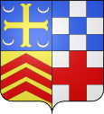
Ault (Somme)
| Ault | ||
|---|---|---|

|
|
|
| region | Hauts-de-France | |
| Department | Somme | |
| Arrondissement | Abbeville | |
| Canton | Friville escarbotin | |
| Community association | Villes Sœurs | |
| Coordinates | 50 ° 6 ′ N , 1 ° 27 ′ E | |
| height | 0-107 m | |
| surface | 5.99 km 2 | |
| Residents | 1,464 (January 1, 2017) | |
| Population density | 244 inhabitants / km 2 | |
| Post Code | 80460 | |
| INSEE code | 80039 | |
| Website | http://www.ault.fr/ | |
 Ault cliff coast |
||
Ault is a French commune with 1,464 inhabitants (at January 1, 2017) in the department of Somme in the region of Hauts-de-France . The Seebad Ault has received the Blue Flag for consistently high water quality. The inhabitants are called Aultois (es) .
geography
Ault is located 28 kilometers west of Abbeville on the English Channel in north-west Picardy, about six kilometers north of the Bresle , which marks the border with the Normandy region .
The community consists of three districts. Bourg is the center, in the south is the hamlet Bois-de-Cise and in the north is Onival . From the Bourg to the mouth of the Seine , the coast is lined with chalk cliffs . On the coast north of the town center there is a spit that runs to the mouth of the Somme .
history
Finds from the Paleolithic Age have been made on the beach at Onival . There are no remains from the Gallo-Roman period , although it is assumed that the place name Ault from the Latin word altus is derived (high, low). Coming from the north, the town center seems to be high above the sea.
In the Middle Ages, the place belonged to the Abbey of Saint-Valery-sur-Somme , which was founded in the 7th century. In the 12th century, the place name appears as Alt , Auth or Aulth in several documents.
Web links
Individual evidence
- ↑ Ault on annuaire-mairie.fr (French) Retrieved November 2, 2009


