
Dörnberg (Lahn)
| coat of arms | Germany map | |
|---|---|---|

|
Coordinates: 50 ° 20 ' N , 7 ° 53' E |
|
| Basic data | ||
| State : | Rhineland-Palatinate | |
| County : | Rhein-Lahn district | |
| Association municipality : | Diez | |
| Height : | 280 m above sea level NHN | |
| Area : | 5.82 km 2 | |
| Residents: | 459 (Dec. 31, 2019) | |
| Population density : | 79 inhabitants per km 2 | |
| Postal code : | 56379 | |
| Area code : | 06439 | |
| License plate : | EMS, DIZ, GOH | |
| Community key : | 07 1 41 030 | |
| Community structure: | 3 districts | |
| Association administration address: | Louise-Seher-Strasse 1 65582 Diez |
|
| Website : | ||
| Local Mayor : | Heiko Hoffmann | |
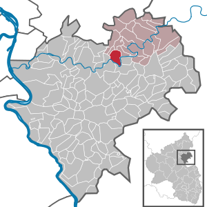
| Location of the local community Dörnberg in the Rhein-Lahn district | ||
  |
||

Dörnberg an der Lahn is a municipality in the Rhein-Lahn district in Rhineland-Palatinate . It belongs to the community of Diez .
geography
The local community Dörnberg consists of the districts Dörnberg, Dörnberg-Hütte and Kalkofen an der Lahn.
The Bergerhof, Birkenhof, Schleuse, Zechenhof and Jagdhaus residential areas also belong to Dörnberg .
history
Dörnberg's origins cannot be precisely dated. The first documentary mention as Durinberg goes back to the year 1360. In the following centuries the spelling of the name changed several times from Durrenberg in 1472 to Durrnberg in 1563 to Dürrnberg in 1607 and Dörrnberg in 1790. The current spelling can be found for the first time in 1818.
During the Thirty Years War in 1634, Dörnberg was destroyed by Spanish troops. From 1806 the place was part of the Duchy of Nassau , which was annexed by Prussia in 1866 . Since 1946 the place has been part of the state of Rhineland-Palatinate .
The first elementary school was established in 1743. In 1903 a new school building was built.
Between 1751 and 1952 , silver , lead and zinc were mined in the Holzappel mine , which is located in the area of the Dörnberg municipality . At this time, alongside agriculture, it was the most important source of income in Dörnberg and the surrounding area.
The population developed as follows in the 19th and 20th centuries: 1843: 335 inhabitants, 1927: 514 inhabitants, 1964: 626 inhabitants.
Dörnberg Hut
As a result of mining in the Holzappel pit, the Dörnberg-Hütte district was created in the 18th century. A hospital was set up in Dörnberg-Hütte in 1892. The village had its own school between 1908 and 1968, the "Hut School".
religion
Dörnberg is assigned to the Roman Catholic parish St. Bonifatius in Holzappel and belongs with it to the pastoral area Diez , which in turn is incorporated into the Limburg district in the Limburg diocese .
The Protestant church Dornberg is the deanery Diez provost South Nassau in the Evangelical Church in Hessen and Nassau (EKHN) belong. It has existed since 1649. In 1766, the Protestant parish of Charlottenberg was incorporated.
politics
Municipal council
The municipal council in Dörnberg consists of eight council members, who were elected in the local elections on May 26, 2019 in a majority vote, and the honorary local mayor as chairman. Until 2009 the council had twelve council members.
mayor
Heiko Hoffmann is the local mayor of Dörnberg. In the direct election on May 26, 2019, he was elected with 66.80% of the vote and is the successor to Norbert Menche, who was involved in local politics for over 30 years.
Culture and sights
theatre
The volxtheater is a member of the state association of independent professional theaters in Rhineland-Palatinate and operates a theater in a dance hall from the 1920s. The village has gained national fame through the “Dörnberger Festival”. In the volxtheater in cooperation with LandSchetztKultur e. V. instead. In addition to the festival production, the “Dörnberger Festival” also includes other theater guest performances, concerts and readings from the end of August to the beginning of October.
Buildings
The Dörnberger Church was built between 1739 and 1741. It replaced an older chapel, which was first mentioned in 1544 and belonged to the parish in Esten (today Holzappel ). In 1862 the church received a new organ with eleven registers , which was built by the organ builder Johann Daniel Buderus. This organ was destroyed by a lightning strike in 1911.
See also: List of cultural monuments in Dörnberg
traffic
The municipality of Dörnberg is on the B 417 , which leads through the districts of Hütte and Kalkofen. Dörnberg itself is connected to the regional road network with Kreisstraße 22.
The closest long-distance train stations are Montabaur train station and Limburg Süd train station .
Personalities
Born in Dörnberg
- Karl Veidt (1879–1946), theologian (Confessing Church) and politician (DNVP, CSVD), MdR, MdL (Prussia)
Connected with Dörnberg
- Jutta Reiss , (* 1963), visual artist, lives in Dörnberg
Web links
- Internet presence of the local community Dörnberg
- Local municipality Dörnberg on the website of the Verbandsgemeinde Diez
- Short portrait of Dörnberg on SWR television
Individual evidence
- ↑ State Statistical Office of Rhineland-Palatinate - population status 2019, districts, communities, association communities ( help on this ).
- ↑ State Statistical Office Rhineland-Palatinate (ed.): Official directory of the municipalities and parts of the municipality. Status: January 2018 [ Version 2020 is available. ] . S. 41 (PDF; 2.2 MB).
- ^ The Regional Returning Officer Rhineland-Palatinate: Local elections 2019, city and municipal council elections
- ^ The State Returning Officer Rhineland-Palatinate: direct elections 2019. see Diez, Verbandsgemeinde, seventh line of results. Retrieved November 9, 2019 .
- ^ Willi Schmiedel: Farewell in Dörnberg: Thanks to people for many years of service. November 5, 2019, accessed November 9, 2019 .

Altendiez | Aull | Balduinstein | Birlenbach | Charlottenberg | Cramberg | Diez | Dörnberg | Eppenrod | Geilnau | Gückingen | Hambach | Heistenbach | Hirschberg | Holzappel | Holzheim | Horhausen | Isselbach | Langenscheid | Laurenburg | Scheidt | Steinsberg | Wasenbach

Allendorf | Altendiez | Arzbach | Attenhausen | Auel | Aull | Bad Ems | Balduinstein | Becheln | Mountain | Berghausen | Berndroth | Bettendorf | Biebrich | Birlenbach | Bogel | Bornich | Braubach | Bremberg | Book | Burgschwalbach | Charlottenberg | Cramberg | Dachsenhausen | Dahlheim | Dausenau | Dessighofen | Dienethal | Diethardt | Diez | Dörnberg | Dornholzhausen | Dörscheid | Dörsdorf | Ebertshausen | Honor | Eisighofen | Endlichhofen | Eppenrod | Ergeshausen | Eschbach | Fachbach | Filsen | Flat | Fruit | Geilnau | Geisig | Gemmerich | Gückingen | Gutenacker | Hahnstätten | Hainau | Hambach | Heistenbach | Herald | Himmighofen | Hirschberg | Holzappel | Holzhausen an der Haide | Holzheim | Hömberg | Horhausen | Hunzel | Isselbach | Kaltenholzhausen | Kamp-Bornhofen | Kasdorf | Katzenelnbogen | Kaub | Kehlbach | Kemmenau | Kestert | Klingelbach | Kördorf | Lahnstein | Langenscheid | Laurenburg | Lautert | Liiffer | Lipporn | Lohrheim | Lollschied | Lykershausen | Marienfels | Miehlen | Mielle | Misselberg | Mittelfischbach | Mudershausen | Nassau | Nasta | Netzbach | Niederbachheim | Niederneisen | Niedertiefenbach | Niederwallmenach | Never | Nochern | Oberbachheim | Oberfischbach | Oberneisen | Obernhof | Obertiefenbach | Oberwallmenach | Oberwies | Oelsberg | Osterspai | Patersberg | Pohl | Prath | Reckenroth | Reichenberg | Reitzenhain | Rescue Grove | Rescues | Roth | Ruppertshofen | Sankt Goarshausen | Sauerthal | Scheidt | Schiesheim | Schönborn | Schweighausen | Seelbach | Singhofen | Steinsberg | Strüth | Sulzbach | Wasenbach | Weidenbach | Weinähr | Weisel | World destruction | Weyer | Winches | Winter advertising | Room difference