Montperreux
| Montperreux | ||
|---|---|---|

|
|
|
| region | Bourgogne-Franche-Comté | |
| Department | Doubs | |
| Arrondissement | Pontarlier | |
| Canton | Frasne | |
| Community association | Lacs et Montagnes du Haut-Doubs | |
| Coordinates | 46 ° 50 ′ N , 6 ° 21 ′ E | |
| height | 848-1,112 m | |
| surface | 11.61 km 2 | |
| Residents | 840 (January 1, 2017) | |
| Population density | 72 inhabitants / km 2 | |
| Post Code | 25160 | |
| INSEE code | 25405 | |
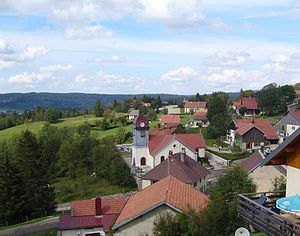
 View of Montperreux |
||
Montperreux is a French municipality with 840 inhabitants (as of January 1 2017) in Doubs in the region Bourgogne Franche-Comté .
geography
Montperreux is located at 1000 m above sea level, about nine kilometers south of the city of Pontarlier (as the crow flies). The village extends in the Jura , in the Haut-Doubs, on a leveled area in a panoramic position around 150 m above the east bank of the Lac de Saint-Point , on the slope of the ridge of Montperreux.
The area of the 11.61 km² large municipality covers a section of the French Jura. The western border runs along the mostly relatively flat bank of Lac de Saint-Point and extends from the alluvial cone of the stream with the Source Bleue, which rises slightly into the lake, to almost the outflow of the Doubs . From the lakeshore, the community area extends eastward over the terraces of Chaudron and Montperreux to the adjacent, predominantly wooded, partly also with pastureland anticline of Montperreux. The highest point in Montperreux is reached at 1112 m on the Montezan . The eastern boundary forms the narrow valley of the Fontaine Ronde (La Combe), which follows an important fault line across the Jura.
In addition to the actual village, Montperreux also includes several hamlets and individual farms, including:
- Chaon ( 885 m ) on the slope northeast of Lac de Saint-Point
- Chaudron ( 897 m ) on a terrace above the east bank of Lac de Saint-Point
Neighboring municipalities of Montperreux are Oye-et-Pallet in the north, La Cluse-et-Mijoux and Les Hôpitaux-Vieux in the east, Touillon-et-Loutelet and Malbuisson in the south and Saint-Point-Lac and Les Grangettes in the west.
history
In the Middle Ages, Montperreux belonged to the rulership of Pontarlier. Together with Franche-Comté , the village came to France with the Peace of Nijmegen in 1678. A change of territory took place in 1856, when the main part of the communal land of Chaudron was assigned to the commune of Montperreux. With the opening of the tram, which ran from Pontarlier via Mouthe to Foncine-le-Haut , Montperreux was connected to public transport in 1900. The line ceased operations after the Second World War . Today Montperreux is a member of the Lacs et Montagnes du Haut-Doubs municipal association .
Attractions
The village church was built in the middle of the 18th century. A chapel from the 15th century is on the northern outskirts. Natural attractions include the Lac de Saint-Point, the Source Bleue and Fontaine Ronde springs. The latter is located in the Combe of the same name on the eastern edge of the municipal area.
population
| Population development | |
|---|---|
| year | Residents |
| 1962 | 192 |
| 1968 | 201 |
| 1975 | 215 |
| 1982 | 251 |
| 1990 | 422 |
| 1999 | 605 |
| 2006 | 747 |
| 2016 | 847 |
With 840 inhabitants (January 1, 2017), Montperreux is one of the small communities in the Doubs department. After the population had decreased significantly in the first half of the 20th century (404 people were still counted in 1896), a marked increase in population has been recorded again since the early 1970s thanks to the attractive residential area. Since then, the number of inhabitants has almost quadrupled.
Economy and Infrastructure
For a long time, Montperreux was predominantly a village characterized by agriculture, especially dairy farming and cattle breeding, as well as forestry. In addition, there are now some local small businesses. In the meantime, the village has also turned into a residential community. Many workers are commuters who work in the larger towns in the area.
As a resort in a popular excursion area in the High Jura, Montperreux today also benefits from tourism. The municipality is geared towards both summer tourism (water sports, fishing, hiking, cycling) and winter tourism (especially cross-country skiing).
The village is very well developed in terms of traffic. It is located above the D437, which leads from Pontarlier to Mouthe . Another road connection exists with the main road N57 in the Combe de la Fontaine Ronde.
literature
- Le Patrimoine des Communes du Doubs. Volume 2, Flohic Editions, Paris 2001, ISBN 2-84234-087-6 , pp. 979-981.

