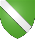
Boujailles
| Boujailles | ||
|---|---|---|

|
|
|
| region | Bourgogne-Franche-Comté | |
| Department | Doubs | |
| Arrondissement | Pontarlier | |
| Canton | Frasne | |
| Community association | Plateau de Frasne et du Val du Drugeon | |
| Coordinates | 46 ° 53 ' N , 6 ° 5' E | |
| height | 780-901 m | |
| surface | 28.22 km 2 | |
| Residents | 428 (January 1, 2017) | |
| Population density | 15 inhabitants / km 2 | |
| Post Code | 25560 | |
| INSEE code | 25079 | |
Boujailles is a French municipality with 428 inhabitants (as of January 1 2017) in Doubs in the region Bourgogne Franche-Comté .
geography
Boujailles is 810 m above sea level, about 21 kilometers west of the city of Pontarlier (as the crow flies). The former street-line village extends in the Jura , on the western edge of the wide high plateau of Arlier (Pontarlier-Frasne).
The area of the 28.22 km² large municipality covers a section of the French Jura. The whole area is occupied by the high plateau of Arlier, which is on average at 820 m. It is mainly covered by meadow land, but also shows some forest areas, especially in the peripheral areas. Two small brooks arise near Boujailles, after a short time flow together in a boggy depression and disappear into a sinkhole . Otherwise, the plateau has no surface watercourses because the rainwater seeps into the karstified subsoil. The area is limited in the northwest by the elongated ridges of the Forêt du Scay (up to 890 m) and the Forêt du Maublin (at 902 m the highest elevation in Boujailles), which lead to lower plateaus. In the east, the community area extends to the forest crest of the Bois des Auges ( 865 m ). To the south, the municipality extends into the forest of the Bois de Lézinnes , which is part of the large wooded area of the Forêt de la Joux .
Neighboring municipalities of Boujailles are Villers-sous-Chalamont and Levier in the north, Chapelle-d'Huin , Dompierre-les-Tilleuls and Frasne in the east, Courvières , Cuvier and Esserval-Tartre in the south and Supt and Lemuy in the west.
history
The municipality of Boujailles was probably already settled during Roman times. It was on the trade route that led from Pontarlier to Salins , and of which individual traces are still visible at the transition to the forest area of the Forêt du Scay . Since 2003 Boujailles has been a member of the communal association Communauté de communes du Plateau de Frasne et du Val du Drugeon, which comprises 10 localities .
Attractions
An outstanding building by Boujailles is the twin-towered parish church of Saint-Maurice , which was built from 1845 to 1849 in the neo-Gothic style based on medieval church buildings. The Notre-Dame des Champs field chapel was built in 1707. Boujailles is located directly on the old salt road that led from the French coast on the Mediterranean via Switzerland and Austria to Italy. Parts of the road and ruins of watchtowers in the limestone can still be seen there today.
population
| Population development | |
|---|---|
| year | Residents |
| 1962 | 473 |
| 1968 | 431 |
| 1975 | 368 |
| 1982 | 413 |
| 1990 | 354 |
| 1999 | 371 |
| 2006 | 415 |
| 2016 | 422 |
With 428 inhabitants (January 1, 2017) Boujailles is one of the small communities in the Doubs department. After the population had decreased markedly in the first half of the 20th century (795 people were still counted in 1881), only relatively small fluctuations have been recorded since the early 1970s.
Economy and Infrastructure
Until well into the 20th century, Boujailles was primarily a village characterized by agriculture, in particular dairy and cattle breeding, as well as forestry. In addition, there are now a few local small businesses, including a sawmill. In the meantime, the village has also turned into a residential community. Many workers are commuters who work in the larger towns in the area.
The village is located off the main thoroughfares on a departmental road that leads from Levier to Censeau . There are other road connections with Villers-sous-Chalamont, Frasne and Chapelle-d'Huin.

