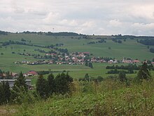
Saint-Antoine (Doubs)
| Saint-Antoine | ||
|---|---|---|
|
|
||
| region | Bourgogne-Franche-Comté | |
| Department | Doubs | |
| Arrondissement | Pontarlier | |
| Canton | Frasne | |
| Community association | Lacs et Montagnes du Haut-Doubs | |
| Coordinates | 46 ° 47 ' N , 6 ° 20' E | |
| height | 920-1,101 m | |
| surface | 4.51 km 2 | |
| Residents | 339 (January 1, 2017) | |
| Population density | 75 inhabitants / km 2 | |
| Post Code | 25370 | |
| INSEE code | 25514 | |
 Mairie Saint-Antoine |
||
Saint-Antoine is a French municipality with 339 inhabitants (as of January 1 2017) in Doubs in the region Bourgogne Franche-Comté .
geography
Saint-Antoine is located at 958 m above sea level, about 14 kilometers south of the city of Pontarlier (as the crow flies). The village extends in the Jura , in a basin in the eastern part of the longitudinal basin of the Haut-Doubs, at the northern foot of the Morond , near the border with Switzerland .
The area of the municipality of 4.51 km² covers a section of the French Jura. The southern border runs along the Rouge Bief , which meanders through a wide valley and drains the area to the southwest to the Doubs . In the Saint-Antoine basin, it picks up the Bief Bleu from the north . From the Rouge Bief, the municipal area extends northward into the basin of Saint-Antoine and over the adjacent slope to the partly wooded, partly pastureland elevation of Fort de Saint-Antoine, at which the highest point of Saint-Antoine reaches 1104 m becomes. This ridge separates the basin from the Lac de Saint-Point to the north .
Neighboring municipalities of Saint-Antoine are Malbuisson in the north, Touillon-et-Loutelet in the east, Métabief , Longevilles-Mont-d'Or and Fourcatier-et-Maison-Neuve in the south and Labergement-Sainte-Marie in the west.
history
The area of Saint-Antoine was cleared and made arable in the 12th century by the monks of the monastery of Mont-Sainte-Marie. A chapel dedicated to St. Anthony is first mentioned in 1309; the village was then still called Rougebief . Since the Middle Ages, Saint-Antoine has belonged to the monastic rule of Mont-Sainte-Marie. Together with Franche-Comté , the village came to France with the Peace of Nijmegen in 1678. Today Saint-Antoine is a member of the Lacs et Montagnes du Haut-Doubs municipal association .
Attractions
The parish church of Saint-Antoine was built in the mid-16th century in Gothic styles. The three-aisled church with a rectangular choir has an important wooden altarpiece with richly carved sculptures. At the height north of the village is the Fort Lucotte (also called Fort de Saint-Antoine), which was built from 1879 to 1882 and is now used as a storage facility for the ripening of cheese wheels.
population
| Population development | |
|---|---|
| year | Residents |
| 1962 | 173 |
| 1968 | 154 |
| 1975 | 160 |
| 1982 | 197 |
| 1990 | 243 |
| 1999 | 276 |
| 2006 | 278 |
| 2016 | 339 |
With 339 inhabitants (January 1, 2017), Saint-Antoine is one of the small communes of the Doubs department. After the population had decreased markedly in the first half of the 20th century (355 people were still counted in 1881), there has been significant population growth again since the beginning of the 1970s.
Economy and Infrastructure
For a long time, Saint-Antoine was a village dominated by agriculture, especially dairy farming and cattle breeding. In addition, there are now some local small businesses, including a cheese dairy, a sawmill and some retail shops. In the meantime, the village has also turned into a residential community. Many people in employment are commuters who work in the larger towns in the area and as cross-border commuters in Switzerland.
Saint-Antoine has also benefited from tourism since the 1960s, when the area around Morond and Mont d'Or was developed into an important winter sports area in the French Jura.
The village is very well developed in terms of traffic. It is located at the intersection of the roads that lead from Pontarlier to Rochejean and from Les Hôpitaux-Neufs to Labergement-Sainte-Marie. Another road connection is with Métabief.
literature
- Le Patrimoine des Communes du Doubs. Volume 2, Flohic Editions, Paris 2001, ISBN 2-84234-087-6 , pp. 826-827.


