
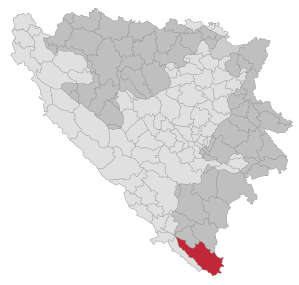
Trebinje
|
Trebinje Требиње |
|||
|
|
|||
|
|||
| Basic data | |||
|---|---|---|---|
| State : | Bosnia and Herzegovina | ||
| Entity : | Republika Srpska | ||
| Coordinates : | 42 ° 43 ′ N , 18 ° 19 ′ E | ||
| Height : | 274 m. i. J. | ||
| Area : | 904 km² | ||
| Residents : | 28,334 (2018) | ||
| Population density : | 31 inhabitants per km² | ||
| Postal code : | 89101 | ||
| Structure and administration (as of 2016) | |||
| Mayor : | Luka Petrović ( SNSD ) | ||
| Website : | |||
  |
|||


Trebinje ( Serbian - Cyrillic Требиње , German earlier Trebing ) is a city in the southeastern corner of Bosnia and Herzegovina near the border with Montenegro and Croatia . It belongs to the Republika Srpska and is located in the historical region of Herzegovina on the Trebišnjica river about 25 km from the Adriatic Sea , which makes it an outpost to the Adriatic Sea. It is the second largest city in the region after Mostar .
geography

The sub-Adriatic city is located in the southeastern Lower Herzegovina in the historic Travunja region on the Trebišnjica . Before the karst hydrological regulation started in the 1960s by the project "Upper Horizons" ( Gornji horizonti , reservoir of Bileća, reservoir of Trebišnjica, underground aqueduct into the Ombla near Dubrovnik, regulation of the upper Herzegovinian poljen) in the most important karst hydrological node of the Dinarides, its The end point is in Popovo polje , which was therefore formerly flooded for up to 300 days a year, the city has only been able to develop in the extreme and highest southeastern area of the Polje . Here at the exit of the 98 km longest Dinaric karst river (in its function as Ponornica - a karst river that disappears underground in a ponor without an above-ground drain), from a canyon-like breakthrough valley through the Banjani into the Popovo polje, the city leans against the southern slopes of the 1227 m high leotar. The official height of the city is given as 274 m. In the north, the high plateau of the upper Herzegovina Banjani extends to the place, to Popovo Polje the 400 m high karst cone Hum, namesake of all geomorphological forms of the Hums , closes off against the Polje. The lower Herzegovina is because of this island-like karst cones with mogotes are related and karst towers tropical or randtropischer climates, Humine . In the southeast the high mountain plateau of the Bijela gora towers over the lower highlands of the Banjani. The most important eastern cross-connection between Herzegovina and today's southwestern Montenegro (formerly Old Herzegovina) stretches from the Bijela gora in the Lastva Valley. According to Herceg Novi , the tectonic rift of Grab, one of the most noticeable neotectonic fault lines in the earthquake-prone region (1666 and 1979 earthquakes of magnitude IX and X Mercalli struck the region) connects the region.
climate
Comparative values for the Trebinjes climate are given in the tables for the neighboring coastal town of Dubrovnik. Trebinje is located in a place with very high amounts of precipitation and a sub-Mediterranean climate. Because of the altitude and the neighboring highlands, the winters are much colder than on the coast. Therefore, summer green plants of oak forests and summer green Šibljak bush formations are characteristic of Trebinje , even if numerous Mediterranean elements move in here.
| station | period | Height [m] | I. | II | III | IV | V | VI | VII | VIII | IX | X | XI | XII | I-XII [mm / m²a] |
|---|---|---|---|---|---|---|---|---|---|---|---|---|---|---|---|
| Dubrovnik | 1931-1960 | 49 | 147 | 113 | 102 | 92 | 79 | 60 | 24 | 38 | 97 | 156 | 213 | 186 | 1307 |
| Trebinje | 1931-1960 | 276 | 193 | 190 | 160 | 102 | 119 | 70 | 43 | 76 | 110 | 239 | 247 | 249 | 1762 |
* Average monthly and annual rainfall [mm] in the neighboring towns of Dubrovnik (Croatia) and Trebinje (Bosnia)
| station | period | Height [m] | I. | II | III | IV | V | VI | VII | VIII | IX | X | XI | XII | I-XII [° C] |
|---|---|---|---|---|---|---|---|---|---|---|---|---|---|---|---|
| Dubrovnik | 1931-1960 | 49 | 8.6 | 9.3 | 10.6 | 13.9 | 18.1 | 22.0 | 24.6 | 24.5 | 21.5 | 17.4 | 13.5 | 10.4 | 16.2 |
| Trebinje | 1925-1940 | 274 | 5.2 | 5.5 | 8.0 | 11.8 | 16 | 20.8 | 23.5 | 23.2 | 19.2 | 14.3 | 10.5 | 5.9 | 14.4 |
* Average monthly and annual temperatures [° C] in the neighboring towns of Dubrovnik (Croatia) and Trebinje (Bosnia)
population
At the 1991 census, there were 30,372 people in the Trebinje municipality, including 21,387 Serbs (69.2%), 5,542 Bosniaks (17.9%), 1,625 Yugoslavs (5.3%), 1,226 Croatians (3.9%) and 1,099 other nationalities (3.7%). As a result of the Bosnian War , the population structure changed significantly on the one hand through the expulsion of Bosniak and Croatian residents and on the other hand through the admission of Serbian war refugees from other parts of Bosnia. The municipality of Trebinje now (as of 2013) has around 31,000 inhabitants. These are almost exclusively Serbs.
history


At the time of the Roman Empire , the Illyrian tribe of the "Derbani" lived in the area around Trebinje . The whole area was probably named Tervunia after the Derbani .
middle Ages
In the 10th century, the Byzantine emperor and historian Constantine VII also described the area of today's Herzegovina in De Administrando Imperio . In the east of Herzegovina he calls the duchy " Travunia ", which also included parts of what is now northern Montenegro , and the capital Tervunia, today's Trebinje. The Duchy of Travunia has belonged to Serbia since the 9th century . Important Serbian ruling dynasties came from Travunia, such as the Vojisavljević , founder of the first Serbian kingdom, or the Mrnjavčević , co-regents of the last Serbian tsar Stefan Uroš V.
With the collapse of the Serbian Empire , Prince Nikola Altomanović established himself in Travunia , who claimed the Serbian tsar's crown for himself. Nikola Altomanović conquered large areas in western central Serbia before he was defeated in 1373 by a joint action of the Bosnian prince and later king Tvrtko I and the Serbian prince Lazar and his territory was divided between the victors. Travunia together with the city of Trebinje fell to Bosnia . In the 15th century, the voivode Stefan Vukčić Kosača and his descendants ruled what is now Herzegovina and northern Montenegro until the Ottoman conquest . Stefan Vukčić Kosača founded his capital in Mostar , but Trebinje nonetheless remained an important post on the trade route from Dubrovnik to the interior of Bosnia and Serbia . The Serbian Orthodox Monastery Tvrdoš, which became the seat of the Serbian Orthodox Bishop for Herzegovina, also came from this time .
The Roman Catholic Bishop of Dubrovnik resided in Trebinje for a while .
Modern times

The Ottomans ruled Trebinje from 1470 to 1878 . The city belonged to the Sanjak Herzegovina ( Turkish Hersek ) with the capital Mostar within the Paschaluk Bosnia. The Ottomans and the resulbegović (formerly Burović) family who converted to Islam have had the greatest impact on the image of the old town of Trebinje. A mosque and the 80 m long white bridge over the Trebišnjica from the 16th century, renamed Arslanagić Bridge a century later, date from this period .
In 1878, after the Russo-Turkish and Serbian-Turkish wars of 1876–1878, Bosnia-Herzegovina came under the administration of Austria-Hungary , which was officially annexed in 1908.
After the end of the First World War , Bosnia-Herzegovina and with it Trebinje became part of the Kingdom of Yugoslavia in 1918 . In 1917 a memorial for Franz Ferdinand and Sophie was erected at the scene of the attack in Sarajevo, but it disappeared in a museum immediately after the First World War. Today part of the monument is in Trebinje, the other part in Sarajevo.
Second World War
During the Second World War , Trebinje was part of the fascist Independent State of Croatia between 1941 and 1945 . In May 1941, right-wing Ustasha militias invaded the city, destroyed two Serbian monuments and removed Cyrillic inscriptions from official buildings. On May 31, between 120 and 270 Serbian men were killed in a massacre near Trebinje. On June 1st, nine men were murdered in Trebinje. In the same month, numerous other civilians in the region were abducted by the Ustaša to the nearby Karst region and murdered, for example up to 133 prisoners in the Serbian village of Korita outside of Gacko .
Bosnian War

The disintegration of Yugoslavia in 1991/1992 also reached Bosnia-Herzegovina, where a war broke out between Bosniaks, Croats and Serbs. This led to a de facto division of Herzegovina into a Croatian and a Serbian dominated part. Trebinje itself became the de facto capital of the Serbian part of Herzegovina, the proclaimed Srpska autonomna oblast (SAO) Hercegovina (Serbian Autonomous Region of Herzegovina), also SAO Istočna Hercegovina (Serbian Autonomous Region of Eastern Herzegovina). This area was integrated into the Republika Srpska after the end of the war.
In October 1991, JNA units in Trebinje started a looting campaign against Croatians and Bosniaks living there. Serbs from Mostar fled to Trebinje in May 1992. At the beginning of August, the Croatian Defense Forces (HOS) under their leader Blaž Kraljević initially conquered Trebinje, but left the city a few days later after Kraljević was murdered. An agreement between the Croatian and Serbian leadership about the division of Herzegovina is assumed to be the background. Several thousand Bosniaks and, to a lesser extent, Croats fled the city or were expelled. Ten mosques were destroyed. In return, more Serbian displaced persons or refugees from other parts of the country settled in Trebinje.
After the war, the reconstruction of the Osman-pašina Mosque was initially prevented in 2001 by Serbian protests. The Resulbegović mosque, however, was able to be reconstructed. In 2005 the Osman Pašina Mosque was also reopened.
Based on events in Trebinje during the war, the film Circles (original title: Krugovi ) was produced.
Attractions
- Tvrdoš Serbian Orthodox Monastery (15th century)
- The Perović Bridge (formerly Arslanagić Bridge) (16th century)
- The Serbian Orthodox Hercegovačka Gračanica Monastery with a striking Church of Our Lady, a foundation by Jovan Dučić
- The clock tower (Sahat Kula) on the bank of the Trebišnjica
- The reconstructed Resulbegović Mosque
- The Museum of Herzegovina in Trebinje
sons and daughters of the town
- Alojzije Mišić (1859–1942), bishop of the Roman Catholic diocese of Mostar-Duvno
- Jovan Dučić (1871–1943), writer
- Otto Günther (1884–1970), Austrian diplomat
- Muradif Ćerimagić (* 1949), painter
- Vladimir Gudelj (* 1966), football player
- Nebojša Gudelj (* 1968), football player
- Nebojša Glogovac (born 1969), actor
- Nataša Ninković (* 1972), actress
- Vladimir Radmanović (* 1980), basketball player
- Asmir Begović (* 1987), football player
- Milena Nikolić (* 1992), soccer player
- Mijat Gaćinović (* 1995), football player
- Tijana Bošković (* 1997), volleyball player
Individual evidence
- ↑ http://rzs.rs.ba/front/article/3630/ Updated population figures for 2018 from the Institute for Statistics of the Republika Srpska. Retrieved June 9, 2019.
- ↑ Slobodna Evropa Bosna i Hercegovina "Gornji horizonti" i dolina Neretve: Ima li cijenu prirodno bogatstvo (online: slobodnaevropa.org)
- ↑ Reference data of the Hidrometeorološki Savez Jugoslavije: MAKJANIĆ, B. 1990: Klima Jugoslavije. In: Sirotkovic, J. (edt.): Enciklopedija Jugoslavije 6: 178-189, Jugoslav. Leksikogr. Zavod Miroslav Krleza, Zagreb.
- ↑ Reference data of the Hidrometeorološki Savez Jugoslavije: MAKJANIĆ, B. 1990: Klima Jugoslavije. In: Sirotkovic, J. (edt.): Encikolpedija Jugoslavije 6: 178-189, Jugoslav. Leksikogr. Zavod Miroslav Krleza, Zagreb.
- ↑ http://www.bhas.ba/obavjestenja/Preliminarni_rezultati_bos.pdf
- ↑ http://derstandard.at/1385169341791/Das-Antlitz-von-Franz-Ferdinand-oder-Gavrilos-Fuesse
- ↑ Alexander Korb: In the shadow of the world war. Mass violence of the Ustaša against Serbs, Jews and Roma in Croatia, 1941-45 . Dissertation 2010, p. 220
- ↑ David M. Crowe: Crimes of State Past and Present: Government-Sponsored Atrocities and International Legal Responses , 2013, p. 65. online
- ↑ Alexander Korb: In the shadow of the world war. Mass violence of the Ustaša against Serbs, Jews and Roma in Croatia, 1941-45 . Dissertation 2010, p. 221f.
- ↑ Hajo Funke, Alexander Rhoter: Under Our Eyes: Ethnic Purity: The Policy of the Milosevic Regime and the Role of the West. Verlag Hans Schiler, 1999. ISBN 9783860932193 p. 109
- ↑ http://www.diss.fu-berlin.de/diss/servlets/MCRFileNodeServlet/FUDISS_derivate_000000001228/4_4_Mostar.pdf Kristóf Gosztonyi: Negotiating in Humanitarian Interventions. The Case of the International Intervention into the War in Bosnia-Hercegovina . Dissertation, Berlin 2002, p. 131
- ↑ http://www.nytimes.com/1993/02/07/world/serbs-expel-4000-from-bosnian-town.html
- ↑ l page 156
- ↑ DerStandard.at - "Serbs prevent rebuilding of a mosque in Bosnia"
- ↑ http://www.hercegovinapromo.com/osman-pasina-dzamija/
- ↑ http://barnsteiner-film.org/wp-content/uploads/CIRCLES_EPD-Film.pdf
Web links

Banja Luka | Banovići | Berkovići | Bihać | Bijeljina | Bileća | Bos. Krupa | Bos. Brod | Bos. Petrovac | Šamac | Bos. Grahovo | Bratunac | Brčko | Breza | Bugojno | Busovača | Bužim | Cazin | Centar | Čajniče | Čapljina | Čelić | Čelinac | Čitluk | Derventa | Drvar | Doboj | Doboj Istok | Doboj Jug | Dobretići | Domaljevac-Šamac | Donji Vakuf | Donji Žabar | Foča | Foča-Ustikolina | Fojnica | Gacko | Glamoč | Goražde | Gornji Vakuf-Uskoplje | Gračanica | Gradačac | Gradiška | Grude | Hadžići | Han Pijesak | Ilidža | Ilijaš | Istočna Ilidža | Istočni Drvar | Istočni Mostar | Istočni Stari Grad | Istočno Novo Sarajevo | Jablanica | Jajce | Jezero | Kakanj | Kalesija | Kalinovik | Kiseljak | Kladanj | Ključ | Kneževo | Konjic | Kostajnica | Kotor Varoš | Kozarska Dubica | Kreševo | Krupa na Uni | Kupres | Kupres (RS) | Laktaši | Livno | Ljubinje | Ljubuški | Lopare | Lukavac | Maglaj | Milići | Modriča | Mostar | Mrkonjić degree | Neum | Nevesinje | Novi Grad | Novi Grad (Bos. Novi) | Novi Travnik | Novo Sarajevo | Odžak | Olovo | Orašje | Osmaci | Oštra Luka | Pale | Pale-Prača | Pelagićevo | Petrovac | Petrovo | Posušje | Prijedor | Prnjavor | Prozor-Rama | Ravno | Ribnik | Rogatica | Rudo | Sanski Most | Sapna | Sokolac | Srbac | Srebrenica | Srebrenik | Stari Grad | Stanari | Stolac | Šekovići | Šipovo | Široki Brijeg | Teočak | Teslić | Tešanj | Tomislavgrad | Travnik | Trebinje | Trnovo (RS) | Trnovo (FBiH) | Tuzla | Ugljevik | Usora | Ustiprača | Vareš | Velika Kladuša | Visoko | Višegrad | Vitez | Vlasenica | Vogošća | Vukosavlje | Zavidovići | Zenica | Zvornik | Žepče | Živinice