
Bechhofen (Middle Franconia)
| coat of arms | Germany map | |
|---|---|---|
.svg)
|
Coordinates: 49 ° 10 ' N , 10 ° 33' E |
|
| Basic data | ||
| State : | Bavaria | |
| Administrative region : | Middle Franconia | |
| County : | Ansbach | |
| Height : | 431 m above sea level NHN | |
| Area : | 61.86 km 2 | |
| Residents: | 6005 (Dec. 31, 2019) | |
| Population density : | 97 inhabitants per km 2 | |
| Postal code : | 91572 | |
| Area code : | 09822 | |
| License plate : | AN , DKB, FEU, ROT | |
| Community key : | 09 5 71 115 | |
| Market structure: | 28 parts of the community | |
Market administration address : |
Martin-Luther-Platz 1 91572 Bechhofen |
|
| Website : | ||
| First Mayor : | Helmut Schnotz ( UWG ) | |
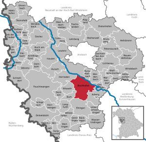
| Location of the Bechhofen market in the Ansbach district | ||
  |
||


Bechhofen (also: Bechhofen an der Heide , colloquially: Béchof ) is a market in the district of Ansbach in Middle Franconia ( Bavaria ).
geography
Neighboring communities
Neighboring communities are clockwise starting from the north: Burgoberbach , Weidenbach , Ornbau , Arberg , Ehingen , Burk , Wieseth and Herrieden .
Community structure
There are 28 officially named municipal parts (the type of settlement is given in brackets ):
|
|
|
The Gastenfelden and Rangenmühle residential areas are not officially designated parts of the municipality.
history
In 1311 Bechhofen was first mentioned in a document as "Bechouen an der Wisent". The place name goes back to a Pechsiederei. In 1351, Emperor Karl IV granted Konrad kitchen master von Forndorf the right to judge the market in Bechhofen. The place had market rights since 1434 at the latest and was fortified.
The gentlemen von Nordenberg , von Pappenheim and von Seckendorff were wealthy in the village . The monastery Heilsbronn were subject to 1554 eight estate in Bechhofen. In the same year, seven of these properties were exchanged for the Seckendorffer. In 1643 the manorial claims of the noble families came to the Brandenburg-Ansbach Oberamt Feuchtwangen .
In 1732 there were 60 properties. The village and township government had the Vogt office Bechhofen held. The sole landlord was the Oberamt Feuchtwangen: Waizendorf administration office (grinding and sawmill) and the Bechhofen Vogtamt (1 grinding mill, 1 yard, 1 yard with tabern and baking rights, 1 half yard with baking rights, 5 half yards, 1 estate with bath room, 3 goods with Backrecht, 2 goods with forge, 22 goods, 12 goods owned by Jews, 1 brickworks, 8 Sölden houses, 1 house). There was also a church , 1 castle, 1 school and shepherd's house, 1 Ansbach customs post, 1 Jewish cemetery and 1 imperial post. Towards the end of the Old Kingdom there were 81 properties, all of which were subordinate to the Oberamt Feuchtwangen.
Bechhofen belonged to the principality of Ansbach acquired from Prussia since 1791 . From 1797 to 1808 the place was subordinate to the Justice and Chamber Office Feuchtwangen . As part of the principality, Bechhofen fell to the Kingdom of Bavaria in the Treaty of Paris (February 1806) . With the municipal edict (early 19th century) the tax district Bechhofen was formed, to which Gastenfelden , Rohrbach , Voggendorf , Waizendorf and Wiesethbruck belonged. A little later, the rural community Bechhofen was formed, to which Gastenfelden belonged. It was subject to the Herrieden district court in terms of administration and jurisdiction . The community originally had an area of 3.861 km².
The places in the municipality have been predominantly Evangelical-Lutheran since the Reformation. They are supplied by the parishes of Bechhofen ( St. Johannis with St. Georg (Sachsbach) ), Königshofen ( Marienmünster ) and Thann ( St. Peter ). St. Laurentius (Großenried) has remained Catholic . After the Second World War, numerous Catholics came to Bechhofen through the expellees. This created the parish Herz Jesu (Bechhofen) . The Jewish population is said to have made up almost two-thirds of the total population of the place between 1700 and 1860. The listed synagogue , a so-called barn synagogue with richly painted 17th century paintings by Eliezer Sussmann , was destroyed in the pogrom night of 1938. The Jewish residents emigrated or were deported and killed during the Third Reich .
From 1903 to 1970, Bechhofen was the terminus of the Leutershausen-Wiedersbach-Bechhofen railway , which connected the town with Ansbach and was very important for the transportation of paintbrushes and brushes made there.
Incorporations
During the regional reform on January 1, 1971, the previously independent communities of Liebersdorf and Thann were incorporated. On July 1, 1971, Heinersdorf and Königshofen followed (both in the Dinkelsbühl district at that time ), as well as Großenried, Kaudorf, Mörlach and Sachsbach. On October 1, 1971, a part of the dissolved Wiesethbruck community was added. On January 1, 1974 Waizendorf completed the list of incorporated places.
Population statistics
In the period from 1988 to 2018, the population increased from 5457 to 5960 by 503 inhabitants or 9.2%.
Bechhofen community
| year | 1818 | 1840 | 1852 | 1861 | 1867 | 1871 | 1875 | 1880 | 1885 | 1890 | 1895 | 1900 | 1905 | 1910 | 1919 | 1925 | 1933 | 1939 | 1946 | 1950 | 1961 | 1970 | 1987 | 2005 | 2011 | 2017 |
|---|---|---|---|---|---|---|---|---|---|---|---|---|---|---|---|---|---|---|---|---|---|---|---|---|---|---|
| Residents | 629 | 708 | 699 | 667 | 738 | 731 | 740 | 799 | 806 | 826 | 832 | 949 | 1082 | 1109 | 1075 | 1173 | 1356 | 1379 | 3058 | 2014 | 2271 | 5334 | 5384 | 6176 | 5851 | 5964 |
| Houses | 163 | 127 | 142 | 160 | 168 | 218 | 286 | 416 | 1423 | 1731 | 1798 | |||||||||||||||
| source |
Part of the municipality Bechhofen
| year | 1818 | 1840 | 1861 | 1871 | 1885 | 1900 | 1925 | 1950 | 1961 | 1970 | 1987 | 2017 |
|---|---|---|---|---|---|---|---|---|---|---|---|---|
| Residents | 608 | 678 | 640 | 701 | 773 | 917 | 1143 | 1933 | 2271 | 2540 | 2564 | 2744 |
| Houses | 159 | 123 | 155 | 163 | 213 | 275 | 416 | 678 | ||||
| source |
Denomination statistics
According to the 2011 census , 59.0% of the inhabitants were Protestant , 32.3% Roman Catholic and 8.7% were non-denominational , belonged to another religious community or did not provide any information. The number of Protestants and Catholics has decreased since then. Currently (as of December 31, 2019) Bechhofen has 29.7% Catholics, 53.3% Protestants and the remaining 16.8% either have another religion or no religious affiliation at all.
politics
Market council
The municipal council of Bechhofen has 20 members, plus the full-time mayor (UWG).
| Bechhöfer list | CSU | FW | List south | UWG | Country list | total | |
| 2008 | 4th | 4th | 4th | 2 | 5 | 1 | 20 seats |
| 2014 | 4th | 4th | 2 | 3 | 5 | 2 | 20 seats |
(As of: local elections on March 16, 2014 )
mayor
Mayor Helmut Schnotz has been in office since 2008 and was re-elected with over 87% in the local elections on March 16, 2014. The second mayor is Bernd Kober (Bechhöfer list), who won the drawing of lots against Martin Günther (CSU), who was then elected third mayor.
badges and flags
The coat of arms is first documented as a seal in 1456. The municipality of Bechhofen has had this as its coat of arms since 1933.
|
|
Blazon : " Split of silver and red, in front and in the back two rollers each in staggered colors with stuck-in golden spindles."
Red and white municipal flag |
| Justification for the coat of arms: The spindles stand for the place name and represent baker walkers in the sense of "Beck" equal to "Bäck". But they were also interpreted as walkers, coils, waves or pitch torches. In the Middle Ages there was a bad luck factory here. |
Town twinning
The twin town has been Le Blanc in the central French department of Indre since 1975 .
Culture and sights
Museums
The only German paintbrush and brush museum is worth mentioning. Bechhofen is the center of the German brush industry. The museum has set itself the task of presenting the paintbrush and brush maker craft, which has probably existed since the 18th century, in all its diversity. To this day, some of the brushes are made at home .
The private museum weigh & measure in Königshofen deals extensively with measurements, scales and weights. The subject of weighing and measuring is comprehensively illustrated on over 3000 exhibits.
Architectural monuments

- Castle of Bechhofen
- Heinersdorfer Mühle with historical sawmill in Heinersdorf
- Mill from Wiesethbruck
- Evangelical Lutheran Johannis Church Bechhofen
- Evangelical-Lutheran Katharinenkirche Bechhofen (former castle church)
- Church of St. Georg / St. Veit Sachsbach
- Marienmünster in Königshofen, formerly the monastery church of Königshofen an der Heide monastery
- Church of St. Laurentius in Großenried
- Jewish cemetery in Bechhofen
Sports
- Modern indoor swimming pool
- TSV 1898 Bechhofen (with gymnastics , soccer , volleyball , table tennis , singing , tennis )
- DJK Großenried
- FC Heide Königshofen
- Shooting Club Unity 1922 e. V. Bechhofen
- RV Adler Bechhofen (cycling and tennis)
- MSC Bechhofen (Motorsport)
- 1923 Bechhofen Chess Club
- TV 1990 Lettenmühle
- Rifle club Jägerhöhe Reichenau
- Fishing club Rotauge Bechhofen
traffic
The state road 2210 leads to Königshofen an der Heide or to Fröschau . The state road 2222 via Forndorf after Wieseth . The state road 2221 leads to Großenried or Röttenbach and Dennenlohe to Unterschwaningen . The district road AN 56 leads to taatsstraße 2221 near Großenried. Communal roads lead to Liebersdorf and Waizendorf .
Personalities
- Oskar Vogelhuber (1878–1971), teacher, ministerial official, author and holder of the Bavarian Order of Merit , was born in Bechhofen.
literature
- Working group book of the market Bechhofen (Hrsg.): Bechhofen. 650 years of market law . Bechhofen 2001.
- Johann Kaspar Bundschuh : Bechhofen . In: Geographical Statistical-Topographical Lexicon of Franconia . tape 1 : A-egg . Verlag der Stettinische Buchhandlung, Ulm 1799, DNB 790364298 , OCLC 833753073 , Sp. 315-316 ( digitized version ).
- Johann Bernhard Fischer : Bechhofen . In: Statistical and topographical description of the Burggraftum Nürnberg, below the mountain, or the Principality of Brandenburg-Anspach. Second part. Containing the economic, statistical and moral condition of these countries according to the fifteen upper offices . Benedict Friedrich Haueisen, Ansbach 1790, p. 197 ( digitized version ).
- Georg Paul Hönn : Bechhofen . In: Lexicon Topographicum of the Franconian Craises . Johann Georg Lochner, Frankfurt and Leipzig 1747, p. 316 ( digitized ).
- Georg Muck: History of Heilsbronn Monastery from prehistoric times to modern times . tape 2 . For Kunstreprod. Schmidt, Neustadt an der Aisch 1993, ISBN 3-923006-90-X , p. 497-500 (first edition: Beck, Nördlingen 1879).
- Wolf-Armin von Reitzenstein : Lexicon of Franconian place names. Origin and meaning . Upper Franconia, Middle Franconia, Lower Franconia. CH Beck, Munich 2009, ISBN 978-3-406-59131-0 , p. 35 .
- Hans Karlmann Ramisch: District Feuchtwangen (= Bavarian art monuments . Volume 21 ). Deutscher Kunstverlag, Munich 1964, DNB 453909426 , p. 25-26 .
- Gottfried Stieber: Bechhofen . In: Historical and topographical news from the Principality of Brandenburg-Onolzbach . Johann Jacob Enderes, Schwabach 1761, p. 244-246 ( digitized version ).
Web links
- Homepage
- Bechhofen in the Topographia Franconiae of the University of Würzburg , accessed on September 16, 2019.
- Bechhofen (Middle Franconia): Official statistics of the LfStat
Individual evidence
- ↑ "Data 2" sheet, Statistical Report A1200C 202041 Population of the municipalities, districts and administrative districts 1st quarter 2020 (population based on the 2011 census) ( help ).
- ↑ Our employees. Municipal administration Markt Bechhofen, accessed on May 29, 2020 .
- ^ Elisabeth Fechter: The place names of the district of Ansbach . Inaugural dissertation. Erlangen 1955, DNB 480570132 , p. 46 . In contrast to Bechhofen (Neuendettelsau) , which is colloquially pronounced Bechhûfn ( Pech -hofen ), the original meaning of the place name has been preserved in the dialect ( Pechofen ).
- ^ Bechhofen community in the local database of the Bavarian State Library Online . Bavarian State Library, accessed on September 16, 2019.
- ↑ W.-A. v. Reitzenstein, p. 35.
- ↑ G. Muck, Vol. 2, pp. 499f.
- ↑ After the Vette Rischen description of Oberamt Feuchtwangen from 1732 (see Bechhofen (basic rule) on the website geschichte-feuchtwangen.de).
- ^ Johann Bernhard Fischer : Bechhofen . In: Statistical and topographical description of the Burggraftum Nürnberg, below the mountain, or the Principality of Brandenburg-Anspach. Second part. Containing the economic, statistical and moral condition of these countries according to the fifteen upper offices . Benedict Friedrich Haueisen, Ansbach 1790, p. 183 ( digitized version ).
- ↑ JK Bundschuh, Vol. 1, Col. 315f.
- ^ Address and statistical manual for the Rezatkreis in the Kingdom of Baiern . Buchdruckerei Chancellery, Ansbach 1820, p. 45 ( digitized version ).
- ↑ a b c Bavarian State Statistical Office (ed.): Official city directory for Bavaria, territorial status on October 1, 1964 with statistical information from the 1961 census . Issue 260 of the articles on Bavaria's statistics. Munich 1964, DNB 453660959 , Section II, Sp. 774 ( digitized version ).
- ^ Bechhofen barn synagogue. In: nurinst.org. Retrieved February 22, 2020 .
- ^ Wilhelm Volkert (ed.): Handbook of Bavarian offices, communities and courts 1799–1980 . CH Beck, Munich 1983, ISBN 3-406-09669-7 , p. 461 .
- ^ Federal Statistical Office (ed.): Historical municipality directory for the Federal Republic of Germany. Name, border and key number changes in municipalities, counties and administrative districts from May 27, 1970 to December 31, 1982 . W. Kohlhammer, Stuttgart / Mainz 1983, ISBN 3-17-003263-1 , p. 706 .
- ↑ a b Only inhabited houses are given. In 1818 these were designated as fireplaces , in 1840 as houses , and from 1871 to 2017 as residential buildings.
- ↑ a b Alphabetical index of all the localities contained in the Rezatkreise according to its constitution by the newest organization: with indication of a. the tax districts, b. Judicial Districts, c. Rent offices in which they are located, then several other statistical notes . Ansbach 1818, p. 8 ( digitized version ). For the community of Bechhofen plus the residents and buildings of Gastenfelden (p. 28).
- ^ A b Eduard Vetter (Ed.): Statistical handbook and address book of Middle Franconia in the Kingdom of Bavaria . Self-published, Ansbach 1846, p. 156–157 ( digitized version ).
- ^ A b c d e f g h i Bavarian State Statistical Office (Hrsg.): Historical municipality directory: The population of the municipalities of Bavaria from 1840 to 1952 (= contributions to Statistics Bavaria . Issue 192). Munich 1954, DNB 451478568 , p. 171 , urn : nbn: de: bvb: 12-bsb00066439-3 ( digitized ).
- ↑ a b Joseph Heyberger, Chr. Schmitt, v. Wachter: Topographical-statistical manual of the Kingdom of Bavaria with an alphabetical local dictionary . In: K. Bayer. Statistical Bureau (Ed.): Bavaria. Regional and folklore of the Kingdom of Bavaria . tape 5 . Literary and artistic establishment of the JG Cotta'schen Buchhandlung, Munich 1867, Sp. 1023 , urn : nbn: de: bvb: 12-bsb10374496-4 ( digitized version ).
- ↑ Kgl. Statistisches Bureau (Ed.): Directory of the municipalities of the Kingdom of Bavaria according to the status of the population in December 1867 . XXI. Issue of the contributions to the statistics of the Kingdom of Bavaria. Ackermann, Munich 1869, p. 160 ( digitized version ).
- ↑ a b Kgl. Statistical Bureau (ed.): Complete list of localities of the Kingdom of Bavaria. According to districts, administrative districts, court districts and municipalities, including parish, school and post office affiliation ... with an alphabetical general register containing the population according to the results of the census of December 1, 1875 . Adolf Ackermann, Munich 1877, 2nd section (population figures from 1871, cattle figures from 1873), Sp. 1187–1188 , urn : nbn: de: bvb: 12-bsb00052489-4 ( digital copy ).
- ↑ K. Bayer. Statistical Bureau (ed.): Community directory for the Kingdom of Bavaria. Manufactured due to the new organization of government districts, district offices and judicial districts. Addendum to issue 36 of the articles on Bavaria's statistics. Munich 1879, p. 63 ( digitized version ).
- ↑ K. Bayer. Statistical Bureau (ed.): Community directory for the Kingdom of Bavaria. Results of the census of December 1, 1880. Issue 35 of the articles on Bavaria's statistics. Munich 1882, p. 180 ( digitized version ).
- ↑ a b K. Bayer. Statistical Bureau (Ed.): Localities directory of the Kingdom of Bavaria. According to government districts, administrative districts, ... then with an alphabetical register of locations, including the property and the responsible administrative district for each location. LIV. Issue of the contributions to the statistics of the Kingdom of Bavaria. Munich 1888, Section III, Sp. 1119 ( digitized version ).
- ↑ a b K. Bayer. Statistical Bureau (Ed.): Directory of localities of the Kingdom of Bavaria, with alphabetical register of places . LXV. Issue of the contributions to the statistics of the Kingdom of Bavaria. Munich 1904, Section II, Sp. 1187 ( digitized version ).
- ↑ a b Bavarian State Statistical Office (ed.): Localities directory for the Free State of Bavaria according to the census of June 16, 1925 and the territorial status of January 1, 1928 . Issue 109 of the articles on Bavaria's statistics. Munich 1928, Section II, Sp. 1225 ( digitized version ).
- ↑ a b Bavarian State Statistical Office (ed.): Official place directory for Bavaria - edited on the basis of the census of September 13, 1950 . Issue 169 of the articles on Bavaria's statistics. Munich 1952, DNB 453660975 , Section II, Sp. 1053 ( digitized version ).
- ↑ a b Bavarian State Statistical Office (Hrsg.): Official local directory for Bavaria . Issue 335 of the articles on Bavaria's statistics. Munich 1973, DNB 740801384 , p. 167-168 ( digitized version ).
- ↑ a b Bavarian State Office for Statistics and Data Processing (Ed.): Official local directory for Bavaria, territorial status: May 25, 1987 . Issue 450 of the articles on Bavaria's statistics. Munich November 1991, DNB 94240937X , p. 324 ( digitized version ).
- ↑ a b c Bechhofen (Middle Franconia): Official statistics of the LfStat
- ↑ Half-yearly statistics on the markt-bechhofen.de website
- ↑ Markt Bechhofen Religion , 2011 census
- ↑ Markt Bechhofen NUMBERS - FACTS , accessed on July 14, 2020
- ^ Entry on the coat of arms of Bechhofen (Middle Franconia) in the database of the House of Bavarian History
- ↑ Bechhofen. In: Kommunalflaggen.eu. Retrieved March 6, 2020 .
- ↑ German Paintbrush and Brush Museum
- ↑ Pia Ratzesberger: The home of the brush maker . In: Süddeutsche Zeitung of April 18, 2015, p. 27.

Adelshofen | Arberg | Aurach | Bechhofen | Bruckberg | Book at the forest | Burgoberbach | Burk | Colmberg | Dentlein am Forst | Diebach | Dietenhofen | Dinkelsbühl | Dombühl | Dürrwangen | Ehingen | Feuchtwangen | Flachslanden | Gebsattel | Gerolfingen | Geslau | Heilsbronn | Herrieden | Insingen | Langfurth | Lehrberg | Leutershausen | Lichtenau | Merkendorf | Mitteleschenbach | Mönchsroth | Neuendettelsau | Neusitz | Oberdachstetten | Ohrbach | Ornbau | Petersaurach | Röckingen | Rothenburg ob der Tauber | Rügland | Saxony near Ansbach | Schillingsfürst | Schnelldorf | Schopfloch | Steinsfeld | Unterschwaningen | Wassertrüdingen | Weidenbach | Weihenzell | Weiltingen | Wettringen | Wieseth | Wilburgstetten | Windelsbach | Windsbach | Wittelshofen | Wolframs-Eschenbach | Wörnitz
Unregulated areas:
Lower Forest