
Rubenov
| coat of arms | Germany map | |
|---|---|---|

|
Coordinates: 54 ° 6 ' N , 13 ° 42' E |
|
| Basic data | ||
| State : | Mecklenburg-Western Pomerania | |
| County : | Vorpommern-Greifswald | |
| Office : | Lubmin | |
| Height : | 9 m above sea level NHN | |
| Area : | 35.21 km 2 | |
| Residents: | 802 (Dec 31, 2019) | |
| Population density : | 23 inhabitants per km 2 | |
| Postal code : | 17509 | |
| Area code : | 038354 | |
| License plate : | VG, ANK, GW, PW, SBG, UEM, WLG | |
| Community key : | 13 0 75 120 | |
| Community structure: | 6 districts | |
| Office administration address: | Geschwister-Scholl-Weg 15 17509 Lubmin |
|
| Website : | ||
| Mayor : | Bernd-Ulrich Knorr | |
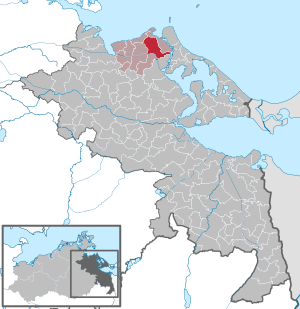
| Location of the Rubenow community in the Vorpommern-Greifswald district | ||
  |
||

Rubenow is a municipality in the north of the Vorpommern-Greifswald district . It is administered by the Lubmin Office based in the Lubmin seaside resort . On January 1, 2005, Groß Ernsthof merged from the former Wolgast-Land office with the municipality. Rubenow has been the largest municipality in terms of area since then.
geography
Rubenow is located between Wolgast and Lubmin south of the Baltic Sea coast . The town of Wolgast is about seven kilometers southeast of the municipality and the official seat of Lubmin is seven kilometers to the north. The north of the municipality is forested. The former Greifswald nuclear power plant is also located there, some of which is located in the municipality. In the south of the municipality is the up to three kilometers wide Ziesetal with the Ziesebruch, a glacial valley that emerged before the Vistula Ice Age . There are no significant standing water in the municipality.
Community structure
|
|
history

Great Ernsthof
The Bronze Age stone circle (urn grave field) is located in the southwest of the forest near Groß Ernsthof (district Netzeband), which documents a settlement by the Teutons .
Groß Ernsthof was first shown on the Lubin map as Ernsthoff in 1618 . From 1681 it was called large Ernsthof and from 1708 Groß Ernsthof but also in different spellings.
In the 16th century, Duke Ernst Ludwig had an arable farm built on this site, which took his name. The Slavic predecessor name is said to have been Lasow .
The original place was divided into Oberdorf and Unterdorf or Bauernhof and Kathenhof. The farms that were distributed along the streets in the 21st century were only built after the completion of the Wolgast - Greifswald road in 1878/1879. A windmill no longer exists since 1905 at the latest.
Characteristic for the place is the Krug built by the municipality after 1879, today an inn at the Wolgast - Greifswald - Kröslin junction. The branch line of the Kleinbahn-Gesellschaft Greifswald-Wolgast (KGW) ran parallel to the Wolgast - Freest road since 1897 , the route of which is still a bike path in the 21st century and still has some relics of the railway buildings.
Latzow

Archaeological evidence of two late Wendish (1000 to 1200) settlements in the immediate vicinity is evidence of an early settlement of the area.
Latzow was first mentioned in documents as Latsow in 1271, and in 1303 the Slavic name changed to Latzow, which means place on the clearing .
The document from 1271 comes from Bishop Hermann von Kammin, who transferred the tithe from several villages, including Latzow, to the church of Wusterhusen . With the certificate of 1303, Duke Bogislaw IV gave the villages of Latzow and Rappenhagen to the Eldena monastery .
The farming village of Latzow is a rural village. A post mill stood north of the village from before 1880 to around 1920.
Nun village

The place Nonnendorf was first mentioned in 1193 as Mylziz , the Slavic original name means dear . Mylziz was given to the Bergen nunnery on Rügen and was therefore renamed Nonnendorf. The place was mentioned in a document in 1271 with the name Nunnendorp . The Slavic origin was also documented by two archaeological settlements from this period.
The property recorded in the table sheet around 1880 was quite impressive. The post mill southwest of the village no longer exists.
Rubenov
.jpg)
Rubenow was first mentioned in documents as Rubenowe in 1334 . The Slavic name is interpreted as compulsory labor . The Slavic origin of the settlement is evidenced by three middle to late Slavic settlements and by a Slavic castle wall.
The street village Rubenow was always a farming and Büdner village . Before the Thirty Years' War there were 10 farmers in Rubenow, in 1697 4 farms were still occupied, 2 of them with 3 half-farmers. 6 farms were desolate, some of which were cultivated from Nonnendorf and Groß Ernsthof. During the Napoleonic occupation from 1807 Rubenow was given as a donation to General Lechi and after 1810 with the Swedes to Lieutenant General Eberhard Ernst Gotthard von Vegesack .
Before 1825 there were only 2 full and 3 half farmers. Around 1825 agricultural land was gained through the amelioration of the Ziesebruch, approved by the Prussian government . After 1827 these lands were separated and 5 farms, a mill property with a windmill and 6 Büdner sites were built. Of the windmill, only the elevation, the Mühlberg, has been preserved in the 21st century . The livestock was described as sizable. The state domain was leased to the resident families. In 1836 the farms became the property of the farmers and Büdner.
In 1865 Rubenow had 187 inhabitants in 34 families. In addition to the owners and their families, 39 servants and maids, 32 day laborers and 5 craftsmen were resident. There was a school, 19 residential buildings, a factory (mill) and 37 farm buildings.
In the cadastral map of 1865, three windmills are shown at Rubenow, of which only one was left in the MTB ( measuring table sheet ) in 1880, the demolition of which was documented according to the building tax role for 1943.
From 1897 Rubenow was touched directly by the Kleinbahn Greifswald-Wolgast (KGW) , which, however, was dismantled as everywhere in 1945 as a reparation to the USSR.
By 1960 at the latest, all farms were transferred to the LPG .
Rubenov settlement
Rubenow-Siedlung is a modern village that was created after 1931 as part of a settlement of the large Dinse farm separately from Rubenow on the Greifswald - Wolgast road.
Voddow
Voddow was first mentioned as such in a document in 1305. The Slavic name ( voda ) means something like water , but there are also other meanings, e.g. B. Reign, Duke ( Vojevode ).
Voddow is a rural village, with a larger yard, probably a leasehold or Vorwerk. There is a large number of scattered settlement courtyards in the vicinity.
Voddow was developed directly from 1897 by the Kleinbahn Greifswald-Wolgast (KGW) with a breakpoint, which was dismantled in 1945 as a reparation.
Desolations and living spaces
Mittelhof (living space)
The place was mentioned in 1841 as Karrin-Mittelhof . Along with Karrin-Sandfeld and Karrin-Neuhof, it belonged to Karrin, which was then also called Karrin-Hof. From 1843 it was assigned to the community of Groß Ernsthof as the Mittelhof . They were lined up colonists' farms. Until 1877 Karrin-Mittelhof was a Prussian state domain. In 1877/78 the area was divided among five farm owners, two Kossäthen, seven Büdners, a blacksmith and a miller, and a tailor. According to MTB, there were already two windmills before 1880, which were still in place after 1920. One was a post mill that was entered on the cadastral map in 1885. The other windmill , which was only registered in the cadastre in 1899, was a Dutch windmill , which was demolished in 1943 at the latest.
Neuhof (desert)
The place was mentioned in 1841 as Karrin-Neuhof, but it was already there in 1835 according to the Prussian original table sheet (PUM 1835). In 1843 it was deleted from the community directories and maps, the field mark was changed from Karrin to the community of Groß Ernsthof.
Sandhof (living space)
The square was laid out in 1841 as Karin sand field, originally belonged to Karrin, was then deleted from the municipal directories in 1843 and has been called Sandhof since 1851 . This was also a settlement of colonists. Sandhof and Mittelhof are the connection between the community and the Peenestrom.
During the GDR era, LPG systems were built in the direction of Mittelhof.
Nieder Voddow (living space)
The court was first drawn in the measuring table sheet from 1880. It was named as Vorwerk zu Voddow from 1920. It was not until 1995 that the name Nieder Voddow was mentioned in the municipality register . Name interpretation, like Voddow. Like the litter yards around the main village, however, it was more of a somewhat larger settlement yard that later developed into a residential area.
Warsin (desert)
Warsin, which later gave its name to Lubmin, was located on the northern tip of the municipality, south of the later nuclear power plant. Warsin was first mentioned as Warszin in 1271. The Slavic name is interpreted as a forester . Until 1859 the place was still listed in official registers. Until after 1920 it was mentioned in the Mes table sheet 1920 (with corrections until 1945) with Forsthaus Warsin .
The forest clearing where the settlement was located can still be seen today.
politics
Coat of arms, flag, official seal
The municipality has no officially approved national emblem, neither a coat of arms nor a flag . The official seal is the small state seal with the coat of arms of the region of Western Pomerania . It shows an upright griffin with a raised tail and the inscription "GEMEINDE RUBENOW".
traffic
Landstrasse 262 runs through the district of Groß Ernsthof. Via Wolgast, Rubenow has a connection to the federal road network with federal road 111 , which , coming from federal freeway 20 , crosses the city and leads to the island of Usedom .
Wolgast is also the closest train station: the Züssow – Wolgast Hafen railway, which has existed since 1863, and the Ducherow – Heringsdorf – Wolgast ferry, which has existed since 1876 .
Attractions
- Rubenow castle wall with several Slavic settlements
- Gutsanlage Nonnendorf
- Rubenow manor house
- Site of the former Lubmin nuclear power plant (the eastern part belongs to the Rubenow municipality)
- Sea buckthorn plantations east of the former Lubmin nuclear power plant
Personalities
Sons and daughters of the church
- Otto Bollnow (1877–1959), German school teacher and local researcher (born in Latzow)
literature
- Manfred Niemeyer: East Western Pomerania. Collection of sources and literature on place names. Vol. 2: Mainland. (= Greifswald contributions to toponymy. Vol. 2), Ernst-Moritz-Arndt University of Greifswald, Institute for Slavic Studies, Greifswald 2001, ISBN 3-86006-149-6 . Pages 79, 98, 116, 138/139
Individual evidence
- ↑ Statistisches Amt MV - population status of the districts, offices and municipalities 2019 (XLS file) (official population figures in the update of the 2011 census) ( help ).
- ↑ StBA Area: changes from 01.01. until December 31, 2005
- ↑ a b c d e f g h i j Manfred Niemeyer: Ostvorpommern . Collection of sources and literature on place names. Vol. 2: Mainland. (= Greifswald contributions to toponymy. Vol. 2), Ernst-Moritz-Arndt University of Greifswald, Institute for Slavic Studies, Greifswald 2001, ISBN 3-86006-149-6 . P. 79 ff
- ↑ Pommersches Urkundenbuch , Vol. II, No. 945.
- ↑ Pomeranian Document Book , Vol. IV, No. 2132.
- ^ Heinrich Berghaus : Land book of the Duchy of Pomerania and the Principality of Rügen , IV. Part Volume II, Anklam 1868, p. 1038
- ↑ Main Statute § 1 (PDF).
Web links
Ahlbeck | Old Tellin | Altwarp | Altwigshagen | Anklam | Bandelin | Bargischow | Behrenhoff | Bentzin | Benz | Mountain wood | Blankensee | Blesewitz | Boldekow | Boock | Brietzig | Brünzow | Bugewitz | Buggenhagen | Butzow | Daberkow | Dargelin | Dargen | Dersekow | Ducherow | Eggesin | Fahrwalde | Ferdinandshof | Garz | Glazov | Görmin | Grambin | Grambov | Greifswald | Gribow | Gross Kiesow | Groß Luckow | Great Polzin | Gützkow | Hammer ad Uecker | Hanshagen | Heinrichswalde | Heringsdorf | Hinrichshagen | Hintersee | Iven | Jarmen | Jatznick | Comb teeth | Karlsburg | Karlshagen | Katzow | Kemnitz | Klein Bünzow | Koblentz | Korswandt | Koserow | Krackow | Krien | Kröslin | Kruckow | Krugsdorf | Krummin | Krusenfelde | Lassan | Leopoldshagen | Levenhagen | Liepgarten | Löcknitz | Loddin | Loissin | Loitz | Lubmin | Luebs | Luckow | Luetow | Medow | Meiersberg | Mellenthin | Mesekenhagen | Mölschow | Mönkebude | Murchin | Nadrensee | Neetzow-Liepen | New Boltenhagen | New Kosenow | Neuenkirchen | Neuenkirchen | Low | Papendorf | Pasewalk | Peenemünde | Penkun | Plow | Polzow | Postlow | Pudagla | Ramin | Rankwitz | Rollwitz | Rossin | Rossow | Rothemühl | Rothenklempenow | Rubenov | Rubkov | Sarnow | Sassen-Trantow | Sauzin | Schmatzin | Schönwalde | Spantekow | Stumble on the Peene | Stolpe on Usedom | Strasburg (Uckermark) | Torgelow | Trassenheide | Tutow | Ückeritz | Ueckermünde | Usedom | Square | Vogelsang-Warsin | Völschow | Wackerow | Weitenhagen | Wilhelmsburg | Wolgast | Wrangelsburg | Wusterhusen | Zemitz | Zempin | Zerrenthin | Ziethen | Zinnowitz | Zirchow | Züssow