
Hirschberg (Rhein-Lahn district)
| coat of arms | Germany map | |
|---|---|---|

|
Coordinates: 50 ° 23 ' N , 7 ° 55' E |
|
| Basic data | ||
| State : | Rhineland-Palatinate | |
| County : | Rhein-Lahn district | |
| Association municipality : | Diez | |
| Height : | 300 m above sea level NHN | |
| Area : | 2.5 km 2 | |
| Residents: | 392 (Dec. 31, 2019) | |
| Population density : | 157 inhabitants per km 2 | |
| Postal code : | 65558 | |
| Area code : | 06439 | |
| License plate : | EMS, DIZ, GOH | |
| Community key : | 07 1 41 057 | |
| Association administration address: | Louise-Seher-Strasse 1 65582 Diez |
|
| Website : | ||
| Mayoress : | Birgit Rutenbeck | |
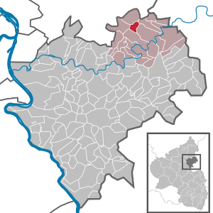
| Location of the local community Hirschberg in the Rhein-Lahn district | ||
  |
||


Hirschberg is a municipality in the Rhein-Lahn district in Rhineland-Palatinate . It belongs to the community of Diez .
geography
Hirschberg is 6 km west of Diez , 8 km west of Limburg an der Lahn and 9 km south of Montabaur in the Westerwald . The area of the local community Hirschberg belongs to the Esterau and the Nassau nature park .
In the area of the local community Hirschberg lies the 444 m high mountain Höchst , which owes this name, used since the 19th century, to the fact that it was the highest mountain in the former Unterlahn district. The mountain was previously called Hirtzberg . The village of Hirschberg is located on the eastern slope of Höchst.
history
Hirschberg probably goes back to a foundation in Franconian times. According to the latest findings, the first documentary mention dates to the year 1336, before that the oldest known documentary mention was from the year 1395. Hirschberg has belonged to the territory of the County of Diez since its inception . From 1806 the place was part of the Duchy of Nassau , which was annexed by Prussia in 1866 . Since 1946 the place has been part of the state of Rhineland-Palatinate .
The name is due to the abundance of game in the then very wooded area around the Höchst mountain.
In 1834 an elementary school was built in Hirschberg . School lessons had previously taken place in residential buildings since around 1700. Between 1827 and 1834 the community hall was used as a school. The school building from 1834 was replaced by a new school building in 1928, which was used for teaching until 1969. Hirschberg has been part of the catchment area of the Esterauschule in Holzappel since 1969.
The population developed as follows in the 19th and 20th centuries: 1843: 191 inhabitants, 1927: 281 inhabitants, 1964: 295 inhabitants.
religion
Hirschberg is assigned to the Roman Catholic parish St. Bonifatius in Holzappel and belongs with it to the pastoral area Diez , which in turn is incorporated into the Limburg district in the Limburg diocese .
On the Protestant side, the place is parish Langenscheid -Hirschberg in the deanery Diez the provost South Nassau in the Evangelical Church in Hessen and Nassau (EKHN) belongs and has about 300 inhabitants Protestant denomination.
politics
Municipal council
The local council in Hirschberg consists of eight council members, who were elected in the local elections on May 26, 2019 in a majority vote, and the honorary local mayor as chairman.
mayor
Birgit Rutenbeck is the local mayor of Hirschberg. In the direct election on May 26, 2019, she was elected with a share of 70.45% of the vote and is the successor to Gunter Meckel, who had held the office for 15 years.
Culture and sights
The oldest chapel in Hirschberg was built in 1400. This 14th century chapel was demolished in 1871 because it had become dilapidated and replaced in 1892 by the construction of a new Protestant church in neo-Gothic style. It was designed by the architect Ludwig Hofmann . One of the bells dates back to 1409 and thus dates from the beginning of the chapel, which was built in 1400.
See also: List of cultural monuments in Hirschberg
Economy and Infrastructure
Hirschberg is now a residential community. Tourism is of economic importance.
traffic
The B 417 runs from Nassau in the south to Diez and Limburg an der Lahn in the east. The national road 317 branches in Hirschberg from the B 417 and runs to the north. The Lahn-Ferien-Straße runs from south to north on the B 417 and L 317 through Hirschberg. The nearest motorway junction is Diez on the A 3 4 km north of Hirschberg.
Hirschberg is directly connected to Diez and Limburg an der Lahn with the number 540 of the Rhein-Mosel transport association .
The closest ICE long-distance train stations are Montabaur and Limburg Süd .
Web links
Individual evidence
- ↑ State Statistical Office of Rhineland-Palatinate - population status 2019, districts, communities, association communities ( help on this ).
- ↑ The Esterau - Hirschberg ( Memento of the original from May 11, 2016 in the Internet Archive ) Info: The archive link was inserted automatically and has not yet been checked. Please check the original and archive link according to the instructions and then remove this notice.
- ^ The Regional Returning Officer Rhineland-Palatinate: Local elections 2019, city and municipal council elections
- ^ The State Returning Officer of Rhineland-Palatinate: direct elections 2019. see Diez, Verbandsgemeinde, 13th line of results. Retrieved November 9, 2019 .

Altendiez | Aull | Balduinstein | Birlenbach | Charlottenberg | Cramberg | Diez | Dörnberg | Eppenrod | Geilnau | Gückingen | Hambach | Heistenbach | Hirschberg | Holzappel | Holzheim | Horhausen | Isselbach | Langenscheid | Laurenburg | Scheidt | Steinsberg | Wasenbach

Allendorf | Altendiez | Arzbach | Attenhausen | Auel | Aull | Bad Ems | Balduinstein | Becheln | Mountain | Berghausen | Berndroth | Bettendorf | Biebrich | Birlenbach | Bogel | Bornich | Braubach | Bremberg | Book | Burgschwalbach | Charlottenberg | Cramberg | Dachsenhausen | Dahlheim | Dausenau | Dessighofen | Dienethal | Diethardt | Diez | Dörnberg | Dornholzhausen | Dörscheid | Dörsdorf | Ebertshausen | Honor | Eisighofen | Endlichhofen | Eppenrod | Ergeshausen | Eschbach | Fachbach | Filsen | Flat | Fruit | Geilnau | Geisig | Gemmerich | Gückingen | Gutenacker | Hahnstätten | Hainau | Hambach | Heistenbach | Herald | Himmighofen | Hirschberg | Holzappel | Holzhausen an der Haide | Holzheim | Hömberg | Horhausen | Hunzel | Isselbach | Kaltenholzhausen | Kamp-Bornhofen | Kasdorf | Katzenelnbogen | Kaub | Kehlbach | Kemmenau | Kestert | Klingelbach | Kördorf | Lahnstein | Langenscheid | Laurenburg | Lautert | Liiffer | Lipporn | Lohrheim | Lollschied | Lykershausen | Marienfels | Miehlen | Mielle | Misselberg | Mittelfischbach | Mudershausen | Nassau | Nasta | Netzbach | Niederbachheim | Niederneisen | Niedertiefenbach | Niederwallmenach | Never | Nochern | Oberbachheim | Oberfischbach | Oberneisen | Obernhof | Obertiefenbach | Oberwallmenach | Oberwies | Oelsberg | Osterspai | Patersberg | Pohl | Prath | Reckenroth | Reichenberg | Reitzenhain | Rescue Grove | Rescues | Roth | Ruppertshofen | Sankt Goarshausen | Sauerthal | Scheidt | Schiesheim | Schönborn | Schweighausen | Seelbach | Singhofen | Steinsberg | Strüth | Sulzbach | Wasenbach | Weidenbach | Weinähr | Weisel | World destruction | Weyer | Winches | Winter advertising | Room difference