
Brünzow
| coat of arms | Germany map | |
|---|---|---|

|
Coordinates: 54 ° 6 ' N , 13 ° 34' E |
|
| Basic data | ||
| State : | Mecklenburg-Western Pomerania | |
| County : | Vorpommern-Greifswald | |
| Office : | Lubmin | |
| Height : | 5 m above sea level NHN | |
| Area : | 16.14 km 2 | |
| Residents: | 637 (Dec. 31, 2019) | |
| Population density : | 39 inhabitants per km 2 | |
| Postal code : | 17509 | |
| Area code : | 038354 | |
| License plate : | VG, ANK, GW, PW, SBG, UEM, WLG | |
| Community key : | 13 0 75 018 | |
| LOCODE : | DE UZW | |
| Community structure: | 6 districts | |
| Office administration address: | Geschwister-Scholl-Weg 15 17509 Lubmin |
|
| Website : | ||
| Mayor : | Alfred Bligenthal | |
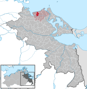
| Location of the municipality of Brünzow in the Vorpommern-Greifswald district | ||
  |
||

Brünzow is a municipality in the district of Vorpommern-Greifswald . It is administered by the Lubmin Office based in the Lubmin seaside resort .
Districts
|
|
|
Geography and traffic
The municipality of Brünzow is located between Greifswald and Wolgast on the Greifswalder Bodden . The place is north of the federal highway 109 and west of the railway line Greifswald – Lubmin . Three kilometers northeast of the municipality is Lubmin with the seat of the local administration and around 14 kilometers southwest is the city of Greifswald.
history
Brünzow

Brünzow was first mentioned in 1248 as Brunissogh . The place name is of Slavic origin and means to defend or protect . Until 1798 the spelling of the names changed, then the name now used established itself.
Brünzow was transferred to the Eldena Monastery by Duke Bogislaw IV in 1299 . Bishop Hermann had already given the tithe to the new church in Wusterhusen in 1271 . The property of the monastery is later lost without tradition, the Dowet family sat there in the 15th century.
Another documented tradition dates back to 1406, when Marquard Dowat sold a lease to the Brotherhood of Maria Magdalena in Greifswald on Brünzow. The Dowat family died out in Brünzow around 1500. Then all the news will be missing for a few hundred years. At the beginning of the 19th century, the von Vahl brothers are given as owners, but Melms sold them to Melms in 1842 and Heinrich Peters in 1854. Most of the time, however, the property was leased.
In 1865 Brünzow had 87 inhabitants in twelve families, the village had a school, six residential and ten farm buildings as well as a post mill and a distillery.
Kraepelin

A large number of Slavic settlements are archaeologically proven north of the village . The subsequent early German settlement is documented by a tower hill in the estate park.
Kröpelin was first mentioned in 1256 by its owner Wilhelmus miles de Cropelyn. This family - also called crepelin, soon died out and the fief fell back to the duke. Then it was Dominal.
The village was also mentioned in a document in 1271 as "Trepelin", when taxes from the village were given to the church in Wusterhusen. The Slavic place name is interpreted as snorting or gasping . It did not appear until 1302 as "Cropelin". In 1209 the place came to the Eldena monastery through a donation from Duke Bogislaw IV . Later, however, the Dowet and von Spandow families sat there.
The village has only been spelled with ä since 1722. A mix-up with Kröpelin would be possible, but neighboring locations are always indicated in the documents.
Duke Bogislaw XIV then had to pledge the estate to the von Bohlen family in 1631 due to financial worries. In 1693, like many in Swedish-Pomerania, the estate was supposed to be reduced, that is, to revert to the tax authorities, but the von Bohlen were able to maintain ownership because of the old debt. But already in 1702 they were no longer financially able to hold the estate. It then came into the possession of the von Wakenitz family, but the line in Kräpelin died out in 1757 and after long trials the property came back to the von Bohlen because of the remaining bond , but now it was a line from Silesia . They leased the property, in 1865 it was the Rodbertus family.
In 1865, Kräpelin had 67 residents in ten families, there were six residential buildings and 15 farm buildings in the village.
Stilow
In the Feldmark von Stilow and Stilow-Siedlung there are six archaeologically proven Slavic settlements that prove the village as a Slavic foundation.
Stilow was documented as "Stylogh" in 1248 in the monastery prescription for Hilda by Duke Wartislaw III. first mentioned. The Slavic name is probably to be interpreted as dark . It was released from the monastery in 1480 when the duke pawned it.
In terms of ownership, it then had the same change as Brünzow, it was pertinence to this property, but had a small Vorwerkshof.
In 1865 Stilow had 133 inhabitants in 21 families, the village had seven residential and seven farm buildings.
The village is to be classified as an estate village with the distinctive courtyard and the Katenzeile.
Stilow settlement
Stilow settlement was first mentioned as such in the list of places from 1957. It is an elongated housing estate that was probably founded by the land reform settlements.
Vierow
In the area around Vierow there are four archaeological settlements from the early to the late Slav period (600 to 1200), these are evidence of the foundation and the naming. Vierow was first mentioned in a document in 1264 as "Wiroch". The Slavic name means something like vortex, vortex . Vierow was a farming and Büdnerdorf with four farms and over twenty Büdnereien , the shape can be described as a cluster village . In 1865 the place had 266 inhabitants in 56 families, there were 31 residential and 35 farm buildings.
From 1897 Vierow was touched by the Kleinbahn Greifswald – Wolgast (KGW) and had a stop at the site . On July 1, 1950, Vierow was incorporated.

The port of Vierow , which was built after 1990, is located on the Greifswalder Bodden and has a handling facility especially for agricultural products, mainly grain (wheat and barley). In 2012 the port received a siding from the Lubmin route. In 2019, 523,700 tons of goods were handled at the two berths in Vierower Hafen, in 2018 it was 588,500 tons. The port operations and the Viela Export GmbH maintain several warehouses here with a total of 120,000 t capacity for grain.
An active cliff stretches from Vierow to the Gahlkow district with many erratic boulders , including some noteworthy ones, even a stone from the Viking Age , which is, however, archeologically controversial. The route of the North German Romanticism leads through the town. The 54 km long nature trail connects a total of ten life and motif stations of early romantic painters from the region from Greifswald to Wolgast .
Klein Ernsthof
.jpg)
Seven Middle to Late Slavic settlements (800 to 1200) have been archaeologically proven in the field marrow of the village. They document the early settlement of the place and its surroundings.
Klein Ernsthof was first mentioned as Malin in 1271 . That means "small" in Slavic. It was not until 1631 that it was officially named with the current name.
In 1300, Duke Bogislaw IV gave the village to the Eldena Monastery as property. Shortly before the monastery was dissolved, it sold the property to Joachim Holste, who received it from the duke as a fief.
In 1578 the place came into the possession of the Pomeranian Duke Ernst Ludwig , who gave the place his name, but had it named Klein Ernsthof to distinguish it from Ernsthof - Groß Ernsthof.
Klein Ernsthof was a farming village that consisted of two farms and three mill properties. However, until the 16th century it was a knight's seat with the name "Brüggendorf" also "Westenbrüggendorf" still belonging to the Westenbrugge family of the same name. When this became extinct, the von Lepel came back to the Duke, when the last owner Heinrich von Lepel died here in 1487 (?).
The structure of the village has hardly changed since 1880, according to the measurement table, until today.
In 1865 the village had 43 inhabitants in eight families, as well as five residential and 14 farm buildings. Of the three Dutch windmills , only one remained in 1865.
Wusterbode (desert)
In the triangle between Vierow, Kräpelin and Lubmin there is archaeological evidence for about 15 Slavic settlements. This proves that the area is relatively densely populated.
Wusterbode was first mentioned as such in 1273. It is described as the location of a mill between Vierow and Lubmin. But it seems to have fallen wildly afterwards. The name is probably borrowed from the nearby Wusterhusen as church place (Wuster) and the Danish word "bode" for "Bude". Since there were predominantly water mills in the 13th century, the place on the Grenzbach between Vierow and Lubmin could have been and because the small stream had too little water, the mill had to be stopped and the settlement became desolate.
politics
Coat of arms, flag, official seal
The municipality has no officially approved national emblem, neither a coat of arms nor a flag . The official seal is the small state seal with the coat of arms of the region of Western Pomerania . It shows an upright griffin with a raised tail and the inscription "GEMEINDE BRÜNZOW".
Attractions

- Manor house in Brünzow: One-storey, 13-axis plastered building with a medium risalit
- Manor house in Kräpelin
- Manor house in Stilow: The two-storey plastered building was built in the mid-19th century. Two farm buildings are at right angles to the manor house.
- Vierow grain port
- Mühlenberg , a 23 meter high elevation between Klein Ernsthof and Stilow
- Kräpelin tower hill and Bronze Age bowl stone (cult site)
- Windmill in Klein Ernsthof
- Ziesetal in the area of the municipality with very many (so far 26) Slavic settlements
Pomeranian legends
A Pomeranian legend has been passed down from Vierow, which deals with the farmer Brand from Vierow. He lived in a simple house at the entrance to the village and one night he heard a voice in a dream. She ordered him to go to Stettin - there he would find happiness on the Long Bridge. He went to Stettin and was noticed by a soldier who passed him several times. At noon the soldier spoke to him about what he was doing on the bridge. Brand told him about his dream. The soldier laughed and also told of his dream. For his part, he should dig in Vierow in the first hut on the right side of the village and thus make his fortune. But he has neither the time nor the money for such a trip and anyway does not believe in such dreams. The farmer had heard enough. He returned to his village, dug on his property and found a great treasure with which he could build a permanent house. It still stands today on the right-hand side at the entrance to Vierow.
literature
- Manfred Niemeyer: East Western Pomerania . Collection of sources and literature on place names. Vol. 2: Mainland. (= Greifswald contributions to toponymy), Ernst-Moritz-Arndt-University Greifswald, Institute for Slavic Studies, Greifswald 2001, ISBN 3-86006-149-6 , pp. 68, 137
Web links
Individual evidence
- ↑ Statistisches Amt MV - population status of the districts, offices and municipalities 2019 (XLS file) (official population figures in the update of the 2011 census) ( help ).
- ↑ a b c d e f g h Manfred Niemeyer: Ostvorpommern . Collection of sources and literature on place names. Vol. 2: Mainland (= Greifswald contributions to toponymy, vol. 2), Ernst-Moritz-Arndt-Universität Greifswald, Institute for Slavic Studies, Greifswald 2001, ISBN 3-86006-149-6 , p. 14 ff
- ↑ H. Hoogeweg: Monasteries in Pomerania , Part 1, Stettin 1924, p. 529
- ^ Heinrich Berghaus : Land book of the Duchy of Pomerania and the Principality of Rügen . IV. Part II. Volume: Greifswalder Kreis . Anklam 1868, p. 1106 ( Google Books ).
- ^ Heinrich Berghaus : Land book of the Duchy of Pomerania and the Principality of Rügen . IV. Part II. Volume: Greifswalder Kreis , Anklam 1868, p. 1114 ( Google Books ).
- ↑ H. Hoogeweg: Monasteries in Pomerania , Part 1, Stettin 1924, p. 533
- ↑ H. Hoogeweg: Monasteries in Pomerania , Part 1, Stettin 1924, p. 533
- ^ Heinrich Berghaus : Land book of the Duchy of Pomerania and the Principality of Rügen . IV. Part II. Volume: Greifswalder Kreis . Anklam 1868, p. 1111 ( Google Books ).
- ^ Heinrich Berghaus : Land book of the Duchy of Pomerania and the Principality of Rügen . IV. Part II. Volume: Greifswalder Kreis . Anklam 1868, p. 1100 ( Google Books ).
- ^ Heinrich Berghaus : Land book of the Duchy of Pomerania and the Principality of Rügen . IV. Part II. Volume: Greifswalder Kreis , Anklam 1868, p. 1119 ( Google Books ).
- ↑ Thomas Schwandt: Grain trip between Vierow and Mukran · The load for large bulkers comes from the small port in Western Pomerania. In: Daily port report of March 18, 2020, special supplement No. 4 Shortsea Shipping , pp. 10/11
- ↑ Pommersches Urkundenbuch , Vol. II, No. 945.
- ↑ Pommersches Urkundenbuch , Vol. III, No. 1964.
- ^ Hermann Hoogeweg : Monasteries in Pomerania. Part 1, Stettin 1924, p. 552.
- ^ Heinrich Berghaus : Land book of the Duchy of Pomerania and the Principality of Rügen . IV. Part II. Volume: Greifswalder Kreis . Anklam 1868, p. 1107 ( Google Books ).
- ↑ Main Statute § 1 (PDF).
- ^ Elke Maier, Karl-Ewald Tietz, Adelheid Ulbricht: From Pomerania's legends . 1st edition. Axel Dietrich, Peenemünde 1993, ISBN 3-930066-10-6 , p. 56 .
Ahlbeck | Old Tellin | Altwarp | Altwigshagen | Anklam | Bandelin | Bargischow | Behrenhoff | Bentzin | Benz | Mountain wood | Blankensee | Blesewitz | Boldekow | Boock | Brietzig | Brünzow | Bugewitz | Buggenhagen | Butzow | Daberkow | Dargelin | Dargen | Dersekow | Ducherow | Eggesin | Fahrwalde | Ferdinandshof | Garz | Glazov | Görmin | Grambin | Grambov | Greifswald | Gribow | Gross Kiesow | Groß Luckow | Great Polzin | Gützkow | Hammer ad Uecker | Hanshagen | Heinrichswalde | Heringsdorf | Hinrichshagen | Hintersee | Iven | Jarmen | Jatznick | Comb teeth | Karlsburg | Karlshagen | Katzow | Kemnitz | Klein Bünzow | Koblentz | Korswandt | Koserow | Krackow | Krien | Kröslin | Kruckow | Krugsdorf | Krummin | Krusenfelde | Lassan | Leopoldshagen | Levenhagen | Liepgarten | Löcknitz | Loddin | Loissin | Loitz | Lubmin | Luebs | Luckow | Luetow | Medow | Meiersberg | Mellenthin | Mesekenhagen | Mölschow | Mönkebude | Murchin | Nadrensee | Neetzow-Liepen | New Boltenhagen | New Kosenow | Neuenkirchen | Neuenkirchen | Low | Papendorf | Pasewalk | Peenemünde | Penkun | Plow | Polzow | Postlow | Pudagla | Ramin | Rankwitz | Rollwitz | Rossin | Rossow | Rothemühl | Rothenklempenow | Rubenov | Rubkov | Sarnow | Sassen-Trantow | Sauzin | Schmatzin | Schönwalde | Spantekow | Stumble on the Peene | Stolpe on Usedom | Strasburg (Uckermark) | Torgelow | Trassenheide | Tutow | Ückeritz | Ueckermünde | Usedom | Square | Vogelsang-Warsin | Völschow | Wackerow | Weitenhagen | Wilhelmsburg | Wolgast | Wrangelsburg | Wusterhusen | Zemitz | Zempin | Zerrenthin | Ziethen | Zinnowitz | Zirchow | Züssow