List of streets and squares in Oerlinghausen
The list of streets and squares in Oerlinghausen describes the street system in the city of Oerlinghausen with the corresponding historical references. It does not claim to be complete.
City structure
According to the main statute of the city of Oerlinghausen, the city is divided into the three districts of Oerlinghausen , Helpup and Lipperzeile . In addition, a distinction is usually made between other parts of the city: Währentrup , Mackenbruch and Wellentrup is a historical subdivision of the Helpup district . With Südstadt a large housing estate in the south of the Oerlinghausen district is generally referred to, which was built in the 1960s. The so-called Conle settlement is a specialty in the southern part of the city . It was originally built for British soldiers and their families. After their departure in 1995, the buildings were converted into rental apartments. The city center is also known as Alt-Oerlinghausen and the district of Oerlinghausen is called the core city .
The following table shows the area and the population of the districts. It is noticeable that the eponymous district of Oerlinghausen is the smallest in terms of area:
| Population figures and area of the city districts 1 | ||||
|---|---|---|---|---|
| District | surface | Residents | Districts of the city of Oerlinghausen | |
| Oerlinghausen | 9.20 km² | 10,975 | ||
| Helpup | 13.46 km² | 4,789 | ||
| Lip line | 10.04 km² | 3,362 | ||
| total | 32.7 km² | 19,126 | ||
Overview of the streets and squares in Oerlinghausen
The following list gives an overview of the streets and squares in Oerlinghausen, as well as some additional information. In detail these are:
- Name : Current name of the street or square.
- Length / dimensions in meters from Straßenweb.de
- Name origin : origin or reference of the name.
- Location / Notes : Location of the street in OpenStreetMap , as well as indication of the start and end point for streets. More information about nearby institutions, the history of the street, historical names, monuments, etc.
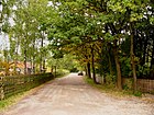
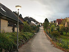
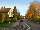
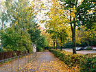
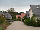
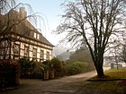
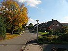
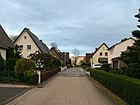
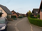
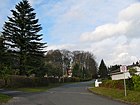
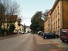
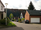
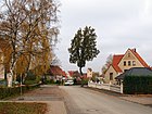
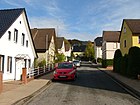
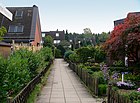
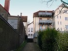
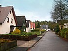
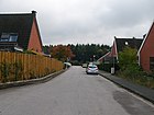
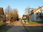
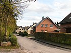
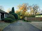
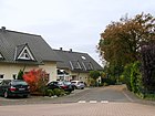
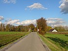
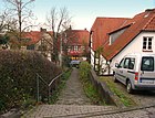
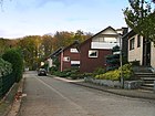
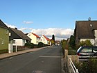
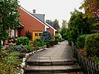
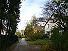
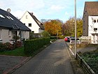
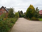
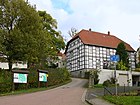
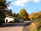
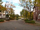
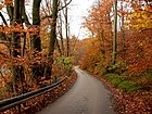
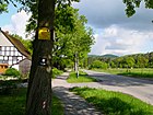
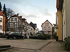
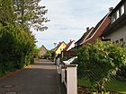
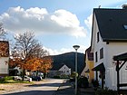
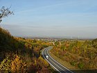
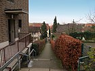
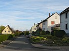
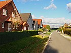
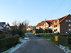
- Image : Photo of the street or an adjacent object.
| Surname | Length / dimensions (in meters) |
Origin of name | Date of designation | Location / Notes | image |
|---|---|---|---|---|---|
| Ackerweg | 150 | A field is a piece of agricultural land. The name is reminiscent of the earlier use of this area before the development. | Ackerweg at OpenStreetMap The residential street is located in the Helpup district and branches off as a cul-de-sac in a southerly direction from Osterheide street . In the further course it forms several side streets of the same name. | ||
| Adolf-Sältemeier-Strasse | 570 | Named after the former landowner, farmer Adolf Sältemeier . In 1958, under city director Heinrich Kindsgrab , the city acquired parts of the Sältemeiersche Hof on which the southern part of the city was built. | around 1960 | Adolf-Sältemeier-Straße at OpenStreetMap The residential and commercial street in the southern part of the city begins on Stukenbrocker Weg , leads first to the northeast, then in a curve to the southeast and ends in Kirchweg . | |
| Agnes-Miegel-Weg | 425 | Agnes Miegel (1879–1964), German writer, journalist and ballad poet. | Agnes-Miegel-Weg at OpenStreetMap The residential street is located in the southern part of the city, branches off in a southerly direction from Florence-Nightingale-Straße and ends as a dead end. | ||
| Ahornweg | 124 | The name comes from the plant genus maple . | Ahornweg at OpenStreetMap The residential street in the Helpup district is located in the cross bar (field name ) and branches off Eichenstraße as a cul-de-sac in a westerly direction . | ||
| Akazienkamp | 38 | The name comes from the genus acacia ; Kamp means fenced cattle pasture in Low German in Lippe . | Akazienkamp at OpenStreetMap A short cul-de-sac in the southern part of the city, which branches off from An der Bleiche to the southwest. Two footpaths lead to Adolf-Sältemeier-Strasse . | ||
| Albert-Schweitzer-Strasse | 684 | Albert Schweitzer (1875–1965), German-French doctor, theologian, philosopher and pacifist. | Albert-Schweitzer-Strasse at OpenStreetMap The residential street in the south of the city branches off from Stukenbrocker Weg to the northeast, passes the Südstadtschule , curves to the southeast and ends at the parking lot of the Dietrich-Bonhoeffer-Haus . A footpath leads to Heinrich-Kindsgrab-Straße and the Dietrich-Bonhoeffer-Haus . Three footpaths branching off in parallel from Stukenbrocker Weg bear the same name. | ||
| Albrecht-Ober-Platz | 75 | Albrecht Ober was head of the former village of Währentrup and mayor. | Albrecht-Ober-Platz at OpenStreetMap The square is located in the Helpup district at the confluence of Bahnhofstrasse with Lagesche Strasse opposite the Helpuper Church. | ||
| Old Holter Street | 497 | Named after the place Schloß-Holte. | Alte Holter Straße at OpenStreetMap Forms a section of the old street course before the expansion of Holter Straße in the south of the city center. The residential street in the southern core of the city branches off from the new Holter Strasse and accompanies it to the confluence of the An der Bleiche street . | ||
| Old mill path | 725 | The way to a former mill in the Schopke valley, also called Menkebach . | Alter Mühlenweg at OpenStreetMap Unpaved road in the district of Lipperzeile, which branches off at the eastern end of Schulstrasse to the north and later leads as a hiking trail to Hellweg . | ||
| At the Barkhauser Berge | 728 | Named after the mountain ( 292.6 m above sea level ) in the Teutoburg Forest , at whose western foot the road runs. | At the Barkhauser Berge near OpenStreetMap The road in the south of the city center begins at the parking lot of the Archaeological Open-Air Museum Oerlinghausen , passes the entrance and initially runs east. It then describes a wide arc, leads above the museum to the west and ends as a dead end. A hiking trail leads to the southern part of the city. | ||
| At the Brachtsberge | 158 | It is named after the Brachtsberg , on the northern slope of which the road runs. | On the Brachtsberge near OpenStreetMap Located in the northern core of the city and branches off to the west as a spur road from the quarry road . | ||
| At the Brinkhof | 419 | Named after a former farm at this point. | At the Brinkhof at OpenStreetMap The residential street in the Lipperreihe district begins on Bachstrasse and heads west. Then it runs in a rectangle and returns to the starting point. | ||
| At the Buchenbrink | 309 | The name comes from the beech tree genus . With Brink a hill or the then leading the way is referred to Lippische Low German. | Am Buchenbrink near OpenStreetMap The residential street in the north of the city center consists of two parallel streets, both of which start on the hillside path and are connected at the end by a cross street. | ||
| At the bottom | 217 | The road runs at the bottom of the valley between two mountain ranges of the Teutoburg Forest, the Tönsberg in the north and the Barkhauser mountains in the south. | At the bottom at OpenStreetMap The residential road in the south of the city center begins on the forest path, leads to the northwest and ends as a dead end. | ||
| At the Holzkamp | 125 | Holzkamp is a tree-lined, delimited piece of land. | Am Holzkamp near OpenStreetMap The residential street is located in the far north of the Helpup district, begins on Am Sportplatz street , leads to the southwest and ends as a dead end. An unpaved path continues and ends in the street Auf der Neustadt . | ||
| At the Iberg | 652 | The wooded Iberg ( 236.2 m above sea level ) belongs to the northern chain of the Teutoburg Forest. | Am Iberg near OpenStreetMap The only access to this residential street in the Helpup district is via Währentruper Straße . The road runs in a west-east direction at the foot of the mountain and ends as a dead end. Several spur streets with the same name lead to the right and left. The Währentrup water park is on the south side . | ||
| On the Kalderberg | 360 | Named after the mountain where the road runs | On Kalderberg near OpenStreetMap The residential street is located in the center of the city, begins on Detmolder Straße , then leads southwards steeply uphill and ends in Hermannstraße . The Oerlinghauser Seniors Center Müllerburg can be found on Kalderberg . | ||
| At the lime kiln | 630 | The name comes from the neighboring disused limestone quarry, in which two large lime kilns used to be used to produce lime for building houses. | At the Kalkofen at OpenStreetMap On the residential street in the south of the city center is the Am Kalkofen sports field and the Oerlinghausen outdoor pool . It begins on the street An der Bleiche , heads north and ends at the parking lot of the outdoor pool and the sports field. A footpath leads to the Triftweg . | ||
| At the Kopphof | 168 | Named after a previous farm at this point. | On Kopphof OpenStreetMap In the garden road branches off to the west side road in the district Helpup located Oerlinghauser indoor pool . | ||
| At the Kuffenbach | 110 | Named after the stream that the street crosses. Today, however, his name is Siekbach . | Am Kuffenbach near OpenStreetMap The residential street in the Helpup district branches off from Gartenstrasse in a westerly direction and ends as a dead end. | ||
| On the clay stitch | 176 | The name comes from a former clay quarry on the southern slope of the Tönsberg. | At the loam stitch at OpenStreetMap The residential street in the city center begins on Welschenweg , leads northwards steeply uphill and ends as a dead end. | ||
| At the mill pond | 201 | The name comes from the pond at the end of the street, which belonged to a former mill. | At the mill pond near OpenStreetMap The dirt road in the Helpup district branches off as a dead end in a north-westerly direction from Währentruper Straße . | ||
| At the horse camp | 305 | Kamp means fenced pasture in Low German in Lippe , a synonym for horse paddock . | At the Pferdkamp near OpenStreetMap The residential street in the south of the city center branches off at right angles from Welschenweg , leads south and meets a cross street, which is also called Pferdekamp . | ||
| At the Räkerhof | 136 | At the end of the street is the eponymous Räkerhof . | At the Räkerhof near OpenStreetMap. The residential street in the Helpup district branches off to the west from Bahnhofstrasse and at the end turns left into Gartenstrasse . | ||
| At the black pond | 256 | Named after a former pond that was created by a farm owner named Schwartz . The area in question bears the field name Im Schwartzen Teich . | At the Black Pond at OpenStreetMap The residential street in the Lipperreihe district branches off at an acute angle from Wellbachstrasse and leads in an easterly direction to the confluence with the Untere Reihe street . In the middle there is a side street with the same name. | ||
| At the sports field | 494 | Named after the Helpup sports field at the end of the street. | At the sports field at OpenStreetMap The residential street in the extreme northeast of the Helpup district leads from Bahnhofstrasse along the railway tracks in an easterly direction to the sports field that gives it its name. | ||
| At the forest | 215 | Named after the forest on the southern slope of the Iberg. | Am Walde at OpenStreetMap Wohnstraße in the Helpup district, which branches off the Am Iberg street in a northerly direction and runs along the southern slope as a cul-de-sac . | ||
| At the Weberpark | 135 | The neighboring Weberpark , named after the manufacturer Carl David Weber (1824–1907), gave this street its name. | At the Weberpark at OpenStreetMap The residential street in the city center branches off from Detmolder Straße in a southerly direction and ends as a dead end. | ||
| At the Widfeld | 590 | Named after an old field name . | At Widfeld at OpenStreetMap The residential street in the southern core of the city begins on Holter Straße , leads steeply westwards up the Menkhauser Berg ( 253 m above sea level ) in the Teutoburg Forest and ends there as a dead end. A second street of the same name branches off to the north. | ||
| Ammernweg | Named after the bird family of the Ammern . | Ammernweg at OpenStreetMap The residential street in the Lipperreihe district branches off to the west as a dead end from Bachstrasse . | |||
| Amselweg | The name comes from the bird species blackbird from the thrush family . | Amselweg at OpenStreetMap The residential street in the district of Lipperzeile begins on Kiefernweg and leads back in a wide curve in a south-westerly direction to the same street. | |||
| Steps to office | 22nd | Named after the former office building and the officials who were appointed as successors to the last bailiff Hermann Adolf Bracht around 1770 in what was then the village of Oerlinghausen. Today, after several renovations, the office building is part of the city hotel . | Official stairs at OpenStreetMap The Twete in the center of the city center leads from the parking lot of the Amtsgarten on the main street over a stone staircase to Hermannstraße . | ||
| On the bleach | 752 | Washed whites and linens used to be bleached in the sun to remove unwanted stains. | At the Bleiche at OpenStreetMap The residential street in Südstadt begins at Holter Strasse , runs in a south-easterly direction past the wood-fired power station, then turns to the southwest and ends at the confluence with Helmstedter Strasse . From here it changes its name and is now called Heinrich-Kindsgrab-Straße . At the time of the First World War (1914–1918) there was a military training area north of the road, which was criss-crossed by trenches, shelters and barbed wire. To the south of it were the hangars for the old glider airfield around 1937. | ||
| At the dune | 102 | The inland dunes in the Senne were formed around 11,000 years ago at the end of the last ice age . The eponymous dune is immediately north at the end of the road. | At the dune near OpenStreetMap The residential street in the southern part of the city branches off as a dead end in an easterly direction from Berliner Straße . | ||
| At the Bailiwick | 78 | Vogtei was the name for the official building and the district of the Vogt, who carried out the official business as the representative of the feudal lord. | At the Vogtei at OpenStreetMap The residential street in the city center begins at the street Am Brachtshof , leads uphill as a cul-de-sac and ends after about 80 meters at the last of three houses. | ||
| Apple road | 722 | The name comes from the various fruit trees that line it. | Apple Street at OpenStreetMap The street in the Helpup district begins on Währentruper Strasse , first heading west and then turning south. In a curve from which it is called Wistinghauser Strasse , a branch leads to Gut Wistinghausen . | ||
| On the mountain | 161 | The name refers to the Tönsberg . | On the mountains at OpenStreetMap The residential street in the city center begins on Tönsbergstraße on the western ascent to Tönsberg, turns in a southeastern direction and follows the southern flank of the mountain. At the level of the youth hostel on the mountain side, the name changes to Piperweg . | ||
| On the Röden | 297 | The name indicates that this area has been cleared for development . | On the Röden at OpenStreetMap The residential street in the city center connects the street Am Kalderberg with the Steinbruchstraße and runs in a west-east direction. | ||
| On the sand | 108 | The Oerlinghauser area south of the Teutoburg Forest is mainly covered by Sennesand . | On the sand at OpenStreetMap The short residential street in the southern part of the city connects the street An der Bleiche with Adolf-Sältemeier-Straße, which runs parallel to the south . | ||
| On the Brede | 247 | The field name Brede means latitude in Low German : If the individual parts of an arable land were of a very different nature, several Breden of similar quality could be formed from them . | On the Brede at OpenStreetMap The residential street in the south of the Helpup district is a connection between Währentruper Straße and Friedhofsweg and runs in a west-east direction. | ||
| On the light | 73 | The field name Helle is derived from hell and stands for a narrow, wild area. | In the light of OpenStreetMap The residential street in the center of the city center leads steeply downhill and forms a connection between the streets Unter der Howe and Wehme on the western slope of the Tönsberg . | ||
| On the new town | 427 | The name indicates that this is a new building district. | On the Neustadt near OpenStreetMap The residential street is located in the Helpup district and can be reached in the eastern extension of the Osterheide street . It then runs in the shape of a horseshoe first to the north and finally in a longer straight stretch to the west. It ends shortly before the junction with Bahnhofstrasse . | ||
| On the furrow | 132 | With Warderfohr (water furrow) a downhill section of the formerly Detmold street called, which was eroded by flowing water. It was below what is now called the street. | On the furrow at OpenStreetMap The residential street is located in the northeastern city center and branches off as a dead end from the hillside path to the west. | ||
| August-Prante-Weg | 322 | Named after the former mayor of the Lipper Egret, August Prante . | August-Prante-Weg at OpenStreetMap The residential street in the district of Lipperreihe begins on Pollmannsweg , leads first to the north and then in a wide circle back to the starting point. | ||
| Bachstrasse | 2041 | Named after the Dalbkebach , which the road partly follows. | Bachstraße at OpenStreetMap The residential street in the Lipperreihe district runs from north to south through the entire village. It begins in the north as an unpaved forest road on Senner Hellweg and crosses a forest area. It is asphalted from the confluence of the Obere Reihe street , passes the town center with the Lipperreiher Church and finally joins Wellbachstraße in the south . | ||
| Bahnhofstrasse | 960 | Named after the former Helpup train station . Today there is only one stop of the NordWestBahn at this point . | Bahnhofstrasse at OpenStreetMap The residential and commercial street leads north to the local border. It begins in the south on Lageschen Straße , then leads through the entire village and ends at the confluence of Flurstraße . From here it belongs to the district of Greste in the municipality of Leopoldshöhe and is called Helpuper Straße . | ||
| Barkhauser way | 130 | The Barkhauser Weg is one of two routes that used to lead from Oerlinghausen to Gut Barkhausen and beyond. Because of the arduous driveway for horse- drawn teams, both were popularly called Stöhnebrinksweg . | Barkhauser Weg at OpenStreetMap The street in the north of the city center begins as an extension of Rathausstrasse and ends after 130 m in a dead end. On its east side is the Diekhof house , the former yielding house of Gut Niederbarkhausen . In this way one of the village led to 1860 Mack break coming church and Leichweg to Oerlinghausen. | ||
| Tree heather | 115 | It is named after the tree heather , a tree-like plant from the heather genus . | Tree heather at OpenStreetMap The residential street in the Lipperreihe area begins on Heideweg , leads to the southwest and ends in a dead end. | ||
| Mountain road | 629 | Ascent to the Schafberg (207.8 m) in the north chain of the Teutoburg Forest . | Bergstraße at OpenStreetMap The residential street in the Helpup district begins in the north at the confluence with Mackenbrucher Straße , crosses Bielefelder Straße , leads up the mountain in a serpentine and ends at Detmolder Straße . | ||
| Berlin street | 663 | Named after the capital of Germany Berlin . | Berliner Straße at OpenStreetMap The residential street in the southern part of the city leads from Heinrich-Kindsgrab-Straße in a wide arc first to the east and later to the south and joins Sennestraße . | ||
| Bielefelder Strasse | 582 | Named after the city of Bielefeld . The road continues to lead to the neighboring city. | Bielefelder Straße at OpenStreetMap Wohn und Industriestraße in the Helpup district and is a section of the federal highway 66, which runs from east to west . It begins at the junction with Detmolder Straße and heads west to the local border. In the Leopoldshöher area it is called Detmolder Strasse . | ||
| Birch path | 61 | Named after the birch plant genus from the birch family . | Birkenweg at OpenStreetMap Short residential street in the Helpup district on the so-called Querriegel (field name ), which branches off Eichenstraße as a dead end in a western direction. | ||
| Blumenbrink | 61 | Apparently a fantasy name that means mountain of flowers . | Blumenbrink at OpenStreetMap Short residential street in the southern part of the city, which branches off as a dead end street in a northerly direction from Adolf-Sältemeier-Straße . A footpath leads to the street Auf der Bleiche . | ||
| Flower Street | 721 | In everyday language, a flower refers to a decorative blossom . | Blumenstraße at OpenStreetMap residential and industrial street in the far north of the Helpup district. It begins on Bahnhofstrasse , initially heading east, later bends north and then again east. It ends at the local border to Lage and is then called Obersfeld . | ||
| Bokelfenner Strasse | 764 | Leads to Bokelfenn , a swampy valley on the Westerholter Bach south of the Teutoburg Forest . | Bokelfenner Straße at OpenStreetMap The residential street in the southeast of the Südstadt begins at Robert-Kronfeld-Straße and runs in a southeast direction. After crossing the Westerholter Bach , it passes the Bokelfenner Krug and flows into the Stapelager Weg . | ||
| Bokelweg | 172 | The name refers to Bokelfenn . | Bokelweg at OpenStreetMap The short residential street in the extreme southeast of the Südstadt branches off in a southeastern direction from Stapelager Weg and at the end turns into an unpaved forest path that leads to the Bokelmeyer farm and on to Holte-Stukenbrock Castle . | ||
| Brachtshof | 321 | Named after a former farm in the area. | Brachtshof at OpenStreetMap The residential street in the city center begins on the main street , leads in a south-easterly direction up the slope of the Tönsberg and flows into the Piperweg . Nice view of the Alexander Church . | ||
| Brandsheide | 1035 | Named after a previous landowner. | Brandsheide at OpenStreetMap The dirt road is in the Lipperzeile district. It begins at Senner Hellweg , leads first to the south, later to the southwest along the Westerholter Bach and finally ends as a dead end. | ||
| Fire mill | 1107 | It is named after a former mill at the end of the street. | Brandsmühle at OpenStreetMap The residential street is located in the far north-west of the Lipperzeile district and begins on Senner Hellweg . It runs to the northeast and ends as a dead end in the area of the former mill. Shortly before, a right fork leads as a hiking trail to Oerlinghauser Südstadt. | ||
| Width base | 541 | Breitegrund comes from the area's earlier field name . | Breitegrund at OpenStreetMap The residential street in the eastern core of the city begins as an extension of Steinbruchstrasse , leads uphill in an easterly direction and ends in a dead end. There are a total of four side streets with the same name. | ||
| Breitenkamp | 1272 | It is named after the former field name of this area. | Breitenkamp at OpenStreetMap Breitenkamp refers to several interconnected residential streets in the city center northeast of Welschenweg on the lower southern slope of the Tönsberg. | ||
| Broad ash | 182 | It is named after the plant genus ash . | Wide Esch at OpenStreetMap The residential street in the city center begins on Emilienstraße , heads west and ends as a dead end. Shortly before the end, a side street of the same name branches off. | ||
| Breslauer Strasse | 749 | Named after Breslau , a former German and now Polish city (Wrocław). | Breslauer Straße at OpenStreetMap The residential street in the northeast of the city center can be reached via Detmolder Straße and Königsberger Straße . It leads first to the northeast and later in a wide curve to the southeast. At the end it joins Danziger Straße and thus reaches Detmolder Straße again . | ||
| Bruchweg | 168 | Named after the break , a synonym for a damp, swampy area. The Menkhauser Bach or the Schopke rises here . | Bruchweg at OpenStreetMap The residential street in the city center branches off to the west from Emilienstraße and ends as a dead end. | ||
| Well vent | 51 | Named after a fountain on Simonsplatz . Around 1911 there was a water pump that supplied the well there with water, as there were no water pipes. The residents filled their buckets and dragged the water into their homes. From 1912 the first water from the Schopke was pumped through a pipeline into an elevated tank on the Tönsberg and from there the various districts were supplied with running water. | Brunnentwete at OpenStreetMap The Twete begins at Simonsplatz and leads up a staircase to the lower street Unter der Howe . | ||
| Bridge path | 154 | The bridge over the Dalbkebach gives it its name. | Bridge path at OpenStreetMap The residential street in the district of Lipperzeile begins on Bachstraße , leads south of the church in an easterly direction over the Dalbkebach and then turns north. From here on it bears the name Mittelweg . | ||
| Buchenweg | 452 | The name comes from the plant genus beech . | Buchenweg at OpenStreetMap The residential street in the Helpup district is located in the cross bar (field name ) and branches off Eichenstraße as a cul-de-sac in a westerly direction . It begins on Detmolder Straße , climbs steeply to the east and divides in a curve. While the left branch ends as a dead end, the right branch continues uphill and ends at Eichenstraße . | ||
| Buckwheat Trail | 133 | Named after the genus buckwheat , a pseudograin. | Buckwheat Trail at OpenStreetMap The short residential street in the Lipperreihe district begins on Schulstrasse , initially runs south, then turns to the southwest and ends in a dead end. There is a branch to the east in the curve. | ||
| Bussardweg | 237 | Named after the buzzards of the raptor . | Bussardweg at OpenStreetMap The residential street in the district of Lipperzeile begins on Dalbker Straße , first leading south and then in a curve to the east. There are three branches of the same name in a northerly direction until the road ends in a dead end. | ||
| Bakerswete | 61 | According to the population list of 1901, there were nine master bakers in Oerlinghausen. One of them had his bakery near this Twete. | Bäckertwete at OpenStreetMap The Twete in the center of the city center leads down several stone stairs from the main street between houses No. 56 and No. 48 to the street Unter der Wehme . | ||
| Dalbker Street | 1846 | It is named after the district of Dalbke in the Sennestadt district of Bielefeld . | Dalbker Straße at OpenStreetMap The residential and commercial street in the Lipperzeile district leads from Holter Straße in an east-west direction through the entire district. It begins in the east on Tunnelstrasse or Holter Strasse, leads through the town center with the Lipperreiher Church to the city limits between Bielefeld and Oerlinghausen in the west. | ||
| Dam road | 216 | It takes its name from the embankment on the Bielefeld - Altenbeken line , along which the road runs. | Dammstraße at OpenStreetMap The Industriestraße in the north of the Helpup district lies exactly on the municipal boundary to Leopoldshöhe . The street begins on Bahnhofstrasse , heads west and ends as a dead end at the bridge over the Siekbach . | ||
| Danziger Strasse | 247 | Named after Danzig , a former German and now Polish city (Gdańsk). | Danziger Straße at OpenStreetMap The residential street in the north of the city center begins on Detmolder Straße and leads north. It eventually bends east before ending in a dead end. An unpaved forest path leads west to the Tenge Mausoleum | ||
| Detmolder Strasse | 2715 | It is named after the largest city of Detmold in the Lippe district with around 73,000 inhabitants . | 1901 | Detmolder Straße at OpenStreetMap The residential and commercial street is located in the city center and in the Helpup district and begins as an extension of the main street . It leads first to the east and later to the northeast, before it flows again in an easterly direction in the district Helpup into the Lagesche Straße . The road was laid out around 1831 as Detmolder Chaussee with limestone gravel and deep ditches on the left and right to drain the rainwater. From 1901 it got its current name. | |
| Dresdner Strasse | 207 | It is named after the Saxon capital Dresden . | Dresdner Straße at OpenStreetMap The residential street in the Helpup district can be reached via Leipziger Straße . It leads both to the northeast and to the southwest, ending in a dead end in both directions. | ||
| Throttle path | 202 | Named after the thrush bird family . | Drosselweg at OpenStreetMap The residential street in the district of Lipperzeile begins on Kiefernweg, runs in an easterly direction and ends as a dead end. | ||
| Eduard-Mörike-Weg | 75 | It is named after the German pastor and poet Eduard Mörike (1804–1875). | Eduard-Mörike-Weg at OpenStreetMap The short residential street in the southern part of the city was laid out as a footpath, branches off from Goethestrasse in a southerly direction and ends at Gerhart-Hauptmann-Weg . | ||
| Eggeweg | 113 | Named after the harrow , an arable implement for leveling the plow furrows. | Eggeweg at OpenStreetMap The residential street in the south of the city center begins on Welschenweg , runs in a south-westerly direction and ends as a dead end. At the end of the road there is a short branch to the east. | ||
| Eichendorffweg | 38 | It is named after the German poet and writer Joseph von Eichendorff (1788–1857). | Eichendorffweg at OpenStreetMap The residential street in the southern part of the city was laid out as a footpath, branches off from Wilhelm-Busch-Weg in an easterly direction and ends in a dead end. | ||
| Oak Street | 276 | The name refers to the plant species oak . | Eichenstrasse at OpenStreetMap The residential street in the Helpup district begins on Detmolder Strasse , goes south up the so-called cross bar and ends at the height as a dead end. | ||
| Ellernstrasse | 276 | The name comes from the tree genus alder , which is called Ellern in Low German in Lippe . | Ellernstraße at OpenStreetMap The residential street in the Helpup district begins on Gartenstraße and leads to the southwest. After the first third, it bends briefly to the south, then swings again in a westerly direction and ends at the Goldstrasse . | ||
| Elsa-Brändström-Strasse | 137 | Named after Elsa Brändström (1888–1948), a Swedish philanthropist who became known as the Angel of Siberia . | Elsa-Brändström-Straße at OpenStreetMap The residential street in the southern part of the city lies in the eastern area of the so-called Conle-Siedlung . It begins on Florence-Nightingale-Strasse , leads northwest and ends in a dead end. The street is continued by two footpaths that lead to apartment blocks with the same address. | ||
| Emilienstraße | 137 | Named after the first name of Emilie Weber , who was married to the co-owner of the linen weaving mill Carlo Weber . | Emilienstraße at OpenStreetMap The residential and industrial street in the city center begins at the confluence of Marienstraße and Webereistraße . It leads first to the west and then turns at a right angle to the north. Then it leads slightly uphill and ends at the confluence with the Hanegge street . | ||
| Erikaweg | 101 | The name comes from the plant genus heathers , and Erika called. | Erikaweg at OpenStreetMap The short residential street is located in the Lipperreihe district and begins on Heideweg. It runs in a south-westerly direction and ends as a dead end. | ||
| Eschenweg | 83 | Ash trees are a genus of plants belonging to the olive family. | Eschenweg at OpenStreetMap The short residential street in the Helpup district is located in the so-called cross bar (field name ) and branches off from Detmolder Straße in a southerly direction . After a few meters it turns to the west and ends in a dead end. | ||
| Feldstrasse | 175 | Before the area was released for development, it consisted of fields and arable land, hence the street names Feldstrasse , Im Felde and Ackerweg there . | Feldstrasse at OpenStreetMap The residential street in the Helpup district branches off to the east from Bahnhofstrasse and ends as a dead end. | ||
| Felix-Fechenbach-Strasse | 80 | Felix Fechenbach (1894-1933) was a German political journalist, poet and resistance fighter against the Nazis and was murdered by them in 1933. | Felix-Fechenbach-Straße at OpenStreetMap The residential street in the southern part of the city branches off from Stukenbrocker Weg in an easterly direction and ends as a dead end. Three parallel walkways lead to further residential buildings, which also have the address Felix-Fechenbach-Straße . | ||
| Finkenweg | 140 | Finches belong to a species-rich family from the order of the passerines . | Finkenweg at OpenStreetMap The residential street in Lipperzeile branches off from the Untere Reihe street in an easterly direction, bends south and ends as a dead end. | ||
| Flachsweg | 175 | Flax is extracted from the stalks of the flax plant and used to make linen. | Flachsweg at OpenStreetMap The residential street in Lipperzeile branches off to the south from Schulstraße and ends as a dead end. A total of four sidewalks lead to residential buildings, all of which bear the address Flachsweg . | ||
| Lilac way | 163 | Lilac is a genus of plants belonging to the olive family . It is named after the common lilac , which is planted as an ornamental shrub . | Fliederweg at OpenStreetMap The residential street is located in the Helpup district and branches off the Am Räkerhof street in a northerly direction. It ends as a dead end in two parallel cross streets with the same name. | ||
| Florence Nightingale Street | 512 | The Englishwoman Florence Nightingale (1820–1910) is considered to be the founder of modern nursing and medical services. | Florence-Nightingale-Straße at OpenStreetMap The residential street in the southern part of the city begins on Stukenbrocker Weg and initially leads to the southeast. Then it turns in a north-easterly direction and ends at Sennestrasse . To the north and west of Florence-Nightingale-Strasse is the so-called Conle settlement . | ||
| Hallway | 366 | The corridor designated in its old meaning scenery or grounds. Today, the term “ corridor” means the parceled out usable area of a settlement. | Flurstraße at OpenStreetMap The residential street in the Helpup district begins on Bahnhofstraße , leads to the northeast and ends in Kachtenhauser Straße in the municipality of Leopoldshöhe . The Flurstraße runs exactly on the northern border between Oerlinghausen and Leopoldshöhe. | ||
| Trout Trail | 86 | The trout is a species of fish belonging to the salmon family . | Trout Trail at OpenStreetMap The residential street is located in the Lipperreihe district and branches off from Teichstrasse . The trout trail runs in a north-westerly direction and ends as a dead end. | ||
| Forest path | 333 | As forestry is a managed forest is called. Here the path leads to the forest on the northern slope of the Barkhauser Mountains . | Forest path at OpenStreetMap The residential road in the south of the city center begins on Welschenweg and initially runs to the southwest. Then it turns at a right angle to the northwest and ends as a dead end. At the end, a footpath leads to the Am Barkhauser Berge street . | ||
| Freiligrathstrasse | 106 | Ferdinand Freiligrath (1810–1876) was a German poet and translator. | Freiligrathstraße at OpenStreetMap The residential street in the city center branches off from Marktstraße in a southerly direction and ends as a dead end. A staircase was created here as a connection to the nearby Detmolder Straße . | ||
| Friedhofsweg | 224 | Named after the cemetery in Helpup. | Friedhofsweg at OpenStreetMap The residential street in the Helpup district begins on Lageschen Straße and passes the Helpuper Church. It leads in a south-easterly direction to the cemetery, where it ends as a dead end. | ||
| Friedrichstrasse | 103 | Friedrich is a German male given name that was one of the most popular names in the 18th and 19th centuries. | Friedrichstrasse at OpenStreetMap The residential street in the city center begins on Holter Strasse and leads as a one-way street in a westerly direction to Robert-Koch-Strasse . | ||
| gardenstreet | 496 | A garden is a demarcated piece of land for planting vegetables, flowers, ornamental shrubs and trees. | Gartenstraße at OpenStreetMap The residential street in the Helpup district can only be reached via side streets, because both the beginning and the end are dead ends. From the Räkerhof in the north it first runs to the southwest and then turns to the southeast at the confluence of the Mackenbrucher Straße . The access to Lageschen Strasse is closed; however, it can be reached via a short footpath. | ||
| Gehrenberg | 103 | The name was taken from an old hallway name . | Gehrenberg at OpenStreetMap The residential street in the center of the city center leads steeply downhill from Unter der Howe in a northerly direction and joins Weerthstrasse , which bends at right angles to the east. | ||
| Gerhart-Hauptmann-Weg | 151 | Gerhart Hauptmann (1862-1946) was a German playwright and writer. | Gerhart-Hauptmann-Weg at OpenStreetMap The residential street in the southern part of the city was laid out as a footpath, leads from Florence-Nightingale-Straße to the east and ends in a dead end. | ||
| Court tweets | 59 | The Twete owes its name to the building of the former district court on the main street . | Richtstwete at OpenStreetMap The Twete in the city center leads from the main street past the listed house No. 32 to the north and down a stone staircase to the street Unter der Howe . | ||
| Geschwister-Scholl-Strasse | 115 | The siblings Hans (born 1918) and Sophie (born 1921) Scholl were active as members of the White Rose in the resistance against National Socialism . They were executed in Munich on February 22nd, 1943 . | Geschwister-Scholl-Strasse at OpenStreetMap The residential street in the southern part of the city leads from Adolf-Sältemeier-Strasse to the south and ends in a dead end. | ||
| Gorse path | 140 | Gorse is a genus of plants that belongs to the butterfly family. | Ginsterweg at OpenStreetMap The residential street in the southern part of the city begins on Adolf-Sältemeier-Straße , leads north and ends as a dead end. Three short footpaths with the same name branch off to the west and east. | ||
| Glatzer Strasse | 116 | Glatz is the German name of today's Polish city of Klodzko , around 80 km southwest of Wroclaw in Lower Silesia . | Glatzer Straße at OpenStreetMap The residential street in the district of Lipperzeile begins on Dalbker Straße , leads to the northwest and ends in a dead end. | ||
| Bell heather | 117 | The bell heather is a genus of plants and belongs to the heather family . The name refers to the shape of the flower crowns. | Glockenheide at OpenStreetMap The residential street in the district of Lipperzeile leads from Heideweg to the southwest and ends as a dead end. | ||
| Goethestrasse | 108 | Johann Wolfgang von Goethe (1749–1832) is considered the most important German poet . | Goethestrasse at OpenStreetMap The short residential street in the southern part of the city begins on Florence-Nightingale-Strasse , runs in an easterly direction and ends as a dead end. | ||
| Gold road | 826 | Gold is a precious metal and a chemical element with the symbol AU. | Goldstrasse at OpenStreetMap The residential street in the Helpup district begins on Lageschen Strasse , leads first to the north and then in a wide curve to the northwest and ends as a dead end. | ||
| Grave road | 173 | Christian Dietrich Grabbe (1801–1836) was a German playwright . | Grabbestraße at OpenStreetMap The residential street in the Helpup district begins on Goldstraße and initially runs in an easterly direction. It then bends to the southeast and ends as a dead end. Then a footpath leads to the street Am Kuffenbach . | ||
| Green meadow | 146 | In urban planning, green meadow refers to the development of areas that previously did not belong to the settlement area of the city. | Green meadow at OpenStreetMap The residential street in the far east of the Helpup district begins on Wellentruper Straße , runs in a north-easterly direction and flows into Lagesche Straße . | ||
| Goodness | 465 | The Grüte is a 29 hectare nature reserve , the largest part of which lies in the urban area of Oerlingshausen. The former Hellweg to the east led partly on the route of today's Markstraße through the Grütewald. | Greetings to OpenStreetMap The residential street in the northeast of the city center begins on Marktstrasse and leads north. Here it meets a cross street with the same name, which extends in the west to Im Boksiek and in the east to Waldstrasse . | ||
| Gustav-Haupt-Weg | 135 | Gustav Haupt was a long-time lifeguard at the neighboring Oerlinghauser outdoor pool and chairman of the DLRG in Oerlinghausen. | Gustav-Haupt-Weg at OpenStreetMap The footpath runs from the street Am Kalkofen and the neighboring parking lot to the north to the entrance of the sports field and the Oerlinghauser outdoor pool. From there a staircase leads to the upper parking lot and to Holter Straße . | ||
| Goddernstrasse | 156 | The street was still called Götterstraße in the 19th century . It was only in the last few decades that Göddernstrasse developed from this . | Göddernstrasse at OpenStreetMap The narrow lane in the city center begins below the Alexander Church , leads from Unter der Howe downhill to the southwest and takes a short flight of stairs to Robert-Koch-Strasse . Göddernstraße continues on the opposite side of the street and finally flows into Steinbält . The Göddernstraße has existed for a long time and was used by the residents of the Senne communities as a church and easy path . Later it served the residents of the Steinbült as a way to go shopping in the city center. | ||
| Hambusch | 1353 | In Lippe Low German, the word Hammbusse means : drunken beggar, tramp or vagabond. | Hambusch at OpenStreetMap The Waldstraße in the Helpup district begins on Währentruper Straße and leads in a south-westerly direction. It passes the entrance to Gut Wistinghausen , then turns to the northwest and describes a curve. Shortly afterwards it turns into a hiking trail that joins the Hermannsweg on the eastern ascent to the Tönsberg . | ||
| Hanegge | 915 | Named after the hand harrow , a device for manually loosening the soil. | Hanegge at OpenStreetMap The residential street in the northern core city begins on Rathausstrasse and runs in a westerly direction. The last section is declared a private road, which ends as a dead end just before the pedestrian bridge over Tunnelstrasse . In the four houses 14, 16, 18 and 20, high officers of the British Army of the Rhine were housed until their departure . You were visited here in 1980 by Queen Elisabeth II . | ||
| Hillside path | 289 | After the mountainside that the road leads up or down. | Hillside path at OpenStreetMap The residential street begins at Detmolder Straße and leads steeply uphill in a southerly direction. At the end it turns to the east and flows into the street Am Buchenbrink . A footpath leads to the Breitegrund . | ||
| Hasenheide | 127 | Named after the former heathland and the hares that populated it. | Hasenheide at OpenStreetMap The residential street in the Lipperreihe area begins on Heideweg , leads in a south-westerly direction and ends as a dead end. | ||
| Main road | 753 | Main shopping street in the city center with by far the largest number of listed buildings . During the Nazi regime it was called Adolf-Hitler-Strasse . | Main street at OpenStreetMap The residential and commercial street in the city center was laid out after 1750 because the old pass road over the Tönsberg was very difficult for carts. For this purpose, quarries were laid to expose the route for the new road. The stones obtained were used to build the neighboring houses. The road begins at the confluence of the Town Hall Street in the Detmold Road and ends at the junction of the low road . From here on it is called Holter Strasse . | ||
| Heidersdorfer Strasse | 153 | Named after Heidersdorf , today Łagiewniki , a municipality in the Lower Silesian Voivodeship in Poland . | Heidersdorfer Straße at OpenStreetMap The residential street in the extreme north of the city center begins on Breslauer Straße , first leads north, then turns east and ends as a dead end. A footpath leads to the nearby Tenge Mausoleum . | ||
| Heideweg | 647 | Named after the heathland , which is characterized by the blooming heather and nutrient-poor soil. | Heideweg at OpenStreetMap The residential street in the south-east of the Lipperreihe district begins on Holter Strasse , runs in a south-easterly direction and ends as a dead end. The continuation is a hiking trail in the same direction that leads to the glider airfield . | ||
| Heinrich-Heine-Weg | 49 | Heinrich Heine (1797–1856) was one of the most important German poets, writers and journalists of the 19th century. | Heinrich-Heine-Weg at OpenStreetMap The short residential street in the southern part of the city was laid out as a footpath, starts at Goethestrasse , runs north and ends as a dead end. | ||
| Heinrich-Kindsgrab-Strasse | 276 | City director Heinrich Kindsgrab was one of the people in charge who implemented the Südstadt project. He died in 1959 and could no longer experience the first new building. | Heinrich-Kindsgrab-Straße at OpenStreetMap The residential street in the southern part of the city begins in the extension of the street An der Bleiche , runs downhill in a south-westerly direction and flows into Sennestraße . On the west side is the Bonhoeffer house and the church of the Mennonite Brethren . | ||
| Hellweg | 1380 | In the Middle Ages, the Hellweg was an important thoroughfare for long-distance trade. This is a section of the Senner Hellweg leading south of the Teutoburg Forest . | Hellweg at OpenStreetMap The Industriestraße begins as an extension of the Senner Hellweg on Holter Straße and leads to the southeast. It passes several industrial companies on the north side and ends in Stukenbrocker Weg . | ||
| Helmstedter Strasse | 436 | Helmstedt is a city in Lower Saxony and lies on the border with Saxony-Anhalt , around 35 km east of Braunschweig . There was a border crossing to the former GDR nearby . | Helmstedter Straße at OpenStreetMap The residential street in the southern part of the city begins as an extension of the street An der Bleiche . It first runs north, then east, turns south and finally west. It describes a wide arc and ends as a dead end. | ||
| Henri Dunant Street | 221 | Henri Dunant (1828–1910) was a Swiss businessman and humanist with a Christian background. He is considered to be the founder of the international Red Cross . | Henri-Dunant-Straße near OpenStreetMap The residential street in the southern part of the city is located in the north-western area of the so-called Conle settlement . It begins on Sennestrasse , first leads to the southwest, then turns to the southeast and ends as a dead end. | ||
| Hostel stairs | 92 | The Twete is after 1929 opened hostel named on the Tönsberg. | Hostel stairs at OpenStreetMap The stairs start at Jägerstraße and lead up 159 stone steps to the Kammweg on the Tönsberg opposite the youth hostel. | ||
| Herderweg | 59 | Johann Gottfried Herder (1744–1803) was a German poet, philosopher and writer. | Herderweg at OpenStreetMap The short residential street in the southern part of the city was laid out as a footpath, branches off from Wilhelm-Busch-Weg in an easterly direction and ends as a dead end. | ||
| Hermannstrasse | 1312 | The first name Hermann was the most frequently given boy's name in Germany at the end of the 19th century. Today, however, it is rarely used. | Hermannstraße at OpenStreetMap The residential street in the city center begins as an extension of Tönsbergstraße , leads slightly uphill in a south-easterly direction and ends as a dead end. From the former Meierhof Wistinghausen a church and funeral path led to Oerlinghausen, which in the last third used the current course of the Hermannstraße and was mostly in very poor condition. | ||
| Hermannsweg | 5019 | The 156 kilometer long Hermannsweg , named after Hermann the Cherusker , is considered one of the most beautiful high-altitude trails in Germany and runs in parts over the ridge of the Teutoburg Forest . | Hermannsweg at OpenStreetMap The Oerlinghauser section of the hiking trail begins at the western border in the Schopketal , then leads in an easterly direction over streets of the city center up the Tönsberg (333 m) and reaches the paved ridge path . Here the Kumsttonne , the Oerlinghauser landmark, is passed and after about 500 m the Kammweg ends. This is followed by an unpaved hiking trail that passes the memorial and the Lönsdenkmal . After descending into the Stapelager Gorge , you will reach the eastern Oerlinghauser city limits. The eastern end of the Hermannsweg is the Hermannsdenkmal near Detmold | ||
| Ladder to heaven | 125 | Name for a stone staircase that leads from the city center with 233 steps up to the Tönsberg. | Himmelsleiter at OpenStreetMap The stairs begin on Hermannstrasse between house no. 26 and no. 28, pass the Philosophenweg halfway up and end near the Kumsttonne . The staircase, equipped with stone steps in 1977, got its name as early as 1898, but at that time consisted of a wooden structure that only lasted for 30 years and then had to be renewed. | ||
| Holter Street | 4508 | Schloß Holte is a district of Schloß Holte-Stukenbrock in the Gütersloh district in North Rhine-Westphalia. | Holter Straße at OpenStreetMap The residential and commercial street begins in the city center at the confluence of Niedernstraße as an extension of the main street and runs south. It flows into Robert-Koch-Straße , crosses Südstadt and meets Tunnelstraße in the district of Lipperzeile , which from here on is called Holter Straße until it reaches the city limits . | ||
| Hudeweg | 590 | Hude is the name for a forest that is used extensively as pasture. | Hudeweg at OpenStreetMap The residential street in the southern part of the city begins on Unter dem Menkhauser Berge and runs in a south-westerly direction. Then it turns to the northwest, later to the northeast, thus describing an elongated rectangle. | ||
| Hill path | 411 | Under Hill is in a form to be off a medium elevation landscape to understand. | Hill path at OpenStreetMap The residential street in the south of the city center begins in the west on Triftweg and runs in a south-easterly direction. After about 300 meters it turns north and ends at Welschenweg. Two short side streets also belong to the Hügelweg. | ||
| In the Boksiek | 241 | Siek is the old name for a damp lowland and is part of a field name . | In the Boksiek at OpenStreetMap The residential street in the city center begins on Marktstrasse . It leads in the form of a square first to the north, then to the east and finally to the south, until it ends again at Marktstrasse . | ||
| In Elkenkamp | 134 | Elken means polecat in Lippish Low German and Kamp is a delimited piece of land. | In Elkenkamp at OpenStreetMap The residential street in the Helpup district begins on Osterheide street , leads to the northwest and ends as a dead end. The nearby Bahnhofstrasse can be reached via a footpath . | ||
| In the field | 240 | A field is an open, unforested piece of land that is known in agriculture as an arable land . The name is reminiscent of the earlier use of this area before the development. | In the field at OpenStreetMap The residential street in the Helpup district branches off from Oststraße , leads to the northwest and ends as a dead end. The neighboring street Osterheide can be reached via a footpath . | ||
| In the ear | 126 | With Miter a triangular formerly field or parcel designated. | In Gehren at OpenStreetMap The short residential street in the Helpup district branches off from Ellernstrasse , runs north and ends as a dead end. | ||
| In the grass camp | 521 | The term Graskamp describes a measured piece of land, mainly in northwest Germany , that is overgrown with grass. | In the Graskamp at OpenStreetMap The residential street in the Helpup district begins on Währentruper Straße and leads in an easterly direction to the city limits between Oerlinghausen and Lage . About in the middle there is a branch to the north of the same name as a connection to the street Im Sandkamp . At the city limits, the street ends as a dead end. The Währentrup water park is also located there , with entrances on the east and north sides. | ||
| In Heidsiek | 132 | The name Heidsiek comes from the region around Jöllenbeck in East Westphalia and means Heide im Siek , a damp lowland. | In Heidsiek at OpenStreetMap The residential street in the Helpup district begins on Gartenstraße , runs to the northwest, crosses the Siekbach (a tributary of the Haferbach ) and ends as a dead end. | ||
| In the Hermstoffel | 320 | Named after Herm Stoffel , a former resident of the area. | In Hermstoffel at OpenStreetMap The residential street in the Lipperreihe district begins on Pollmannsweg , leads first to the west, then to the northwest and ends in a circle. Two footpaths with the same name branch off. | ||
| In the Lappenbusch | 145 | Lappenbusch is in Lippe Low German the name for a long, narrow piece of land made up of bushes and is probably a field name here . | In the Lappenbusch near OpenStreetMap The short residential street in the Helpup district begins on Währentruper Straße , leads to the southwest and ends as a dead end. | ||
| In the broken quirks | 1538 | The name comes from the former village of Mackenbruch, which together with Währentrup and parts of Wellentrup belonged to today's Oerlinghauser district Helpup. The ending bruch means damp lowland . | In the Mackenbruch near OpenStreetMap The residential street in the west of the Helpup district begins on Detmolder Straße, runs in a north-easterly direction along the Siekbach and meets Mackenbrucher Straße , which from here takes on the name Im Mackenbruch . After crossing the Bielefeld-Lage railway line , it ends at the confluence with Viehstraße and is now called Mühlenstraße . | ||
| In Sandkamp | 273 | The term Sandkamp describes a measured piece of land, mainly in northwest Germany, that is covered by sand. | In Sandkamp near OpenStreetMap The residential street in the Helpup district begins on Währentruper Straße , first leads in an easterly direction, then turns sharply to the south and runs in a wide curve in a south-westerly direction. Shortly before the junction with the street Am Graskamp, it bends south. | ||
| In the quiet corner | 360 | The name is intended to emphasize the quiet residential area of the street. | In the quiet corner at OpenStreetMap The residential street in the Helpup district branches off from Osterheide street , leads to the southeast and ends as a dead end. | ||
| In the storm | 290 | The field name Im Storm is derived from Sturm and stands for an open, windy area. | In the storm at OpenStreetMap The street in the Helpup district begins on Währentruper Strasse and runs in a south-easterly direction. It ends shortly after the bridge over the Haferbach as a dead end. From there a hiking trail leads to the Iberg . | ||
| Immenkamp | 73 | Imme is the poetic name for bee and Kamp denotes a piece of land. | Immenkamp at OpenStreetMap The residential street in the southern part of the city branches off from Hudeweg to the southeast and ends as a dead end. Several parallel walkways all have the same name. | ||
| Industriestrasse | 190 | The name refers to the industrial and commercial enterprises located there . | Industriestraße at OpenStreetMap The street in the industrial area of Südstadt begins on Stukenbrocker Weg , runs in a south-westerly direction and ends as a dead end. | ||
| Jahnstrasse | 259 | Friedrich Ludwig Jahn (1778–1852), also called gymnastics father . | Jahnstraße at OpenStreetMap The residential and commercial street in the center of the Helpup district creates a connection between Bahnhofstraße and Gartenstraße and runs in a west-east direction. The indoor swimming pool is in the immediate vicinity. | ||
| Youth stairs | 51 | It is named after a neighboring youth center and a kindergarten, both of which are located in the administration building of the former Heißenberg furniture factory on Hermannstrasse . | Youth stairs at OpenStreetMap The uphill Twete represents a connection between the main and Hermannstrasse and is located right next to the Amtsgarten car park in the center of the village. | ||
| Julius-Leber-Strasse | 87 | Julius Leber (1891–1945) was a German SPD politician, member of the Reichstag and resistance fighter against National Socialism | Julius-Leber-Straße at OpenStreetMap The short residential street branches off from Adolf-Sältemeier-Straße to the southwest and ends as a dead end. A footpath to the west is also part of Julius-Leber-Strasse . | ||
| Jaegerstrasse | 367 | This is where the local hunter's house was located . | Jägerstraße at OpenStreetMap The residential street in the center of the city center begins on the main street , goes slightly uphill in a westerly direction and ends in the street Auf dem Berge am Tönsberg . | ||
| Kachtenhauser Strasse | 719 | Kachtenhausen , formerly an independent municipality, is now part of the neighboring Lippe town of Lage . | Kachtenhauser Strasse at OpenStreetMap The street runs between Flurstrasse and Obersfeld street, right on the border with the community of Leopoldshöhe . | ||
| Ridge path | 636 | The name refers to the ridge of the Tönsberg . | Kammweg at OpenStreetMap The street in the city center begins as an extension of the Auf dem Berge street and initially runs uphill in a south-easterly direction. It passes the Kumsttonne and ends at the mountain inn . From here the paved ridge path merges into the unpaved Hermannsweg . | ||
| Carp Trail | 96 | The carp is one of the most famous European fish species. | Karpfenweg at OpenStreetMap The residential street in the district of Lipperzeile branches off from Teichstraße in a north-westerly direction and ends as a dead end. | ||
| Pine path | 844 | Pines are a genus of the coniferous family. | Kiefernweg bei OpenStreetMap The residential street in the district of Lipperzeile begins on Dalbker Straße , leads first to the north and then in an arc to the northeast, before it joins Bachstraße . | ||
| Kilian-Kirchhoff-Strasse | 163 | Kilian Kirchhoff (1892–1944) was a Catholic priest, translator and dissident . He was executed by the Nazis in 1944 . | Kilian-Kirchhoff-Straße at OpenStreetMap The residential street in the city center begins at Steinbruchstraße , leads to the east and ends in the hillside path . | ||
| Kirchtwete | 122 | The Kirchtwete is one of the oldest streets in Oerlinghausen and formed the last section of the path for churchgoers and the deceased to the Alexander Church . | Kirchtwete at OpenStreetMap The Twete begins on the street Unter der Howe in the west of the church. It leads up a stone staircase, in an arch around the church and to the side and main portal of the church. The main street can be reached via another staircase . | ||
| Kirchweg | 205 | Named after the earlier Kirch- und Leichweg , on which the residents of Bokelfenn went to the Alexander Church . | Kirchweg at OpenStreetMap The residential street in Südstadt begins at Adolf-Sältemeier-Straße , leads to the southeast and ends as a dead end. A narrow footpath runs as an extension to the south and connects to Heinrich-Kindsgrab-Straße . | ||
| Kleistweg | 85 | Heinrich von Kleist (1777-1811) was a German poet and playwright. | Kleistweg at OpenStreetMap The residential street in the Helpup district begins on Schillerweg, leads to the northwest and ends as a dead end. | ||
| Plumber's wet | 58 | Named after the plumber's trade , of which there were at least three in Oerlinghausen 100 years ago. Before the introduction of a central water supply in 1912, the plumber's job consisted of installing pumps and gutters, as well as various sheet metal work. | Klempnertwete at OpenStreetMap The Twete in the center of the city center connects the main street with the street Unter der Howe and is equipped with a few steps. It begins opposite the Jägerhaus restaurant , leads between houses on main roads 36 and 38 to the parking lots on Howe . | ||
| Korl-Biegemann-Strasse | 237 | Korl Biegemann (1854–1937) was a Lippe doctor and dialect poet . | Korl-Biegemann-Straße at OpenStreetMap The residential street in the city center branches off from Liekefettstraße in an easterly direction and ends as a dead end. On the opposite side of Liekefettstraße , a sidewalk with the same name runs west. | ||
| Krämertwete | 56 | The first shopkeeper came to the then village of Oerlinghausen in 1580 and was called Heinrich Krämer . | Krämertwete at OpenStreetMap The Twete in the central core city begins on the main street between houses Hauptstrasse 24 and 26 and leads north over a short stone staircase down to the street Unter der Howe . | ||
| Short street | 92 | The road is named after the short 92 m street. | Short street at OpenStreetMap The residential street in the Helpup district branches off to the east from Bahnhofstrasse and ends as a dead end. A footpath connects it with Oststraße . | ||
| Koenigsberger Strasse | 98 | Königsberg was the capital of East Prussia until 1945 . Today the city bears the Russian name Kaliningrad and is the capital of the oblast of the same name in a Russian exclave . | Königsberger Straße at OpenStreetMap The residential street in the northern core city runs in an east-west direction and connects Detmolder with Breslauer Straße . | ||
| Küsterfeld | 236 | The name given to the land owned by the sexton of the Evangelical Reformed Alexander Church . | Küsterfeld at OpenStreetMap The residential street in the central city center begins on Robert-Koch-Straße , goes slightly uphill in a northerly direction and ends at the confluence with Unter der Howe . Several side streets or paths have the same name. On Sexton field is located DRC - Kita Sexton field. | ||
| Küstertwete | 63 | It is intended to remind of the sextons of the Alexander Church and the sexton school . The tasks of the sexton included ringing the church bells and collecting donations. In addition, they had to play the organ and were also used in the school service since the 18th century. | Küstertwete at OpenStreetMap The Twete in the center of the city center is considered to be the shortest connection between the church square and the main street . | ||
| Lagesche Strasse | 2557 | The location , about 6 km away, is a town in the Lippe district with around 35,000 inhabitants in the northeast of Oerlinghausen. | Lagesche Straße at OpenStreetMap The residential and commercial street in the Helpup district is part of Bundesstraße 66 . It begins as an extension of Bielefelder Strasse at the confluence of Detmolder Strasse in the west, passes the Helpuper Church and runs in a north-easterly direction to the city limits. After that it is called Bielefelder Straße again . | ||
| Landerweg | 459 | Landerweg at OpenStreetMap The residential street in the city center begins as an extension of Steinbält Street and continues to the northwest until it ends shortly after Tunnelstrasse . From there the Hermannsweg continues into the Schopke valley . | |||
| Linengasse | 60 | As early as 1750, Oerlinghausen was a center for linen production and trade. The alley, however, was not built until 1970 after a building at Hauptstrasse 6 was demolished . | around 1970 | Leinengasse at OpenStreetMap The alley begins between the houses Hauptstrasse 6 and Hauptstrasse 10 and leads to the Rathausplatz . | |
| Leipziger Street | 107 | Leipzig is an independent city in the Free State of Saxony with around 520,000 inhabitants (2012). | Leipziger Strasse at OpenStreetMap The residential street in the Helpup district can be reached via Magdeburger Strasse and extends on both sides of the confluence in a west-east direction. In the west it ends on Stettiner and in the east on Dresdner Straße . | ||
| Lessingweg | 47 | Gotthold Ephraim Lessing (1729–1781) was a German poet and playwright. | Lessingweg at OpenStreetMap The residential street in the southern part of the city was laid out as a footpath, begins on Wilhelm-Busch-Weg , leads as a footpath from west to east and ends as a dead end. | ||
| Liekefettstrasse | 107 | Named after the village chief Liekefett , who initiated the construction of a public water supply network in 1912. | Liekefettstraße at OpenStreetMap The residential street in the city center begins at the street Auf dem Röden , goes uphill in a southerly direction and ends in Marianne-Weber-Straße . | ||
| Lindenweg | 167 | Linden trees form a genus of plants in the subfamily linden family . | Lindenweg near OpenStreetMap The residential street in the Helpup district is located in the cross bar (field name ) and branches off Eichenstraße as a cul-de-sac in an easterly direction . | ||
| Lortzingstrasse | 161 | Albert Lortzing (1801-1851) was a German composer, singer and conductor. | Lortzingstraße at OpenStreetMap The residential street in the Helpup district branches off from Goldstraße in an easterly direction and ends as a dead end. A footpath leads to the Im Heidsiek street . | ||
| Lämershagener Strasse | 1245 | Lämershagen-Gräfinghagen is a district of the city of Bielefeld and belongs to the Stieghorst district . | Lämershagener Straße at OpenStreetMap The Landstraße belongs to the city center and begins as a continuation of Zeppelinstraße from where it joins Tunnelstraße . It leads slightly uphill in a north-westerly direction and ends at the city limits. In Bielefeld it is called Oerlinghauser Straße . | ||
| Lärchenweg | 200 | Larchs are a genus of plants and belong to the pine family . | Lärchenweg at OpenStreetMap The residential street in the Helpup district is located in the cross bar (field name ) and branches off Eichenstraße as a cul-de-sac in an easterly direction . | ||
| Lönsweg | 574 | Hermann Löns (1866-1914) was a German journalist and writer. | Lönsweg at OpenStreetMap The residential street is located on the southern slope of the Tönsberg in the city center. It begins on Piperweg , runs in a south-easterly direction parallel to Kammweg and ends as a dead end. Here a hiking trail leads to the Hermannsweg . | ||
| Mackenbrucher Strasse | 1482 | Mackenbruch was a formerly independent municipality that today belongs to Helpup and thus to the city of Oerlinghausen. | Mackenbrucher Straße at OpenStreetMap The residential street in the Helpup district begins on Gartenstraße . It leads in a westerly direction, crosses the Goldstrasse and meets the Bergstrasse . After a short turn to the north, it continues west until it joins the street Im Mackenbruch . | ||
| Magdeburger Strasse | 192 | Magdeburg is the state capital of Saxony-Anhalt with around 230,000 inhabitants (2012). | Magdeburger Straße at OpenStreetMap The residential street in the Helpup district begins as an extension of Bergstraße , leads to the northeast and ends in Leipziger Straße . | ||
| Marianne-Weber-Strasse | 197 | Marianne Weber (1870–1954) was a German women's rights activist and legal historian. | Marianne-Weber-Straße at OpenStreetMap The residential street in the city center branches off from the Am Kalderberg street , runs in a south-easterly direction and ends as a dead end. A footpath of the same name leads from the end of the street in an arch to Liekefettstraße . | ||
| Marienstrasse | 160 | The name Marie was one of the ten most frequently given first names in Germany at the end of the nineteenth century. In the new millennium, the name was once the most frequently given name. | Marienstraße at OpenStreetMap The residential street in the city center begins as a one-way street on Webereistraße and runs to the southwest. It crosses Zeppelinstrasse and ends at a parking lot. | ||
| Marketplace | The square at the beginning of Marktstrasse / corner of Rathausstrasse was laid out in 1896 and served as the Oerlinghauser market square until it was built in 1995. From 1936 to 1997 a staircase led down to the square. | 1896 | Marketplace at OpenStreetMap The marketplace is located in the heart of the city with an access from Marktstrasse . The square is now used as a parking lot, especially by the neighboring savings bank. Before it was built, it was much larger and, in addition to the weekly markets, served for various types of events. | ||
| Market street | 707 | Named after the market square on which the weekly market was held until it was built in 1995 . | 1896 | Marktstraße at OpenStreetMap The residential street in the city center begins on Rathausstraße , heads east and ends in Detmolder Straße . On the north side is the Catholic Church of St. Michael . The route of Marktstrasse corresponds to the course of the earlier Hellweg , a post and country road that led to the east from Bielefeld to Detmold. | |
| Matthias-Claudius-Weg | 55 | Matthias Claudius (1740-1815) was a German poet and journalist. | Matthias-Claudius-Weg at OpenStreetMap The residential street in the southern part of the city was laid out as a footpath, begins at Wilhelm-Raabe-Weg , heads north and ends at a footpath between Florence-Nightingale-Strasse and Sennestrasse . | ||
| Memel way | 95 | Memel is now called Klaipėda and is located in Lithuania . Until 1920 it was the northernmost city in Germany. | Memeler Weg at OpenStreetMap The residential street in the city center branches off from Breslauer Straße in a northerly direction and ends as a dead end. | ||
| Menkhauser way | 941 | Gut Menkhausen is a listed former Meierhof in the area of the city of Oerlinghausen. | Menkhauser Weg at OpenStreetMap The residential street in the city center begins on Lämershagener Straße , leads first to the northeast and then bends to the northwest. It reaches Gut Menkhausen and ends a little later as a dead end. The continuation forms a hiking trail in an easterly direction, which crosses Tunnelstrasse on a pedestrian bridge and joins Hanegge Street . | ||
| Menno Simons Way | 61 | Menno Simons was a Dutch-Frisian theologian and was named after the Mennonites . | Menno-Simons-Weg at OpenStreetMap The footpath leads from Heinrich-Kindsgrab-Straße to the portal of the church of the Mennonite Brethren in Oerlinghauser Südstadt. | ||
| middle way | 147 | Mittelweg bei OpenStreetMap The residential street in the district of Lipperzeile begins on Dalbker Straße , leads south and ends in a curve where it joins Brückenweg shortly after the rectory . | |||
| Mühlenstrasse | 1657 | It is named after the Helpuper mill , which is on the road. | Mühlenstraße at OpenStreetMap The residential street in the Helpup district is divided into two parts. The first part begins on Bahnhofstrasse , leads north-west to the mill building and ends as a dead end on the border with the municipality of Leopoldshöhe , here at the same time the course of the Bielefeld-Lage railway line. The second part connects the Mühlenstraße of the same name coming from the Leopoldshöher area with the street Im Mackenbruch at the confluence of the Viehstraße . | ||
| Niedernstrasse | 86 | Niedernstraße at OpenStreetMap The residential street in the city center begins on the main street and leads in a north-westerly direction as a one-way street down to Unter der Howe street , where it joins. | |||
| Nonengrund | 292 | Named after the field name Nonengrund or Nonnengrund , which referred to a cattle collection point. | Nonengrund at OpenStreetMap The residential street in the city center begins at Waldstrasse , leads west and finally bends south until it ends at Grüte street . | ||
| Top row | 989 | Early 17th century lippische farmers were settled as scheduled on the southwest border and it was popularly called Lippische series . The northern settlers formed the upper row , those further south the lower row . | Upper row at OpenStreetMap The residential street in the district of Lipperzeile begins on Bachstraße and runs in a north-easterly direction. Shortly before it ends, it bends to the east and flows into the Senner Hellweg . | ||
| Upper depression | 72 | The valley between the Barkhauser Mountains (293 m) and the Menkhauser Berg (271 m) is referred to as the valley here . Two side streets of the Triftweg are named after them as Upper Sink and Lower Sink . | Upper depression at OpenStreetMap The residential street in the city center begins on Triftweg , runs in an easterly direction and ends as a dead end. | ||
| Upper street | 123 | Obere Straße at OpenStreetMap The residential street in the Helpup district begins on Bergstraße , runs southeast parallel to Bielefelder Straße and ends as a dead end. | |||
| Oetenhauser Strasse | 2094 | In the middle of the two kilometer long road on the north side is the former village of Oetenhausen , which was called Oetingchusen around 1490 and comprised four farms. | Oetenhauser road at OpenStreetMap The county road 11 lies in the core city and in the district Helpup and begins at the Detmolder road . It runs in an easterly direction, passes Oetenhausen on the north side and opens into Währentruper Straße . | ||
| Osterheide | 373 | Heath is the name for a type of landscape that is predominantly overgrown with heather . The area is in the east of the Helpup district. | Osterheide at OpenStreetMap The residential street in the Helpup district begins on Bahnhofstrasse , initially runs in an easterly direction until it bends south and finally ends as a dead end. Here a footpath leads to the street Im Felde . | ||
| East Street | 500 | The residential street is in the east of the Helpup district. | Oststrasse at OpenStreetMap Oststrasse begins on Lageschen Strasse . It runs first in a northerly direction and then bends to the east and finally to the northeast until it joins the street Im Stillen Winkel . | ||
| Paul-Steck-Weg | 108 | Paul Stecker was the headmaster of the von Lipperzeile school from 1926 to 1966. | Paul-Steck-Weg at OpenStreetMap The residential street in the district of Lipperzeile begins on the street Obere Reihe , runs first to the southeast, then in a curve to the northeast and ends as a dead end. A footpath leads to the August-Prante-Weg . | ||
| Pfarrstrasse | 108 | It is named after the Protestant rectory next to the Alexander Church . | Pfarrstraße at OpenStreetMap The residential street in the center of the city center begins at Simonsplatz and initially runs to the southeast, before making a sharp bend to the west. It passes the rectory and leads downhill to the confluence with the street Unter der Howe . | ||
| Philosophers' Way | 731 | A philosopher or thinker is a person who seeks answers to basic human questions. | Philosophenweg at OpenStreetMap From the upper steps of the hostel stairs the Philosophenweg branches off in a south-easterly direction. The hiking and walking path was laid out in 1896 by the newly founded Heimat- und Beautification Association and runs several hundred meters along the north side of the Tönsberg. | ||
| Pipenbrink | 182 | Pipen are pipes made of oak wood and brink means elevated point or slope . The wooden pipes led to a spring on the Kalderberg , from which the citizens of Oerlinghausen obtained their water. | Pipenbrink at OpenStreetMap The residential street in the city center begins on Welschenweg and leads steeply up the southern slope of the Tönsberg . It runs in a north-easterly direction and flows into the Piperweg . | ||
| Piperweg | 1178 | Similar to Pipenbrink , the name Piper refers to wooden pipelines that were laid here before an elevated tank for a central water pipe was built on the Tönsberg. | Piperweg at OpenStreetMap The residential street in the city center begins at the level of the youth hostel as an extension of the street Auf dem Berge . It runs in a west-east direction parallel to the Kammweg on the southern slope of the Tönsberg and ends as a dead end. From there a hiking trail continues to the Hermannsweg . | ||
| Pollmannsweg | 683 | Named after the Pollmann mug , which was nearby from 1721 to 1976. The ruins were torn down a few years ago and gave way to new buildings. | Pollmannsweg at OpenStreetMap The residential street in the Lipperreihe district begins on Schulstrasse and leads in a north-westerly direction. It describes a large square, passes the Lipperzeile primary school and returns to the starting point at Im Hermstoffel street . On Pollmannsweg also are the AWO - Kita and the sports field of TuS Lipper series . | ||
| Post | 200 | It is named after the Post . | Postweg bei OpenStreetMap The footpath in the city center begins on Rathausstrasse next to the building of the former post office , heads west and ends on Ravensberger Strasse . | ||
| Town Hall Square | 58 | The building on Rathausplatz has served as the town hall of the city of Oerlinghausen since 1976 . | Rathausplatz at OpenStreetMap The square is located in the center of the city center and can be reached via several paths and streets (clockwise): Postweg, Kinogasse, Ratsgasse, Leinengasse, Tabakgasse and Rathausplatz street . Today's Oerlinghauser Rathaus was a school from 1887 to 1975. The weekly market takes place in the square on Wednesday and Saturday . | ||
| Rathausstrasse | 1311 | From 1933 to 1975 the house at Detmolder Strasse 1 / corner of Rathausstrasse was the Oerlinghauser Rathaus and thus gave its name to this street. | Rathausstrasse at OpenStreetMap The residential street in the city center begins on Detmolder Strasse / Hauptstrasse and initially leads to the northeast. Then it describes a large arc in a westerly direction and ends in the tunnel road . You pass the former post office on the west side and the Oerlinghauser Friedhof in the east. The company buildings of Dr. August Oetker KG . The road was in front of their expansion in the 1890s, a sunken road and the land west past were on hunting Taken called. | ||
| Ratsgasse | 39 | Today's town hall is named after it . | Ratsgasse at OpenStreetMap The street is located in the heart of the city and begins on Rathausstrasse between houses 1a and 1. It heads west to Rathausplatz . | ||
| Ravensberger Strasse | 746 | The Ravensberger Land is a cultural landscape in East Westphalia-Lippe . | Ravensberger Straße at OpenStreetMap The residential street in the city center begins on the main street and runs south. It crosses Zeppelinstrasse , bends to the southwest and later to the west and passes the Niklas-Luhmann-Gymnasium . It finally leads under the Tunnelstrasse and ends in the Menkhauser Weg . | ||
| Reichenbacher Strasse | 110 | Reichenbach im Vogtland is a town in southwestern Saxony with around 19,000 (2012) inhabitants. | Reichenbacher Straße at OpenStreetMap The residential street in the city center begins on Breslauer Straße , leads first to the southeast, then bends to the southwest and ends as a dead end. | ||
| Reuterstrasse | 176 | The first mayor of the young city of Oerlinghausen was August Reuter (1883–1960) in 1926 , who was removed from office in 1933 by the National Socialists. After the war in 1945, August Reuter returned to the mayor's office for a short time until he was replaced by Heinrich Kramer in 1946 . | Reuterstraße at OpenStreetMap The residential street in the city center begins on Postweg and runs in a north-easterly direction. It crosses Zeppelinstraße , becomes a one-way street from here and ends in Webereistraße . | ||
| Robert-Hanning-Strasse | 612 | Robert Hanning (1912–1977) founded Hanning Elektro-Werke in Oerlinghausen in 1947 . | Robert-Hanning-Straße at OpenStreetMap The residential and industrial street in Südstadt begins on Holter Straße , leads to the northwest and ends in Tunnelstraße . | ||
| Robert-Koch-Strasse | 1,040 | Robert Koch (1843–1910) was a German doctor and microbiologist . He discovered the causative agent of tuberculosis . | Robert-Koch-Strasse at OpenStreetMap The residential street in the city center begins on Zeppelinstrasse in the north, runs southwards past the Evangelical Altenzentrum and ends at the Kastanienkrug in Holter Strasse . | ||
| Robert-Kronfeld-Strasse | 1,526 | Robert Kronfeld (1904–1948) was an Austrian glider pioneer and the first person to sail more than 100 km in a row in 1929. | Robert-Kronfeld-Straße at OpenStreetMap The residential street in the southern part of the city begins on Stukenbrocker Weg , initially runs to the southeast and follows the southern edge of the Oerlinghausen glider airfield . Then it bends to the northeast and runs along the eastern edge of the square. The gliding school is on the west side and the Hellweg clinic for addicts on the east side . At the end it leads to the street Wistinghauser Senne . | ||
| Rosenstrasse | 321 | Roses are the eponymous plant genus of the rose family and comprise around 250 species. | Rosenstrasse at OpenStreetMap The residential street in the Helpup district is located in the far north of the city and begins as an extension of the Blumenstrasse . It runs in a north-easterly direction and ends at the city limits as a dead end. A dirt road leads north to the Blumenstrasse . | ||
| Rudolf-Diesel-Strasse | 737 | Rudolf Diesel (1858–1913) was a German engineer and the inventor of the diesel engine . | Rudolf-Diesel-Straße at OpenStreetMap Industriestraße in Südstadt begins on Holter Straße and leads to the southeast. It flows into a cross street of the same name, which extends from southwest to northeast and has a turning loop at both ends . There are also four short side streets to the south-east. | ||
| Schillerweg | 282 | Friedrich Schiller (1759–1805) was a German poet , philosopher and historian . He is considered one of the most important German-speaking dramatists and poets . | Schillerweg at OpenStreetMap The residential street in the Helpup district begins at the end of Goldstraße , leads to the northeast and ends as a dead end. | ||
| Schleienweg | 80 | The tench belongs to the carp-like order and lives mainly on the bottom of slowly flowing or stagnant water. | Schleienweg at OpenStreetMap The short residential street in the district of Lipperzeile begins on Teichstraße , leads to the northwest and ends as a dead end. | ||
| Schmiedetwete | 37 | In the 19th century there were several blacksmiths in what was then the village of Oerlinghausen , as demonstrated by numerous hand-forged bars in the front gardens and on old graves. | Schmiedebrink bei OpenStreetMap The Schmiedetwete or Schmiedebrink in the center of the city center begins between the houses in Hauptstrasse 29 and 31. It leads up stairs past the former forge and locksmith's shop Grote to today's town house . | ||
| Schneiderbrink | 37 | It was named after an ancestor of the tailor Hilbrink around 1840. | Schmiedebrink at OpenStreetMap The steep stairway connects the main street opposite the Alexander Church with Tönsbergstraße. The oldest house in Oerlinghausen, popularly known as Langer Gottfried , is located at Schneiderbrink . | ||
| Schopke | 465 | The Menkebach is called Menkhauser Bach or Schopke in its upper course . It rises in the area of the Menkhausen estate and flows through the Schopketal. The name comes from the Low German word Schop for sheep that were brought there to drink. | Schopke at OpenStreetMap The residential street in the city center named after Schopke begins at Lämerhagener Straße and runs downhill in a south-westerly direction. In places it leaves Oerlinghauser city area and ends after several turns at house no. 70 at the former Schopkebad , an idyllic forest pool that was operated until 1975. A hiking trail continues along the course of the stream, which here also corresponds to the Oerlinghauser city limits to Bielefeld , southwards to the district of Lipperzeile. | ||
| Schulstrasse | 740 | The primary school Lipperzeile is named after it . | Schulstrasse at OpenStreetMap The residential street in the district of Lipperzeile begins on Bachstrasse and runs in an easterly direction. It passes the Lipperzeile elementary school on the north side, finally bends to the southeast and ends as a dead end. A side street and a footpath of the same name lead to Dalbker Straße . | ||
| Schultwete | 105 | It is named after several schools that can be reached via this Twete : Heinz-Sielmann-Schule, Fröbelschule and the Niklas-Luhmann-Gymnasium . | Schultwete at OpenStreetMap The residential street in the city center was laid out as a footpath after the Heinz Sielmann School was built in 1958 and runs with a slight gradient from Unter der Howe to Weerthstrasse . From 1803 to 1887 there was the cantor school in the immediate vicinity of Twete , which was closed after the construction of the elementary school, today's town hall. | ||
| Schwalbenweg | 72 | Swallows are a species-rich family of the order passerine birds . | Schwalbenweg at OpenStreetMap The short residential street in the Lipperreihe district begins on Pollmannsweg , runs west and ends as a dead end. | ||
| Senner Hellweg | 599 | In the Middle Ages, the Hellweg was an important thoroughfare for long-distance trade. This is a section of the Westphalian Hellweg through the Senne that runs south of the Teutoburg Forest . | Senner Hellweg at OpenStreetMap The residential street in the Lipperreihe district begins on the western city limits of Bielefeld and runs in a south-easterly direction. It passes the Bartholdkrug located on the southwest side and ends in Tunnelstrasse. After the crossing the name changes to Hellweg . | ||
| Sennestrasse | 599 | The Senne is a landscape in the Ostwestfalen-Lippe region and lies on the western slope of the Teutoburg Forest between Bielefeld in the north and Paderborn in the south. | Sennestraße at OpenStreetMap The residential street in the southern part of the city begins on Stukenbrocker Weg , curves to the southeast and ends as a dead end. From there a hiking trail leads to the glider airfield and the Wistinghauser Senne . The so-called Conle settlement is located south of Sennestrasse . | ||
| Simonsplatz | 75 | Named after the cooper Simon Diekmann , who had his workshop there. | Simonsplatz at OpenStreetMap The Simonsplatz is located on the curve of the main street , the nose of Oerlinghausen , and can also be reached via Pfarrstraße, Brunnentwete and an alley of the same name from Unter der Wehme . The most striking house on the square is the Alte Gasthaus Nagel , a half-timbered house from the 18th century, monument no. 28 in Oerlinghausen. | ||
| Sophienweg | 92 | Sofie , Sophie or Sophia is a female given name that was given very often in the past and now. | Sophienweg at OpenStreetMap The residential street in the city center forms an extension of Webereistraße in a westerly direction before it bends to the southwest and ends as a dead end. Two side paths each branch off to the left and right. | ||
| Sperlingsweg | 110 | Under sparrows , a bird family is summarized that the songbirds heard. | Sperlingsweg at OpenStreetMap The residential street in the district of Lipperreihe branches off from Wellbachstrasse in an easterly direction and ends as a dead end. | ||
| Stacking way | 3,882 | Stapelage is a district of Hörste and belongs to the city of Lage . | Stapelager Weg at OpenStreetMap The Stapelager Weg in the southern part of the city is initially a residential street and then a hiking trail that leads in places along the eastern border of the city to the Augustdorf community and ends at Hermannsweg . | ||
| Starenweg | 59 | The starlings form a species-rich family of birds that belong to the passerine birds . | Starenweg at OpenStreetMap The short residential street in Lipperzeile branches off from Kiefernweg in an easterly direction and ends as a dead end. | ||
| Quarry road | 330 | A quarry is used to extract solid rock from a rock deposit. The road probably led to a former quarry. | Steinbruchstraße at OpenStreetMap The residential street in the city center begins on Detmolder Straße and runs slightly uphill in a southerly direction. It passes the Antonius Chapel on the west side , monument no. 11 on the list of monuments , and curves to the southeast until it crosses into Breitenkamp street at a fork . | ||
| Steinbül | 619 | Named after the neighboring Steinbält hill , which belongs to the Menkhauser Berg . | Steinbühlt at OpenStreetMap The residential street in the city center begins on Robert-Koch-Straße and curves first to the west and then to the northwest. It passes Schützenplatz and then bends to the northeast. Two streets of the same name lead back to the starting point. Nice view of the Alexander Church and the city center. | ||
| Steinweg | 440 | The name comes from the unpaved, stony surface. | Steinweg at OpenStreetMap The residential and industrial road in the Helpup district begins on Bergstrasse , leads east and, after a curve, joins Bielefelder Strasse , part of the B 66 . | ||
| Stettiner Strasse | 142 | After the city of Stettin , until 1945 the capital of the Prussian province of Pomerania , today the capital of the West Pomeranian Voivodeship in Poland and the largest city in the region with around 420,000 inhabitants. | Stettiner Straße at OpenStreetMap The residential street in the Helpup district begins on Leipziger Straße , leads to the northeast and ends at Weißen Weg . From there, a footpath continues to the Bielefeld-Lage railway line , bends to the east and joins Kleistweg . | ||
| Stieglitzweg | 115 | The goldfinch is also called the thistle finch and is a species of bird in the finch family . | Stieglitzweg at OpenStreetMap The residential street in Lipperzeile begins on Bachstraße , heads east, bends north just before the end and ends as a dead end. | ||
| Stukenbrocker way | 2,973 | Stukenbrock is a district of the town of Schloß Holte-Stukenbrock in the Gütersloh district . | Stukenbrocker Weg at OpenStreetMap The residential street in the southern part of the city branches off from Holter Strasse , leads to the southeast and later to the south, passes the glider airfield on its west side and goes beyond the southern city limits into Flugplatzstrasse . | ||
| Stöhnebrink | 910 | Former name of the Barkhauser Weg , referring to the arduous incline. | Stöhnebrink at OpenStreetMap The Barkhauser Weg leading to Oerlinghausen was the old Stöhnebrinksweg, the church and Leichweg of the Barkhauser residents and the wider area to the Oerlinghauser church. | ||
| South slope | 110 | The name refers to the location on the southern slope of the Iberg (236 m), a mountain in the northern range of the Teutoburg Forest . | South slope at OpenStreetMap The residential street in the district of Währentrup begins on the street Am Iberg , climbs steeply in a northerly direction and ends as a dead end. | ||
| Tobacco Alley | 57 | Named after the August Gronemeyer cigar factory , which was located in this alley from 1897 to 1933. | Tabakgasse at OpenStreetMap The street in the city center begins on the main street between houses no. 12 and 14 and leads to the town hall square. In the years from 1875 to 1890, the heyday of cigar production was when over 100 citizens of Oerlinghausen found employment. | ||
| Tannenweg | 155 | Firs are a genus of plants in the pine family . | Tannenweg at OpenStreetMap The residential street in the Helpup district is located in the cross bar (field name ) and branches off Eichenstraße as a cul-de-sac in an easterly direction . | ||
| Teichstrasse | 251 | It is named after the two hectare Dalbker pond beyond the city limits, which is fed by the Menkhauser Bach . | Teichstrasse at OpenStreetMap The residential street in the district of Lipperzeile begins on Wellbachstrasse , leads to the southwest, swings to the southeast shortly before its end and opens into Dalbker Strasse . | ||
| Theodor-Heuss-Strasse | 155 | Theodor Heuss (1884–1963) was the first Federal President of the Federal Republic of Germany . | Theodor-Heuss-Straße at OpenStreetMap The residential street in the southern part of the city leads in an easterly direction and ends as a turning loop . Two footpaths branch off northwards and each lead into Albert-Schweitzer-Straße . | ||
| Theodor Storm Way | 35 | Theodor Storm (1817–1888) was a German poet and writer. | Theodor-Storm-Weg at OpenStreetMap The residential street in the south of the city leads from Goethestrasse as a footpath southwards and ends in Gerhart-Hauptmann-Weg . | ||
| Tischlertwete | 73 | In the first half of the 20th century, the carpentry trade had its heyday in Oerlinghausen, which the name is supposed to remind of. Around 1936, around 300 carpenters were employed in large and small businesses. | Tischlertwete at OpenStreetMap The Twete in the center of the city center begins on the main road between house no. 42 and no. 44 and leads north over several stone stairs to the street Unter der Howe . | ||
| Triftweg | 399 | A drift path was a wide path on which the cattle were driven to the community meadows. | Triftweg at OpenStreetMap The residential street in the southern core city begins on Welschenweg , leads first to the southeast and then in a curve to the south. It passes the parking lot at the Archaeological Open Air Museum and ends as a dead end. A footpath leads further to the outdoor pool and to the street Am Kalkofen . | ||
| Tunnel road | 4,197 | Named after the tunnel opened in 1998 through the Menkhauser Berg with a length of 492 m. | Tunnel road at OpenStreetMap The tunnel road begins at the northern city limits, leads south on the western edge through the core city and crosses the Menkhauser Berg in the tunnel . On the south side it reaches the district Lipperzeile and is then called Holter Straße up to the city limits . | ||
| Twete | 79 | A Twete is usually a narrow alley that is not passable. | Twete at OpenStreetMap The Twete begins on Jägerstrasse , leads steeply uphill in a southerly direction and flows into Hermannstrasse between houses No. 9 and No. 13 . In earlier years it served the Oerlinghauser children as an ideal toboggan run . | ||
| Tönsbergstrasse | 223 | Named after the Tönsberg (333.4 m) in the Teutoburg Forest, which the road leads up to. | Tönsbergstraße at OpenStreetMap The residential street in the center of the city center begins on the main street , leads to the right in a southerly direction uphill and after a southeast bend it joins the street Auf dem Berge . At the Tönsbergstraße are two listed building , the town house (house no. 3) and the former synagogue (house no. 4). | ||
| Uhlandweg | 70 | Ludwig Uhland (1787–1862) was a German poet, lawyer and politician. | Uhlandweg at OpenStreetMap The residential street in the southern part of the city was laid out as a footpath, begins on Wilhelm-Busch-Weg and heads east. After a bend to the north, it flows into Sennestrasse . | ||
| Ulmenstrasse | 409 | The elms form a genus of plants in the elm family | Ulmenstrasse at OpenStreetMap The residential street in the northern core city begins on Detmolder Strasse and initially leads to the southeast. After a slight bend, it runs south and flows into Oetenhauser Straße . | ||
| Under the Menkhauser mountains | 614 | The Menkhauser Berg (271 m) is an elevation in the Teutoburg Forest . | Below the Menkhauser Berge at OpenStreetMap The residential street in the southern part of the city begins at Holter Strasse , leads northwest along the foot of the mountain and ends in a dead end. From there a hiking trail leads under the tunnel road to Brands Mühle . A short junction at the beginning of the road runs north up the mountain. | ||
| Under the Howe | 612 | Howe stands for burial mound . The road leads below the former cemetery along the Alexander Church. | Under the Howe at OpenStreetMap The residential street in the center of the city center begins at the end of Niedernstrasse and leads in a north-westerly direction in a large curve at the foot of the Tönsberg . Finally it runs to the east and flows into Ravensberger Straße . | ||
| Bottom row | 341 | Early 17th century lippische farmers were settled as scheduled on the southwest border and it was popularly called Lippische series . The northern settlers formed the upper row , those further south the lower row . | Lower row at OpenStreetMap The residential street in the district of Lipperzeile begins on Bachstraße , first leads to the east, then bends to the southeast and ends in a dead end. | ||
| Lower depression | 88 | The valley between the Barkhauser Mountains (293 m) and the Menkhauser Berg (271 m) is referred to as the valley here . Two side streets of the Triftweg are named after them as Upper Sink and Lower Sink . | Lower depression at OpenStreetMap The residential street in the city center begins on Triftweg , runs in an easterly direction and ends as a dead end. | ||
| Uphofweg | 1.004 | Up means in Lippe Low German on, on, on ; the path leads to the farm. | Uphofweg at OpenStreetMap The paved path in the Helpup district begins on Oetenhauser Straße , leads north, then in an arc uphill to the northeast and ends in Währentruper Straße . | ||
| Cattle road | 612 | The road used to be used as a cattle drive through which the cattle were driven to pasture and back to the stable. | Viehstraße at OpenStreetMap The country road in the Helpup district begins on Im Mackenbruch and leads northwest to the city limits to the municipality of Leopoldshöhe . In the Leopoldshöher area it keeps the same name. | ||
| Von-Stauffenberg-Strasse | 148 | Claus Schenk Graf von Stauffenberg (1907–1944) was a German officer and resistance fighter against National Socialism . | Von-Stauffenberg-Straße at OpenStreetMap The residential street in the southern part of the city begins at Adolf-Sältemeier-Straße , leads south and ends as a dead end. Several footpaths with the same name branch off. | ||
| In front of the Obernberge | 467 | The Obernberg (270 m) is a hill north of the Tönsberg in the Teutoburg Forest . | In front of the Obernberge at OpenStreetMap The residential street in the city center begins on the hillside path and initially leads east. Then it bends to the south and then to the west until it reaches the slope again. | ||
| Forest road | 615 | It is named after the Grüte , a 29 hectare wooded nature reserve , mostly within the city of Oerlinghausen. | Waldstrasse at OpenStreetMap The residential street in the city center begins on Marktstrasse and initially leads north. Then it describes a large rectangle, runs east, then north, later west, and finally in a southerly direction back to the starting point. | ||
| Webereistraße | 260 | Named after linen weaving , which was the main line of business in Oerlinghausen in the 19th and early 20th centuries. On this road earlier the company was Carl Weber & Co , the company, in its place. Dr. August Oetker KG established a branch today. | Webereistraße at OpenStreetMap The residential street in the city center begins on Rathausstraße , leads to the west and, after a short swivel to the south, back to the west. At the level of Marienstraße , it becomes Emilienstraße . | ||
| Weerthstrasse | 260 | Ferdinand Weerth (1774-1836) was a German Reformed theologian and school reformer in Lippe. | Weerthstrasse at OpenStreetMap The residential street in the city center begins on Ravensberger Strasse , leads west and ends at Gehrenberg Street . On its north side are the Heinz Sielmann School ( secondary school ) and the Froebel School ( special needs school ). | ||
| Wehme | 207 | Wehme is an old name for the parish . A Wehmeier was z. B. the parish clerk who was responsible for the maintenance of the pastor. | Wehme bei OpenStreetMap The residential street in the center of the city center begins on Unter der Howe , goes downhill to the west and ends as a dead end. Two branches of the same name run north; the first leads into the street Auf der Helle , the second ends as a dead end. | ||
| Weir pond | 141 | Named after an earlier pond in the area. | Wehrenteich near OpenStreetMap The residential street in the southern core of the city begins on Triftweg , first leads to the west, then bends at right angles to the south and ends as a dead end. A footpath leads uphill from there to Holter Strasse . | ||
| White way | 379 | White path at OpenStreetMap The residential street in Helpup begins at Mackenbrucher Straße , leads in a north-easterly direction, bends to the east shortly before its end and flows into Stettiner Straße . | |||
| Wellbachstrasse | 893 | Wellbachstraße at OpenStreetMap The residential street in the district of Lipperzeile begins on Holter Straße . It leads first in a westerly direction and then bends to the northwest. At Dalbker Straße , it is briefly interrupted by Kiefernweg , branches off from this to the northwest, leads to the city limits and is called Huckepackweg in Bielefeld . | |||
| Shaft break | 176 | The field name indicates a wetland. Under fraction is meant a water-rich, swampy terrain. | Breaking waves at OpenStreetMap The short residential street in the northern core of the city runs from Breslauer Straße to the east and west and ends as a dead end. From the western end, a footpath leads to the neighboring Grütewald . | ||
| Wellentruper Strasse | 1,992 | On April 1, 1957, the formerly independent community Wellentrup lost parts of the area to the new community Helpup . On December 11, 1963, the rest of the Wellentrup was renamed Kachtenhausen . | Wellentruper Straße at OpenStreetMap The residential street in the Helpup district begins on Lageschen Straße , leads to the southeast, crosses the Haferbach and reaches the border with the city of Lage . After that it is called Hellweg . | ||
| Welschenweg | 2,550 | Welsche is a term used in German and other Germanic languages for members of the Romance peoples. | Welschenweg at OpenStreetMap The residential street in the south of the city center begins on Holter Straße , runs in a south-easterly direction and follows the valley between the Tönsberg in the north and the Barkhauser mountains in the south. It reaches a forest car park and then leads steeply uphill in a wide arc to the Naturfreundehaus Bielefeld on the southern slope of the Tönsberg. From here several hiking trails lead through the Teutoburg Forest . | ||
| Westerholter Strasse | 664 | Named after the Holte hunting lodge . | Westerholter Straße at OpenStreetMap The unpaved forest path begins at Bokelfenner Straße , leads south-west over the city limits to Schloss Holte-Stukenbrock and ends there in Forthofstraße . | ||
| Meadow path | 664 | A meadow is agricultural grassland . The name should remind of the use of the area before the development. | Meadow path at OpenStreetMap The residential street in the southern core town begins on the forest path, leads to the southeast and ends as a dead end. Several footpaths lead from there: to the Welschenweg , to the street Am Pferdekamp and to the Barkhauser mountains . | ||
| Wilhelm-Busch-Weg | 196 | Wilhelm Busch (1832–1908) was a German humorous poet and draftsman. | Wilhelm-Busch-Weg at OpenStreetMap The residential street in the southern part of the city was laid out as a footpath, begins on Sennestraße , leads south and ends in Gerhart-Hauptmann-Weg . | ||
| Wilhelm-Raabe-Weg | 78 | Wilhelm Raabe (1831-1910) was a German writer. | Wilhelm-Raabe-Weg at OpenStreetMap The residential street in the southern part of the city was laid out as a footpath, branches off from Florence-Nightingale-Straße to the east and joins Wilhelm-Busch-Weg . | ||
| Winkelweg | 311 | The road describes a right angle . | Winkelweg bei OpenStreetMap The residential street in the Lipperreihe district begins on Heideweg , leads to the southwest and then bends at a right angle to the southeast. A short junction leads first to the southeast and then swings to the southwest. Both streets end as dead ends. | ||
| Wistinghauser Senne | 1,472 | Named after the Wistinghausen estate , some of which were located in the Senne. | Wistinghauser Senne at OpenStreetMap The forest road in Südstadt and in the Helpup district begins on the eastern edge of the glider airfield and leads to the southeast. It crosses Robert-Kronfeld-Straße , continues as an unpaved road to the southeast and reaches the city limits to the municipality of Augustdorf and the edge of the Senne military training area . | ||
| Wistinghauser Strasse | 1.103 | The road leads to Gut Wistinghausen , a former farmyard . | Wistinghauser Straße at OpenStreetMap The street in the city center and in the Helpup district begins on Oetenhauser Straße and initially leads south. Then it turns to the east and finally reaches Wistinghausen . In the continuation it will be named Apple Street . | ||
| Währentruper Strasse | 1,247 | Währentrup was an earlier independent municipality in Lippe. | Währentruper Straße at OpenStreetMap The residential street in the Helpup district begins on Lageschen Straße , passes the Helpup elementary school and leads to the southeast. It crosses the Währentrup, which today belongs to the Helpup district, in a wide arc, then turns to the east and crosses the city limits to the city of Lage . | ||
| Zeppelinstrasse | 785 | Zeppelins are airships named after their builder Ferdinand Graf von Zeppelin (1838–1917). | Zeppelinstraße at OpenStreetMap The residential street in the city center begins on Rathausstraße and runs in a westerly direction. It passes the Niklas-Luhmann-Gymnasium and, after the junction to Tunnelstrasse, leads into Lämershagener Strasse . | ||
| To the forester's house | 435 | Named after the forester's house , the former office of a forester . | To the forester's house at OpenStreetMap The unpaved forest path in the district of Lipperzeile begins on Wellbachstrasse , initially heads west and then bends south. It ends at the former forester's house, which lies on the city limits, which also form the Lippe border here. | ||
| To the Havergo | 140 | In the Middle Ages called Havergo (Hafergau) the oats area while using Wetigo was named (Weizengau) the area where the wheat was grown. | To Havergo at OpenStreetMap The residential street in the extreme east of the Helpup district begins on Lageschen Straße and runs to the southeast. After crossing the Haferbach , it ends as a dead end just before the city limits. A dirt road leads further south to Wellentrup . | ||
| To the rose pond | 136 | The Krampsbach rises in two spring basins known as rose ponds in a forest area in the Lipperzeile district. | To the rose pond at OpenStreetMap The residential street in Lipperzeile begins on Heideweg , leads to the southwest and ends as a dead end. A short footpath branches off to the southeast and ends in the street Hasenheide . The rose ponds are about 1 km further south and can be reached via hiking trails. | ||
| To the forge | 278 | Named after a former blacksmith's shop on this path. | To the smithy at OpenStreetMap The unpaved forest road in the Lipperreihe district begins on Wellbachstrasse , leads south and ends just before the city limits, which is also the boundary of the Lippe district. |
See also
literature
- City of Oerlinghausen (ed.): Oerlinghausen - history and stories . 1984.
- Katharina Korell: leaps in time-Oerlinghausen . Sutton Verlag, Erfurt 2011, ISBN 978-3-86680-928-4 .
- Werner Höltke: Alt-Oerlinghausen and its surroundings . Ed .: Verkehrs- und Verschönerungsverein e. V. Oerlinghausen. tape 1 . Heka-Verlag, Leopoldshöhe 1997, ISBN 3-928700-42-1 .
- Werner Höltke: Alt-Oerlinghausen and its surroundings . Ed .: Verkehrs- und Verschönerungsverein e. V. Oerlinghausen. tape 2 . Heka-Verlag, Leopoldshöhe 2000, ISBN 3-928700-56-1 .
- Werner Höltke: The Tweten . Dreamy stairs and alleys in Oerlinghausen . Thomas P. Kieper, Bielefeld 2002, ISBN 3-9803990-3-6 .
Web links
Individual evidence
- ↑ Main statutes of the city of Oerlinghausen ( page no longer available , search in web archives ) Info: The link was automatically marked as defective. Please check the link according to the instructions and then remove this notice. (PDF; 78 kB) dated May 30, 2005 in the version of the 1st amendment by December 15, 2005.
- ↑ City of Oerlinghausen: Website of the city of Oerlinghausen: Brief information ( Memento of the original from September 7, 2014 in the Internet Archive ) Info: The archive link was inserted automatically and has not yet been checked. Please check the original and archive link according to the instructions and then remove this notice.
- ↑ Straßenweb.de. Retrieved February 14, 2014 .
- ↑ Dieter Burkamp and a .: Oerlinghausen - history and stories . Ed .: City of Oerlinghausen. 1984, p. 153-155 .
- ↑ a b c d e f g h i Fritz Platenau: Low German dictionary in Istrup dialect . Ed .: Lippischer Heimatbund. Detmold 1978.
- ↑ Katharina Korell: Time leaps-Oerlinghausen . Sutton Verlag, Erfurt 2011, ISBN 978-3-86680-928-4 .
- ↑ a b c d e f g h i j k l m n o p q r s t Werner Höltke: Die Tweten . Dreamy stairs and alleys in Oerlinghausen . Thomas P. Kieper, Bielefeld 2002, ISBN 3-9803990-3-6 .
- ↑ a b c d e f g h i Werner Höltke: Alt-Oerlinghausen and its surroundings . Ed .: Verkehrs- und Verschönerungsverein e. V. Oerlinghausen. tape 1 . Heka-Verlag, Leopoldshöhe 1997, ISBN 3-928700-42-1 .
- ↑ Origin of the name Brede. Retrieved February 27, 2014 .
- ↑ Origin of the name Helle. Retrieved February 27, 2014 .
- ↑ Werner Höltke: Alt-Oerlinghausen and its surroundings . tape 1 , p. 91-93 .
- ↑ Dieter Burkamp and a .: Oerlinghausen - history and stories . Ed .: City of Oerlinghausen. 1984, p. 159 .
- ↑ Dieter Burkamp and a .: Oerlinghausen - history and stories . Ed .: City of Oerlinghausen. 1984, p. 153 .
- ↑ S. Hirzel, Research on German Regional Studies, Volumes 56–59, p. 21, 1951.
- ↑ Werner Höltke: Alt-Oerlinghausen and its surroundings . tape 1 , p. 17 .
- ↑ Oerlinghausen - then and now. (No longer available online.) Bruno Hunke: Heimatland Lippe 05/1976, archived from the original on March 5, 2016 ; Retrieved March 5, 2016 . Info: The archive link was inserted automatically and has not yet been checked. Please check the original and archive link according to the instructions and then remove this notice.
- ↑ Werner Höltke: Alt-Oerlinghausen and its surroundings . tape 1 , p. 65.66.71 .
- ↑ Werner Höltke: Alt-Oerlinghausen and its surroundings . tape 1 , p. 93 .
- ↑ Werner Höltke: Alt-Oerlinghausen and its surroundings . tape 1 , p. 87.88 .
- ↑ a b Dieter Burkamp u. a .: Oerlinghausen - history and stories . Ed .: City of Oerlinghausen. 1984, p. 171-172 .
- ↑ Werner Höltke: Alt-Oerlinghausen and its surroundings . tape 1 , p. 89-91 .
- ↑ Informative street sign . Retrieved April 3, 2014.
- ↑ Katharina Korell: Time leaps-Oerlinghausen . S. 92-93 .
- ↑ Werner Höltke: Alt-Oerlinghausen and its surroundings . tape 1 , p. 64-65 .
- ↑ Katharina Korell: Time leaps-Oerlinghausen . S. 84-85 .
- ↑ Werner Höltke: The corner was considered the nose of Oerlinghausen. In: Lippische Landeszeitung. No. 107 of May 8, 2014, p. 15.
- ↑ Werner Höltke: Alt-Oerlinghausen and its surroundings . Ed .: Verkehrs- und Verschönerungsverein e. V. Oerlinghausen. tape 2 . Heka-Verlag, Leopoldshöhe 2000, ISBN 3-928700-56-1 , p. 57 .
- ^ Origin of the word Wehme , accessed on April 16, 2014.
- ↑ Stephanie Reekers: The regional development of the districts and communities of Westphalia 1817-1967 . Aschendorff, Münster Westfalen 1977, ISBN 3-402-05875-8 , p. 252 .
- ↑ Wistinghausen ( Memento of the original from March 5, 2016 in the Internet Archive ) Info: The archive link was inserted automatically and has not yet been checked. Please check the original and archive link according to the instructions and then remove this notice. (PDF) accessed on March 5, 2016.
- ↑ Sven Högermann: Helpup And they called help up . tredition, 2012, ISBN 978-3-8472-8607-3 , p. 15 .


