New Mexico
| New Mexico | |||||
|---|---|---|---|---|---|
| |||||
| List of states | |||||
| Capital: | Santa Fe | ||||
| State motto: |
Crescit Eundo (Latin: It grows as it goes ) |
||||
| Official language : |
de jure : none de facto : English and Spanish used by authorities |
||||
| Surface: | 314,915 km² | ||||
| Residents: | 2,059,179 (2010 census) (6.5 U / km²) | ||||
| Member since: | January 6, 1912 | ||||
| Time zone: | Mountain: UTC − 7 / −6 | ||||
| The highest point: | 4013 m ( Wheeler Peak ) | ||||
| Average Height: | 1735 m | ||||
| Deepest point: | 866 m Red Bluff Reservoir | ||||
| Governor : | Michelle Lujan Grisham ( D ) | ||||
| Post / Office / ISO | NM / / US-NM | ||||
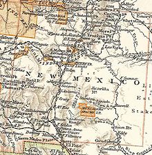
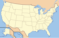
| Map of New Mexico | |||||
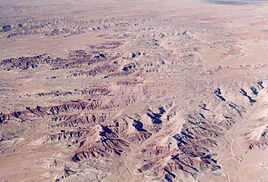
| Landscape impressions over New Mexico | |||||
New Mexico ( [ nuːˈmɛksɪkoʊ̯ ] AE ; German Neumexiko , Spanish Nuevo México , short: NM) is a federal state in the southwest of the United States . The name comes from the Spanish conquerors who used it to designate the land west and north of the Rio Grande . New Mexico is also known as the Land of Enchantment / Tierra de Encanto ("Land of Enchantment").
geography
National nature
New Mexico is characterized by its location on a plateau . However, this is not uniform, but the transition area of four geological provinces in North America. From the east the terrain rises flat out of the high plains prairies . The southwest of the state is part of the Chihuahua Desert , which is part of the Basin and Range Province. From northwest projecting Colorado Plateau to New Mexico and range to the north with the Sangre de Cristo Mountains , the southernmost parts of the Rocky Mountains to Santa Fe . The major parts of the country on the leeward side ( Lee ) of the Rocky Mountains are arid . The drought characterizes the landscape in the plains as in the mountains. Exceptions are the mountains north of Santa Fe and the area to the west beyond the continental divide , where there are extensive forests. In the mountains north of Santa Fe, the amount of precipitation in winter is so great that a winter sports region has emerged there. There are also areas that are almost untouched by humans, such as the Gila Wilderness in the southwest. The highest mountain is Wheeler Peak north of Santa Fe with 4011 m.
The wealth of landforms, the clear air with the mostly blue sky and the varied colorful rocks are characteristic of New Mexico.
rivers and lakes
The most important river is the Rio Grande . It rises in Colorado and flows through New Mexico from north to south, past Albuquerque and Las Cruces - mostly accompanied by Interstate Highway 25. From Texas , the Rio Grande forms the border with Mexico and flows into the Gulf of Mexico after 2,896 km . The Rio Grande is a real lifeline for agriculture , but it is also important for the energy industry.
The Rio Pecos and the Canadian River are also important rivers. The Rio Pecos also flows north to south, irrigating the southeast from Roswell via Artesia and Carlsbad to the Texas border. The Canadian River flows through northeast New Mexico and then over the "Panhandle" from Texas until it flows into Arkansas in eastern Oklahoma . The Canadian River, however, only gains importance in Texas and Oklahoma.
Because of the mainly dry climate, there are only insignificant natural lakes; Of the artificial reservoirs , the Elephant Butte Reservoir is the most important.
Extension of the national territory
With an area of 314,915 km², New Mexico ranks fifth among the 50 US states. Only Alaska , Texas , California and Montana are bigger. This makes New Mexico about the size of Poland .
New Mexico extends from the 31st to 37th parallel north (maximum north-south distance ~ 630 km) and from 103rd to 109th western longitude (mean east-west distance ~ 553 km).
Neighbore states
New Mexico borders Colorado to the north, Oklahoma to the northeast, Texas to the east and south and Arizona to the west . At Utah New Mexico borders only at a single point in the northwest, the so-called Four Corners . The state border with Mexico forms part of New Mexico's southern border.
structure
climate
Because of its southern location and the fact that it is on the leeward side ( Lee is) the Rocky Mountains, the climate of New Mexico is consistently dry and very very very hot in summer. In winter, however, due to the altitude, it can also get frosty cold, especially in the north, where there is a real winter sports area in the mountains north of Santa Fe.
population
| Population development | |||
|---|---|---|---|
| Census | Residents | ± in% | |
| 1850 | 61,547 | - | |
| 1860 | 93,516 | 51.9% | |
| 1870 | 91,874 | -1.8% | |
| 1880 | 119,565 | 30.1% | |
| 1890 | 160.282 | 34.1% | |
| 1900 | 195.310 | 21.9% | |
| 1910 | 327,301 | 67.6% | |
| 1920 | 360,350 | 10.1% | |
| 1930 | 423.317 | 17.5% | |
| 1940 | 531.818 | 25.6% | |
| 1950 | 681.187 | 28.1% | |
| 1960 | 951.023 | 39.6% | |
| 1970 | 1,017,055 | 6.9% | |
| 1980 | 1,303,302 | 28.1% | |
| 1990 | 1,515,069 | 16.2% | |
| 2000 | 1,819,046 | 20.1% | |
| 2010 | 2,059,179 | 13.2% | |
| Before 1900
1900-1990 2000 |
|||
With 2,086,000 inhabitants (as of 2013) , New Mexico is 36th among the 50 US states . The population density is correspondingly low with six inhabitants per square kilometer.
Ethnic composition of the population:
- 44.7% whites of non- Hispanic descent
- 42.1% Hispanic descent
- 9.5% Indians (esp. Pueblos )
- 1.9% African American
- 1.1% Asian Americans
- 3.6% of mixed race
The five largest single ancestry groups in New Mexico are Mexicans (18.1%), Germans (9.9%), Native Americans (9.5%), Spaniards (9.3%), and English (7.6%).
Population development and immigration policy
Compared to the US average, New Mexico recorded a disproportionately high population growth. In the period from 1990 to 2000 the increase was 20.1%. This development is explained by the high rate of immigrants from Mexico and other Latin American countries, but it is also a sign of positive economic development. A significant example of the legal and illegal immigration of people from the south is the city of Las Cruces , located near the Mexican border . Thirty years ago there were less than 30,000 residents in the city, it is now around 98,000. Las Cruces has grown to become the second largest city in New Mexico.
When Democratic Governor Bill Richardson was in power, liberal policies against illegal immigrants were fundamentally different from those of neighboring Arizona.
Religions
The religious groups with the largest number of members in 2000 were the Catholic Church with 670,511, the Southern Baptist Convention with 132,675, the Church of Jesus Christ of Latter-day Saints with 42,261 and the United Methodist Church with 41,597.
education
There are two major universities in New Mexico, the University of New Mexico in Albuquerque and New Mexico State University in Las Cruces with branch offices in Alamogordo and Carlsbad .
Biggest cities
The larger cities show a partly significant population increase in the period from 2000 to 2010 (Rio Rancho around 69%), while the smaller cities with less than 35,000 inhabitants tend to stagnate.

history
Long before Europeans explored the area , the area was inhabited by Indian tribes. They settled on rivers and in the hinterland. Probably the oldest continuously inhabited settlement in the United States is Taos Pueblo in the north of the state. Significant cultures, including the Anasazi and Chaco cultures, emerged in the southwestern part of what is now the United States between about AD 1000 and 1300 . These cultures ended in the 13th and 14th centuries, probably due to changes in climatic conditions. Century. Álvar Núñez Cabeza de Vaca was the first European to cross the country with his three companions in 1536. The men were survivors of the Narváez expedition . The reports of Álvar Núñez Cabeza de Vaca were heavily falsified and triggered the search for the seven golden cities of Cibola .
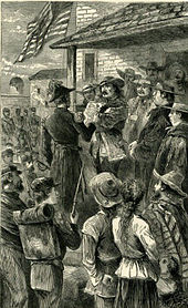
When the Spanish conqueror Francisco Vásquez de Coronado crossed the country in 1540 in search of the seven golden cities of Cibola, Pueblo Indians lived there , especially Hopi and Zuñi . Spanish missionaries and settlers followed the conquerors . As a result, there were repeated clashes between the Indians and the immigrants. After the Pueblo Indians had allied themselves with the Apaches , the Pueblo uprising began in 1680 , which was directed against the poor working conditions of the Indians and the exploitation of their land. The Indians succeeded in conquering Santa Fe. In 1692/1693 it was recaptured by the Spaniards under Don Diego de Vargas . Despite trade between whites and Indians, there were always armed conflicts. In order to secure the border, the settlement of Genízaros (Hispanic Indians, often former slaves) in the 18th century specifically established new settlements to protect the border from raids. It was not until 1780 that the first peace agreement between the Indians and Spaniards came about. New Mexico was under Spanish rule until 1821, then under Mexican rule until 1846. In Mexican times, trade with the American settlement centers on the Missouri River was established via the Santa Fe Trail , which had not only economic, but above all political and cultural influence on the previously remote part of the Spanish Empire. At the beginning of the Mexican-American War (1846-1848) General Stephen W. Kearny took Santa Fe, and in 1848 New Mexico fell to the United States with the Guadalupe-Hidalgo Treaty .
In 1853 the southernmost part of the state was acquired by Mexico with the Gadsden Purchase . Nine years later, New Mexico was briefly under the Confederate government , which, however, had to surrender the area to the Union after the Battle of Glorieta Pass . On February 23, 1863, New Mexico was divided in a north-south direction with the creation of the Arizona Territory within its present boundaries. After the Civil War , ranching became one of the most important economic drivers in New Mexico. Clashes between the cattle barons and the government culminated in a regular war that went down in history as the Lincoln County Cattle War . Billy the Kid played a big part in this war . In addition, the construction of the Santa Fe Atchison, Topeka and Santa Fe Railway in the 1880s and the discovery of oil in the late 19th century resulted in rapid growth in the area. Finally, on January 6, 1912, New Mexico became the 47th state in the United States. With Ezequiel Cabeza de Baca , a Mexican American was elected governor for the first time in 1916 . After the development of the atomic bomb as part of the Manhattan Project in Los Alamos , the first nuclear weapon explosion in history, the Trinity test, took place on July 16, 1945 at the Alamogordo test site , 280 km south of Albuquerque.
flag
In 1925, Santa Fe's Harry Mera won the design competition to design the flag of New Mexico . The flag contains the red Zia symbol on a yellow background. The four sides of the symbol symbolize the four winds, the four seasons, the four cardinal points, the four elements. The circle symbolizes the connection between the four elements and the circle of life.
politics
| year | republican | Democrats |
|---|---|---|
| 2016 | 40.04% 319,685 | 48.25% 385,232 |
| 2012 | 42.84% 335,788 | 52.99% 415,335 |
| 2008 | 41.78% 346,832 | 56.91% 472,422 |
| 2004 | 49.84% 376,930 | 49.05% 370,942 |
| 2000 | 47.85% 286,417 | 47.91% 286,783 |
| 1996 | 41.86% 232,751 | 49.18% 273,495 |
| 1992 | 37.34% 212,824 | 45.90% 261,617 |
| 1988 | 51.86% 270,341 | 46.90% 244,497 |
| 1984 | 59.70% 307,101 | 39.23% 201,769 |
| 1980 | 54.97% 250,779 | 36.78% 167,826 |
| 1976 | 50.75% 211,419 | 48.28% 201,148 |
| 1972 | 61.05% 235,606 | 36.56% 141,084 |
| 1968 | 51.85% 169,692 | 39.75% 130,081 |
| 1964 | 40.24% 131,838 | 59.22% 194,017 |
| 1960 | 49.41% 153,733 | 50.15% 156,027 |
Like most states, New Mexico has a two-chamber parliament, a Senate and a House of Representatives . Michelle Lujan Grisham of the Democratic Party , which replaced the Republican Susana Martinez , has been governor since 2019 . The capital, Santa Fe, is the oldest seat of government in the United States. Santa Fe was already the seat of a governor under Spanish rule. In the Congress in Washington, DC New Mexico sent the two Democratic Senators Tom Udall and Martin Heinrich ; the state delegation to the 116th Congress House of Representatives consists of three Democrats.
New Mexico has long been considered a swing state with very evenly distributed voting opportunities for the two major parties. Since joining the United States in 1912, New Mexico has failed to vote for the ultimately victorious presidential candidate only three times ( 1976 , 2000 and 2016 ). Due to its relatively small population, the state attracted less attention in election campaigns than, for example, Florida or Ohio . Besides Iowa, New Mexico was the only state that George W. Bush won against John Kerry in 2004 , but not against Al Gore in 2000 (in New Hampshire it was the other way around). Overall, the Democratic candidates in all presidential elections since 2000 performed slightly above average, the Republican candidates below average. Political observers now rate New Mexico as a likely to certain democratic state.
Governors
congress
Culture and sights
New Mexico is rich in attractions because of its natural beauty and well-preserved historical sites. In addition, the consistent adherence to the historical adobe building style in recent times has particularly highlighted the cities of Santa Fe and Albuquerque from the uniform image of American cities in the west.
Parks
| National park | location | view |
|---|---|---|
Carlsbad Caverns National Park
|

|
National Monuments and Memorials
- Aztec Ruins National Monument
- Bandelier National Monument
- Capulin Volcano National Monument
- El Malpais National Monument
- El Morro National Monument
- Fort Union National Monument
- Gila Cliff Dwellings National Monument
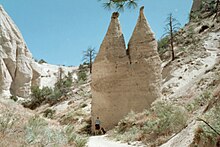
- Kasha-Katuwe Tent Rocks National Monument
- Petroglyph National Monument
- Salinas Pueblo Missions National Monument
- White Sands National Monument
- Chaco Culture National Historical Park
- Coronado State Park near Albuquerque
Economy and Infrastructure
The real gross domestic product per capita ( English per capita real GDP) was 44,832 US dollars in 2016 (national average of the 50 US states: 57,118 US dollars; national ranking: 40). The unemployment rate was 6.1% in November 2017 (national average: 4.1%), making it the third highest of all states.
Agriculture (corn, wheat, millet, cotton) is only possible with artificial irrigation. Livestock is important. Funding in New Mexico a. a. Crude oil, natural gas and potash salts.
Main industrial products include:
- chemical products
- food
- machinery
- Metal goods
- Wood products
The US government operates two nuclear research and development centers in New Mexico through the Department of Energy (DOE) and its National Nuclear Security Administration (NNSA): Sandia National Laboratories in Albuquerque and Los Alamos National Laboratory in Los Alamos . The only active nuclear waste repository in the United States is also located in New Mexico: WIPP is approved for medium- and low-level radioactive transuranium elements .
Rail transport
Two well-known Amtrak long-distance trains traverse New Mexico approximately in an east-west direction and serve Albuquerque and El Paso, among others: Southwest Chief (Chicago – Kansas City – Albuquerque – Los Angeles) and Texas Eagle ( Chicago - St. Louis - Dallas - San Antonio - El Paso - Los Angeles ). The New Mexico Rail Runner Express connects Albuquerque and Santa Fe .
Road traffic
Personalities
literature
German
- Tim Freytag: Education, Educational Behavior and Cultural Identity. Reasons for the below-average educational level of the Hispanic population in New Mexico , Heidelberg University, Geographer. Inst., 2003, ISBN 3-88570-118-9 .
English
- Hubert Howe Bancroft: The Works of Hubert Howe Bancroft, Vol. XVII. (History of Arizona and New Mexico 1530-1888) (1889); reprint 1962. online edition ( Memento from May 27, 2008 in the Internet Archive )
- Warren Beck: Historical Atlas of New Mexico 1969.
- Thomas E. Chavez: An Illustrated History of New Mexico , 267 pages, University of New Mexico Press 2002, ISBN 0-8263-3051-7 .
- Joseph G. Dawdon III: Doniphan's Epic March; The 1st Missouri Volunteers in the Mexican War , Kansas Press
- Lynne Marie Getz: Schools of Their Own: The Education of Hispanos in New Mexico, 1850–1940 University of New Mexico Press 1997.
- Erlinda Gonzales-Berry, David R. Maciel (Eds.): The Contested Homeland: A Chicano History of New Mexico. 314 pages, University of New Mexico Press, 2000, ISBN 0-8263-2199-2 .
- Nancie L. González: The Spanish-Americans of New Mexico: A Heritage of Pride. 1969.
- Ramón A. Gutiérrez, When Jesus Came, the Corn Mothers Went Away: Marriage, Sexuality, and Power in New Mexico, 1500-1846. Stanford University Press, 1991, ISBN 0-8047-1832-6 .
- Paul L. Hain: F. Chris Garcia, Gilbert K. St. Clair: New Mexico Government 3rd ed. (1994)
- Jack E. Holmes: Politics in New Mexico. 1967.
- Paul Horgan : Great River, The Rio Grande in North American History , 1038 pages, Wesleyan University Press, 1991, 4th Reprint, ISBN 0-585-38014-7 , Pulitzer Prize 1955.
- Robert W. Kern: Labor in New Mexico: Strikes, Unions, and Social History, 1881–1981 , University of New Mexico Press, 1983, ISBN 0-8263-0675-6 .
- Howard R. Lamar: The Far Southwest, 1846–1912: A Territorial History (1966, repr 2000)
- Robert W. Larson: New Mexico's Quest for Statehood, 1846-1912 (1968)
- John M. Nieto-Phillips: The Language of Blood: The Making of Spanish-American Identity in New Mexico, 1880s – 1930s , University of New Mexico Press, 2004, ISBN 0-8263-2423-1 .
- George I. Sánchez: Forgotten People: A Study of New Mexicans (1940; reprint 1996)
- Marc Simmons: New Mexico: An Interpretive History , 221 pages, University of New Mexico Press, 1988, ISBN 0-8263-1110-5 , Introduction
- Ferenc M. Szasz, Richard W. Etulain: Religion in Modern New Mexico. (1997)
- David J. Weber: The Mexican Frontier, 1821-1846: The American Southwest under Mexico. 1982.
Web links
- Official website of the state of New Mexico. Retrieved April 26, 2019 .
- Department of Tourism (English)
- New Mexico Magazine (English)
Individual evidence
- ^ Density Using Land Area
- ^ US Census Bureau _ Census of Population and Housing . Retrieved February 28, 2011
- ↑ Extract from Census.gov . Retrieved February 28, 2011
- ↑ Excerpt from factfinder.census.gov.Retrieved February 28, 2011
- ↑ Randal C. Archibold: Side by Side, Divided Over Immigration but. The New York Times , May 11, 2010.
- ^ The Association of Religion Data Archives | Maps & Reports
- ↑ Álvar Núñez Cabeza de Vaca: Shipwrecks , p. 115.
- ^ David Leip: Dave Leip's Atlas of US Presidential Elections. Retrieved November 28, 2018 .
- ↑ Don't Look Now, but the Mountain West Is Turning Blue , The Daily Beast, November 9, 2018, accessed November 16, 2019
- ^ Electoral Scorecard 2020 , Cook Political Report October 29, 2019, accessed November 16, 2019
- ↑ Trump's New Math: Inside the Plan to Flip Blue States in 2020 , time.com, September 9, 2019, accessed: November 16, 2019
- ↑ 2020 Electoral College Ratings , Sabato's Crystal Ball, November 7, 2019, accessed: November 16, 2019
- ^ US Department of Commerce, BEA, Bureau of Economic Analysis: Bureau of Economic Analysis. Retrieved August 27, 2017 (American English).
- ^ Unemployment Rates for States. Retrieved January 8, 2018 .
- ↑ Doniphan's Epic March ( Memento from September 1, 2006 in the Internet Archive )
Coordinates: 34 ° N , 106 ° W


