Gahlener Kohlenweg

The Gahlener Kohlenweg was a coal route from the south of Bochum to Gahlen . The section from Hamme to Gahlen is called Gahlensche Straße .
history
The name “Kohlenweg” refers to its original purpose of transporting coal from Stiepel (Bochum) via Weitmar , Hamme , Eickel , Crange to the village of Gahlen, a former port on the Lippe near Dorsten . The 8.60 meter wide road, laid out as a stick dam on marshy ground, was one of the first paved roads in the central Ruhr area for the transport of the coal extracted from the Ruhr to the north when construction began around 1766 . At that time, the Ruhr was not yet navigable; the only alternative available was the much longer Hellweg, leading through other duchies with corresponding tariffs, to the Rhine. The teacher and entrepreneur Johann Wilhelm Müser (1725–1788) from Blankenstein played a key role in the construction.
The coal was mined in the County of Mark, which was part of Prussia at the time. It should be deposited in the Prussian possessions further west on the Rhine. If one used the ancient east-west connection Hellweg , then the imperial direct dominions Essen , Werden and the Duchy of Berg had to be crossed. The tariffs raised would have made the coal very expensive. The advantage of the new coal route was that only a foreign territory, namely Vest Recklinghausen , which belongs to the Electorate of Cologne, had to be crossed.
With the making of the Ruhr navigable in the 1780s, the lifting of customs barriers and the development of rail traffic in the 19th century, the coal route gradually lost its economic importance.
course
From Stiepel (more precisely Rauterdeller Siepen) the road led through the towns of Weitmar, Hamme and Marmelshagen (today part of Bochum ), past Eickel and Crange (today Herne ) through the sparsely populated area of the Emscherbruch to Buer (today Gelsenkirchen ) and met only at Dorsten again on a larger settlement. A few kilometers west of it it reached Prussian territory again ( Duchy of Kleve ). The coal - filled in barrels of 50 pounds - was transported on mules and carts over a stretch of almost 40 kilometers through many windings. The coal was transported from the port near Gahlen over the Lippe to the Rhine, and in 1767 the "Kohlhaus" was built there for this purpose. It was used to manage the shipment and as a residence for the officials. The Kohlhaus, whose property is now located in the Dorsten area after regional reforms, was demolished in 1972 with the expansion of the Wesel-Datteln Canal . At the former location there is now a steel stele. The recipients of the coal shipped were the Duchy of Kleve and the counties of Moers and Geldern ; later also today's Netherlands .
The routes of today's federal highways 226 and 224 between Bochum and Dorsten are in many places identical to Gahlenschen Straße.
Preserved structures
On the border between Gelsenkirchen and Herne is the Fleuthebrücke , which led the coal route over the Emscher tributary of the same name, which has now dried up . The coal route and bridge are part of the route of industrial culture .
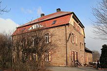
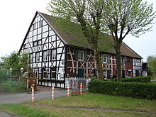
The oldest monument on the Kohlenweg, the former “ Schlenkhoffsche Kotten ”, is located in Herne-Wanne at kilometer 20. In today's inn from 1775, road fees, the so-called “Chausseegeld”, were collected.
memory
The street names in Bochum, Herne and Dorsten, for example, Kohlenstraße, Gahlensche Straße, Dorstener and Gahlener Straße, remind of the historical reference.
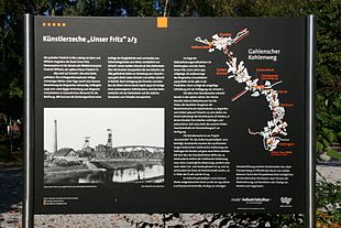
As part of the 2010 Capital of Culture year , the project "Art Street becomes Art Street" was launched. The artificial street, which was laid out 250 years ago, was themed by several works of art and made locally tangible. Art associations from Gelsenkirchen, Hattingen and Dorsten as well as a Bochum gallery and the support association of the Künstlerzeche Our Fritz from Herne developed art brands and objects along the route that is now 29 kilometers long. Existing structures (customs stations, bridges, administration buildings, mines, chapels, etc.) and the materials transported at the time (coal, ore, wood, etc.) were included, and both temporary and permanent works of art were created.
literature
- Working group "History of mining in the Hattinger area" (Ed.): The Gahlensche Kohlenweg. The Gahlensche Kohlenweg from the Stiepel court near Hattingen an der Ruhr to Gahlen an der Lippe . projektverlag, Bochum 2019, ISBN 978-3-89733-469-4 .
Footnotes
Web links
- Description of all locations on this themed route as part of the Route of Industrial Culture
- Gahlener Kohlenweg with a map at ruhrkohlenrevier.de
- Project "Art Street becomes Street of Art"
- City of Herne: Streets in Herne, Dorstener Straße
Coordinates: 51 ° 32 ′ 52 ″ N , 7 ° 7 ′ 14 ″ E


