
Exchanges
| coat of arms | Germany map | |
|---|---|---|

|
Coordinates: 53 ° 29 ′ N , 10 ° 17 ′ E |
|
| Basic data | ||
| State : | Schleswig-Holstein | |
| Circle : | Duchy of Lauenburg | |
| Office : | High Elbgeest | |
| Height : | 50 m above sea level NHN | |
| Area : | 8.42 km 2 | |
| Residents: | 4796 (Dec. 31, 2019) | |
| Population density : | 570 inhabitants per km 2 | |
| Postal code : | 21039 | |
| Area code : | 040 | |
| License plate : | RZ | |
| Community key : | 01 0 53 012 | |
| LOCODE : | DE BRN | |
| Office administration address: | Christa-Höppner-Platz 1 21521 Dassendorf |
|
| Website : | ||
| Mayor : | Klaus Tormählen ( Greens ) | |
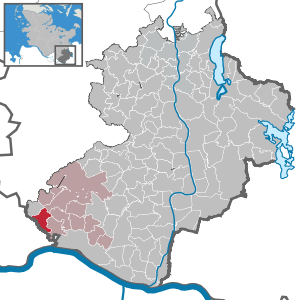
| Location of the municipality Börnsen in the Herzogtum Lauenburg district | ||
  |
||

Börnsen is a municipality in the Duchy of Lauenburg in Schleswig-Holstein .
geography
The community is on the eastern border of Hamburg . In the northwest, Börnsen shares the Lohe recreational area with the neighboring communities of Wentorf and Wohltorf . In the north lies the Sachsenwald , the largest contiguous forest area in Schleswig-Holstein. In the east, Börnsen shares the Dalbek Gorge nature reserve with the neighboring municipality of Escheburg . In the south the community extends into the Elbe glacial valley .
Börnsen is divided by the Geesthang , which was formed during the Ice Ages . The upper Geest area was created as a ground moraine during the Saale Ice Age . The Dalbek Gorge was formed when the ice of the Saale Ice Age retreated and the meltwater was looking for a way to drain off. After the last ice age, the Vistula Ice Age, the melt water from Lauenburg to Wedel formed the steep slope that is still present today and the Elbe glacial valley.
The district of Neubörnsen, which borders on the Lohe recreational area, is located in the north-west of Börnsen.
history
The place Börnsen was first mentioned in 1217 as "Burnessem" (= "home at the source") in a document.
politics
Community representation
Of the 17 seats in the municipal council, the Greens have had nine seats since the 2018 local elections, while the SPD has eight.
coat of arms
Blazon : “In red a silver draw well, consisting of a round basin, a pole to the left of it and a lifting rod that rotates in the top of the pole and from the top of which a bucket hangs over the basin; top left a silver horse head turned right. "
Culture and sights
Natural monuments

Sports
- VfL stock exchanges
- SV Börnsen
- Shooting club Dalbek
- Sachsenwald Börnsen tennis club
- Riding and driving club Börnsen
traffic

The former federal road 5 - downgraded in 2008 to district road 80 - Hamburg – Lauenburg / Elbe (–Ludwigslust-Berlin) and the federal road 207 Hamburg-Bergedorf – Schwarzenbek – Mölln – Lübeck run through Börnsen .
The federal autobahn 25 Hamburg – Geesthacht leads over Börnsener area, the next junctions are in the west Hamburg-Curslack and in the east the end of the autobahn between Escheburg and Geesthacht .
The Bergedorf-Geesthacht Railway (BGE, now operated by AKN ) connects Börnsen with Hamburg-Bergedorf and Geesthacht. However, this railway line is only used by the supply and disposal trains of the Krümmel nuclear power plant and the museum railway of the Geesthacht Railway Working Group with their “Karoline” steam locomotive.
The nearest airports are in Lübeck (regional airport) and in Hamburg-Fuhlsbüttel .
The public buses of the Hamburg-Holstein transport company (VHH) run in the municipality and connect it with Hamburg, Geesthacht and Lauenburg within the Hamburg Transport Association (HVV). In addition, the autokraft regional bus route 8810 runs from Hamburg-Bergedorf via Wentorf to Schwarzenbek and Mölln through Neu-Börnsen, which is reinforced by further school bus trips .
Personalities
- Günter Harte , Low German author and narrator; lived in Börnsen
- The futurologist Horst W. Opaschowski lives in Börnsen
literature
- Stock exchanges - a home chronicle. Contributions to the history of a community in Lauenburg . September 2000, publisher: Municipality of Börnsen, The Mayor
Web links
Individual evidence
- ↑ North Statistics Office - Population of the municipalities in Schleswig-Holstein 4th quarter 2019 (XLSX file) (update based on the 2011 census) ( help on this ).
- ↑ Schleswig-Holstein topography. Vol. 2: Boren - Ellerau . 1st edition Flying-Kiwi-Verl. Junge, Flensburg 2002, ISBN 978-3-926055-68-2 , p. 28 ( dnb.de [accessed June 11, 2020]).
- ↑ Schleswig-Holstein topography. Vol. 2: Boren - Ellerau . 1st edition Flying-Kiwi-Verl. Junge, Flensburg 2002, ISBN 978-3-926055-68-2 , p. 28 ( dnb.de [accessed June 12, 2020]).
- ↑ Schleswig-Holstein's municipal coat of arms
Albsfelde | Alt-Mölln | Aumühle | Bäk | Blue | Basedow | Basthorst | Behlendorf | Berkenthin | Besenthal | Bliestorf | Exchanges | Borstorf | Breitenfelde | Bröthen | Brunsmark | Brunstorf | Books | Buchholz | Buchhorst | Dahmker | Dalldorf | Dassendorf | Düchelsdorf | Duvensee | Single house | Elmenhorst | Escheburg | Fitzen | Fredeburg | Fuhlenhagen | Geesthacht | Giesensdorf | Göldenitz | Goddess | Grabau | Grambek | Grinau | Big floor | Great Disnack | Groß Grönau | Great Pampau | Great Sarau | Groß Schenkenberg | Grove | Gudow | Gülzow | Bream | Hamfelde | Hamwarde | Harmsdorf | Havekost | Hohenhorn | Hollenbek | Hornbek | Horst | Juliusburg | Kankelau | Kasseburg | Kastorf | Kittlitz | Klein Pampau | Klein reveler | Plumbing | Klinkrade | Koberg | Kollow | Koethel | Kröppelshagen-Fahrendorf | Krukow | Curved mass | Krüzen | Kuddewörde | Killing | Kulpin | Labenz | Langenlehsten | Lankau | Lance | Lauenburg / Elbe | Clay wheel | Linau | Lüchow | Lütau | Mechow | Möhnsen | Mölln | Mill wheel | Must | Mustin | Niendorf ad St. | Niendorf near Berkenthin | Nuts | Panting | Pogeez | Poggensee | Ratzeburg | Ritzerau | Römnitz | Rondeshagen | Roseburg | Sahms | Salem | Sandesneben | Schiphorst | Schmilau | Schnakenbek | Schoenberg | Schretstaken | Schulendorf | Poking soles | Schwarzenbek | Seedorf | Seven trees | Seven oaks | Sierksrade | Sirksfelde | Steinhorst | Sterley | Stump | Talkau | Tramm | Walksfelde | Wangelau | Wentorf (Amt Sandesneben) | Wentorf near Hamburg | Wiershop | Witzeeze | Wohltorf | Woltersdorf | Worth | Ziethen
Community-free area in the Duchy of Lauenburg
Sachsenwald district