Saint-Denis-des-Monts
| Saint-Denis-des-Monts | ||
|---|---|---|
|
|
||
| region | Normandy | |
| Department | Your | |
| Arrondissement | Bernay | |
| Canton | Bourgtheroulde-Infreville | |
| Community association | Roumois Seine | |
| Coordinates | 49 ° 16 ' N , 0 ° 49' E | |
| height | 108-161 m | |
| surface | 3.88 km 2 | |
| Residents | 211 (January 1, 2017) | |
| Population density | 54 inhabitants / km 2 | |
| Post Code | 27520 | |
| INSEE code | 27531 | |
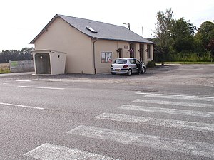
 Town hall (Mairie) of Saint-Denis-des-Monts |
||
Saint-Denis-des-Monts is a commune with 211 inhabitants (as of January 1 2017) in the Eure in the region Normandy (before 2016 Haute-Normandie ). The municipality belongs to the Arrondissement of Bernay and the canton of Bourgtheroulde-Infreville . The inhabitants are called Dionysia .
geography
Saint-Denis-des-Monts is located in northern France about 38 kilometers southwest of Rouen . Saint-Denis-des-Monts is surrounded by the neighboring communities of Thénouville in the north, Les Monts du Roumois in the east and northeast, Saint-Éloi-de-Fourques in the south and Saint-Philbert-sur-Boissey in the west.
Population development
| year | 1793 | 1851 | 1886 | 1921 | 1962 | 1968 | 1975 | 1982 | 1990 | 1999 | 2006 | 2013 | |
| Residents | 408 | 348 | 220 | 178 | 160 | 150 | 139 | 175 | 185 | 180 | 188 | 218 | |
| Source: Cassini and INSEE | |||||||||||||
Attractions
- Saint-Denis church
Web links
Commons : Saint-Denis-des-Monts - Collection of images, videos and audio files
