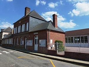
Saint-Vincent-du-Boulay
| Saint-Vincent-du-Boulay | ||
|---|---|---|
|
|
||
| region | Normandy | |
| Department | Your | |
| Arrondissement | Bernay | |
| Canton | Beuzeville | |
| Community association | Lieuvin Pays d'Auge | |
| Coordinates | 49 ° 6 ′ N , 0 ° 29 ′ E | |
| height | 164-195 m | |
| surface | 6.56 km 2 | |
| Residents | 381 (January 1, 2017) | |
| Population density | 58 inhabitants / km 2 | |
| Post Code | 27230 | |
| INSEE code | 27613 | |
 Saint-Vincent-du-Boulay |
||
Saint-Vincent-du-Boulay is a French municipality with 381 inhabitants (at January 1, 2017) in the Eure in the region Normandy (before 2016 Haute-Normandie ). It belongs to the canton of Beuzeville (until 2015 Thiberville ).
geography
Saint-Vincent-du-Boulay is located about nine kilometers west-northwest of Bernay and about 23 kilometers east-southeast of Lisieux in the Pays d'Auge . Saint-Vincent-du-Boulay is surrounded by the neighboring municipalities of Drucourt in the north and north-west, Bournainville-Faverolles in the north, Saint-Martin-du-Tilleul in the east and north-east, Plainville in the south, and Saint-Mards-de-Fresne in the south Southwest and Le Planquay in the west.
The A28 autoroute runs along the south-eastern edge of the municipality .
history
| year | 1793 | 1806 | 1856 | 1886 | 1901 | 1954 | 1962 | 1968 | 1975 | 1982 | 1990 | 1999 | 2006 | 2013 |
|---|---|---|---|---|---|---|---|---|---|---|---|---|---|---|
| Residents | 641 | 815 | 760 | 477 | 389 | 232 | 254 | 231 | 220 | 258 | 263 | 267 | 277 | 350 |
Attractions
- 15th century Saint-Vincent church

